

1. Introduction
- Berwick Bank Wind Farm Limited (BBWFL) is a wholly owned subsidiary of SSE Renewables (SSER) Limited and will hereafter be referred to as ‘the Applicant’. The Applicant is developing the Berwick Bank Wind Farm (hereafter referred to as ‘the Project’). This Marine Archaeology Technical Report presents baseline information for the offshore environment in the Firth of Forth offshore wind farm development Zone. The Marine Archaeology Technical Report covers the offshore elements of the Project located seaward of Mean Low Water Springs (MLWS) (henceforth referred to as the Proposed Development). The onshore transmission elements of the Project are being applied for separately. The onshore archaeology and cultural heritage assessment which includes the intertidal zone is provided in volume 1, chapter 10 of the Berwick Bank Wind Farm Onshore Environmental Impact Assessment (EIA) Report (SSER, 2022a).
- The baseline described in the Marine Archaeology Technical Report underpins mitigation measures proposed within the Applicant’s Written Scheme of Investigation (WSI), which includes a Protocol of Archaeological Discoveries (PAD). In November 2021, the Marine Archaeology Technical Report and Outline WSI were shared with Scottish Borders Council (SBC), Historic Environment Scotland (HES) and East Lothian Council Archaeology Service (ELC). HES and SCB confirmed that the mitigation was considered adequate[1] to avoid significant impacts (in EIA terms) on marine archaeology and it was appropriate for the Applicant to scope marine archaeology out of the EIA.
- In June 2022, the Berwick Bank Wind Farm boundary was revised and the Proposed Development array area was reduced by approximately 20 percent. The assessments presented in the final Application are based on new Proposed Development boundaries and an updated Project Design Envelope. No significant changes have been made to the Proposed Development export cable corridor or landfall or the Proposed Development array area which falls entirely within the previous Proposed Development boundary.
- The Marine Archaeology Technical Report and WSI have been updated to account for the location of anomalies and known archaeological assets relative to a revised marine archaeology study area that corresponds with the new Proposed Development boundaries. The updated WSI is available in the Berwick Bank Wind Farm Offshore EIA Report (at volume 4, appendix 22, annex D). The updated Marine Archaeology Technical Report (this report) is provided as an ‘accompanying document’ to the Application to ensure that the archaeological baseline that corresponds to the WSI is available to consultees.
- The Applicant’s responses to feedback received during consultation (see Table 1.1 Open ▸ ). The updated Marine Archaeology Technical Report does not report any updates to marine archaeology baseline for the revised marine archaeology study area that might warrant changes to the general methodology and procedures in the WSI and the fundamental conclusions are unchanged.
1.2. Purpose of this Report
1.2. Purpose of this Report
- The aim of this Marine Archaeology Technical Report is to provide an overview of the offshore archaeological baseline associated with the Proposed Development. The objectives of this study are to:
- summarise the potential for submerged prehistoric archaeology to be encountered within the marine archaeology study area ( Figure 1.1 Open ▸ ).
- identify known maritime and aviation sites, and based on the maritime history of the marine archaeology study area and the wider area, assess the potential for the existence of unknown sites and materials within the Proposed Development site;
- present site-specific geophysical data from surveys across the Proposed Development array area and Proposed Development export cable corridor, identify anomalies of archaeological interest and characterise these anomalies integrating the results of the site-specific survey data with the findings of a desk-based review;
- review available site-specific geophysical data for sediments of archaeological and palaeo-environmental interest and integrate the results with the findings of the desktop review; and
- highlight updates to the baseline that might require additional mitigation measures or adaptations to the strategy.
- Section 2: planning policy and legislation: sets out the relevant legislation, policy and guidance in relation to the known and potential marine archaeology within the marine archaeology study area;
- Section 3: methodology: presents the marine archaeology study area ( Figure 1.1 Open ▸ ), the scope of this study and the methodology and evidence used to define the baseline environment;
- Section 4: baseline environment; characterises the known and potential submerged prehistoric and maritime archaeology within the marine archaeology study area:
– Section 4.1: seabed and topography: describes the seabed and topography within the marine archaeology study area, as informed by site-specific surveys;
– Section 4.2: submerged prehistoric archaeology: characterises the known and potential submerged prehistoric archaeology within the marine archaeology study area;
– Section 4.3: maritime archaeology: characterises the baseline environment in relation to maritime archaeology by chronological period;
– Section 4.4: Designated, Known and Recorded Wrecks: presents the results of a desktop review of designated, known and recorded wrecks within the marine archaeology study area; and
– Section 4.5: archaeological assessment of seabed contacts identified during geophysical survey: presents the results of the geophysical assessments undertaken to identify anomalies of anthropogenic origin and therefore of archaeological potential.
- Section 5: conclusions: presents the known and potential for submerged prehistoric and maritime archaeology within the marine archaeology study area.
Figure 1.1: Marine Archaeology Study Area and Marine Archaeology Study Area (Revised July 2022
Table 1.1: Summary of Key Consultation and How This was Considered Within Marine Archaeological Technical Report, Written Scheme of Investigation and or Protocol for Archaeological Discoveries
2. Planning and Legislation
2. Planning and Legislation
2.1. Legislative Context
2.1. Legislative Context
- This section outlines the legislation, policy, guidance and development plans relevant to offshore archaeological remains in the context of offshore renewable energy development.
2.1.2. Marine (Scotland) Act 2010
- Marine historic assets of national importance within Scottish Territorial Waters (STW) are protected primarily by the Marine (Scotland) Act 2010 (content available on the UK Government Website accessed August 2022 - legislation.gov.uk), in particular Part 5 Section 73. This states that an area may be designated as an Historic Marine Protected Area (MPA) if Scottish Ministers consider it desirable to preserve a marine historic asset which is located in the area.
- A marine historic asset is defined as a vessel, vehicle or aircraft (or part of), the remains of a vessel, vehicle or aircraft (or part of), an object contained in or formerly contained in a vessel, vehicle or aircraft, a building or other structure (or part of), a cave or excavation, and a deposit or artefact or any other thing which evidences previous human activity.
- The purpose of Historic MPAs is to preserve by law, marine historic assets of national importance. There is no requirement for specific permission to carry out work inside a Historic MPA, however permission under the Town and Country (Scotland) Planning Act (1997) or a Marine Licence (ML) under the Marine and Coastal Access Act (MCCA) 2009 (in waters 12 nm to 200 nm), or under the Marine (Scotland) Act 2010 (from Mean High Water Springs (MHWS) to 12 nm) may be required (content available on the United Kingdom (UK) Government Website accessed August 2022 legislation.gov.uk).
- Clear preservation objectives are provided for each Historic MPA and their boundaries define an exclusion zone to activities that could lead to disturbance of the marine historic asset.
- In Scotland, the Marine Scotland Act 2010 has replaced Section 1 of the Protection of Wrecks Act 1973.
2.1.3. Protection of Wrecks Act 1973
- Section 2 of the Protection of Wrecks Act 1973 (content available on the UK Government Website accessed August 2021 legislation.gov.uk) provides guidance on the protection of wrecks that are designated as dangerous due to their contents. Protections are administered by the Maritime and Coastguard Agency (MCA) through the Receiver of Wreck (RoW).
2.1.4. Protection of Military Remains Act 1986
- The Protection of Military Remains Act 1986[2] makes it an offence to interfere with the wreckage of any crashed, sunken or stranded military aircraft or designated vessel, without a licence. This is irrespective of whether there was loss of life associated with the wreck, or whether the loss of the aircraft or vessel occurred during peacetime or wartime.
- All crashed military aircraft receive automatic protection under this Act, but vessels must be individually designated. There are two levels of protection offered by this Act:
- designation as a Protected Place: Protected Places include the remains of any aircraft which crashed while in military service or any vessel designated (by name, not location) which sank or stranded in military service after 04 August 1914. Although crashed military aircraft receive automatic status as a Protected Place, vessels need to be specifically designated by name. The location of a vessel does not need to be known for it to be designated as a Protected Place; and
- designation as a Controlled Site: Controlled Sites are designated areas which encompass the remains of military aircraft or a vessel sunk or stranded in military service within the last 200 years. Diving operations are effectively prohibited in these sites without a specific licence granted by the Secretary of State in accordance with the provisions of the Act.
2.1.5. Ancient Monuments and Archaeological Areas Act 1979
- This primarily land-based Act also provides protection for underwater sites within the UK territorial waters. Buildings, structures or works, caves or excavations, vehicles, vessels, aircraft or other movable structures of national importance may be scheduled as ‘monuments’. It is an offence to demolish, destroy, remove, alter or repair or make any alterations to a monument or carry out any flooding or tipping operations, without scheduled monument consent (content available on the UK Government Website accessed August 2022 - legislation.gov.uk). The Act is administered in Scotland by HES on behalf of Scottish Ministers.
2.1.6. Merchant Shipping Act 1995
- All wrecks within UK territorial waters and any wreck which landed in the UK from outside the UK territorial waters must, as stated in Section 236 of the Merchant Shipping Act 1995, be declared to the RoW, who acts on behalf of the MCA in administering this section of the Act. The Act defines ‘wreck’ as anything which is found in or on the sea or washed ashore from tidal waters (content available on the UK Government Website accessed August 2022 legislation.gov.uk).
- All items which are raised from the seabed, regardless of age or importance, must be reported to the RoW who will act to settle questions of ownership and salvage. Finders who report their finds to the RoW have salvage rights.
2.1.7. International Law
- Outside the UK territorial waters (i.e. beyond 12 nm), the regulation and reporting of maritime archaeology is governed by international legislation and guidance, such as the United Nations Convention on the Law of the Sea 1982 (UNCLOS, 1982), the European Convention on the Protection of the Archaeological Heritage (Revised) 1992 (the Valletta Convention) and the United Nations Educational, Scientific and Cultural Organisation’s Convention on the Protection of Underwater Cultural Heritage 2001 (UNESCO, 2001).
2.2. Planning Framework
2.2. Planning Framework
2.2.1. Marine Policy Statement 2011
- The UK Marine Policy Statement (MPS) sets out high level marine objectives for ensuring that marine resources are used in a sustainable way. It was published by the UK Government in 2011.
- Section 2.6.6 of the MPS sets out the aspects of the historic environment that merit consideration in marine planning and advises that heritage assets should be conserved through marine planning in a manner appropriate and proportionate to the significance of the asset. When considering the significance of a heritage asset and its setting, the marine planning authority should take into account the particular nature of the interest held in the asset and the value it might hold for this and future generations.
- Designated heritage assets in coastal/intertidal zones and inshore/offshore waters may include Scheduled Monuments, Protected Wreck Sites and sites designated under the protection of the Military Remains Act 1986. Non-designated heritage assets of equivalent status should be considered under the same policy principles as designated heritage assets.
- Where the loss of the whole or material part of a heritage asset’s significance is justified, suitable mitigation measures should be put in place. Mitigation requirements should be based on advice from relevant regulators and advisors.
2.2.2. Scotland’s National Marine Plan 2015
- The Scottish National Marine Plan (NMP) was published in 2015 and reviewed in 2018 and 2021 and sets out high-level objectives for managing offshore development and advise for the preparation of future Regional Marine Plans.
- General Policy 6 within the National Marine Plan relates to the historic environment and states that ‘Development and use of the marine environment should protect and, where appropriate, enhance heritage assets in a manner proportionate to their significance’.
- The NMP advises that designated heritage assets should be protected in situ within an appropriate setting, and that substantial loss of harm to designated assets should be exceptional and should only be permitted ‘if this is necessary to deliver social, economic or environmental benefits that outweigh the harm or loss’.
- The NMP further identifies that non-designated heritage assets that meet designation criteria or make a positive contribution should also be protected in situ, wherever possible, and consideration given ‘to the potential for new discoveries of historic or archaeological interest to arise’.
- The NMP outlines that proposals for development that may ‘affect the historic environment should provide information on the significance of known heritage assets and the potential for new discoveries to arise. They should demonstrate how any adverse impacts will be avoided, or if not possible, minimised and mitigated. Where it is not possible to minimise or mitigate impacts, the benefits of proceeding with the proposal should be clearly set out’.
- The NMP also states that ‘where the case for substantial change to heritage asset is accepted, marine decision-making authorities should require applicants to undertake suitable mitigating actions to record and advance understanding of the significance of the heritage asset before it is lost, in a manner proportionate to that significance’.
2.2.3. Regional Marine Plan
- The Proposed Development lies within the Forth and Tay region as defined by the Scottish Marine Regions Order 2015 (legislation.gov.uk). The regional marine plan for the Forth and Tay region is still at the very early stages of development.
2.2.4. Marine Archaeological Guidance
- Guidance which has been considered in the production of this Marine Archaeology Technical Report includes:
- Code of Conduct (Chartered Institute for Archaeologists, 2014);
- Standard and Guidance for Historic Environment Desk Based Assessment (Chartered Institute for Archaeologists, 2014);
- The Code of Practice for Seabed Developers (The Joint Nautical Archaeology Policy Committee, 2008);
- Historic Environment Guidance for the Offshore Renewable Energy Sector (COWRIE, 2007);
- Offshore Renewables protocol for Archaeological Discoveries (The Crown Estate, 2014);
- Offshore Geotechnical Investigations and Historic Environment Analysis: Guidance for the Renewable Energy Sector (Gribble and Leather, 2010); and
- Making the Most of Scotland’s Seas (The Scottish Government, 2010).
3. Methodology for defining the baseline environment
3. Methodology for defining the baseline environment
3.1. Scope
3.1. Scope
- The scope of this study is to:
- assess the results of the 2019 and 2020 geophysical survey datasets provided by Fugro Consultants (2019, 2020a 2020b) (Fugro) to identify any sites and materials of possible archaeological significance within the marine archaeology study area; and
- compare the geophysical interpretation with the desktop review, historical data, known archaeological sites and previous investigations in the vicinity of the marine archaeology study area to outline the known and potential marine archaeological resource.
- Marine archaeology as assessed in this report is characterised as:
- submerged prehistoric archaeology (for example, palaeochannels and other features that contain prehistoric sediment, and derived Palaeolithic artefacts e.g., hand axes); and
- maritime archaeology (such as shipwrecks and associated material including cargoobstructions and fishermen’s’ fasteners) and aviation sites (aircraft crash sites and associated debris).
3.2. Marine Archaeology Study Area
3.2. Marine Archaeology Study Area
- The marine archaeology study area encompasses the Proposed Development array area and Proposed Development export cable corridor up to MLWS at the selected landfall (Skateraw Landfall). The Proposed Development array area together with the Proposed Development export cable corridor comprise the Proposed Development site. Geophysical survey was undertaken over the Geophysical Survey Area (GSA) indicated in Figure 3.1 Open ▸ which covers the Proposed Development array area and a representative portion of the Proposed Development export cable corridor. Where the GSA extends beyond the Proposed Development export cable corridor an assumption can be made for a similar corresponding result within the Proposed Development export cable corridor itself. The marine archaeology study area is defined as the Proposed Development site plus an additional 2 km buffer area around the extent of the Proposed Development site. This was used as the search area within which records from relevant archive databases were obtained. This wider marine archaeology study area allows for a greater understanding of the wider archaeological baseline environment, with the dual purpose of enabling any archaeological trends within the region to be recognised and to allow any archaeological sites identified to be represented in a broader archaeological context.
- The marine archaeology study area overlaid onto Admiralty Chart is shown in Figure 3.2 Open ▸ .
Figure 3.1: Geophysical Survey Area Relative to the Marine Archaeology Study Area
3.2.2. Desktop Review
- Information on marine archaeology within the marine archaeology study area was collected through a detailed desktop review of existing studies and datasets from the following principal primary sources:
- records of UK Hydrographic Office (UKHO) wrecks and obstructions;
- records of MPAs held by HES in their online Historic Environment Portal;
- catalogue of heritage sites recorded on the National Record of the Historic Environment held by HES and accessed via their website called Canmore;
- records held in East Lothian Historic Environment Record; and
- records held in Scottish Borders Historic Environment Record.
- The baseline data were plotted to identify the general distribution of known and recorded shipping casualties within the marine archaeology study area. Information drawn from secondary sources was used qualitatively, particularly to develop an understanding of the likelihood of unknown and unrecorded maritime archaeological sites.
- Records of Second World War Air/Sea Rescue Operations cited by Wessex Archaeology (2008) were used with a documentary review of historic aviation activity in the region, to understand the density and general distribution of wartime aircraft activity in the marine archaeology study area and thus highlight the potential for the presence of aircraft crash sites.
3.2.3. Site-specific Surveys
- The potential for submerged prehistoric archaeology is assessed with reference to seabed geology and topography, which has been informed by a combination of sources, including peer-reviewed literature but principally, geophysical survey data. A geophysical survey was undertaken across the GSA. Magnetometer, Sidescan Sonar (SSS), Sub-Bottom profiler (SBP) and Multibeam Bathymetry (Multibeam Echosounder; MBES) survey data were collected by Fugro between August and October 2019 (Fugro 2019, Fugro 2020a and 2020b). The primary purpose of these data was to inform the potential for submerged prehistoric archaeology and anomalies of potential anthropogenic origin requiring consideration to be present within the marine archaeology study area and provide baseline information to inform the EIA of the Proposed Development ( Figure 3.2 Open ▸ ).
- The data collected varied in specification however, it is considered comparable and appropriate to allow for the characterisation of the marine archaeological potential of the Proposed Development site. The full scope and methods for these investigations are described in the method statements produced in advance of each geophysical and geotechnical survey.
Figure 3.2: Marine Archaeology Study Area Overlaid onto Admiralty Chart
- Line spacing within the Proposed Development array area and the areas surveyed within Proposed Development export cable corridor varied. Within the Proposed Development array area the specification was set at 200 m for mainlines (running north north-west/south south-east) with crosslines (running WSW/ENE) at 1000 m; whilst within the Proposed Development export cable corridor mainlines were specified at 75 m with crosslines at 1000 m.
- The data was collected to a specification appropriate to achieve the following interpretation requirements:
- magnetometer: identification of contacts > 5 nano Tesla (nT);
- SSS: ensonfication of contacts > 0.3 m;
- SBP: penetration > 10 m; and
- MBES: ensonification of contacts < 1.0 m.
- Following data delivery, an initial review of the dataset was undertaken to gain an understanding of the geological and topographic make-up of the survey area. Within the survey area, the potential for variations in the seabed are high and can affect the interpretation of contacts. However, the towed sensors, SSS and magnetometer, used an Ultra Short Baseline (USBL) positioning system to ensure positional accuracy of the sensors throughout the survey. Positional accuracy is further increased through the correlation of SSS and Magnetometer datasets with the MBES dataset.
- SSS is considered the best tool for the identification of anthropogenic contacts on the seabed through its ability to ensonify small features and so forms the basis of any archaeological data assessment.
- Magnetometer data indicate the presence of ferrous and thus usually anthropogenic material both on, and under the seabed, and where line spacing allows. The survey line spacing for the site-specific geophysical survey ranges between 75 m and 200 m which is too great for the accurate positioning of magnetic anomalies but can indicate areas of archaeological potential. A magnetic anomaly position can only be determined from directly below the sensor, or where lines are run close together to position an anomaly seen on two, or more lines. Where possible, significant magnetic anomalies were correlated with contacts visible on the seabed.
- Whilst SBP and MBES are useful tools for archaeological assessment, their primary use, outside of seabed and palaeo-landscape characterisation, is in the corroboration of contacts identified in the SSS and magnetometer data. As such, all contacts of potential anthropogenic origin were assessed for archaeological potential, primarily alongside the magnetometer data, with SBP and MBES data used to corroborate identified contacts.
- Archaeological potential was assigned to each contact based on the criteria outlined in Table 3.1 Open ▸ below. Where uncertainty existed as to the identification or archaeological potential of a contact the provided dataset was imported into point cloud visualisation software such as Cloud Compare to view the un-gridded data.
Table 3.1: Criteria for Assigning Archaeological Potential
- Contacts assessed as having low, medium and high archaeological potential were then compiled into a gazetteer and a shapefile created for further assessment alongside known features such as wrecks, mooring buoys, third party assets such as cables and pipelines, and other seabed structures. The data was subsequently assessed against known anomalies of no archaeological interest to remove contacts of no archaeological importance.
- As well as identifying surface contacts of potential archaeological interest the geophysical and hydrographic survey data was reviewed to assess the potential survival of palaeo-landscapes within the marine archaeology study area.
- Sub-surface data acquired from SBP and seismic surveys is key to understanding the palaeo-landscape potential of the marine archaeology study area. Sedimentary horizon grids and geological maps derived from the interpretation of sub-surface data and the current seabed derived from MBES data were assessed. Sedimentary deposits were correlated with geological formations, and the depositional context and make-up of the deposits presented. The results inform the characterisation of the palaeo-environmental and archaeological potential included in this report.
3.2.4. Data Limitations
- The interpretation of geophysical and hydrographic data is by its very nature, subjective. However, by using an experienced specialist who can analyse the form, size and characteristics of an anomaly, a reasonable degree of certainty can be achieved. Measurements can be taken in most data processing software, and whilst largely accurate, discrepancies can occur. Where there is uncertainty as to the potential of an anomaly or its origin, a precautionary approach is always taken to ensure the most appropriate mitigation for the historic environment is recommended. There may be instances where a contact may exist on the seabed but not be visible in the geophysical data. This may be due to the anomaly being covered by sediment or being obscured from the line of sight of the sonar, or due to poor quality data. The use of both SSS and MBES data mitigates this by visualising anomalies from many angles.
4. Baseline Environment
4. Baseline Environment
4.1. Seabed Geology and Topography
4.1. Seabed Geology and Topography
- The geological processes that form a sequence of seabed deposits provide information to inform an understanding of an area’s submerged prehistoric archaeological potential. This section therefore describes the seabed geological sequence and seabed topography within the marine archaeology study area, as a foundation for the sections which follow. It has been informed by a characterisation of the results of the site-specific geophysical surveys, as described in section 3, and by relevant documentary sources.
- The marine archaeology study area lies within the Outer Forth Estuary of the North Sea Basin. Thick sequences of Quaternary deposits have been recorded in this area comprising Holocene Sediments, deposits of the Forth Formation, the Wee Bankie/Marr Bank Formations and the Aberdeen Ground Formation. The Proposed Development array area and Proposed Development export cable corridor are addressed in this section as separate components of the marine archaeology study area ( Figure 4.1 Open ▸ ).
4.1.2. Proposed Development Array Area
- Within the Proposed Development array area, Pre-Quaternary bedrock is characterised by Triassic fine grained deposits of the Smith Bank Formation and outcrops of Permian bedrock. The bedrock is overlain by later Quaternary deposits although it is locally exposed. The bedrock has been incised with a series of features interpreted as channels or tunnel valleys infilled by early to middle Quaternary deposits (Fugro, 2020a and 2020b).
- The Aberdeen Ground Formation (recorded as Unit E (Fugro, 2019 and 2020a and 2020b; Figure 4.1 Open ▸ ) forms the earliest Quaternary deposit within the Proposed Development array area, it is particularly thick within the western parts of the Proposed Development array area (up to 50 m – 100 m). It forms an infill sediment in the channels or tunnel valleys recorded in the bedrock. Investigations in the region have found the Aberdeen Ground Formation to comprise grey clay with occasional shell and plant remains. Partly lignitised wood remains have also been found within this deposit (Holmes, 1977). The Formation was laid down over a long period during the early to middle Pleistocene and deposited in cold environments in fluvial, glacial or marine environments (BGS, 1994; Fugro, 2019).
- The Marr Bank Formation (recorded as Unit D (Fugro, 2019 and 2020a and 2020b; Figure 4.1 Open ▸ ) was identified across the Proposed Development array area, although it is locally absent towards the west. It comprises silty, gravelly sand deposited in a pro-glacial fluvial to deltaic environment potentially representing an outwash plain during the late Devensian. Evidence of palaeo-channel systems are present within the Marr Bank Formation and it also forms infill to channels incised into the Aberdeen Ground Formation. In the west of Unit D, evidence of a moraine has been recorded which resulted from material left behind by ice flowing west/east during the Last Glacial Maximum. Should the deposits represent outwash plain then the moraine could mark the limit of the Devensian glaciation.
- The Wee Bankie Formation (recorded as Unit C (Fugro, 2019 and 2020a and 2020b; Figure 4.1 Open ▸ ) is more dominant in the west of the Proposed Development array area though it is present in discontinuous form in the east of the Proposed Development array area. It is a late Devensian deposit comprising gravelly and sandy clay interpreted as terminal moraine or subglacial till. It infills channels incised into the Marr Bank Formation or the Aberdeen Ground Formation. The deposit may be formed of multiple phases of till units which may represent different stages of the Devensian glaciation. Where the Marr Bank Formation meets the Wee Bankie Formation has been interpreted as potentially the interface between the Last Glacial Maximum (to the west) and the sea (to the east).
- The Forth Formation/St Abbs Formation (recorded as Unit B (Fugro, 2019 and 2020a and 2020b; Figure 4.1 Open ▸ ) is identified across the west of the Proposed Development array area. The deposit was laid down in glacio-lacustrine to glacio-marine conditions during the late Devensian early Holocene.
- Seabed sediments (recorded as Unit A (Fugro, 2019 and 2020a and 2020b; Figure 4.1 Open ▸ ) laid down under marine conditions during the Holocene overlay the Forth Formation across the Proposed Development array area.
- The maximum recorded seabed depth is in the centre of the Proposed Development array area where deep channels cut into the seabed (-68.5 m Lowest Astronomical Tide (LAT)). The shallowest area was recorded in the west of the Proposed Development array area (-32.4 m LAT). The seabed depth across the majority of the Proposed Development array area is recorded between -40 m to -60 m LAT. The seabed is generally recorded as undulating, representing historical erosion with a gentle slope downwards towards the east and south-east. A number of channels have been recorded across the area of various depths and widths of a few metres to several kilometres (Fugro 2019).
- The site-specific geophysical survey recorded mega ripples and sand waves specifically on the western flanks of the large-scale banks. Sand bars (shelly, gravelly sand-filled trenches representing relic
glacial-fluvio marine-reworked sediments) were recorded mainly on the western slopes of the highest topographic areas, whilst furrows and erosion was mainly recorded on the eastern slopes. Extensive boulder fields and isolated boulders were recorded across the Proposed Development array area, and swathes of trawl marks were also recorded. Consequently, it is apparent that post-glacial seabed erosion has taken place to some extent across the Proposed Development array area. - The site-specific bathymetry records a varied seabed morphology with two large-scale banks (the Marr Bank and the northern part of the Berwick Bank array area), two main ridges (possibly representing ice-marginal features in southern part of the Proposed Development array area) and incised valleys/relict glacial lake and channels, as discussed above (Fugro, 2019). Features such as infilled channels, ridges and kettle holes/glacial lakes could represent relict periglacial conditions (ice edge environments) during periods when the seabed was potentially exposed, and it is these areas that could have been exploited by early hominins.
Figure 4.1: Schematic Geomodel of Quaternary Stratigraphy of the Proposed Development Export Cable Corridor (Top) and Proposed Development Array area (Bottom)
4.1.3. Proposed Development Export Cable Corridor
- The pre-Quaternary bedrock across the Proposed Development export cable corridor is characterised by Triassic siliciclastic and argillaceous rock, and sandstone and Permian mudstone and gypsum stone in the eastern part of the route, Dinantian siliciclastic and argillaceous rock and sandstone in the central and inshore part of the route. Generally, the bedrock is overlain by later Quaternary deposits although it is locally exposed. The bedrock has been incised with a series of features interpreted as channels or tunnel valleys infilled by early to middle Quaternary deposits (Fugro, 2020).
- The Aberdeen Ground Formation (recorded as Unit E (Fugro, 2019 and 2020a and 2020b; Figure 4.1 Open ▸ ) forms the earliest Quaternary deposit within the Proposed Development export cable corridor, although it was only identified locally in the east of the route. Across the remainder of the route, it is indistinguishable from the pre-Quaternary bedrock.
- The Marr Bank Formation (recorded as Unit D (Fugro, 2019 and 2020a and 2020b; Figure 4.1 Open ▸ ) was only identified in the eastern part of the Proposed Development export cable corridor.
- The Wee Bankie Formation (recorded as Unit C (Fugro, 2019 and 2020a and 2020b; Figure 4.1 Open ▸ ) is recorded centrally and to the east of the Proposed Development export cable corridor and is discontinuous in the west. It infills palaeo-channels, which are up to 90 m thick. These channels cut into the underlying Marr Bank Formation or Aberdeen Ground Formation and may represent tunnel valleys.
Figure 4.2: Main Geomorphological Features Shown on MBES Bathymetry Survey within Proposed Development Array Area
- The Forth Formation/St Abbs Formation (recorded as Unit B3 (Fugro, 2019 and 2020a and 2020b; Figure 4.1 Open ▸ ) is present primarily in the east of the Proposed Development export cable corridor and south of the Proposed Development array area. The deposit was laid down in glacio-lacustrine to glacio-marine conditions during the late Devensian/early Holocene and comprises sands, silts or clays. It infills channels incised into the underlying Wee Bankie Formation and also forms part of the infill of palaeo-valleys incised into the Aberdeen Ground Formation. These palaeo-valleys form a complex up to 30 km in width (Fugro, 2019).
- The St Abbs Formation (recorded as Unit B2 (Fugro, 2019 and 2020a and 2020b; Figure 4.1 Open ▸ ) is present within the central and western survey areas. It is thought to consist of clays and occasional gravels deposited in glacio-lacustrine to glacio-marine conditions laid down during the Late Devensian. Geotechnical boreholes in the Proposed Development export cable corridor might indicate the presence of organic material/peat within this Unit (Fugro, 2019).
- The Largo Bay Member of the Forth Formation (recorded as Unit B1 (Fugro, 2019 and 2020; Figure 4.1 Open ▸ ) is present in the central and western part of the survey area. It is characterised by clays, silts and occasional gravels deposited in glacio-marine conditions in the Late Devensian.
- A mix of seabed sediments and St Andrews Bay Member of the Forth Formation (recorded as Unit A (Fugro, 2019 and 2020; Figure 4.1 Open ▸ ) is recorded across the bulk of the surveyed area of unit. The St Andrews Bay Member consists of clayey and gravelly sand and was deposited in the early Holocene. It represents shallow marine or estuarine environments and overlays the Largo Bay Member. It infills a number of large valleys and depressions in the Forth Formation. Later Holocene seabed sediments laid down under marine conditions are also recorded.
- Across the Proposed Development export cable corridor, the seabed slopes gently towards the east reaching seabed depth of 60 m LAT in the centre of the corridor before decreasing to between 30 m – 40 m depth over the southern part of the Marr Bank and then increasing again to depths of about 64 m deep at the eastern extent (Fugro, 2019) ( Figure 4.2 Open ▸ ).
- Ripples, mega ripples, sand bars and ribbons characterise the seabed morphology across the Proposed Development export cable corridor. Extensive trawl marks dominate the centre of the Proposed Development export cable corridor but stop before the ridges outcrop, whilst the eastern extent of the corridor’s morphology is very similar to that discussed above for the Proposed Development array area. Consequently, post-glacial seabed erosion is considered likely to have taken place to some extent across the Proposed Development export cable corridor.
- The bathymetry again ( Figure 4.2 Open ▸ ) records a varied and uneven seabed morphology framed by the pre-Holocene landscape of outcrops, ridges, high topographic mounds, incised valleys and channels. The western extent consists of a rocky outcrop covered by a thin layer of sediment. The central part of the Proposed Development export cable corridor is dominated by an elongated ridge rising for about 6 m from the seabed and interpreted as pre-Quaternary bedrock. A rocky outcrop/platform has been identified within the nearshore area that extends up to 6 km offshore (Fugro, 2020). This platform may tie in with the Main Late glacial shoreline recorded elsewhere along the east coast of Scotland (Stoker, 2008). The eastern extent includes some high topographic features, incised valleys and channels similar to those recorded in the Proposed Development array area.
Figure 4.3: Main Geomorphological Features Shown on MBES Bathymetry Survey
4.2. Submerged Prehistoric Archaeology
4.2. Submerged Prehistoric Archaeology
- This section characterises the potential for submerged prehistoric archaeology to be present within the marine archaeology study area. For example, deposits containing archaeological material (e.g., flint tools), or submerged landscapes. This section is informed by the geophysical baseline data and desk-based review of secondary sources cited within the text.
- The archaeological/geological time periods set out in Table 4.1 Open ▸ are covered in chronological order in the sections below.
Table 4.1: Archaeological and Geological Timeline
4.2.2. Introduction
- The three major glaciations (Anglian, Wolstonian and Devensian) have shaped the submerged prehistoric landscape within the North Sea. The cyclical glacial periods throughout the Quaternary Period ( Table 4.1 Open ▸ ) led to the formation of the thick sediment deposition encountered within the marine archaeology study area. It is possible that evidence of Palaeolithic artefacts and palaeo-landscapes have been deposited in the sediments whenever exposure of the sea floor may have occurred outside the limits of the ice. During these periods much of the Scottish landmass and seabed was likely to have been covered by successive ice sheets and so early archaeological deposits are unlikely. However, during interglacial stages when the glacier retreated and the sea level rose, periglacial (ice edge environments) and palaeo-shorelines developed. It is these areas that could have been exploited by early hominins.
- However, there is an absence of early to middle Palaeolithic sites within Scotland. The earliest reliable evidence for human occupation in Scotland comes from a flint assemblage from Howburn Farm, South Lanarkshire. This evidence has been roughly dated to the Windemere Interstadial of the early Lateglacial period of late Upper Palaeolithic date (Ballin, Saville; Tipping et al., 2010). This absence of early material is likely due to sub-glacial conditions, but could be due to the effects of glaciation which could have destroyed/scoured away isolated finds or buried them beneath later glacial deposits. As such, evidence of early archaeological deposits or isolated finds should not be entirely ruled-out. Evidence from the rest of the UK supports the possibility of Palaeolithic finds, where Palaeolithic evidence pre-dates 780,000 B.P. and the pre-Anglian glaciation (Cromerian Glacial stage). For example, at Happisburgh on the north Norfolk coast, lower Palaeolithic flint artefacts and hominin footprints have been encountered in the Cromer Forest Bed Formation.
- Tools and faunal remains potentially deposited during the Devensian, were found during offshore dredging works off the coast of Great Yarmouth in Norfolk, confirming the potential for Palaeolithic evidence to survive in underwater contexts (Wessex Archaeology, 2007). The discovery of an isolated flint scraper from a borehole sample on the Viking Bank in the North Sea also confirms that prehistoric deposits can survive within submerged landscapes (Flemming, 2004).
- The recent Waterlands project funded by the Marine Aggregate Levy (ABP Marine Environment Research Ltd, 2010) has characterised the potential for palaeo-landscape material across the UK. The Waterlands project identified the North Sea area where the marine archaeology study area is located as ‘low potential’ for palaeo-landscape material. The seabed is thought to have been submerged or covered by ice since the last glacial maximum and further, the exposure of hard rock outcrops to the marine environment means that the preservation of archaeological or palaeo-environmental remains is unlikely.
- The near shore/intertidal western extent of the Proposed Development export cable corridor lies in an area of known high potential for archaeology. Here, marine palaeo-landscape features and areas of dry land which are now submerged could once have been favourable areas of habitation (ABP Marine Environment Research Ltd, 2010). This ties in with Flemming’s strategic environmental assessment of this part of the North Sea (Flemming, 2004). Flemming’s study concluded that the potential for archaeological material relating to the Upper Palaeolithic and Mesolithic periods is low. However, the study acknowledges a period during the ice retreat of the Post Devensian phase (before the rising sea level covered the exposed seabed) when western extent of the marine archaeology study area may have been exposed and open for exploitation.
4.2.3. Pre-Devensian >780,000 B.P. – c73,000 B.P. Lower and Middle Palaeolithic
- The earliest Quaternary deposits within the marine archaeology study area are represented by the Aberdeen Ground Formation. This formation is considered partially contemporary with some of the earliest deposits associated with hominid activity associated with the UK. For example, the Aberdeen Ground Formation is contemporary with the Cromer Forest Bed formation located at Happisburgh as discussed above and therefore of similar archaeological potential. However, glacial, and marine deposits characterise the Aberdeen Ground Formation within the marine archaeology study area. These are associated with environments that are not conducive for hominid activity, suggesting there is limited potential for in-situ remains. In addition, the formation pre-dates the earliest known evidence of hominid activity in Scotland suggesting the archaeological potential is very low. Redeposited remains may occur in secondary contexts eroded from formations present in other areas. As no such evidence has been found in Scottish contexts, the likelihood of redeposited remains dating to this period to be present within the marine archaeology study area is also low. However, fine grained sediments and organic remains including wood have been found within the formation suggesting some palaeo-environmental potential.
4.2.4. Devensian to Post Last Glacial Maximum c73, 000 B.P. – 10,000 B.P. Middle and Upper Palaeolithic
- There are no deposits dating from the later Middle Palaeolithic periods within the marine archaeology study area (early Devensian). The Wee Bankie, Marr Bank and St Abbs Formation provide evidence of glacial, glacial marine and marine conditions which characterised the area from the Last Glacial Maximum through to the Windermere Interstadial (a relatively warm period towards the end of the Devensian Glaciation).
- As discussed above, the Wee Bankie Formation is more dominant in the western side of the Proposed Development array area and east of the Proposed Development export cable corridor and interpreted as terminal moraine or subglacial till. The Wee Bankie Formation is sub-glacial and therefore has no potential to contain in situ prehistoric remains.
- Where the Marr Bank Formation meets the Wee Bankie Formation has been interpreted as potentially the interface between the Last Glacial Maximum (to the west) and the sea (to the east). This would corroborate with the Marr Bank Formation representing an outwash plain during the late Devensian. Evidence of a probable kettle hole is present within the Marr Bank deposit. These features often form foci for the accumulation of organic remains and, as such, can have a paleoenvironmental potential. In some areas, prehistoric archaeological remains have been found in association with these features.
- The Marr Bank Formation is marine, fluvial, or deltaic. Whilst marine environments would have no potential for in situ material, the edges (if fluvial or deltaic environments) have the potential to be exploited by early human activity. The earliest known evidence for human activity in Scotland post-dates the deposition of this deposit. Given this and the close proximity of the deposit to the ice sheet, the archaeological potential for this deposit is considered to be limited.
- Following the glacial retreat into the Firth of Forth (15,000 – 14,000 B.P.), the resulting rise in sea level meant that the marine archaeology study area would have been submerged by cool arctic waters. The coastline would therefore potentially have been located much further to the west. This correlates with the deposition of the St Abbs Formation and suggests that this deposit has a low archaeological potential. However, the possible presence of peat recorded within the Proposed Development export cable corridor does suggest that this deposit does have a palaeo-environmental potential.
- The Marr Bank Formation was deposited during the Windemere Interstadial when the marine archaeology study area was submerged. Consequently, the archaeological potential of this deposit is low although toward the end of the Interstadial, relative sea level may have reached close to present day levels and consequently the intertidal zone (not considered part of this assessment) and near shore area was likely to have been exposed during this period. Therefore, where upper parts of the Largo Bay Member have been identified in the nearshore areas there may be some archaeological potential.
- During the Loch Lomond (Younger Dryas) Stadial (c13,000 – 12,000 B.P.) colder conditions were established and once again ice sheet expansion led to a drop in sea level. Around the east coast of Scotland this now submerged shoreline (termed the Main Late Glacial Shoreline) has been recorded. A bedrock platform identified within the nearshore area of the Proposed Development export cable corridor may tie in with the Main Late Glacial Shoreline and could represent an area of archaeological potential during the late Upper Palaeolithic/Early Mesolithic periods. Deposition of the St Andrews Bay Member of the Forth Formation, thought to have begun in this cold period, is recorded across the bulk of the Proposed Development export cable corridor. The glacial conditions of this stadial may have rendered the area largely unfavourable for human habitation however archaeological evidence cannot be entirely ruled-out in the nearshore areas. This potential is dependent on the nature of the St Andrews Bay Member/seabed sediment and future geotechnical investigations in this area will shed further light on this.
4.2.5. Early Holocene 10,000 B.P. – 6000 B.P. Mesolithic
- Deposits within the marine archaeology study area and particularly the Forth Formation, may have the potential to contribute to our understanding of relative sea levels. On the basis of the available evidence, the marine archaeology study area has been inundated for much of the Holocene and whilst near shore areas may have been exposed during the early Holocene, the current intertidal zone may have been characterised as such from the mid Holocene. Extensive shell middens identified in excavations along the east coast, the Forth and a short distance inland from the Firth of Forth indicate that the intertidal and nearshore areas were exploited during the Mesolithic period. Excavations were carried out at Echline, South Queensferry from 2010-2011 at which a Mesolithic sunken-floored structure and possible other Mesolithic structures were uncovered (Dingwall et al., 2011). The Echline area where these excavations were carried out would have had easy access to the maritime and coastal resources of the Firth of Forth. Other examples of Mesolithic activity have been located along the south of the Firth of Forth including evidence of temporary settlement activity at Cramond. A Mesolithic shell midden was found at Stannergate at Dundee adjacent to the Tay Estuary. This shell midden would once have been located closer to the shoreline, confirming the exploitation of the shoreline during this period (Dunwell and Ralston, 2008). There is therefore the potential for archaeological remains to occur within the nearshore area of the Proposed Development export cable corridor within the Forth Formation deposits although erosion and reworking of deposits may have disturbed or removed any evidence.
- Overall based on the available evidence it is considered unlikely that evidence of in situ submerged prehistoric archaeology survives within the Proposed Development site apart from the near shore area of the Proposed Development export cable corridor which is considered to have a heightened archaeological potential based on the survey results recorded to the south. Figure 4.4 Open ▸ identifies the extent of this potential based on the extents of Unit A and B in the nearshore (and intertidal zone) extending outward to the possible Late Glacial Shoreline. If any in situ evidence is encountered it could be considered to be of local, regional to national importance.
Figure 4.4: Areas of Submerged Prehistoric/Palaeo-Environmental Potential
4.3. Maritime Archaeology
4.3. Maritime Archaeology
- The maritime archaeology of the UK is the product of a complex interplay of constantly evolving coastal and marine activities, international links and patterns of shipping, and sea use since the earliest human occupation of the UK during the late Palaeolithic to the Mesolithic. By the end of the Mesolithic, the marine archaeology study area had been inundated and was a fully marine environment. This section reviews the presence (and potential presence) of maritime archaeology within the marine archaeology study area associated with these maritime activities, such as shipwrecks, associated material, and aviation archaeology. Military remains are also covered within the scope of the maritime archaeology considered in this section.
- Through this section, the maritime archaeological record of the marine archaeology study area has been considered chronologically for the following broad temporal phases: Early Prehistoric, Neolithic and Bronze Age, Iron Age and Roman, Early Medieval and Medieval, and Post-Medieval and Modern. The archaeological potential considered for these temporal phases are summarised in Table 4.2 Open ▸ .
- Records of known wreck sites and losses in UK waters are biased towards the Post-Medieval and Modern periods and therefore the precise locations of most wrecks pre-dating these periods in UK waters are not known. The majority of known and recorded wreck sites lie relatively close to the coast. The proximity of many historical sailing routes to the coast and the natural hazards of the North Sea can be expected to have been a determining factor in many maritime casualties in the past (Wessex Archaeology, 2004). Designated, known and recorded wrecks explored in greater detail in section 4.4.
4.3.2. Early Prehistoric (Palaeolithic to Mesolithic)
- There is currently no evidence in the UK for maritime archaeological remains pre-dating the start of the Holocene. However, there are examples from elsewhere in the world which suggest that primitive watercraft were in use by the Middle Palaeolithic period, such as the suggestion that the colonization of Australia approximately 40,000 B.P. involved island-hopping in or on primitive watercraft (Lourandos, 1997).
- During the Late Upper Palaeolithic (approximately 12,000 B.P.), it is possible that simple watercraft such as log boats or rafts were used for coastal journeys and fishing within the British Isles (Wessex Archaeology, 2007; Dunkley, 2016), however no evidence of Palaeolithic sea-faring craft is currently known.
- The first archaeological evidence for the use of watercraft in the UK dates to the Mesolithic (approximately 10,500 to 6,000 Before Christ (B.C.)) and is from Star Carr in Yorkshire where fragments of a wooden oar have been identified (Van de Noort, 2011, Wessex Archaeology, 2007). A late Mesolithic/early Neolithic burial in a partially burnt dugout canoe was found in St. Albans, Hertfordshire in 1988 (Dunkley, 2016). Finds in Germany and Denmark suggest that logboats were used for coastal journeys.
- Watercraft may have been used in the rivers and estuaries during the Mesolithic for coastal journeys, fishing expeditions, and possibly longer journeys in favourable weather. The evidence of the exploitation of the coastal resource by this period suggests the possible use of watercraft during this period. They are likely to have become increasingly important to the Mesolithic inhabitants with rising sea levels. However due to the paucity of evidence and fluvial activity across the marine archaeology study area, the potential for the survival of any archaeology associated with the maritime environment from the Palaeolithic and Mesolithic periods is considered unlikely.
4.3.3. Neolithic and Bronze Age
- No evidence of Neolithic or Bronze Age maritime activity has been recorded within the marine archaeology study area.
- Direct archaeological evidence for the human exploitation of marine resources and maritime activity in the UK during the Neolithic is limited to a number of logboat finds (Johnstone, 1980; Wilkinson and Murphy, 1995; Bradley et al., 1997). Evidence from shell middens at Neolithic sites containing the bones of deep-water fish indicates the capability of journeying onto the open sea (Ellmers, 1996).
- Indirect archaeological evidence also indicates the advent of Neolithic maritime trade. The discovery in the UK of stone axes made in Ireland implies sea transport (Breen and Forsythe, 2004). McGrail (2004) suggests Neolithic technology may have supported complex logboats for use at sea and, possibly, simple plank boats for use in inland waters. No archaeological evidence for such craft has yet been found.
- The Bronze Age (approximately 1,800 to 600 B.C.) was a period of technological innovation and of expansion of trade and exchange networks, facilitated by the introduction of new forms of boats both for ocean and coastal/riverine trade. Clear advances occurred in maritime technology during this period and an increasingly substantial maritime archaeological record allows a less speculative understanding of maritime culture than for earlier periods.
- A number of logboats recorded in Scotland date from the Bronze Age including one from the intertidal zone of the Tay estuary (Strachan, 2004). Inland close to the shore of Linlithgow Loch a logboat was uncovered during the excavations of foundations in the late 19th century at Linlithgow in West Lothian (Mowat 1996). Hide boats are argued to have been a common vessel during this period and sewn plank boats were a new development (Van de Noort, 2011). The latter have been described as the most advanced form of early water transport and would have been readily adaptable for use in riverine, estuarine and possibly even sea-going environments (Lillie, 2005). There have been several examples of these flat-bottomed sewn plank boats found, ranging from the Brigg ‘raft’ (dated to 825 to 760 B.C.) (Chapman and Chapman, 2005; McGrail, 1981) and North Ferriby boats (built between approximately 2,000 to 1,700 B.C.) from the Humber (Cunliffe, 2001; Van de Noort, 2003), and the substantial remains of a boat from Dover in Kent which is particularly significant for its sea-going capabilities (Clark, 2002). No evidence of this type of craft have been recovered from the Firth of Forth and Tay, or within the marine archaeology study area.
- The proximity of the marine archaeology study area to possible shipping routes across the North Sea and up and down the east coast suggests that during the Bronze Age, vessels may have been passing through the marine archaeology study area. It is therefore considered that there is a low to moderate potential for remains of such vessels to be present within the marine archaeology study area.
4.3.4. Iron Age and Roman
- No evidence of Iron Age or Roman maritime activity has been recorded in the marine archaeology study area.
- Extensive maritime activities in the North Sea during the Iron Age (approximately 600 B.C. to Anno Domini (A.D.) 43) and during the Roman occupation of Britain (A.D. 43 to 410) are well-documented, and there is good evidence of regular trade from the Continent, including Roman trade between Britain and the Rhine provinces (Milne, 1990).
- A distinct tradition of substantial, sea-going vessel (known as the ‘Romano-Celtic’ type) was developed in north-western Europe during the later Iron Age (Marsden, 1994). Examples include the Blackfriars boat from London (Marsden, 1994; Dunkley, 2016) and the Barlands Farm boat, from the Severn Estuary in southeast Wales (Nayling and McGrail, 2004).
- There is strong documentary and archaeological evidence that Roman ports were developed along the east coast of the UK to facilitate trade and to protect the exposed eastern side of Roman-occupied Britain. The military establishment made extensive use of the region’s coastal waters for transporting people and goods to and from garrisons as far north as the Firth of Forth (Larn and Larn, 1998).
- The scale of shipping during this period is poorly represented by the shipping remains in the archaeological record, but discoveries of artefact concentrations on the seabed, such as the pottery from Pan Sand in the Thames and a number of other locations around the UK, point to the survival of lost cargoes and shipwrecks from the Roman period (Breen and Forsythe, 2004; Delgado, 1997).
- Together with the evidence for substantial commercial trade this suggests that Iron Age and Roman maritime traffic may have passed through the marine archaeology study area. It is also likely that many more vessels of this period were lost than the available archaeological evidence suggests, increasing the potential that remains from this period could be present within the marine archaeology study area.
4.3.5. Early Medieval and Medieval
- No evidence of Early Medieval and Medieval maritime activity has been recorded within the marine archaeology study area.
- The decline of the Roman navy (Classis Britannica) in the 5th century A.D. left the sea around Britain open for others to use. Maritime activity in the North Sea and in the vicinity increased during the Early Medieval period. This was due, in part, to Viking raiding, the intensification of regional trade and migration that followed, and the growth of a number of major ports on the east coast of the UK (Hutchinson, 1997; Friel, 2003).
- The Viking presence and influence along the east coast of the UK would have demanded the control of rivers and estuaries which secured access to trade routes and passage across the North Sea. Evidence of Viking influence close to the marine archaeology study area is reflected in place names and also the location of Viking hoards along the Forth and Tay estuaries (Owen, 1999). Evidence for Viking vessels has been found in Orkney and there is a number of accounts of maritime travel from Orkney.
- The level of shipping passing through the marine archaeology study area during this period is high enough to suggest that there is a moderate to good potential for archaeological remains to exist within the marine archaeology study area.
- The Medieval period in the UK saw an increase in overseas trade and the expansion of towns and villages into larger trading centres. With this came the development of new shipbuilding techniques and technologies; the emphasis changing from the multi-tasking vessels of the past towards more specialised cargo vessels designed around the requirements of the owner and cargo type.
- The Hanseatic League, established in Lubeck in 1169, protected traders against pirates and extortionate tariffs often levied on trade. This multinational economic alliance encouraged trade between north-western European nations, utilising seaborne links between the North Sea and the Baltic. At its height the League represented some 84 cities, including east coast ports such as Newcastle, Hull, King’s Lynn, Norwich and Great Yarmouth, all developing rapidly to facilitate the growing trade in coal, timber and wine (Hutchinson, 1997; Woodman, 1997).
- The level of medieval maritime activity within the North Sea suggests that the potential presence of Medieval period shipwrecks within the marine archaeology study area is moderate.
4.3.6. Post Medieval and Modern
- The growth of commercial maritime trade beginning during the Late Medieval period continued and expanded in the Post Medieval period. Alongside overseas ventures which were expanding rapidly, inland and local coasting trade continued to be important in the region in the Post Medieval period. During this period, the number of vessels crossing the North Sea increased significantly, particularly after the Tudor period and the establishment of the Royal Navy in the 16th century. The marine archaeology study area was therefore an area of concentrated commercial and military maritime activity.
- From the 18th century onwards, records were kept of ship losses, with records becoming more detailed from the 19th century. Rapid industrialisation in the 18th and 19th centuries revolutionised shipbuilding, introducing technological innovation that precipitated fundamental changes in maritime technology. By the end of the 19th century with the advent of the steam engine, the introduction of iron hulls and the development of the screw propeller had wrought major transformations on ships and shipping (Lambert, 2001). Although steam and steel came to dominate shipping during the 19th century, there remained a strong local core of maritime activity around much of the coast of the UK which retained the more traditional, often wooden vessel types. For example, at the turn of the 20th century, much of the fishing in the North Sea was still conducted by fleets of sailing smacks and there was a rise in fishing settlements along the east coast during the 18th and 19th centuries. Many of the losses in this area reported from this period are of former fishing vessels.
- A large number of wrecks recorded in this part of the North Sea are from major storm events (Ferguson, 1991). All but one of the wrecks recorded close to the shore in the UKHO data within the Proposed Development export cable corridor were lost due to a storm event (see section 4.4).
- The increasing incorporation of metal structural elements into vessel designs during this period means that wrecks for the 19th and early 20th centuries are often more visible on the seabed than their wooden predecessors. They are visible to geophysical survey, and also generate strong magnetic anomalies, and this greater visibility is reflected in the increased number of known wrecks (i.e., those that have been located on the seabed) for the period under discussion, in contrast to the periods discussed previously. All known wrecks recorded within the marine archaeology study area date from the late 19th and early 20th centuries (see section 4.4)).
- The potential for unrecorded archaeology to be discovered within the marine archaeology study area dating to the Post Medieval period is therefore considered to be moderate to good and from the 18th and 19th century onwards is good.
4.3.7. Modern Military Remains
- The maritime archaeological record of the 20th century until the present day is dominated by remains associated with the First and Second World Wars. Warships, submarines, and U-boats along with cargo vessels, personnel transport vessels and aircraft, comprise the losses during this period. The majority of known shipwrecks in the North Sea basin within which the marine archaeology study area is located are the results of military activity. It is thought that initial losses in the First World War were due to the blackouts along the coast which led to wrecks along the shoreline, and then the subsequent U-boat offensive which sunk a number of Royal Navy submarines (and U-boats) in the Outer Tay and Forth and North Sea basin (Ferguson, 1991). During the Second World War, approximately 50 merchant vessels were sunk off the north-east coast, along with military vessels (Headland Archaeology, 2011). All but one of the known wrecks recorded by the UKHO within the Proposed Development array area were merchant ships lost due to military action (see section 4.4).
- A substantial number of military and civilian aircraft casualties have occurred in UK waters since the advent of powered flight in the early 20th century. The bulk of these are casualties of the Second World War, mostly concentrated off the south and southeast coasts of England, as the majority of air combats and military airfields were based here. Records of aircraft losses at sea are seldom tied to an accurate position, further complicating an assessment of the likelihood of aircraft wreckage on the seabed. However the identification of aircraft wrecks has become increasingly common in recent years, with a number located in the course of surveys carried out in support of seabed development.
- Only a small number of British and German aircraft and airships are recorded as being lost around the UK during the First World War (Wessex Archaeology, 2008). Although it is possible that some of these losses occurred in the North Sea, no evidence for the First World War aircraft casualties within the marine archaeology study area has been identified. The lightweight construction of these early airframes also means they are unlikely to survive unless buried in seabed sediments.
- According to Bédoyère (2001), during the Second World War an average of five aircraft were lost over the UK every day, many of these losses occurring over the sea. A small number of offshore aircraft losses have been recorded off the north-east coast of Scotland and a number of military bases are located in the vicinity of the marine archaeology study area such as Leuchars and Crail, which were Royal Air Force (RAF) bases in use during both World Wars. One of the first German aircraft shot down during the Second World War was during an attack on the Royal Navy by 12 German aircraft in the Firth of Forth in October 1939 (Headland Archaeology, 2011).
- The aviation archaeology record is potentially very large, but the ephemeral nature of aircraft wrecks ensures that many sites remain unrecorded. The current available evidence does not provide a precise location of any aircraft crash sites. RAF Second World War Air/Sea Rescue operation distribution maps record a large number of operations in and around the marine archaeology study area (Wessex Archaeology, 2008) and whilst the mapped locations of these operations are not wholly reliable, they provide a useful general guide to these operations in the area and support the other evidence for a potentially substantial number of aircraft wrecks in the marine archaeology study area.
- Since the Second World War there have been few aviation losses and therefore post-war aircraft remains are unlikely to be discovered.
- On the basis of the information presented above, it is considered that there is a moderate to good potential for modern military maritime and aviation archaeological sites and material on the seabed of the marine archaeology study area.
4.3.8. Summary
- The archaeological potential by period, and the likely significance or value of any archaeological remains which may be present within the marine archaeology study area are summarised in Table 4.2 Open ▸ . The significance of any remains is dependent on their state of preservation.
Table 4.2: Summary of Archaeological Potential and Value
4.4. Designated, Known and Recorded Wrecks
4.4. Designated, Known and Recorded Wrecks
- This section correlates the results of a review of UKHO, NRHE and HER data to establish designated, known and recorded maritime archaeology within the marine archaeology study area.
4.4.2. Designated Wrecks
- There are no historic MPAs designated under the Marine (Scotland) Act 2010 within the marine archaeology study area.
- U 12 was a submarine built in 1908-1911 in Danzig, Germany and in March 1915 was patrolling the east coast of Scotland when she was rammed by HMS Ariel and subsequently came under fire. Ten crew managed to escape before she sunk and 19 crew were lost. The wreck lies within the west of the marine archaeology study area but outside the Proposed Development array area ( Figure 4.5 Open ▸ ) and has been declared a war grave and so falls under the protection of the Protection of Military Remains Act. It is therefore considered a designated heritage asset despite the absence of a record of its designation in the available baseline information.
4.4.3. Known Wrecks and Recorded Losses
- Data for known ship and aircraft wrecks and any recorded shipping losses were obtained as appropriate from the UKHO, the National Record of the Historic Environment (NRHE) held by HES and the Scottish Borders and East Lothian Historic Environment Record (HER). The UKHO, HER and NRHE datasets provide a general picture of maritime casualties in the last 150 to 200 years but should also not be viewed as representing the totality of even the more recent potential maritime archaeological remains in the area ( Figure 4.5 Open ▸ ).
Figure 4.5: UKHO, NRHE and HER Data within the Marine Archaeology Study Area
- Wrecks and obstructions (some of which may represent wrecks or wreck material) listed by UKHO, are generally charted, although a small number lack accurate positional information. Although most of these wrecks and obstructions have at one time or another been located on the seabed, many were first identified before the advent of modern surveying techniques and may have been located using a positional system such as the Decca System, which was considerably less accurate than modern satellite navigation systems, such as the United States’ Global Positioning System (GPS).
- Previously charted wrecks or obstructions not located during subsequent surveys may have had their status amended by the UKHO to “dead”. This may be the result of mistaken identification when first identified, inaccurate coordinates, the degradation/destruction of the wreck, or its burial by sediment. This cannot be taken to imply that the wreckage is no longer on the seabed and the location may still contain remains of archaeological interest. However, a reasonable assumption can be made that the wreck is not verified to that specific location if following the project specific geophysical survey, the wreck is still not located at that position. All UKHO records in the marine archaeology study area are thus discussed below, regardless of their current status. The UKHO holds data for a total of 47 wrecks and obstructions (27 live records and 20 dead records) within the marine archaeology study area.
- The Gazetteer at annex A lists all the UKHO data within the marine archaeology study area.
- The marine component of the NRHE originally comprised just the UKHO Wreck Index and as such there is a potential for an overlap of records (for the purpose of this report any repeated data has been removed). This database has since been enhanced by the addition of substantial numbers of historical records of shipping and aircraft casualties, drawn from a range of principally documentary and archival sources. Positions given are often not precise. Often the locations are aggregations at a single, arbitrary position of one or more maritime records for which no other grid reference or position is available. These positions reflect general loss locations, usually drawn from descriptions in the documentary records, or the indicative positions of seabed finds and do not (except by chance) relate to the position of the physical remains of the sites on the seabed which they list.
- The NRHE held by HES holds data for 48 wrecks and obstructions within the marine archaeology study area. The Gazetteer at annex B lists all the NRHE data within the marine archaeology study area. However, only one has a verified location whilst the remainder are all unverified locations obtained from documentary sources such Whitaker (1998) and Baird (1993).
- The marine component of the Scottish Borders and East Lothian HERs generally comprises records obtained from the UKHO Wreck Index and documentary sources such as Whitaker and Larn and Larn (1998). There is therefore an overlap with some of the UKHO and NRHE data discussed above (any repeated data has been removed). However, the HERs also hold additional data not included on the UKHO or NRHE, this data has also been obtained from documentary sources and as a result none of the wreck locations have been verified.
4.4.4. Proposed Development Array Area
- A total of 15 wrecks are recorded on the UKHO data records to lie within the Proposed Development array area, five of which are known; Desabla, Kitty, Rudolph, Benbow and Oswin:
- Desabla was built in 1913 in Newcastle and was a British Tanker on passage from Port Arthur, Texas carrying linseed oil in 1915 when it was shelled by a German submarine, the crew abandoned ship and it was later sunk by charges, no lives were lost. The UKHO records its position as dead however the wreck was discovered by divers in 2010 lying on its port side (content available on the Wrecksite database accessed in August 2021 www.wrecksite.eu).
- Kitty was built in 1898 in Hull and was a fishing trawler on passage to Peterhead for fishing when it was captured by submarine and sunk by explosives in 1917. No lives were lost.
- Rudolph was built in 1922 and was on passage from Hartlepool to Malmo carrying coal when it was mined. Its charted position has not been verified by survey and so its position is recorded as dead.
- Benbow was a British fishing trawler built in 1898 and was scuttled by a German submarine in 1917. No lives were lost. Its charted position has not been verified by survey and so its position is recorded as dead.
- Oswin was built in 1890 in Whitby, it was a cargo ship on voyage to Goteburg carrying coal when it was sunk by a German submarine in 1918. No lives were lost.
- The NRHE records a further seven wrecks within the Proposed Development array area although their positions are not verified.
- No wrecks or other archaeological finds have been recorded on the Scottish Borders and East Lothian HER within the Proposed Development array area.
4.4.5. 2 km Buffer around Proposed Development Array Area
- UKHO data records five wrecks within the 2 km buffer around the Proposed Development array area and only two are known, the U12 Designated Wreck discussed above and Tizona.
- The NRHE records two wrecks within the 2 km buffer.
- No wrecks are recorded on the Scottish Borders or East Lothian HER within the 2 km buffer.
4.4.6. Proposed Development Export Cable Corridor
- A total of seven wrecks and one obstruction (geological) are recorded in the UKHO to lie within the Proposed Development export cable corridor, three of which are known; Craddock, Sharon Vale, Tizona.
- Craddock was built in 1919 and was bombed and sunk by German aircraft. Its charted position has not been verified by survey and so its position is recorded as dead.
- Tizona was a Norwegian steam built in 1901 and in 1917 was on passage from London to Christiana carrying coke when it was captured and sunk by a German submarine, no lives were lost.
- Sharon Vale was a British fishing ship which sunk in 1979 when its hold became flooded, and the bulkhead failed. Its charted position has not been verified by survey and so its position is recorded as dead
- The NRHE records an additional eight wrecks within the Proposed Development export cable corridor.
- The Scottish Borders HER records an additional four wrecks within the Proposed Development export cable corridor, none of which are named. The East Lothian HER records an additional six wrecks within the Proposed Development export cable corridor.
4.4.7. 2 km Buffer around the Proposed Development Export Cable Corridor
- Halland which was built in 1923 and owned by the Ministry of Shipping at time of loss. It was on passage for London from Dundee when it was bombed and sunk by Germain aircraft.
- River Garry was built in 1883 in Belfast and was a cargo ship carrying coal on passage from Leith to London when in 1893 it foundered in a Force 12 storm after being driven ashore. All lives were lost.
- Captain was built in 1898 and was foundered nine miles north-east of St Abbs Head.
- Sharon Vale was a British fishing ship which sunk in 1979 when its hold became flooded, and the bulkhead failed. Its charted position has not been verified by survey and so its position is recorded as dead.
- The NRHE records an additional 12 wrecks within the 2 km buffer around the Proposed Development export cable corridor.
- The Scottish Borders HER record an additional three wrecks within the 2 km buffer.
- The East Lothian HER record an additional five wrecks within the 2 km buffer. In addition, the HER records that ballast potentially associated with the wreck HMS Nymph was recorded during an underwater survey in 1973 (EEL458 Figure 4.5 Open ▸ ).
4.5. Archaeological Assessment of Seabed Contacts Identified During Geophysical Survey
4.5. Archaeological Assessment of Seabed Contacts Identified During Geophysical Survey
- This section reviews the archaeological potential of seabed contacts identified during the archaeological assessment of the site-specific geophysical surveys.
- A total of 244 anomalies of potential anthropogenic origin have been identified during the site-specific geophysical surveys within the Proposed Development site. Of these 197 were identified within Proposed Development array area. Forty-seven were identified within the Proposed Development export cable corridor (although, geophysical survey was not undertaken across the full extent of the Proposed Development export cable corridor).
- In all, 11 contacts were rated as being confirmed high archaeological potential within the Proposed Development site and 25 of unconfirmed medium archaeological potential. A total of 208 sites of low archaeological potential were recorded within the Proposed Development site. Anomalies of low potential have been assessed against all available evidence and as a result are considered unlikely to have any archaeological significance and are not discussed further in this report.
- The positions of the archaeological contacts of high and medium potential are shown in Figure 4.6 Open ▸ (and listed in annex C gazetteer of potential archaeological anomalies, annex D wreck sheets: high potential archaeological anomalies and annex E information sheets: medium potential archaeological anomalies). These are summarised in Table 4.3 Open ▸ below.
Table 4.3: Distribution of Anomalies by High and Medium Archaeological Potential
- In addition, a total of 106 magnetic anomalies with an intensity >100 nT with no correlating seabed contact were identified within the Proposed Development boundary. Of these, 37 lie within the Proposed Development array area, and 69 within the Proposed Development export cable corridor. These anomalies have the potential to represent material of potential archaeological significance and their positions are shown in Figure 4.6 Open ▸ and listed in annex F. A large proportion of these large magnetic anomalies form defined linear features the distribution of which lies within the Proposed Development export cable corridor and likely represent redundant cables, chain etc although there remains the potential for some of these anomalies to represent material of archaeological interest.
Figure 4.6: The Positions of Anomalies of High and Medium Potential within the Limits of the Proposed Development
4.5.1 Proposed Development Array Area
High potential anomalies
BBMB_SSS_2020_0298 (annexes C and D)
- BBMB_SSS_2020_0298 lies within and to the north of the Proposed Development array area and is the degraded, but coherent, remains of a wrecked vessel measuring 76.2 m x 19.7 m and with an associated magnetic anomaly of 59,127.2 nT. The wreck shows evidence of collapse along the length with debris extending to the seabed from the middle section. Debris is noted within the immediate vicinity of the wreck, including medium potential BBMB_SSS_2020_0298. The anomaly lies approximately 25.0 m west of the northern end of the wreck. The form is boulder like, however the proximity to the wreck could potentially indicate related debris. The form of the wreck, and the significant magnetic anomaly indicates metal construction.
- Extending from the wreck, 160 m to the south, is what appears to be an anchor and chain. It is unclear as whether the wreck and the anchor are related or whether is a later deposit.
- The wreck is recorded by the UKHO under record 70456 and was first identified in 2007, through survey, as an upright wreck measuring 77.0 m x 24.6 m and broken in three sections. Current data indicates that whilst the wreck is in poor condition any breaks in the structure are likely as a collapse rather than separation during the sinking event. The identity of the vessel is unknown.
BBMB_SSS_2020_0212 (annexes C and D)
- BBMB_SSS_2020_0212 lies on the eastern boundary of the Proposed Development array area and is the coherent remains of a wrecked vessel measuring 91.6 m x 37.7 m with an associated magnetic anomaly of 1,056.7 nT. The wreck appears to be lying on its side and orientated north-east, south-west. The whole wreck shows evidence of collapse, but it is more prominent to the south-west. Large debris is visible adjacent to the main wreckage along the south-eastern edge. Two further pieces of debris likely related to the wreck are visible 50.0 m to the west (BBMB_SSS_2020_0254) and 60.0 m to the south (BBMB_SSS_2020_0255). Scour is visible around the wreck; however, it appears fairly localised.
- The wreck is recorded by the UKHO under record 70438 as the probable wreck of the Oswin, a Swedish steamship sunk in 1918. The wreck was located in 2007, through survey. Following a diving investigation in 2009 and the description provided by the divers the wreck was identified as probably that of the Oswin. Discrepancies between the current remains on the seabed and the as-built dimensions are likely a result of the collapse of the wreck.
- The potential wreck is not recorded by the UKHO but could potentially be one of the unverified wrecks recorded on the NRHE ( Figure 4.4 Open ▸ ).
BBMB_MBES_2020_0005 (annexes C and D)
- BBMB_MBES_2020_0005 lies towards the south of the Proposed Development array area and is the remains of a broken-up vessel over an area 41.5 m x 12.3 m. The visible remains appear to show one section of the wreck lying east, west, potentially the bow, to the north and further visible debris to the south. Scour is evident to the south and east of the main section of wreckage. It is not possible to determine the construction type with the data available.
- The wreck is recorded by the UKHO under record 70460 and was first identified in 2007, through survey, as a highly degraded wreck measuring 70.5 m x 34.4 m. The differences in observed measurements are likely the result of sediment movement or continued degradation since 2007.
BBMB_MBES_2020_0006 (annexes C and D)
- BBMB_MBES_2020_0006 lies towards the south of the Proposed Development array area and is the remains of a wrecked vessel measuring 28.5 m x 8.5 m lying east, west, and with prominent scour to each end. The form of the wreck is coherent and likely of metal construction. There is little evidence of outlying debris.
- The wreck is recorded by the UKHO under record 70457 and was first identified in 2007, through survey, as an intact wreck measuring 46.2 m x 12.2 m with bows to the east and a list to port. There is a notable difference in dimensions, however there is no evidence of degradation or burial that would account for this, a likely assessment is that a previous build up seabed at each end of the wreck distorted the overall measurements in 2007.
BBMB_MBES_2020_0010 (annexes C and D)
- BBMB_MBES_2020_0010 lies within the southern area of the Proposed Development array area and is the broken up remains of a wrecked vessel measuring 34.0 m x 10.7 m. The form of the wreck suggests steel construction with the bow to the north. The wreck is in two distinct, and separated, sections with further evidence of an addition break to towards the stern. The wreck sits within an area of scour, more prominent to the bow and the stern. There is little evidence of outlying debris.
- The wreck is recorded by the UKHO under record 70439 and was first identified in 2007, through survey, as an intact, upright wreck, 32.0 m x 9.0 m with the hold visible. Whilst the current dimensions correlate with those from 2007 the wreck can no longer be classed as intact.
BBMB_SSS_2020_0341 (annexes C and D)
- BBMB_SSS_2020_0341 lies to the south-west of the Proposed Development array area and is the remains of a small vessel measuring 33.5 m x 7.6 m. The wreck is coherent in form, upright, and with the bow to the south. There is evidence of collapse amidships with the bow and stern remaining prominent. There is potentially small, localised debris towards the bow on the port side. Slight scour is evident around the wreck, more prominent towards the bow.
- The wreck is recorded by the UKHO under record 3151. The current position was established during survey works in 2007 and described as an upright, intact wreck measuring 45.2 m x 11.3 m. The wreck has been identified as possibly that of the Kitty, a British trawler sunk in 1917. The Kitty was built in 1898 by Earle’s Co Ltd in Hull as 32.0 m x 6.4 m which conform with the dimensions recorded in the data to which this report pertains.
BBMB_SSS_2020_0332 (annexes C and D)
- BBMB_SSS_2020_0332 lies within the southern area of the Proposed Development array area and is the remains of a small vessel measuring 35.6 m x 8.6 m. The visible remains of the vessel potentially indicate the bow lies to the south-east. There is evidence of outlying debris within the immediate vicinity of the wreck. Scour is present, although conversely there appears to be an accretion of material to the bow and the stern.
- The wreck is recorded by the UKHO under record 71600 and was first identified in 2007, through survey, as a small, degraded, intact wreck measuring 34.0 m x 9.0 m. The identity of the wreck is unknown.
BBMB_SSS_2020_0373 (annexes C and D)
- BBMB_SSS_2020_0373 lies towards the northern area of the Proposed Development array area and is the coherent remains of a small, wrecked vessel measuring 33.1 m x 10.8 m with the bow potentially lying to the southeast. The vessel does not appear broken, however there is potential evidence of collapse towards the stern. Scour is evident around the wreck, most prominent to the stern but also extending north-east and south-west.
- The wreck is recorded by the UKHO under record 70467 and was first identified in 2007, through survey, as an upright, intact wreck measuring 41.3 m x 12.6 m. It is unclear where the difference in length originates as there is no evidence of collapsed or buried wreckage past the extents of that identified during this assessment. The identity of the wreck is unknown.
BBMB_MBES_2020_0002 (annexes C and D)
- BBMB_MBES_2020_0002 lies within the west area of the Proposed Development array area and is the prominent remains of a wrecked vessel measuring 60.5 m x 10.4 m and with a measurable height of 3.4 m. The wreck appears largely intact and is highly likely to be inverted, scour is evident along all sides although it is less prominent to the north. There is little evidence of any outlying debris. The form of the vessel, including size and current condition, indicates metal construction.
- The wreck is recorded by the UKHO under record 70469 and was first identified in 2007, through survey, as an intact wreck measuring 73.8 m x 14.0 m. No further information regarding origin or identity is available.
BBMB_SSS_2020_0360 (annexes C and D)
- BBMB_SSS_2020_0360 lies towards the centre of the Proposed Development array area and is the very broken up remains of a wrecked vessel measuring 48.1 m x 14.2 m and associated with a significant magnetic anomaly of 13,071.7 nT. The wreck is in two main sections orientated north, south with the most prominent remains to the south. A further smaller section lies to the south. Debris extents around the wreck but is largely confined to the footprint of the site. Scour is visible around the site and the form of the wreck, alongside the magnetic anomaly, indicates metal construction.
- The wreck is recorded by the UKHO under record 70464 and was first identified in 2007, through survey, as a highly degraded site measuring 44.8 m x 19.2 m. The identity of the wreck is unknown.
BBMB_SSS_2020_0189 (annexes C and D)
- BBMB_SSS_2020_0189 lies on the south-western boundary of the Proposed Development array area and is the potential remains of a wrecked vessel measuring 36.2 m x 19.1 m. The form of the anomaly is vessel like in shape and comprises a distinct area of potential anthropogenic debris characterised by multiple features many of which are linear in form. The wreck is low lying with a maximum height of 1.0 m and very broken up, scour is evident around all sides, however it is more prominent to the north.
- The wreck is not recorded by the UKHO but could potentially be one of the unverified wrecks recorded on the NRHE ( Figure 4.4 Open ▸ ).
Medium potential anomalies
- The distribution of medium potential anomalies across the Proposed Development array area is shown in Figure 4.6 Open ▸ with further details in annex E. Unlike the high potential anomalies which comprise clearly recognisable anthropogenic objects (e.g. wrecks) medium potential anomalies represent objects or sites of likely anthropogenic origin that require further investigation in order to fully clarify their nature and establish their archaeological potential.
- There are 20 medium potential anomalies within the Proposed Development array area. Further investigation will be required in order to establish the identity and archaeological significance of these once the final design of Proposed Development is finalised and the potential for direct interaction with these anomalies confirmed.
Magnetic anomalies
- A total of 37 large (>100 nT) magnetic anomalies with no obvious corresponding contact are located within the Proposed Development array area. Their locations are shown in Figure 4.7 Open ▸ with further details in annex F.
Recorded wrecks/Obstructions not identified by geophysical survey
- A total of six UKHO records from within the Proposed Development array area were not identified by geophysical survey (UKHO 3155 Benbow, UKHO 3153 Rudolph, UKHO 3154, UKHO 3157, UKHO 3159, UKHO 3173 Desabla). All of these records relate to wrecks now considered Dead by the UKHO. The marking of a record as Dead means it is no longer detected by repeated surveys and is therefore considered not to exist. It can therefore be assumed that the wreck no longer exists at the given position. Where records relate to a reported sinking there remains the possibility that the wreck lies within the wider area as with the Desabla which was identified as lying on its port side in 2010 during a diver survey but was not identified during the recent survey suggesting it could be currently buried by sediment.
- In addition, it is possible that some of the unverified wrecks recorded by the NRHE could relate to the Medium Potential Anomalies or the Magnetic Anomalies identified during the survey ( Figure 4.8 Open ▸ ).
4.5.2. Proposed Development Export Cable Corridor
High potential anomalies
- There are no anomalies of high potential identified within the Proposed Development export cable corridor (although the survey did not cover the full extent of the Proposed Development export cable corridor).
Medium potential anomalies
- The distribution of medium potential anomalies across the Proposed Development export cable corridor is shown in Figure 4.6 Open ▸ with further details in annex E. Unlike the high potential anomalies which comprise clearly recognisable anthropogenic objects (e.g. wrecks) medium potential anomalies represent objects or sites of likely anthropogenic origin that require further investigation in order to fully clarify their nature and establish their archaeological potential.
- There are five medium potential anomalies within the Proposed Development export cable corridor. Further investigation will be required to establish the identity and archaeological significance of these once the final design of the Proposed Development is finalised and the potential for any direct interaction with these anomalies confirmed.
Magnetic anomalies
- A total of 69 large (>100 nT) magnetic anomalies with no obvious corresponding contact are located within the Proposed Development export cable corridor. The locations of these are shown in Figure 4.7 Open ▸ with further details in annex F.
Recorded wrecks/Obstructions not identified by geophysical survey
- An obstruction recorded as a rock in the UKHO records was not identified by geophysical survey (UKHO 3149) within the Proposed Development export cable corridor. This record is considered Dead by the UKHO. The marking of a record as Dead means it is no longer detected by repeated surveys and is therefore considered not to exist. It can therefore be assumed that the obstruction no longer exists at the given position.
- In addition, eight wrecks recorded on the UKHO and located within the Proposed Development export cable corridor that were not identified by geophysical survey. As such, the positions of these wrecks have not as yet been verified and must be assumed at this stage (UKHO 2873, UKHO 2884; UKHO 2890; UKHO 2892; UKHO2904 Craddock; UKHO 3101; UKHO 63948 UKHO 2875 Sharon Vale). In addition, it is possible that some of the unverified wrecks recorded by the NRHE relate to the Medium Potential Anomalies or the Magnetic Anomalies identified during the survey ( Figure 4.8 Open ▸ ).
Figure 4.7 Magnetic Anomalies with an Intensity >100 nT within the Limits of the Proposed Development
Figure 4.8: Positions of Known and Potential Archaeological Anomalies and as yet Unverified Recorded Wrecks
5. Conclusions
5. Conclusions
5.1. Submerged Prehistoric Archaeological Potential
5.1. Submerged Prehistoric Archaeological Potential
- The marine archaeology study area was submerged during the late glacial/early Holocene and prior to this it was covered in a succession of ice sheets. During periods of glaciation the marine archaeology study area would have been uninhabitable but during inter-glacial periods there is a potential for periglacial occupation at times when the seabed would have formed dry land. The zones of highest potential for the survival of archaeological material are likely to be those on the edges of channels and floodplains, where old ground surfaces and organic remains are most likely to survive. These deposits often lie beneath relatively thin layers of seafloor sediment and may be vulnerable to exposure.
- However, based on the available evidence whilst potential palaeo-landscape features have been recorded within the Proposed Development boundary including palaeo-channels, incised valleys and relict glacial lakes, the proglacial environments in which they are likely to have been formed are not likely to have been attractive locations for human habitation. In other areas such features would have formed foci for human activity following climatic amelioration, however, sea level rises are likely to have submerged these features within the site relatively rapidly further demonstrating the limited archaeological potential of the area.
- Consequently, it is considered unlikely that evidence of in situ Palaeolithic and Mesolithic activity will be found within the Proposed Development array area due to the effects of repeated glaciations, marine transgressions and associated fluvial activity. There is however some paleoenvironmental potential within the Aberdeen Ground Formation. Within the Proposed Development export cable corridor there is some potential for late Palaeolithic/Mesolithic deposits in the near shore area although due to the effects of erosion redeposited material is more likely than in situ evidence. In addition, the localised presence of peat buried in the Quaternary deposits could suggest a good palaeo-environmental potential and where these sediments are present there is a good potential for organic preservation of remains such as fish traps, associated with prehistoric exploitation of the coastal margins. Future archaeological assessment of the results of pre-construction geotechnical investigations within the Proposed Development site will provide further information on the presence or absence of peat and the palaeo-environmental and archaeological potential of this area.
5.2. Maritime Archaeological Potential
5.2. Maritime Archaeological Potential
- The North Sea has been identified as a region with historically high levels of shipping and military aviation activity and vessel/aircraft loss. The survival of ship and aircraft wrecks depends on a range of factors, including the age and construction material of any wreck.
- No designated wrecks are recorded within the marine archaeology study area, although one known wreck (U 12) lies within the west of the marine archaeology study area. The wreck is considered a war grave and so will fall within the protection of the Protection of Military Remains Act.
- A total of eleven wrecks have been recorded by the site-specific geophysical survey within the Proposed Development array area, one of which is known; Kitty. Of the remaining ten wrecks, nine are also recorded as UKHO data. The remaining wrecks may represent one of the wrecks recorded on the NRHE as potentially lying within the Proposed Development array area (although none of the positions have been verified). In addition, six wrecks included within the UKHO data were not identified during the survey and their positions have been recorded as ‘Dead’ (although one wreck recorded as ‘dead’ (Desabla) was recorded during a diver survey in 2010).
- No wrecks were recorded within the Proposed Development export cable corridor during the site-specific geophysical survey (although the survey did not cover the full extent of the Proposed Development export cable corridor). There are eight wrecks recorded on the UKHO located within the Proposed Development export cable corridor that fall outside the GSA and so their positions have not as yet been verified and so must be assumed at this stage (UKHO 2873, UKHO 2884; UKHO 2890; UKHO 2892; UKHO2904 Cradock; UKHO 3101; UKHO 63948, UKHO 2875 Sharon Vale).
- In addition, 25 unconfirmed anomalies identified as being of medium archaeological potential and 106 large magnetic anomalies of archaeological potential were recorded within the Proposed Development site. Some of these anomalies may be associated with wrecks recorded on the UKHO, NRHE, Scottish Borders or East Lothian HER that have no known position, or they could represent anomalies of as yet unknown archaeological interest.
- With respect to shipwrecks, there is a scarcity of charted wrecks pre-dating the 19th century in or near the marine archaeology study area. The known shipwrecks are iron and steel vessels dating from the 19th and 20th centuries. As has been made clear above, this over-representation of more recent wrecks in the record of known and charted sites is the result not only of the nature of their construction, but also the method in which wrecks were recorded in the past.
- The preponderance of iron and steel wrecks in the record probably masks the presence of earlier shipwrecks, which are of potentially greater archaeological interest. Compared to iron and steel wrecks, wooden shipwrecks tend to be older, smaller and to have carried less ferrous material. They also tend to break up more quickly than iron and steel wrecks and are thus more likely to be scattered, dispersed and have a generally lower physical profile on the seabed. Consequently, they are less likely to be located by geophysical survey.
- These earlier wrecks are potentially the most archaeologically important and there will be an on-going recognition of the potential to encounter currently unknown or unrecorded shipwrecks, and mechanisms put in place to ensure the prompt reporting and avoidance of undue damage to any such discoveries.
- There is therefore a generally moderate to good potential for unexpected remains to be discovered within the marine archaeology study area.
6. References
6. References
ABP Marine Environmental Research Ltd (2010). Waterlands: Developing Management Indicators for Submerged Palaeoenvironmental Landscapes
Ballin, T.B., Saville, A., Tipping, R., Ward, T. (2010). An Upper Palaeolithic flint and chert assemblage from Howburn Farm, South Lanarkshire, Scotland in Oxford Journal of Archaeology vol 29
Baird, B. (1993). Shipwrecks of the Firth, including wrecks from Berwick on Tweed to Stonehaven.
Bell (2007). Prehistoric Coastal Communities: the archaeology of Western Brigitain 6000-3000 B.C. CBA Research Report 149.
Bédoyère, G. de la, (2001). Aviation Archaeology in Britain.
Bradley, R, Bradley, R.J, Fulford, M.G. and Tyson, H.J. (1997). The archaeological resource: A regional review in Fulford, M. Champion, T. and Long, A. (eds.) England’s Coastal Heritage: A survey for English Heritage and the RCHME English Heritage.
Breen, C, and Forsythe, W. (2004). Boats and shipwrecks of Ireland.
British Geological Survey (BGS) (1994). United Kingdom Offshore Regional Report: The geology of the central North Sea
Brooks, A.J., Bradley, S., Edwards, R.J., Goodwayn N (2011). The Palaeogeography of Northwest Europe during the last 20,000 years in Journal of Maps 7.
Chapman, H P, and Chapman, P R. (2005) Seascapes and Landscapes — the Siting of the Ferriby Boat Finds in the Context of Prehistoric Pilotage in The International Journal of Nautical Archaeology Vol. 34, No. 1 April 2005.
Clark, P. (2002) The Dover Bronze Age Boat in Context: Society and water transport in prehistoric Europe.
Clark, P., Hughes, A.L.C., Greenwood, S.L., Jordan, C., Sejrup, H.P. (2012) Pattern and timing of retreat of the last British-Irish Ice Sheet.
Cunliffe, B. (2001) Facing the Ocean. The Atlantic and its Peoples, 8000 B.C.-A.D. 1500.
Cunliffe, B. (1990) ‘Hengistbury Head: a late prehistoric haven’, in McGrail S. (ed.), Maritime Celts, Frisians and Saxons in CBA Research Report No. 71:27-31.
Delgado, J. (1997) Encyclopaedia of underwater and maritime archaeology.
Dunkley, M. (2016) Ships and Boats: Prehistory to 1840 Historic England.
Dunwell and Ralston (2008) Archaeology and Early History of Angus.
Ellmers, D. (1996) Earliest Ships.
Fenwick, V. and Gale, A. (1998) Historic Shipwrecks: Discovered, Protected and Investigated.
Ferguson D 1991 Shipwrecks of North East Scotland 1444 – 1990.
Firth, A. (2014) East Coast War Channels in the First and Second World War A report for English Heritage Fjordr unpublished report Ref: 16131 English Heritage Ref: 6586.
Flemming, N (2004) The scope of Strategic Environmental Assessment of North Sea Area SEA5 in regard to prehistoric archaeological remains.
Friel, I. (2003) Maritime History of Great Britain.
Fugro Consultants 2019 SSE Seagreen 2 and 3 and ECR Seagreen Windfarm Zone Geophysical Survey.
Fugro Consultants 2020a Seagreen 2 and 3 Windfarm Zones Geophysical Survey Operations Report – Fugro Frontier and Fugro Pioneer
Fugro Consultants 2020b Seagreen 2 and 3 Windfarm Zones Geophysical Survey Operations Report – Fugro Mercator and Fugro Seeker
Headland Archaeology (2011) Maritime Cultural Heritage Baseline Technical Report Seagreen Energy Phase 1.
Holmes R 1977 Quaternary Deposits of the central North Sea 5 in Report of the Institute of the Geological Sciences Vol77/14
Hutchinson, J. (1997) Medieval Ships and Shipping.
Johnstone, P. (1980) The Sea-craft of Prehistory.
Lambert, A., (2001), Steam, Steel and Shellfire The Steam Warship 1815 – 1905.
Larn, R. and Larn, B. (1998) Shipwreck Index of the British Isles: Volume 4 – Scotland, Lloyd’s Register of Shipping, London.
Lillie, M. (2005) Deconstructing reconstruction: The Bronze Age sewn plank boats from North Ferriby, River Humber, England, UK and their context in Journal of Wetland Archaeology 5:97-109.
Lourandos, H. (1997) Continent of Hunter-Gatherers: New Perspectives in Australian Prehistory.
Lyall, G. (1971) The War in the Air.
Marean, C. W., Bar-Matthews, M., Bernatchez, J., Fisher, E., Goldberg, P., Herries, A.I.R., Jacobs, Z., Jerardino, A., Karkanas, P., Minichillo, T., Nilssen, P. J., Thompson, E., Watts, I. and Williams, H. M. (2007) Early human use of marine resources and pigment in South Africa during the Middle Pleistocene in Nature 449, 905-909.
Marsden, P. (1994) Ships of the Port of London: First to Eleventh Centuries A.D.
McGrail, S. (1981) The Brigg 'Raft' and her Prehistoric environment, British Archaeological Reports, British Series 89.
McGrail, S. (1987) Ancient Boats in North-West Europe.
McGrail, S. (2004) Boats of the World: From the Stone Age to Medieval Times.
McGrail, S, and Parry, S.J. (1991) A flat-bottomed boat from the R. Usk at Tredunnoc, Gwent, Wales, in R Reinders and K Paul (eds.) Carvel Construction Techniques, Oxbow Monograph 12, 161-169.
Milne, G. (1990) Maritime traffic between the Rhine and Roman Britain: a preliminary note, in McGrail, S. (ed.), Maritime Celts, Frisians and Saxons in CBA Research Report No 71, pp 82-85.
Mowat, R J C. 1996. The Logboats of Scotland. Oxbow Monograph 68. Oxbow Books. Oxford.
MSDS Marine (2021) Archaeological Review of Geophysical and Hydrographic Data
Nayling, N. and McGrail, S. (2004) Barland's Farm Romano-celtic Boat.
Needham, S. (2009) Encompassing the Sea: ‘Maritories’ and Bronze Age maritime interactions in Clark, P (ed.) Bronze Age connections Cultural Contact in Prehistoric Europe.
Owen O 1999 The Sea Road: A Viking Voyage Through Scotland.
Scottish Executive (2007) Scottish Marine SEA: Environmental Report Section C Chapter C11 Marine and Coastal Historic Environment
SSER (2022a). Berwick Bank Wind Farm Onshore EIA Report.
Strachan D (2004) A Late Bronze Age logboat from the Tay estuary at Carpow, Perth and Kinross in Tayside Fife Archaeology Journal vol 10.
Stringer (2006) Homo Brittanicus: The Incredible Story of Human Life in Britain.
Stringer, C., Finlayson, J. C., Barton, R. N. E., Fernandez-Jalvo, Y., Caceres, I., Sabin, R.C., Rhodes, E. J., Currant, A. P., Rodriguez-Vidal, J., Giles-Pacheco, F. and Riquelme-Cantal, J. (2008) Neanderthal exploitation of marine mammals in Gibraltar in Proceedings of the National Academy of Sciences 105(38), 14319–14324.
Stoker M, Skinner A, Fyfe J and Long D (1983) Palaeomagnetic evidence for early Pleistocene in the central and northern North Sea in Nature 304.
Stoker M, Golledge, N, Phillips E, Wilkinson I and Akhurst M 2008 Lateglacial-Holocene shoreface progradation offshore eastern Scotland: a response to climatic and coastal hydrographic change in Boreas Vol38
The Crown Estate (2014). Protocol for Archaeological Discoveries: Offshore Renewables Projects.Published by Wessex Archaeology, Salisbury, on behalf of The Crown Estate
Thomson M (1978) IGS Studies of the geology of the Firth of Forth and its approaches Report of the Institute of Geological Sciences 77/17.
Van de Noort, R. (2003) An ancient seascape: the social context of seafaring in the early Bronze Age in World Archaeology 35 (3), 404-414.
Van de Noort, R. (2011) North Sea Archaeologies: A Maritime Biography, 10,000 B.C. to A.D. 1500.
Van de Noort, R, Middleton, R, Foxon, A. and Bayliss, A. (1999) The ‘Kilnsea-boat’ and some implications from the discovery of England’s oldest plank boat remains, in Antiquity 73:131-135.
Wessex Archaeology (2004) Artefacts from the Sea. Aggregate Levy Sustainability Fund Marine Aggregates and the Historic Environment Report.
Wessex Archaeology (2007) UKCS Offshore Oil and Gas and Wind Energy Strategic Environmental Assessment.
Wessex Archaeology (2008) Aircraft Crash Sites at Sea: A Scoping Study. Archaeological Desk-based Assessment.
Whitaker IG (1998) Off Scotland A comprehensive Record of Marine and Aviation Loss in Scottish Waters
Wilkinson, T.J. and Murphy, P.L. (1995) The Archaeology of the Essex Coast, Volume I: The Hullbridge Survey, Essex County Council Archaeology Section in East Anglian Archaeology Report No. 71.
Woodman, R. (1997) The History of the Ship: The Comprehensive Story of Seafaring from the Earliest Times to the Present Day.
7. Confidential Annexes
7. Confidential Annexes
7.1. Confidential Annex A: Gazetteer of UKHO Data within the Marine Archaeology Study Area
7.1. Confidential Annex A: Gazetteer of UKHO Data within the Marine Archaeology Study Area
Table 7.2: Gazetteer of UKHO Data within the Proposed Development Array Area and 2 km Buffer
7.2. Confidential Annex B: Gazetteer or NHRE Data within the Marine Archaeology Study Area
7.2. Confidential Annex B: Gazetteer or NHRE Data within the Marine Archaeology Study Area
Table 7.3: Gazetteer of NHRE Data within the Marine Archaeology Study Area
7.3. Confidential Annex C: Gazetteer of Potential Archaeological Anomalies
7.3. Confidential Annex C: Gazetteer of Potential Archaeological Anomalies
Table 7.4: Gazetteer of Potential Archaeological Anomalies
7.4. Confidential Annex D: Wreck Sheets: High Potential Archaeological Anomalies within Limits of Proposed Development
7.4. Confidential Annex D: Wreck Sheets: High Potential Archaeological Anomalies within Limits of Proposed Development
High Potential Contact BBMB_SSS_2020_0298 | ||||||
|---|---|---|---|---|---|---|
Position coordinates
| 590519.6 E, 6259051.7 N | Area | Proposed Development array area |
| ||
Archaeological potential | High | |||||
Geophysical survey dimensions and notes | Dimensions: 76.2 m x 19.7 m x 3.8 m high Contact is associated with magnetic anomaly 56,127.2 nT and medium potential BBMB_sss_2020_0298 UKHO 70456 | |||||
Build | Type | Unknown | ||||
Construction | Form and evidence of significant magnetic anomaly suggest metal construction | |||||
Dimensions | Unknown | |||||
Shipyard | Unknown | |||||
Loss | Cause | Unknown | ||||
Extent of survival | Degraded but coherent remains of a wrecked vessel. The wreck shows evidence of collapse along the length with debris extending to the seabed from mid -section. Debris is noted in immediate vicinity. | |||||
|
Legend | |||||
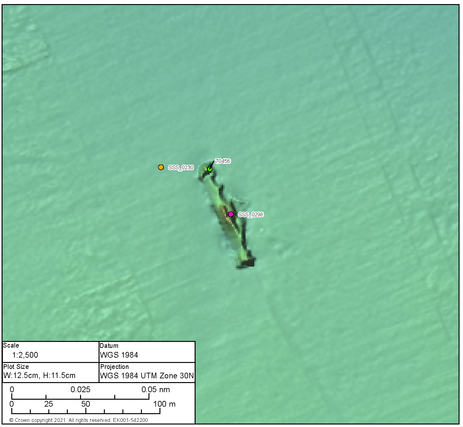
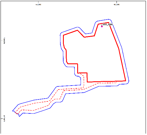
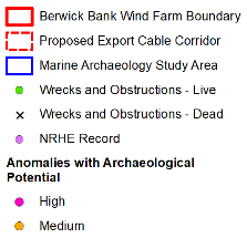
Position coordinates
| 601282.4 E 6245056.7 N | Area | Proposed Development array area |
| ||
Archaeological potential | High | |||||
Geophysical survey dimensions and notes | Dimensions: 91.6 m x 37.7 m x 6.1 m high Contact is associated with magnetic anomaly 1,056.7 and large debris adjacent 50 m to the west ( BBMB_SSS_2020_0254) and 60 m to the south (BBMB_SSS_2020_0255) | |||||
Build | Type | Likely to be the Swedish Steamship Oswin (recorded by UKHO 70438) | ||||
Construction | Form and evidence of significant magnetic anomaly suggest metal construction | |||||
Dimensions | Unknown | |||||
Shipyard | Built in Whitby in 1890 | |||||
Loss | Cause | Cargo ship on voyage to Goteburg carrying coal when it was sunk by a German submarine in 1918. No lives were lost; | ||||
Extent of survival | Coherent remains of a wrecked vessel. The wreck appears to be lying on its side and orientated north-east, south-west. The whole wreck shows evidence of collapse but it is more prominent to the south-west. Scour is visible around the wreck; however, it appears fairly localised. | |||||
|
Legend | |||||
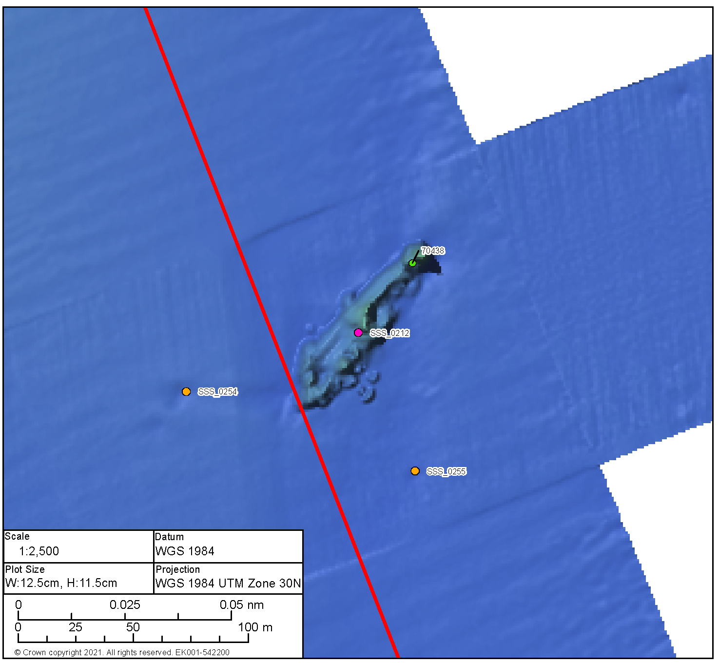

Position coordinates
| 588871.4 E 6232899.6 N | Area | Proposed Development array area |
| ||
Archaeological potential | High | |||||
Geophysical survey dimensions and notes | Dimensions: 41.5 m x 12.3 m x 0.8 m high Contact is not associated with any magnetic anomaly UKHO Ref 70460 | |||||
Build | Type | Unknown | ||||
Construction | Unknown | |||||
Dimensions | Unknown | |||||
Shipyard | Unknown | |||||
Loss | Cause | Unknown | ||||
Extent of survival | The visible remains appear to show one section of the wreck lying east, west, potentially the bow, to the north and further visible debris to the south. Scour is evident to the south and east of the main section of wreckage. It is not possible to determine the construction type with the data available. The wreck was first identified in 2007, through survey, as a highly degraded wreck measuring 70.5 m x 34.4 m. The differences in observed measurements are likely the result of sediment movement or continued degradation since 2007 | |||||
|
Legend | |||||
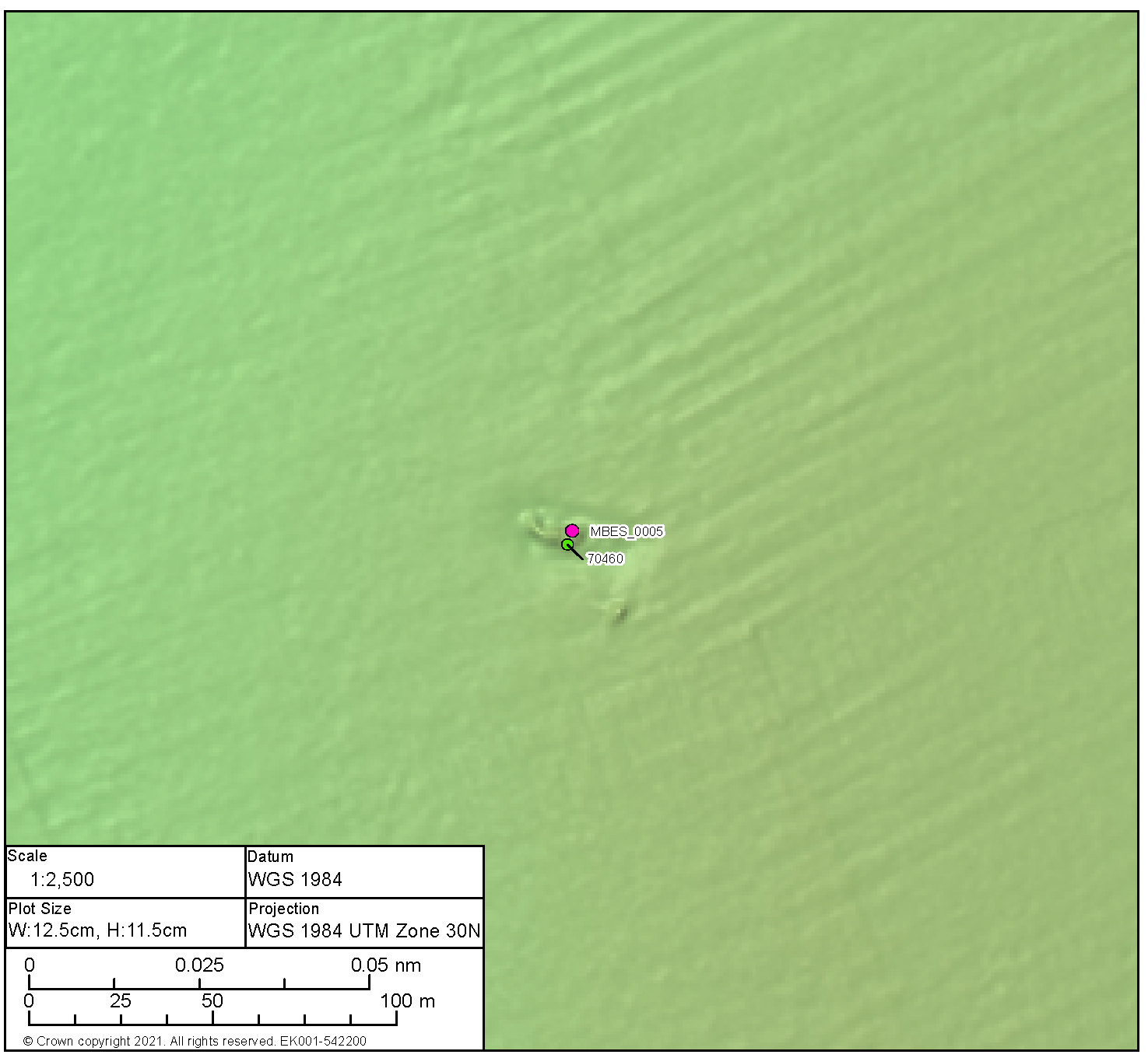

High Potential Contact BBMB_MBES_2020_0006 | ||||||
|---|---|---|---|---|---|---|
Position coordinates
| 590388.3 E 6232872.8 N | Area | Proposed Development array area |
| ||
Archaeological potential | High | |||||
Geophysical survey dimensions and notes | Dimensions: 28.5 m x 8.5 m x 3.0 m high Contact is not associated with any magnetic anomaly UKHO Ref 70457 | |||||
Build | Type | Unknown | ||||
Construction | Likely of metal construction | |||||
Dimensions | Unknown | |||||
Shipyard | Unknown | |||||
Loss | Cause | Unknown | ||||
Extent of survival | The wreck is lying east, west, and with prominent scour to each end. The form of the wreck is coherent and there is little evidence of outlying debris. The wreck was first identified in 2007, through survey, as an intact wreck measuring 46.2 m x 12.2 m with bows to the east and a list to port. There is a notable difference in dimensions, however there is no evidence of degradation or burial that would account for this, | |||||
|
Legend | |||||
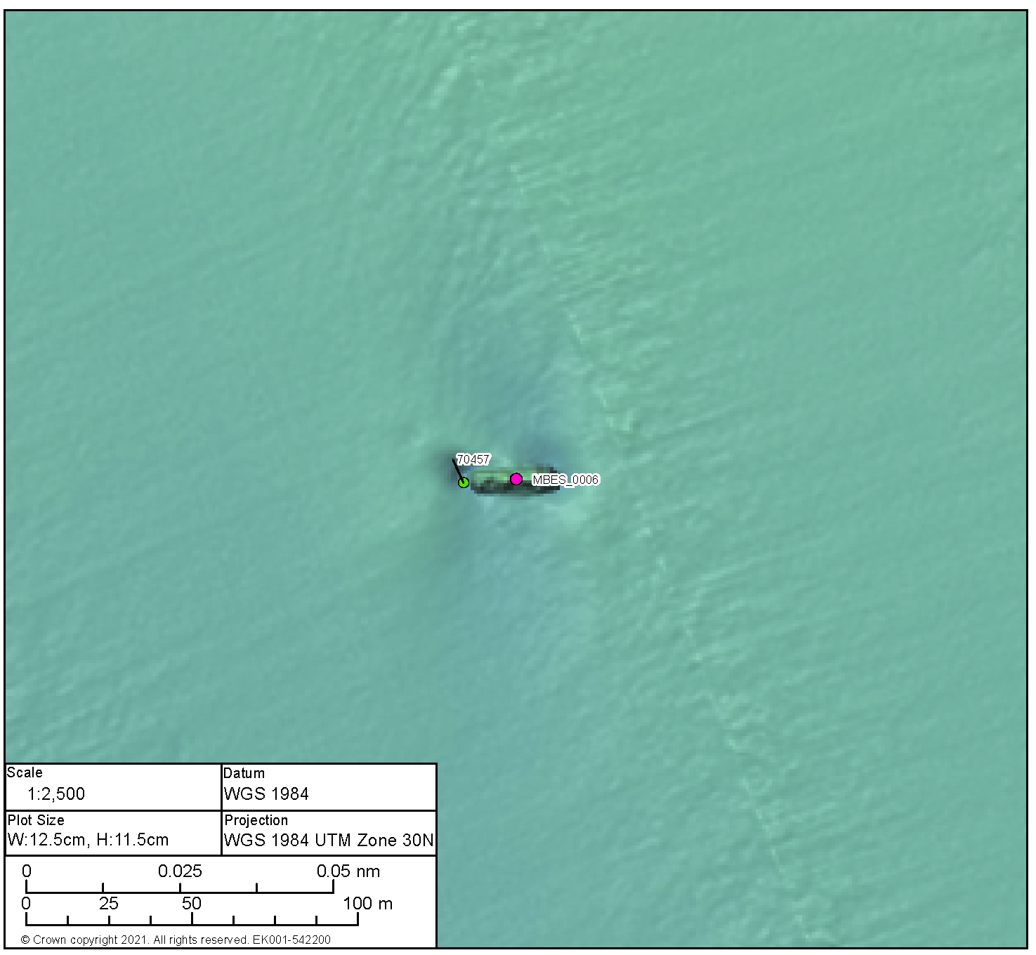
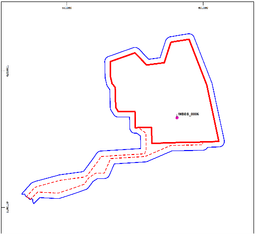
High Potential Contact BBMB_MBES_2020_0010 | ||||||
|---|---|---|---|---|---|---|
Position coordinates
| 597610.4 E 6231315.9 N | Area | Proposed Development array area |
| ||
Archaeological potential | High | |||||
Geophysical survey dimensions and notes | Dimensions: 34.0 m x 10.7 m x 2.7 m high Contact is not associated with any magnetic anomaly UKHO ref 70439 | |||||
Build | Type | Unknown | ||||
Construction | Likely of steel construction | |||||
Dimensions | Unknown | |||||
Shipyard | Unknown | |||||
Loss | Cause | Unknown | ||||
Extent of survival | Broken up remains of a wrecked vessel with the bow to the north. The wreck is in two distinct, and separated, sections with further evidence of an addition break to towards the stern. The wreck sits within an area of scour, more prominent to the bow and the stern. There is little evidence of outlying debris. First identified in 2007, through survey, as an intact, upright wreck, with the hold visible. Whilst the current dimensions correlate with those from 2007 the wreck can no longer be classed as intact. | |||||
|
Legend | |||||
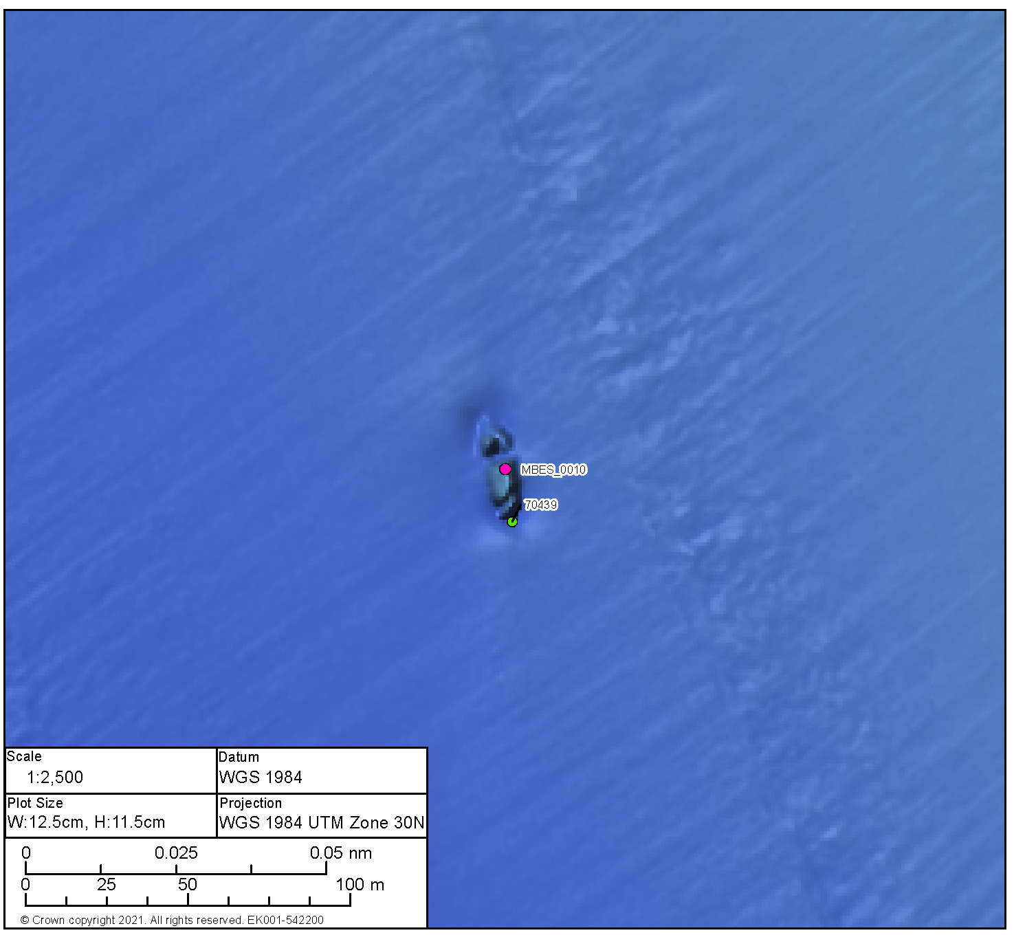

High Potential Contact BBMB_SSS_2020_0341 | ||||||
|---|---|---|---|---|---|---|
Position coordinates
| 591366.5 E 6226686.0 N | Area | Proposed Development array area |
| ||
Archaeological potential | High | |||||
Geophysical survey dimensions and notes | Dimensions: 33.5 m x 7.6 m x 3.3 m high Contact is not associated with a magnetic anomaly UKHO ref 3151 | |||||
Build | Type | Likely to be the Fishing Trawler Kitty recorded by UKHO | ||||
Construction | Likely of metal construction | |||||
Dimensions | 32.0 m x 6.4 m | |||||
Shipyard | Built by Earle’s Co, Hull in 1898 | |||||
Loss | Cause | En-route to Peterhead and captured by submarine and sunk by explosives in 1917. No lives were lost | ||||
Extent of survival | The wreck is coherent in form, upright, and with the bow to the south. There is evidence of collapse amidships with the bow and stern remaining prominent. There is potentially small, localised debris towards the bow on the port side. Slight scour is evident around the wreck, more prominent towards the bow. | |||||
|
Legend | |||||
High Potential Contact BBMB_SSS_2020_0332 | ||||||
|---|---|---|---|---|---|---|
Position coordinates
| 597770.1 E 6227609.8 N | Area | Proposed Development array area |
| ||
Archaeological potential | High | |||||
Geophysical survey dimensions and notes | Dimensions: 35.6 m x 8.6 m x 2.3 m high Contact is not associated with a magnetic anomaly UKHO ref 71600 | |||||
Build | Type | Unknown | ||||
Construction | Unknown | |||||
Dimensions | Unknown | |||||
Shipyard | Unknown | |||||
Loss | Cause | Unknown | ||||
Extent of survival | The visible remains of the vessel potentially indicate the bow lies to the south-east. There is evidence of outlying debris within the immediate vicinity of the wreck. Scour is present, although conversely there appears to be an accretion of material to the bow and the stern. | |||||
|
Legend | |||||
High Potential Contact BBMB_SSS_2020_0373 | ||||||
|---|---|---|---|---|---|---|
Position coordinates
| 571145.9 E 6248792.9 N | Area | Proposed Development array area |
| ||
Archaeological potential | High | |||||
Geophysical survey dimensions and notes | Dimensions: 33.1 m x 10.8 m x 8.7 m high Contact is not associated with a magnetic anomaly UKHO ref 70467 | |||||
Build | Type | Unknown | ||||
Construction | Unknown | |||||
Dimensions | Unknown | |||||
Shipyard | Unknown | |||||
Loss | Cause | Unknown | ||||
Extent of survival | Coherent remains of a small, wrecked vessel with the bow potentially lying to the south, east. The vessel does not appear broken, however there is potential evidence of collapse towards the stern. Scour is evident around the wreck, most prominent to the stern but also extending north-east and south-west. The wreck was first identified in 2007, through survey, as an upright, intact wreck measuring 41.3 m x 12.6 m. It is unclear where the difference in length originates as there is no evidence of collapsed or buried wreckage past the extents of that identified during this assessment. | |||||
|
Legend | |||||
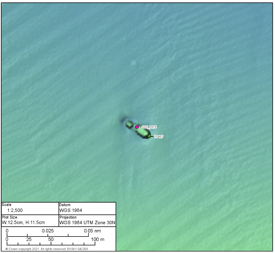
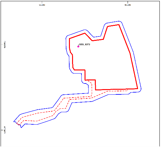
High Potential Contact BBMB_MBES_2020_0002 | ||||||
|---|---|---|---|---|---|---|
Position coordinates
| 567551.6 E 6246444.9 N | Area | Proposed Development array area |
| ||
Archaeological potential | High | |||||
Geophysical survey dimensions and notes | Dimensions: 60.5 m x 10.4 m x 3.4 m high Contact is not associated with a magnetic anomaly UKHO ref 70469 | |||||
Build | Type | Unknown | ||||
Construction | Likely of metal construction | |||||
Dimensions | Unknown | |||||
Shipyard | Unknown | |||||
Loss | Cause | Unknown | ||||
Extent of survival | Prominent remains of a wrecked vessel. The wreck appears largely intact and is highly likely to be inverted, scour is evident along all sides although it is less prominent to the north. There is little evidence of any outlying debris. | |||||
|
Legend | |||||
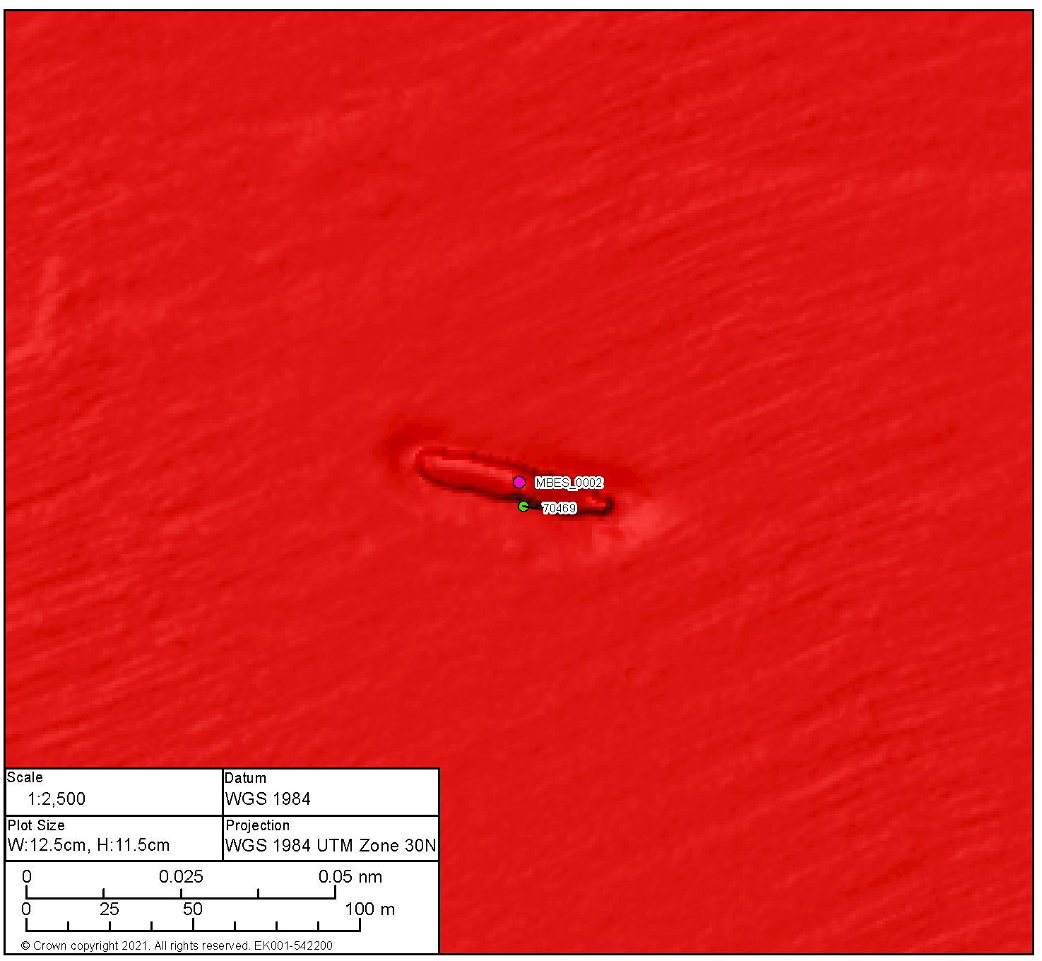
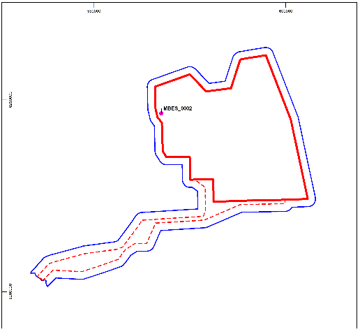
High Potential Contact BBMB_SSS_2020_0360 | ||||||
|---|---|---|---|---|---|---|
Position coordinates
| 577863.1 E 6245712.0 N | Area | Proposed Development array area |
| ||
Archaeological potential | High | |||||
Geophysical survey dimensions and notes | Dimensions: 48.1 m x 14.2 m x 2.3 m high Contact is associated with a significant magnetic anomaly of 13,071.7 nT UKHO ref 70464 | |||||
Build | Type | Unknown | ||||
Construction | Likely of metal construction | |||||
Dimensions | Unknown | |||||
Shipyard | Unknown | |||||
Loss | Cause | Unknown | ||||
Extent of survival | Very broken up remains of a wrecked vessel. The wreck is in two main sections orientated north, south with the most prominent remains to the south. A further smaller section lies to the south. Debris extents around the wreck but is largely confined to the footprint of the site. Scour is visible around the site. | |||||
|
Legend | |||||
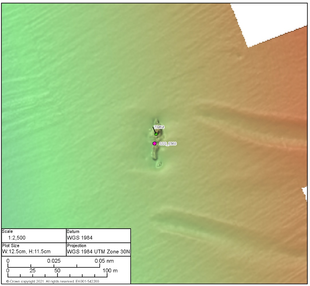

High Potential Contact BBMB_SSS_2020_0189 | ||||||
|---|---|---|---|---|---|---|
Position coordinates
| 574835.5 E 6230067.7 N | Area | Proposed Development array area |
| ||
Archaeological potential | High | |||||
Geophysical survey dimensions and notes | Dimensions: 36.2 m x 19.1 m x 1.0 m high Contact is not associated with a magnetic anomaly nor has it been recorded on the UKHO | |||||
Build | Type | Unknown | ||||
Construction | Of metal construction | |||||
Dimensions | Unknown | |||||
Shipyard | Unknown | |||||
Loss | Cause | Unknown | ||||
Extent of survival | Potential remains of a wrecked vessel. The form of the anomaly is vessel like in shape and comprises a distinct area of potential with anthropogenic debris characterised by multiple features many of which are linear in form. The wreck is low lying and very broken up, scour is evident around all sides, however it is more prominent to the north. | |||||
|
Legend | |||||
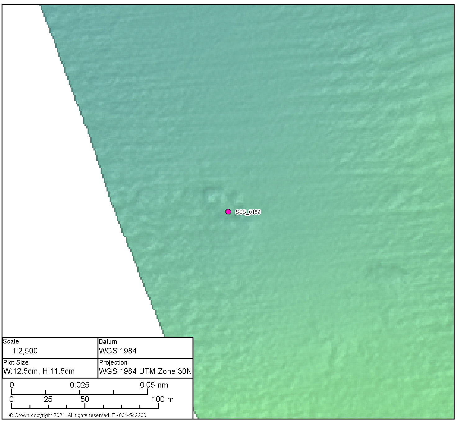
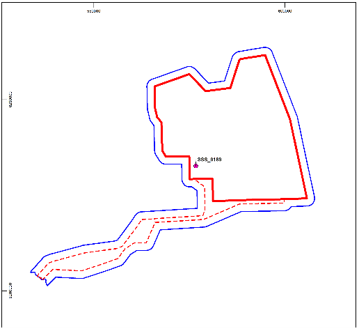
7.5. Confidential Annex E: Information Sheets: Medium Potential Archaeological Anomalies
7.5. Confidential Annex E: Information Sheets: Medium Potential Archaeological Anomalies
Medium Potential Contact BBMB_SSS_0230 | ||
|---|---|---|
Anomaly number | BBMB_SSS_0230 |
|
Location | Proposed Development array area | |
Position coordinates
| 590472.5E 6259083.4 N | |
Archaeological potential | Medium | |
Measurements: 1.1 m x 0.6 m x 0.1 m High This contact is not associated with any Magnetic Anomaly Wreck debris | ||
Medium Potential Contact BBMB_SSS_0258 | ||
|---|---|---|
Anomaly number | BBMB_SSS_0258 |
|
Location | Proposed Development array area | |
Position coordinates
| 595006.5 E 6260421.3 N | |
Archaeological potential | Medium | |
Measurements: 38.1 m x 2.7 m x 0.1 m high This contact is not associated with any Magnetic Anomaly Unidentified debris | ||
Medium Potential Contact BBMB_SSS_0294 | ||
|---|---|---|
Anomaly number | BBMB_SSS_0294 |
|
Location | Proposed Development array area | |
Position coordinates
| 592454.3 E 6255077.3 N | |
Archaeological potential | Medium | |
Measurements: 12.2 m x 8.0 m x 0.1 m high This contact is not associated with any Magnetic Anomaly Likely geological | ||
Medium Potential Contact BBMB_SSS_0255 | ||
|---|---|---|
Anomaly number | BBMB_SSS_0255 |
|
Location | Proposed Development array area | |
Position coordinates
| 601307.1 E 6244996.6 N | |
Archaeological potential | Medium | |
Measurements: 1.7 m x 1.7 m x 0.3 m high This contact is not associated with any Magnetic Anomaly Wreck debris | ||
Medium Potential Contact BBMB_SSS_0254 | ||
|---|---|---|
Anomaly number | BBMB_SSS_0254 |
|
Location | Proposed Development array area | |
Position coordinates
| 601207.6 E 6245031.1 N | |
Archaeological potential | Medium | |
Measurements: 11.8 m x 7.1 m x 1.3 m high This contact is associated with a Magnetic Anomaly of 288.8 nT Wreck debris | ||
Medium Potential Contact BBMB_SSS_0311 | ||
|---|---|---|
Anomaly number | BBMB_SSS_0311 |
|
Location | Proposed Development array area | |
Position coordinates
| 595997.4 E 6242134.5 N | |
Archaeological potential | Medium | |
Measurements: 5.9 m x 3.2 m x 0.2 m high This contact is not associated with a Magnetic Anomaly Unidentified debris | ||
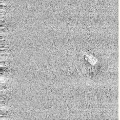
Medium Potential Contact BBMB_SSS_0209 | ||
|---|---|---|
Anomaly number | BBMB_SSS_0209 |
|
Location | Proposed Development array area | |
Position coordinates
| 596419.7 E 6237798.6 N | |
Archaeological potential | Medium | |
Measurements: 7.8 m x 4.1 m x 0.6 m high This contact is not associated with a Magnetic Anomaly Likely geological | ||
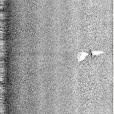
Medium Potential Contact BBMB_MBES_0007 | ||
|---|---|---|
Anomaly number | BBMB_MBES_0007 |
|
Location | Proposed Development array area | |
Position coordinates
| 591704.6 E 6233921.9 N | |
Archaeological potential | Medium | |
Measurements: 32.6 m x 6.6 m x 1.1 m high This contact is not associated with a Magnetic Anomaly Unidentified debris | ||
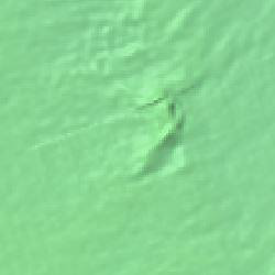
Medium Potential Contact BBMB_SSS_0317 | ||
|---|---|---|
Anomaly number | BBMB_SSS_0317 |
|
Location | Proposed Development array area | |
Position coordinates
| 597156.8 E 6233525.5 N | |
Archaeological potential | Medium | |
Measurements: 16.1 m x 8.2 m x 0.2 m high This contact is not associated with a Magnetic Anomaly Potential debris | ||
Medium Potential Contact BBMB_SSS_0340 | ||
|---|---|---|
Anomaly number | BBMB_SSS_0340 |
|
Location | Proposed Development array area | |
Position coordinates
| 591642.8 E 6227315.5 N | |
Archaeological potential | Medium | |
Measurements: 31.2 m x 13.2 m x 0.2 m high This contact is not associated with a Magnetic Anomaly Unidentified debris | ||
Medium Potential Contact BBMB_MBES_0015 | ||
|---|---|---|
Anomaly number | BBMB_MBES_0015 |
|
Location | Proposed Development array area | |
Position coordinates
| 599253.7 E 6225536.9 N | |
Archaeological potential | Medium | |
Measurements: 20.9 m x 16.3 m x 1.2 m high This contact is not associated with a Magnetic Anomaly Mound | ||

Medium Potential Contact BBMB_SSS_0329 | ||
|---|---|---|
Anomaly number | BBMB_SSS_0329 |
|
Location | Proposed Development array area | |
Position coordinates
| 589027.1 E 6237440.2 N | |
Archaeological potential | Medium | |
Measurements: 14.7 m x 12.3 m x 0.2 m high This contact is not associated with a Magnetic Anomaly Unidentified debris | ||
Medium Potential Contact BBMB_MBES_0009 | ||
|---|---|---|
Anomaly number | BBMB_MBES_0009 |
|
Location | Proposed Development array area | |
Position coordinates
| 591260.0 E 6234573.3 N | |
Archaeological potential | Medium | |
Measurements: 25.3 m x 4. 5 m x 0.9 m high This contact is not associated with a Magnetic Anomaly Unidentified debris | ||
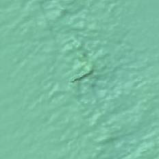
Medium Potential Contact BBMB_SSS_0380 | ||
|---|---|---|
Anomaly number | BBMB_SSS_0380 |
|
Location | Proposed Development array area | |
Position coordinates
| 586970.2 E 6232104.8 N | |
Archaeological potential | Medium | |
Measurements: 7.5 m x 3.4 m x 0.3 m high This contact is not associated with a Magnetic Anomaly Seabed disturbance | ||
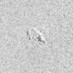
Medium Potential Contact BBMB_SSS_0368 | ||
|---|---|---|
Anomaly number | BBMB_SSS_0368 |
|
Location | Proposed Development array area | |
Position coordinates
| 570872.7 E 6255445.0 N | |
Archaeological potential | Medium | |
Measurements: 16.7 m x 8.1 m x 1.1 m high This contact is not associated with a Magnetic Anomaly Mound | ||
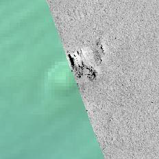
Medium Potential Contact BBMB_SSS_0136 | ||
|---|---|---|
Anomaly number | BBMB_SSS_0136 |
|
Location | Proposed Development array area | |
Position coordinates
| 573999.2 E 6250628.2 N | |
Archaeological potential | Medium | |
Measurements: 13.4 m x 9.0 m x 0.3 m high This contact is not associated with a Magnetic Anomaly Unidentified debris | ||
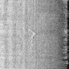
Medium Potential Contact BBMB_SSS_0364 | ||
|---|---|---|
Anomaly number | BBMB_SSS_0364 |
|
Location | Proposed Development array area | |
Position coordinates
| 577231.7 E 6239666.5 N | |
Archaeological potential | Medium | |
Measurements: 23.8 m x 3.3 m 0.4 m high This contact is not associated with a Magnetic Anomaly Unidentified debris | ||
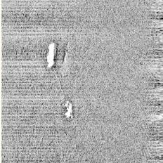
Medium Potential Contact BBMB_SSS_0178 | ||
|---|---|---|
Anomaly number | BBMB_SSS_0178 |
|
Location | Proposed Development array area | |
Position coordinates
| 567819.5 E 6237262.4 N | |
Archaeological potential | Medium | |
Measurements: 34.5 m x 3. 6 m x 0.2 m high This contact is associated with a Magnetic Anomaly up to 44.94nT Unidentified debris with magnetic anomaly | ||

Medium Potential Contact BBMB_SSS_0374 | ||
|---|---|---|
BBMB_SSS_0374 |
| |
Location | Proposed Development export cable corridor | |
Position coordinates
| 579361.4 E 6225549.2 N | |
Archaeological potential | Medium | |
Measurements: 140.8 m x 36.3 m x 0.8 m high This contact is associated with a Magnetic Anomaly up to 88.2 nT Unidentified debris with magnetic anomaly | ||

Anomaly number | BBMB_MBES_0008 |
|
Location | Proposed Development array area | |
Position coordinates
| 591460.0 6234080.5 | |
Archaeological potential | Medium | |
Measurements: 44.9.m x 23.3 m x 1.2 m high This contact is not associated with a magnetic anomaly Unidentified debris | ||
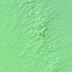
Medium Potential Contact BBMB_MBES_0016 | ||
|---|---|---|
Anomaly number | BBMB_MBES_0016 |
|
Location | Proposed Development array area | |
Position coordinates
| 591068.8 6258079.9 | |
Archaeological potential | Medium | |
Measurements: 103.2. m x 30.9 m x 1.1 m high This contact is not associated with a magnetic anomaly Likely geological | ||
Medium Potential Contact BBMB_SSS_0089 | ||
|---|---|---|
Anomaly number | BBMB_SSS_0089 |
|
Location | Proposed Development export cable corridor | |
Position coordinates
| 593403.5 E 6223700.3 N | |
Archaeological potential | Medium | |
Measurements: 6.1 m x 4.7 m x 0.3 m high This contact is not associated with a Magnetic Anomaly Seabed disturbance | ||
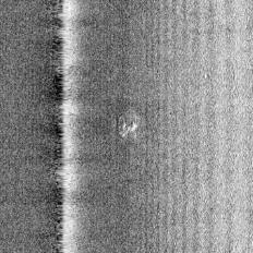
Medium Potential Contact BBMB_SSS_0092 | ||
|---|---|---|
Anomaly number |
| |
Location | Proposed Development export cable corridor | |
Position coordinates
| 567172.9 E 6218924.3 N | |
Archaeological potential | Medium | |
Measurements: 11.0 m x 3.3 m x 0.9 m high This contact is not associated with a Magnetic Anomaly Unidentified debris | ||
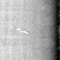
Medium Potential Contact BBMB_SSS_0028 | ||
|---|---|---|
Anomaly number |
| |
Location | Proposed Development export cable corridor | |
Position coordinates
| 562254.0 E 6217904.9 N | |
Archaeological potential | Medium | |
Measurements: 5.6 m x 1.6 m x 0.5 m high This contact is not associated with a Magnetic Anomaly Potential debris | ||
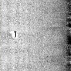
Medium Potential Contact BBMB_SBP_0001 | ||
|---|---|---|
Anomaly number |
| |
Location | Proposed Development export cable corridor | |
Position coordinates
| 549261.0 E 6206294.0 N | |
Archaeological potential | Medium | |
Measurements: N/A This contact is not associated with a Magnetic Anomaly Unidentified anomaly | ||
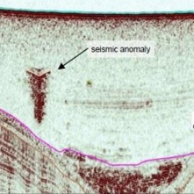
7.6. Confidential Annex F: Gazetteer of Magnetic Anomalies
7.6. Confidential Annex F: Gazetteer of Magnetic Anomalies
Table 7.5: Gazetteer of Potential Magnetic Anomalies
[1] This was the position stated in a letter from HES to the Applicant dated 18 November 2021 and in an email from SBC to RPS Energy (the Applicant’s consultants on 21 December 2021. ELC did not comment on marine archaeology in its response to scoping.
[2] Content available on the UK Government Website [https://www.legislation.gov.uk/ukpga/1986/35/contents] accessed August 2022