

1. Introduction
1.1. Background
1.1. Background
- Berwick Bank Wind Farm Limited (BBWFL) is a wholly owned subsidiary of SSE Renewables (SSER) Limited and will hereafter be referred to as ‘the Applicant’. The Applicant is developing the Berwick Bank Wind Farm (hereafter referred to as ‘the Project’). The Project will be located in the outer Firth of Forth and Firth of Tay, 47.6 km east of the East Lothian coastline and 37.8 km from the Scottish Borders coastline.
- RPS Energy (RPS) has been commissioned to prepare an Archaeological Monitoring and Mitigation: Outline Written Scheme of Investigation (WSI) and Protocol for Archaeological Discoveries (PAD) (hereafter referred to as the Outline WSI (and PAD) for the offshore elements of the Project – those located seaward of Mean Low Water Springs (MLWS) (and henceforth referred to as the Proposed Development). The terrestrial/onshore archaeology, including intertidal elements is considered in a separate WSI to be developed before onshore construction activities start (see volume 1 chapter 10 of the Berwick Bank Wind Farm Onshore Environmental Impact Assessment (EIA) Report (SSER, 2022a).
- This Outline WSI and PAD detail the principles to be implemented to ensure the protection of marine archaeological resources through all Proposed Development phases. The measures within this Outline WSI and PAD encompass the wide range of development options under consideration for the Proposed Development to allow post-consent flexibility in the final design. The Outline WSI and PAD will be monitored and updated throughout the post-consent process to ensure that the WSI is appropriate to the final design. This Outline WSI and PAD will be finalised prior to construction and is secured through the Proposed Development’s Code of Construction Practice (CoCP). The Outline WSI and PAD will continue to be developed in consultation with Historic Environment Scotland (HES) and will be submitted to Marine Scotland - Licensing Operations Team (MS-LOT; as the licencing authority) for approval, prior to construction.
- This Outline WSI (and PAD) has been reviewed and updated since it was last shared with consultees[1] in November 2021. These updates address the selection of Skateraw Landfall option and feedback received from consultation. Updates also account for revisions made to the Proposed Development array area (which has been reduced by approximately 20 percent) in July 2022 and Project Design Envelope (PDE). The marine archaeological baseline has been updated to account for a revised marine archaeology study area that corresponds with the new Proposed Development boundaries (see Figure 1.1 Open ▸ ). The updated baseline described in the Marine Archaeology Technical Report reports no substantial or material changes relative to a revised marine archaeology study area. No additional risks to marine archaeology were identified that could warrant changes to the general methodology and procedures set out in the WSI. No additional mitigation measures or adaptations to the strategy have been made.
- The combined Outline WSI (and PAD) and the Marine Archaeology Technical Report are standalone documents. The Outline WSI and PAD are provided with the Proposed Development’s Offshore EIA Report supporting the Application for planning consent (see volume 4, appendix 22 of the Offshore EIA Report). The updated Marine Archaeology Technical Report is provided with the Application as an ‘accompanying document’ to ensure that the archaeological baseline that corresponds to the WSI is available to consultees.
- As described in volume 1, chapter 3, the Applicant is developing an additional export cable grid connection to Blyth, Northumberland (the Cambois connection). Applications for necessary consents (including any requirements to protect potential marine archaeology) will be applied for separately.
1.2. Aims and Objectives
1.2. Aims and Objectives
- The aim of this Outline WSI and PAD is to outline the archaeological mitigation measures to be undertaken by the Applicant prior to and throughout the construction, operation and maintenance, and decommissioning phases of the Proposed Development.
- The Outline WSI and PAD is informed by pre-application consultation with HES (reported in Table 1.1 Open ▸ ) and the baseline review of known and potential archaeology within the marine archaeology study area outlined in the Marine Archaeology Technical Report).
- The objectives of the Outline WSI and PAD are as follows:
- to fulfil the requirements of the Archaeological Curator (AC) in respect of archaeological monitoring and mitigation of works associated with the Proposed Development;
- to establish the exact position and extent of any Archaeological Exclusion Zones (AEZs) and Temporary Archaeological Exclusion Zones (TAEZs);
- to ensure consultation with archaeologists on all elements of the Proposed Development’s design that have the potential to impact archaeological sites and materials;
- to ensure that any further geophysical and geotechnical investigations associated with the Proposed Development are subject to archaeological input, review, recording and sampling where required;
- to ensure archaeological involvement in any proposed diver and/or remotely operated vehicles (ROV) obstruction surveys conducted within the Proposed Development;
- to propose measures for the mitigation of archaeological remains encountered during further geotechnical/geophysical sampling or investigations, or during construction work associated with the Proposed Development; and
- to establish the reporting and archiving requirements for the archaeological works undertaken during all phases of the Proposed Development and post-construction monitoring.
Figure 1.1: Location of the Proposed Development and Marine Archaeology Study Area (Revised July 2022)
Table 1.1: Summary of Key Consultation and How This Was Considered in the Marine Archaeological Technical Report, Written Scheme of Investigation and Protocol for Archaeological Discoveries
2. Berwick Bank Wind Farm
2. Berwick Bank Wind Farm
- wind turbines and associated support structures and foundations and scour protection;
- Offshore Substation Platforms (OSPs)/Offshore convertor station platforms and associated support structures and foundations;
- inter-array and interconnector cabling within the Proposed Development array area; and
- up to eight offshore export cables within the Proposed Development export cable corridor that connect the OSPs/Offshore convertor station platforms to the Skateraw Landfall.
- The Proposed Development array area is approximately 1,010.2 km2 and located 47.6 km east of the East Lothian coastline and 37.8 km from the Scottish Borders coastline at St. Abbs ( Figure 1.1 Open ▸ ). The Proposed Development array area lies to the south of Seagreen 1 (under construction) and Seagreen 1A Project (consented) array area within the Firth of Forth zone.
- The Proposed Development export cable corridor has been identified and will make landfall at Skateraw on the East Lothian coast ( Figure 1.1 Open ▸ ). The Proposed Development export cable corridor extends offshore in a north-easterly directly from the coast to the south west boundary of the Proposed Development array area ( Figure 1.1 Open ▸ ).
2.2. Project Design Envelope
2.2. Project Design Envelope
- The PDE of relevance to marine archaeology concerns the parameters that define the maximum possible disturbance of the seabed, which are detailed below.
- Seabed disturbance during the construction phase as a result of:
- wind turbine foundation installation: installation of up to 179 wind turbines on suction caisson foundations with associated scour protection;
- installation of up to ten OSPs/Offshore convertor station platforms;
- installation of cable protection associated with up to 1,225 km of inter-array cables, 94 km of interconnector cables and 872 km of offshore export cables and cable crossings;
- sand wave clearance for up to 20% of offshore export cable length and up to 30% of inter-array cables and OSP/Offshore convertor station platforms interconnector cables;
- boulder clearance for up to 20% of the export, inter-array cables and interconnector cable lengths,
- Up to 1,268,000 m2 of disturbance from the use of jack-up vessels during foundation installation, with up to four jack-up locations per wind turbine and four jack-up locations per OSP/Offshore convertor station platform;
- deposition of sand wave clearance material dredged within the Proposed Development array area and Proposed Development export cable corridor;
- clearance of up to 14 UXOs; and
- cable barge anchor placement associated with cable laying from a 100 m2 anchor placed every 500 m.
- Seabed disturbance during the operation and maintenance phase as a result of:
- sand wave clearance to an average depth of 1.3 m, to a width of 25 m, average height 5 m and along 174.4 km of inter-array and inter-connector cables and 395.7 km of offshore export cables;
- up to 245 major component replacements for wind turbines and up to seven for OSPs/Offshore convertor station platforms;
- jack-up barge deployments over the 35- year lifetime of the Proposed Development;
- preventative maintenance (annual inspections) of subsea cables including routine inspections to ensure the cable is buried to an adequate depth and not exposed. The integrity of the cable and cable protection system will also be inspected. Maintenance works to rebury/replace and carry out repair works on inter-array and offshore export cables should this be required.
- disturbance from the use of jack-up vessels during foundation decommissioning;
- disturbance from removal of cables;
- anchor placement associated with cable decommissioning from a 100 m2 anchor placed every 500 m
- barge anchor placement during offshore export cables removal; and
- up to eight exit pits, each 20 x 5 m, for removal of up to eight cable ducts from the landfall.
3. Baseline
3. Baseline
3.1. Overview
3.1. Overview
- A baseline review of known and potential archaeology assets within the marine archaeology study area defined for the Proposed Development has been undertaken (as reported in the Marine Archaeology Technical Report). The following archaeological assets were identified within the marine archaeology study area:
- near shore potential for submerged prehistoric land surfaces and sites;
- known wrecks and seabed obstructions;
- documented shipping losses;
- possible unknown and undocumented wrecks from various periods;
- possible stray finds of shipborne debris from various periods; and
- geophysical anomalies that appear to be wreck sites or wreck debris.
- A summary of the baseline environment is outlined in the following sections (for more detail please see the Marine Archaeology Technical Report).
3.2. Submerged prehistoric archaeology
3.2. Submerged prehistoric archaeology
- Analysis of geophysical survey data collected within the Proposed Development array area and Proposed Development export cable corridor identified potential palaeo-landscape features within the marine archaeology study area (within the Geophysical Survey Area (GSA))[2]. These include palaeo-channels, incised valleys, and relict glacial lakes. However, the proglacial environments in which they are likely to have been formed are not likely to have been attractive locations for human habitation. In other areas, such features would have formed foci for human activity following climatic amelioration. However, with respect to the marine archaeology study area, sea level rises are likely to have submerged these features relatively rapidly, further demonstrating the limited archaeological potential of the area.
- As a result, it is considered unlikely that evidence of in situ Palaeolithic and Mesolithic activity will be found within the marine archaeology study area because of repeated glaciations, marine transgressions and associated fluvial activity. There is, however, some paleo-environmental potential within the Aberdeen Ground Formation. Within the Proposed Development export cable corridor there is some potential for late Palaeolithic/Mesolithic deposits in the near-shore area. However, because of erosion, redeposited material is more likely than in situ evidence. In addition, the potential for the localised presence of peat buried in the Quaternary deposits within the Proposed Development export cable corridor could suggest good palaeo-environmental potential. Where these sediments are present, there is good potential for the preservation of organic matter such as wooden fish traps and other buried organic materials associated with prehistoric exploitation of the coastal margins.
3.3. Maritime archaeology
3.3. Maritime archaeology
- No designated wrecks are recorded within the Proposed Development site.
- A total of 244 anomalies of potential anthropogenic origin have been recorded by geophysical survey within the Proposed Development site. Of these, 197 were identified within the Proposed Development array area (eleven were identified as wrecks and therefore as having a ‘high archaeological potential’ and 20 to have ‘medium potential’). Of the 47 anomalies identified within the Proposed Development export cable corridor, five were considered to have ‘medium potential’ to represent remains of archaeological significance. The remaining anomalies were assessed against all available evidence to have ‘low potential’ and considered unlikely to have any archaeological significance.
- The geophysical survey was not undertaken across the full extent of the Proposed Development export cable corridor and as such, eight wrecks recorded on the United Kingdom Hydrographic Office (UKHO) database were not verified by the survey. Of these, three are recorded as ‘live wrecks’ and potentially indicative of material on the seabed. The positions of these contacts are shown in Figure 3.1 Open ▸ and listed in the Marine Archaeology Technical Report.
- A total of six UKHO records from within the Proposed Development site were not identified by geophysical survey. All these records were related to wrecks that are now considered ‘dead’[3] by the UKHO. The positions given for each of these records is deemed to be approximate, or for filing purposes only. As such, it is highly likely that any wreck to which they may relate is not at the location of the record.
- In addition, a total of 106 magnetic anomalies with an intensity >100 Nanotesla (nT) with no strong correlating seabed contact were identified within the Proposed Development site. Of these, 37 lie within the Proposed Development array area and 69 within the Proposed Development export cable corridor. These anomalies have been provisionally identified as areas of archaeological potential. The position of these magnetic anomalies is shown in Figure 3.1 Open ▸ and listed in the Marine Archaeology Technical Report.
- A total of 36 AEZs to protect the high and unconfirmed medium potential contacts are therefore recommended. In addition, a total of three TAEZs are proposed to protect records of live wrecks outside the survey data coverage. It is intended that these AEZs would remain in place for the lifespan of the Proposed Development, unless amended or removed through further survey. Similarly, the TAEZs will remain in place until further survey can establish the archaeological potential of the live wrecks indicated and whether the temporary exclusion areas should become AEZs or be removed.
- Magnetic anomalies >100 nT within the marine archaeology study area have been identified as Areas of Archaeological Potential. No formal exclusion zones are recommended at this stage however, the positions of magnetic anomalies are identified in the Applicant’s reporting and the archaeological potential of these areas will be monitored during future assessments.
Figure 3.1: The Positions of Magnetic Anomalies Identified within the Marine Archaeology Study Area
4. Potential Impacts
4. Potential Impacts
- The Proposed Development site (comprising the Proposed Development array area and Proposed Development export cable corridor is considered to contain deposits of archaeological potential. These include:
- potential prehistoric sites and land surfaces dating from the late Palaeolithic and early Mesolithic periods (close to the shore);
- undiscovered maritime remains (wrecks and debris);
- aircraft remains, and;
- known maritime remains.
- Any construction activities and subsequent works that disturb the seabed therefore have the potential to negatively affect archaeological sites and deposits.
- The most obvious way in which these archaeological remains can be negatively affected during the construction phase is by a direct impact, for example from dropping anchors, the use of grapnels, cable laying, the use of jack up barges or via foundation installation. In addition, indirect impacts on archaeological remains can occur when direct effects impact an intermediary receptor. For example, if the removal of sediment (a direct effect) influences the hydrodynamic regime (a secondary effect) and this results in increased erosion and scouring and damage to an archaeological receptor. Sediment cover typically provides protection to a submerged archaeological resource, which can deteriorate more rapidly once exposed.
4.2. Measures Adopted as part of the Proposed Development
4.2. Measures Adopted as part of the Proposed Development
- A number of measures have been proposed to avoid or reduce the potential for impacts on marine archaeology. The measures adopted for the Proposed Development relate to the Proposed Development site (comprising the Proposed Development array area and Proposed Development export cable corridor). The mitigation measures set out in Table 4.2 Open ▸ are intended to:
- identify archaeologically sensitive remains encountered during the development;
- avoid archaeologically sensitive remains wherever possible, and;
- enable the recording of any remains that could be directly affected.
Table 4.2: Designed-in Measures Adopted for the Proposed Development
5. Responsibilities and Communications
5. Responsibilities and Communications
5.1. Introduction
5.1. Introduction
- This section sets out the responsibilities of relevant parties and the lines of communications during all phases of the Proposed Development. This structure aims to ensure that the archaeological mitigation measures described within the WSI and PAD are fully implemented in a timely manner that does not interfere with the smooth running of the Proposed Development’s programme.
- An organogram identifying the communication channels between different parties, discussed within this Outline WSI and PAD is illustrated in Figure 5.1 Open ▸ below.
Figure 5.1: Organogram Illustrating the Berwick Bank Wind Farm Marine Archaeology Team
Figure 5.2: Organogram Illustrating the Key Marine Archaeology Consultees for the Proposed Development
5.2. Contacts
5.2. Contacts
- The current relevant contacts at HES are:
- HES planning, Consents and Advice Service hmconsultations@hes.scot - 0131 668 8896
- The current relevant contact at Scottish Borders is:
- Keith Elliott keith.elliott@scotborders.gov.uk 01835 824 000 ext 8886
- The current relevant contact at East Lothian is:
- Andrew Robertson arobertson@eastlothian.gov.uk Tel: 01620 8270397
- Martin McGroarty Martin.McGroarty@fife.gov.uk Tel: 03451 55 00 00
- The current relevant contacts for the PAD Implementation Service are:
- Wessex Archaeology, Portway House, Old Sarum Park, Salisbury, Wiltshire SP4 6EB
- The current contact for the UK Receiver of Wreck is
- The Receiver of Wreck Team row@mcga.gov.uk 020 3817 2575
5.3. Responsibilities
5.3. Responsibilities
5.3.1. The Applicant
- BBWFL, a wholly owned subsidiary of SSE Renewables Limited, is the Applicant for the Proposed Development. The Applicant will directly engage with the appointed Construction Contractor and the RA, as necessary.
- The responsibility for implementing the WSI and PAD rests with the Applicant and its appointed representatives.
- Following the grant of development consent, the Applicant would provide the RA with the programme of construction.
- The Applicant or their representative will advise the RA of its requirements or responsibilities under any CoCP produced for the Proposed Development. The CoCP will fully reference the WSI (and PAD) to inform all phases of the Proposed Development.
- The Applicant or their representatives will submit the archaeological Method Statements or reports to Marine Scotland - Licensing Operations Team in the first instance who will then forward to the Archaeological Curator for approval (HES).
5.3.2. Retained Archaeologist
- The Applicant shall employ the services of a suitably qualified and experienced Archaeological Contractor (the RA) to ensure the effective implementation of the WSI and PAD and other relevant commitments in relation to archaeology.
- Prior to application submission RPS supported by MSDS Marine are acting in the role of the RA.
- In relation to the implementation of the WSI, the RA will report to the Applicant or their named representative. Interaction with the Proposed Development’s construction team will be administered by the Applicant or their appointed representative and advised by the RA
- The responsibilities of the RA will include:
- maintaining, reviewing and updating the WSI as required;
- advising the Proposed Development’s construction team on those elements of the Proposed Development that require archaeological involvement;
- ensuring the scope of work specifications for the Proposed Development meet archaeological requirements;
- liaising with the Applicant/Construction Contractors regarding timescales of completion of site investigations (SI) to ensure sufficient time is available to complete all fieldwork in accordance with the WSI;
- advising the Project Manager for the Proposed Development on the micro siting of infrastructure, particularly wind turbines, OSPs/Offshore convertor station platforms based upon archaeological results from pre-application and pre-construction surveys;
- advising, preparing and issuing Method Statements to the Archaeological Curator for approval;
- implementing and monitoring the PAD;
- providing advice to vessel staff/UXO) specialists in the event of a discovery of high archaeological interest;
- monitoring the work of and liaising with the Archaeological Contractor(s) where this is not the RA;
- monitoring the preparation and submission of archaeological reports as appropriate and making them available to the Archaeological Curator for approval;
- preparing provisions for the management of the Proposed Development’s archives in consultation with an appropriate museum; and
- advising the Applicant and the Archaeological Curator on final arrangements for the analysis, archive deposition, publication and popular dissemination of the results of the archaeological works.
5.3.3. Archaeological Contractors
- Archaeological Contactors may be employed by the Applicant or the RA. Suitably qualified Archaeological Contractors may be called to provide a range of services relating to specialised archaeological provisions (e.g. divers/remote operated vehicles (ROV), geotechnical analysis etc.).
5.3.4. Construction Contractors
- All Construction Contractors engaged in the construction, operation and maintenance and decommissioning of the Proposed Development shall:
- familiarise themselves with the generic requirements of the WSI and make them available to their staff;
- obey legal obligations in respect of ‘wrecks’ under the Merchant Shipping Act 1995 (see section 13);
- obey legal obligations in respect of ‘treasure’ under the Treasure Act of 1996 and the Treasure Trove system in Scotland;
- respect constraint maps and AEZs (see section 8);
- notify the RA prior to any diving/ROV investigation;
- notify the RA in advance of any construction works that warrant archaeological mitigation;
- assist and afford access to archaeologists employed by the Applicant;
- inform the RA of any environmental constraint or matter relating to health, safety and welfare which they are aware that is relevant to the archaeologist’s activities;
- implement the PAD (see section 13); and
- suspend work in areas where objects have been identified as being of potential archaeological interest and contacting the RA in the event of a discovery of potentially high archaeological interest.
5.3.5. Archaeological Curator
- HES is the Archaeological Curator (AC) for heritage matters offshore up to Mean High Water Springs (MHWS), HES are the public body responsible for the care and protection of Scotland’s historic environment, which includes marine archaeology within Scotland’s territorial waters. East Lothian, Scottish Borders and Fife Council will also be consulted for completeness.
- Contact with the Archaeological Curator will be through Marine Scotland - Licensing Operations Team as the Regulator.
- Method Statements, assessment reports or other deliverables will be submitted by the Applicant to Marine Scotland - Licensing Operations Team who will forward on to the Archaeological Curator for approval. Their agreement/acceptance of the documents will be assumed if no contrary response is received within 30 working days of submission.
- To encourage timely decisions relating to archaeological mitigation and avoid disruptions to the Proposed Development’s program, MS-LOT and HES will be consulted as soon as practicable on discoveries made during the programme of works and regarding the management and removal of AEZs or TAEZs
6. Pre-construction Geophysical and Geotechnical Surveys
6. Pre-construction Geophysical and Geotechnical Surveys
- Pre-construction geophysical and geotechnical work is anticipated within the Proposed Development. Archaeological input into survey specifications will be obtained to secure specialist advice on methods to investigate areas of archaeological potential and avoid impacts on known heritage assets.
6.1.2. Health and Safety
- Health and Safety considerations are of paramount importance in conducting all fieldwork in relation to the archaeological mitigation outlined in this Outline WSI and PAD. Safe working practices will always override archaeological considerations. All work must be carried out in accordance with the Health and Safety at Work etc Act 1974, the Management of Health and Safety at Work Regulations 1999 the Federation of Archaeological Managers and Employers health and safety manual (Health and Safety in Field Archaeology Federation of Archaeological Managers and Employers 2010) and all other relevant and contemporary Health and Safety legislation, regulations and codes of practice that apply at the time the works take place.
- The RA will ensure that any Method Statements prepared to meet the requirements of the WSI are compliant with the requirements of the Applicant‘s Health and Safety Plans.
6.2. Planning
6.2. Planning
- When planning geophysical and geotechnical surveys the Applicant will advise the RA (or RPS supported by MSDS Marine if pre-submission) well in advance of the survey planning to secure specialist input into the scope of works.
- The RA will advise on measures to optimise archaeological results from the geotechnical and geophysical surveys. Areas to be considered will include:
- the available details on previously identified sites and/or anomalies and areas of heightened archaeological potential;
- the archaeological potential of areas where no existing sites and/or anomalies are yet known;
- the equipment, equipment settings, survey methodologies and data collection points that will optimise the recovery of archaeological information; and
- the requirements for data analysis, interpretation and archiving.
- The advice from the RA may also include:
- altering vibrocore/borehole positions to maximise the potential for the collection of archaeological data and/or;
- altering grab sample positions to maximise the potential for the collection of archaeological data.
- The results of the surveys will be used to inform the final positioning of wind turbines and other infrastructure. Where a direct impact on a heritage asset is likely to occur, any anomalies identified will be subject to further investigation to determine whether they represent archaeology. In situations where such investigation suggests an archaeological origin, the anomalies in question will be subject to formal AEZs. The Applicant will consult the RA in advance of the finalisation of the wind turbine and infrastructure positions to ensure that known archaeological constraints identified by these surveys are avoided.
- A detailed Method Statement will be produced by the RA in advance of each geophysical and geotechnical survey. Approval by the Archaeological Contractor will be assumed if no response is received within 30 days of submission of each individual Method Statement.
- The Method Statements produced will be in accordance with the clauses set out in the ‘Model Clauses for Archaeological Written Schemes of Investigation’ (The Crown Estate 2010).
6.3. Geophysical Survey
6.3. Geophysical Survey
- New geophysical data obtained for areas where direct impacts are anticipated will undergo analysis by a suitably qualified Archaeological Geophysical Contractor.
- Survey data may be collected to inform potential modifications to an AEZ that has been implemented to protect identified sites and/or anomalies of interest (see section 8). In this instance the collection of such data will be supervised by a suitably qualified Archaeological Geophysical specialist who would be present on the survey vessel to ensure the quality of these data.
6.3.2. Survey Specifications
- The following specifications are based on the ‘Historic Environment Guidance for the Offshore Renewable Sector’ (COWRIE, 2007) and ‘Marine Geophysics Data Acquisition, Processing and Interpretation Guidance Notes’ (Historic England, 2013):
- Surveys will be carried out to a single datum and co-ordinate system. All survey data, including navigation, (position, heading and velocity) will be acquired digitally in industry-standard formats. Care will be taken to maintain the orientation and attitude of sensors online. Track-plots will be corrected for layback (including catenary effects) and made available in digital, Geographic Information System (GIS) form.
- A Sidescan Sonar Survey (SSS) will be carried out at frequency, range and gain settings capable of resolving all objects that are 0.5 m and above throughout the survey area. Preferably, line spacing will be equal to or less then the effective range and no more than 1.75 times the effective range. Anomalies of apparent archaeological potential will be ‘boxed’ by at least two and preferably four lines along and across the principal axis of the anomaly. These lines will be offset so that the anomaly does not lie immediately beneath the survey fish and run at optimal frequency and range settings for imaging the anomaly. SSS data will be made available to the interpreting archaeologist in the form of raw, un-mosaic files in a suitable proprietary format.
- A sub-bottom survey (seismic) will be carried out using a source capable of resolving internal structures to the full depth of impact from the Proposed Development within Quaternary deposits. Line and cross-line spacing, and orientations will be sufficient to resolve the extents and characteristics of the principal Quaternary deposits. A single beam echosounder will be run in conjunction with the sub-bottom survey; the first reflector (seabed) will be levelled with reference to a tide gauge. Sub-bottom data will be made available in a suitable proprietary format.
- A Magnetometer Survey will be carried out using a caesium gas or equivalent system capable of resolving anomalies of 5 nT and above. Lines can be run in conjunction with other sensors (i.e., on the same line spacing and orientation) but provision will be made to run additional lines and cross-lines in areas of apparent archaeological potential, as indicated by the desk-based information or any of the other sensors. Magnetometer data will be made available as cleaned, de-spiked and tidally corrected text (x, y and z) files for each line, including layback.
- Where a multi-beam survey (Multibeam Echo Sounder (MBES)) is to be carried out solely for archaeological purposes then a system capable of achieving an effective cell/bin size better than 1 m is preferred. Use of a beam-forming system is preferred. The entire survey area will be ensonified. Where an anomaly of apparent archaeological potential is identified, an additional single slow pass will be carried out at the highest possible ping rate. Single beam and multi-beam data will be made available as de-spiked and tidally-corrected text (x, y and z) files for each line, in addition to any gridded/rendered surfaces.
- Geophysical surveys may be required for a number of purposes and may be to a lower specification than is generally required to be optimum for archaeological surveying purposes as identified above. If a lower specification is proposed, then it is important that early consultation is undertaken with the RA to allow scope for additional lines of survey in order to fully understand the nature and extent of anomalies identified.
- If an UXO survey is conducted the magnetometer dataset will be subject to archaeological analysis in order to clarify the nature and extent of the known sites and anomalies and to identify as yet unknown buried sites.
6.3.3. Interpretation
- Once the surveys have been processed to meet their primary objectives, the survey data, together with factual reports will be made available in digital formats to the RA or a suitably qualified Archaeological Contractor for archaeological analysis and interpretation.
- Archaeological interpretation will include:
- examination of SSS, Magnetometer, MBES and Seismic data for areas within the vicinity of known wreck sites and previously identified archaeological anomalies;
- examination of SSS, Magnetometer, MBES and seismic data within areas that will be subject to direct impacts from the Proposed Development to identify any unknown wreck remains;
- the assessment of seismic data to plot the general trend of the sub-surface sediments with archaeological potential; and
- further detailed interpretation of seismic data following the initial assessment within those areas that will be subject to impacts from the Proposed Development.
- The archaeological results of any further geophysical survey will be compiled as a report by the RA or the Archaeological Contractor (if different to the RA) and will include likely requirements (if any) for further archaeological work. The report will be submitted to the Applicant by the RA and then on to the Archaeological Contractor for approval. The scope of any further work will be agreed between the Applicant (through the RA) and the Archaeological Curator. The work may be used to inform the final design.
6.4. Geotechnical Surveys
6.4. Geotechnical Surveys
- Geotechnical data assessment will be subject to a staged programme of assessment and analysis by a suitably qualified Archaeological Geotechnical Contractor. Early planning and liaison with the Archaeological Geotechnical Contractor to enable the archaeological recording of intact cores will be a key requirement of this dataset.
- The stages are based on the ‘Historic Environment Guidance for the Offshore Renewable Sector’ (COWRIE 2007). Each stage of this phased assessment of the cores is subject to the results of the preceding stages:
- Stage 1: Archaeological Assessment of geotechnical logs by a competent geoarchaeologist upon completion of the geotechnical investigations. This will provide an overview of the sedimentary sequence within the area, including whether any organic material is present and whether there are homogenous sedimentary layers throughout the area.
- Stage 2: Geoarchaeological recording of geotechnical cores identified in Stage 1 if the Stage 1 assessment identifies horizons of archaeological potential. This will entail the detailed recording of the sediments within selected cores for a range of palaeo-environmental indicators and dating material. The geotechnical cores need to be retained until the selection for archaeological recording has been made. Ideally one undisturbed half of each core is required for archaeological recording. The assessment programme will comprise the longitudinal splitting of each core section, the cleaning of half of each section and the detailed archaeological recording of each section, noting sediment colour, sediment type, sedimentary architecture and inclusions. A Stage 2 outline report will present the results of the archaeological recording and will indicate whether a Stage 3 laboratory assessment of the cores is warranted. The scope of further work will be agreed by the Applicant (via the RA) and the Archaeological Curator. If no further work is recommended a final (Stage 5) report will be produced by the geoarchaeological contractor.
- Stage 3: Geoarchaeological Assessment of selected cores identified during the Stage 2 recording as warranting further laboratory assessment. Stage 3 will comprise the sampling and laboratory assessment to a level sufficient to enable an assessment of the value of the palaeo-environmental material (pollen, diatoms, ostracods and foraminifera) surviving within the cores along with sampling for Radiocarbon (C14) and/or Optically Stimulated Luminescence (OSL) dating purposes. The assessment seeks to further establish the preservation, diversity and quantity of palaeo-environmental material to further refine the interpretation of the sedimentary sequence. A Stage 3 outline report will present the results and will indicate wither further (Stage 4) analysis of samples is required. The scope of further work will be agreed by the Applicant (via the RA) and the Archaeological Curator. If no further work is recommended a final (Stage 5) report will be produced by the geoarchaeological contractor.
- Stage 4: Geoarchaeological analysis of the core material. It typically involves the full counts and analysis of pollen, diatom, ostracod and foraminifera samples and will be supported by C14 dating of suitable sub-samples. This phase will result in an account of the successive environments within the coring area, a model of environmental change over time and an outline of the archaeological implications of the analysis. It will include the incorporation of the results into a model of the seabed sediments and palaeo-topography based on the analysis of the seismic data. If a full seismic analysis has not been undertaken prior to this point it will be required.
- Stage 5: A final report will be prepared by the Geoarchaeological Contractor at the end of the last stage of works. This will include a synthesis of all aspects of the palaeo-topography, geoarchaeology and prehistory of the area affected by the Proposed Development. This will be based on the results of the archaeological work carried out in support of the application in addition to the pre-construction surveys. It may include relevant data generated from the Marine Archaeology Technical Report, geophysical surveys and particularly seismic data. The report will incorporate appropriate 2D and 3D illustration of the sediment sequences identified in different parts of the development zone. This will include a geoarchaeological deposit model but will also include plans and sections of areas where more detailed analysis has been possible. The RA will submit the report to the Applicant and the Archaeological Contractor for approval.
6.5. Provisional Programme
6.5. Provisional Programme
- A programme of future geophysical and geotechnical surveys is planned in connection with the Proposed Development. The anticipated timeframes for completed and planned survey works are outlined in Table 6.1 Open ▸ below:
Table 6.1: Overview of Pre-Application and Pre-Development Offshore Geophysical and Geotechnical Survey for the Proposed Development
7. Pre-Construction Remotely Operated Vehicle and/or Diver Surveys
7. Pre-Construction Remotely Operated Vehicle and/or Diver Surveys
7.1. Non-Archaeological Remotely Operated Vehicle and/or Diver Surveys
7.1. Non-Archaeological Remotely Operated Vehicle and/or Diver Surveys
- To maximise the benefit of any non-archaeological surveys, archaeological input from the RA will be sought at the planning stage. Any survey specifications will be informed by findings from previous stages of the Proposed Development so that archaeological considerations can be taken into account.
- Advice from the RA will include:
- the available details of sites and/or anomalies identified in the Marine Archaeology Technical Report;
- the archaeological potential of areas where no existing sites and/or anomalies are yet known;
- the type and level of diver/ROV positioning, voice recording and video/still recording to be utilised; and
- the type of sites and finds to be reported and recorded.
- However, where non-archaeological surveys do not provide clear results, additional archaeological diver/ROV surveys may be required (see Section 7.2 below).
- Video and positional data not acquired by archaeological survey (for example, that collected within the proposed development by diver, ROV obstruction or UXO surveys) should be subject to Archaeological assessment. Typically, this is appropriate for sites subject to AEZs for which the avoidance of direct impacts is not possible. However, this measure is particularly relevant for UXO/boulder clearance and for areas where there are survey gaps.
- The Applicant will consider provisions for a suitably qualified archaeologist to be present either as an observer or participating diver to optimise archaeological results and therefore reduce the need for repeat surveys.
7.2. Archaeological Remotely Operated Vehicle and/or Diver Surveys
7.2. Archaeological Remotely Operated Vehicle and/or Diver Surveys
- Archaeological Diver/ROV surveys can be employed to gather archaeological data concerning wreck sites for archaeological anomalies to safeguard the archaeological record.
- For sites subject to AEZs, for which the avoidance of direct impacts is not possible and non-archaeological surveys have not provided clear results, an archaeological diver and/or ROV survey will be commissioned by the RA (or a suitably qualified Archaeological Contractor)
- Following the completion of the diver and/or ROV survey all data, including any video footage will be reviewed by the RA/Archaeological Contractor. This review will help to inform the potential for archaeological interest at relevant sites. Typically, this will involve the identification of vessel remains, rather than stray artefacts. A report will identify sites and/or geophysical anomalies of sufficient archaeological interest to warrant further investigation. It will also identify those sites that are no longer of archaeological interest and hence may be removed from the list of sites protected by AEZs.
- The archaeological results of any diver/ROV survey will be compiled into a report by the RA/Archaeological Contractor (see section 14). The report will include a statement of the likely requirements (if any) for further archaeological work.
- The report will be forwarded to the Applicant and the Archaeological Curator.
8. Archaeological Exclusion Zones
8. Archaeological Exclusion Zones
- AEZs will be the principal means used to preserve, in-situ, any features, or deposits of potential or known archaeological interest. The AEZs listed in this document (see Figure 8.1 Open ▸ ).
- Table 8.1 Open ▸ and Table 8.2 Open ▸ are based on a detailed archaeological review of marine geophysical data (see Marine Archaeology Technical Report for further details). AEZ’s for High Potential Archaeological Anomalies (identified wrecks) are presented in appendix D. Medium Potential Archaeological Anomalies are presented in appendix E.
- Although the analysis of further geophysical data or ROV/diver surveys may allow the extent of the AEZ to be refined, it is unlikely that the AEZ would be removed altogether. The removal of an AEZ would only occur where anomalies can conclusively be shown to be non-anthropogenic in nature.
- AEZs will apply to construction activities, vessel mooring and any other activities that may disturb the seabed during construction. AEZs would continue through the operation and maintenance and decommissioning phases unless survey data indicates an AEZ could be amended or removed.
- The Applicant will ensure that the AEZs are marked on the Proposed Development’s master plans, including contract documents. The extent and selection of anomalies for protection by AEZs will be subject to review and revision during the lifetime of the Proposed Development as new data becomes available, as detailed below. Where possible, there will be no activities which affect the seabed within an AEZ.
8.1. AEZs in the Proposed Development array area and Proposed Development export cable corridor
8.1. AEZs in the Proposed Development array area and Proposed Development export cable corridor
- Based on the archaeological and geophysical assessments conducted to date (see Marine Archaeology Technical Report), 36 AEZs are recommended to protect potential contacts of high and unconfirmed medium archaeological potential. These are illustrated in Figure 8.1 Open ▸ . Full details are included in Figure 8.1 Open ▸ .
- Table 8.1 Open ▸ and Table 8.2 Open ▸ and appendix D, appendix E and appendix F.
8.2. Establishing New AEZs
8.2. Establishing New AEZs
- If new finds of archaeological interest are made during construction, additional AEZs may be implemented to protect them. All finds of archaeological material will be reported to the RA and the Construction Contractor(s) in accordance with the PAD (see section 13 below). The RA will inform the Archaeological Contractor and Client of all reports.
- All activities that may affect the seabed in the vicinity of any find will cease until archaeological advice has been sought and received and, if necessary, an archaeological inspection of the material and site has taken place.
- The Archaeological Contractor will be consulted by the RA on the need for, and the design (position, extent) and implementation of any new AEZs.
8.3. Altering AEZs
8.3. Altering AEZs
- AEZs may be altered (enlarged, reduced, moved or removed) commensurate to the results of future geophysical surveys and/or archaeological field evaluation. Archaeological field evaluation may include suitable high-resolution marine geophysical survey, and/or survey by diver or ROV.
- The alteration of AEZs will only be undertaken following consultation and agreement with the Archaeological Curator. Following alteration, a new plan giving details of the revised AEZs will be drawn up for the Applicant by the RA and issued to its Construction Contractor(s) and onboard vessel representatives.
8.4. Monitoring AEZs
8.4. Monitoring AEZs
- The Applicant will regularly supply the RA with vessel track plots and anchor spots to enable the RA to review the effectiveness of the 36 AEZs ( Figure 8.1 Open ▸ and appendix D, appendix E and appendix F). The frequency and timing of these reviews will be agreed with the Archaeological Contractor once the construction programme is known.
- Should a breach of an AEZ be suspected this will be resolved by further investigation, which may include carrying out a geophysical survey or diver/ROV survey of the area thought to be affected.
- On completion of the construction phase the RA will compile a report (see section 14) on the effectiveness of the AEZs, any alterations to them and the results of monitoring.
Figure 8.1: Distribution of Archaeological Exclusions Zones
Table 8.1: High Potential Archaeological Exclusion Zones
Table 8.2: Medium Potential Archaeological Exclusion Zones
9. Low Archaeological Potential Contacts
9. Low Archaeological Potential Contacts
- There are 208 anomalies within the Proposed Development site for which no archaeological significance has been interpreted from the archaeological analysis of the geophysical survey data. These sites have been identified as having low archaeological potential. These anomalies are listed in full in appendix C of the Marine Archaeology Technical Report and shown on Figure 9.1 Open ▸ .
- No exclusion zones are recommended for these anomalies. Should material of potential archaeological significance be identified during pre-development and development works this will be reported through the agreed PAD (see section 13).
Figure 9.1: Distribution of Low Archaeological Potential Contacts
10. Temporary Archaeological Exclusion Zones
10. Temporary Archaeological Exclusion Zones
- TAEZs are proposed to ensure the adequate protection of wrecks and obstructions within the Proposed Development export cable corridor, including those which are not located within the scope of the site-specific surveys (i.e. not within the GSA), but are identified in UKHO records.
- The UKHO records seven wrecks or obstructions within the GSA that were not identified by the Geophysical Survey, but these records are identified by the UKHO as dead and are not attributed to visible remains on the seabed. The positions given for each of these records is approximate, or for filing purposes only, as such, it is highly likely that any wreck to which they may relate is not at the location of the record.
- A further eight UKHO records were identified within the Proposed Development export cable corridor, but outside the GSA. Of these, three are ‘live wrecks’ and potentially indicative of material on the seabed at the given location. As such, TAEZs are recommended for these three ‘live wrecks’ sites. The UKHO records and the recommended TAEZs are detailed in Table 10.1 Open ▸ and appendix F.
- The TAEZs are based on all available information including the stated positional accuracy, the recorded size of the target and the potential archaeological significance as stated in the UKHO records.
- A precautionary approach has been taken to determine the size of the TAEZs. When higher resolution and full coverage data becomes available, primarily through further surveys, the TAEZs will be adjusted to an appropriate size to ensure the contact is provided sufficiently robust mitigation. The TAEZs will remain in place until alterations have been formally agreed between the Applicant via the RA and the Archaeological Contractor.
Table 10.1: Temporary Archaeological Exclusion Zones
Figure 10.1: Distribution of Temporary Archaeological Exclusion Zones
11. Cable Route Clearance
11. Cable Route Clearance
- Due to the nature of the proposed construction works, no archaeological monitoring is proposed for the offshore works. The exception to this would be if any clearance operations were undertaken relating to cable installation (including array, interconnector and offshore export cables) in order to remove obstructions. This is because techniques for clearing the cable route (e.g. pre-lay grapnel runs or trenching) have the potential to bring archaeological material to the surface. In this instance the RA (or an Archaeological Contractor) will be required to be in attendance on the work vessel during clearance.
- All archaeological monitoring will be conducted in compliance with the standards outlined in the Chartered Institute for Archaeologist’s ‘Standard and Guidance for an Archaeological Watching Brief’ (CIFA 2014).
- Archaeological features and deposits uncovered during the course of the watching brief will be recorded to a single datum and co-ordinate system. Suitable time will be allowed, and resources made available within the construction programme for each such intervention.
- Where construction works expose sites of potential archaeological importance, these sites will be reported to the Applicant by the RA. The RA (acting on behalf of the Applicant) will liaise with the Archaeological Contractor and a suitable level of recording will be determined. Following this, the Archaeological Contractor may require that the Applicant include contingencies within the construction programme for any archaeological excavation and recording as advised by the Archaeological Contractor
- Sufficient time and resources will be made available to ensure the archaeological assessment of any archaeological material identified during seabed clearance. This assessment will take place as soon as possible after seabed clearance works, but not necessarily prior to cable laying unless the archaeological site concerned will be impacted by the cable laying. Such an assessment would serve as compensatory work to mitigate the damage to the archaeological site caused by seabed clearance.
- The results of all archaeological monitoring will be compiled as a report (section 14).
12. Mitigation of Unavoidable Direct Impacts on Known sites
13. Protocol for Archaeological Discoveries
- A PAD will be implemented during all subtidal site preparation activities and construction activities. It will address the reporting of unexpected finds of archaeological material, recovered from the sea during site preparation and construction activities. More detailed information relating to the PAD is set out in appendix A so only a short summary is included here.
- The responsibility for ensuring the implementation of the PAD (appendix A) rests with the Applicant who will ensure that its agents and Construction Contractors are contractually bound to implement the Protocol (appendix A).
- The PAD will follow the format laid down in the ‘Protocol for Archaeological Discoveries: Round 3 Offshore Renewables Projects’ (The Crown Estate, 2014). An Implementation Service will operate to administer the PAD, provide initial advice to the Applicant and the team and liaise with the RA and Archaeological Contractor as necessary (appendix A).
- Once agreed by the Applicant, MS-LOT and the Archaeological Curator, the PAD will be distributed in a form suitable for use on board construction vessels. The Applicant will ensure that the relevant staff on all construction vessels are informed of and have access to the PAD. The Implementation Service will provide supporting materials together with the PAD that detail the find types that may be of archaeological interest and the potential importance of any archaeological material encountered (appendix A).
- A Preliminary Record Form will be made available (appendix C) to all vessel crews for completion on discovery of archaeological material.
- All finds of archaeological material will be reported by the Construction Contractor(s), in accordance with the communication plan, to the Site Champion on their vessel (usually the senior person on the vessel), who then reports to the Nominated Contact (who has been nominated by the Applicant to co-ordinate implementation of the Protocol). The Nominated Contact will inform the Implementation Service that will, in turn, inform the Applicant/RA and the Archaeological Curator. If the find is a ‘wreck’ within the meaning of the Merchant Shipping Act 1995, then the Implementation Service will also make a report to the Receiver of Wreck. Full contact details for all relevant parties will be included in the PAD (appendix A).
- The response to reported finds will be implemented through the measures set out in the PAD, including further surveys or establishment of new AEZs if appropriate (appendix A)
- The PAD will be implemented by means of an initial visit by the Implementation Service to the relevant vessels to ensure that all staff are made aware of what constitutes an appropriate find, and through periodic reports by the Nominated Contact. The frequency and timing of these visits will be determined once the construction programme is known. The PAD will be supported by a package of ‘awareness training’ for the Applicant and its Construction Contractors and Construction sub-contractor’s staff (appendix A).
- At the end of the construction phase, the Implementation Service will prepare a report on the results of the PAD. The results will be included in the final Archaeological Report in the section covering maritime sites and finds within the area affected by the Proposed Development (see section 14).
13.1. Approach to Finds
13.1. Approach to Finds
- Any finds and environmental samples will be processed according to professional standards for finds analysis, environmental sampling and archive preparation and in accordance with the Chartered Institute for Archaeologist’s ‘Standards and Guidance for the collection, documentation, conservation and research of archaeological materials’ (CIfA 2015) and the ‘Standards and Guidance for nautical archaeological recording and reconstruction (CIfA 2014d).
- Finds and other items of archaeological interest recovered during offshore investigations are the property of The Crown Estate Scotland (as the landowner) except for items that are ‘treasure’ for the purposes of the Treasure Act 1996 or ‘wreck’ for the purposes of the Merchant Shipping Act 1995. From the point of discovery all finds will be held by the Archaeological Contractor/RA in appropriate conditions pending further recording, investigation, study or conservation. Ownership will be transferred to the institution receiving the archive unless other arrangements are agreed with the Archaeological Curator.
13.1.2. Discovery of Artefacts
- Objects relating to human exploitation of the area that are exposed by Proposed Development activities will be recovered by the Archaeological Contractor or, where recovery is impractical, recorded. All finds will be recorded by context and significant objects (‘special finds’) in three dimensions using a sequence of unique numbers.
- Subject to the agreement reached with a suitable museum regarding selection, retention and disposal of material, the Archaeological Contractor will retain all recovered objects unless they are undoubtedly of modern or recent origin. The presence of modern objects will, however, be noted on context records. In these circumstances, sufficient material will be retained to elucidate the date and function of the deposit from which it was recovered.
- All finds and seabed deposits will be recorded using a pro forma recording system, and a running matrix of assigned contexts will be maintained. Where finds are discovered onboard the vessel, approximate positions will be assigned for where the artefacts were recovered. A full photographic record will be maintained using video and digital stills photography. The photographic record will illustrate both the detail and the general context of the principal features, finds excavated and the site as a whole.
- Specialist work approved by the Archaeological Contractor on metal work, bone (including worked bone, human remains and other organic remains), industrial waste, ceramic material, glass and lithic material will be caried out by a suitable Archaeological Contractors, monitored by the RA.
- In consultation with the Applicant and the Archaeological Curator, the RA will advise on the implementation of passive conservation for smaller objects pending more detailed conservation strategies. The Applicant will make provision for a professional conservator to undertake a conservation assessment of assemblages normally through the RA.
- In the event of the discovery of unexpected, unusual or extremely fragile and delicate objects and deposits, the RA, the Applicant and the Archaeological Contractor will be notified immediately. Additional work required to recover, record, analyse, conserve and archive such objects and deposits will be agreed with the Archaeological Curator.
- In the event of the discovery of items that may be eligible for legal protection, the Contractor will notify the RA who will notify the relevant legal authority as soon as is possible. The Applicant and the Archaeological Contractor will be notified as soon as is possible.
- Objects that require immediate conservation treatment to prevent deterioration will be treated according to guidelines laid down in First Aid for Finds (Watkinson 1998) and First Aid for Underwater Finds (Robinson,1998). A full record will be made of any treatment given.
13.1.3. Discovery of Aircraft Wrecks
- The majority of aircraft wrecks are military and so fall under the legal protection of the Protection of Military Remains Act 1986. The RA should refer to guidance outlined in:
- Historic Environment Guidance for the Offshore Renewable Energy Sector (COWRIE/Wessex Archaeology, 2007)
- Protocol for Archaeological Discoveries: Offshore Renewables Sector (Wessex Archaeology, 2014)
- Military Aircraft Crash Sites: Archaeological guidance on their significance and future management (Historic England, 2002)
- Any finds suspected of being military aircraft will be reported immediately to the RA. The Applicant will be informed as well as the Service Personnel and Veterans Agency (SPVA: Joint Casualty and Compassionate Centre – SO3 Historic Casualty Casework). Any subsequent actions will be guided by ‘Crashed Military Aircraft of Historic Interest: Licencing of Excavations in the UK - Guidance Notes for Recovery Groups’ (Ministry of Defence (MOD) and SPVA 2011) (the ‘Guidance Notes’) and by advice received from SPVA. In the case of a military aircraft being investigated under licence, any human remains will be reported immediately in accordance with paragraph 15 of the Guidance Notes, to the MOD and the local police and, through them, the local coroner.
13.1.4. Discovery of Treasure
- In the event of the discovery of any material covered or potentially covered by the Treasure Act 1996, the Applicant and Archaeological Contractor will be notified immediately. All necessary information required by the Treasure Act 1996 (i.e. finder, location, material, date, associated items, etc.) will be reported to the coroner within 14 days. Items falling under the Treasure Act 1996 will be recovered by the RA/Archaeological Contractor and stored in a secure location, pending a decision from the coroner.
13.1.5. Discovery of Wreck
- Archaeological artefacts that have come from a ship are ‘wreck’ for the purposes of the Merchant Shipping Act 1995. The Applicant should ensure that the ROW is notified within 28 days of recovery.
13.2. Environmental
13.2. Environmental
- For each programme of archaeological work, environmental sampling strategies and methods including methods for processing, assessing and/or analysing samples – will be set out in the Method Statement for the archaeological work.
- Approaches and methods will be consistent with Environmental Archaeology: a guide to the theory and practise of methods, from sampling and recovery to post excavation (Historic England, 2011).
13.3. Conservation and Storage
13.3. Conservation and Storage
- All recovered materials will be subject to a Conservation Assessment to consider whether special measures are required while the material is being held. This assessment will be carried out by the RA/Archaeological Contractor. If no special measures are required finds will be conserved, bagged, boxed and stored in accordance with industry guidelines (CIfA, 2014: Standard and Guidance for the Collection, Storage, documentation, conservation and research of archaeological materials).
14. Reporting
14. Reporting
- All archaeological reports will be prepared in accordance with the guidance given in the relevant Chartered Institute for Archaeologist’s Standards and Guidance. Reports will typically include:
- a non-technical summary;
- the aims and methods of the work;
- the results of the work including finds and environment remains;
- a statement of the potential of the results;
- proposals for further analysis and publication; and
- illustration seabed cultural heritage anomalies Cs and appendices to support the report.
- Each draft report will satisfy the Method Statement for that particular investigation. The RA will forward a hard copy and digital (pdf) copy of each report to the Archaeological Contractor and the Applicant.
- All archaeological reports (inclusive of geophysical and geotechnical investigations) produced during the development and construction process will be submitted to OASIS (Online Access to the Index of Archaeological Investigations).
- Decisions regarding the level of post-excavation work required will be taken following submission of investigative reports and consultation with the Archaeological Curator.
- An overarching final report on the archaeology of the Proposed Development site will be produced by the RA after the completion of the archaeological works relating to the Proposed Development. If little of significance is found during the construction phase, a final report on the investigative work will be prepared by the RA/Archaeological Contractor within 6 weeks of works being completed. The final report will establish final arrangements for publication.
14.1. Publication
14.1. Publication
- Subject to the assessment report the RA/Archaeological Contractor will publish the results of fieldwork, at least to summary level, within one year of completion of the work. Publication will be in an appropriate local or national journal. Other forms of publication (e.g. popular publication/internet) may be employed where appropriate.
- Publication media and all publication matters will be discussed and agreed in advance with the Archaeological Curator.
14.1.2. Archives
- The Archaeological Contractor will be notified of any archaeological investigations in advance and any specific requirements related to the preparation and deposition of Proposed Development archives will be accommodated as appropriate.
- Where there is the likelihood of any archaeological investigations, the RA will contact an appropriate receiving institution to discuss the intended fieldwork and seek its agreement to accept the site archive for long-term storage and curation. The RA will consult with the receiving institution with regard to its policy on the selection, retention and disposal of archaeological material and t confirm the requirements in respect of the format, presentation and packaging of archive records and materials.
- The RA will notify the receiving institution in advance of any fieldwork, and a museum accession number will also be sought on each occasion. The timetable for depositing archives with the receiving institution after completion of the post-fieldwork programme will be set out in the relevant Method Statement.
- The final Archaeological Report should be archived with the National Record of the Historic Environment (NRHE). An OASIS form will be produced for each Deemed Marine Licence and all copies of any reports generated (e.g. geophysical, geotechnical data analysis) and agreed with the relevant curatorial body are to be attached as data files in compliance with the appropriate standards. A copy of the final reports will be submitted to Scottish Borders, East Lothian and Fife Historic Environment Record
- The Applicant will seek permission from Crown Estate Scotland to donate finds to an appropriate Museums Service prior to depositing the archive.
15. Arrangements for Monitoring and Reviewing the WSI
15. Arrangements for Monitoring and Reviewing the WSI
- At each stage of the Proposed Development including construction, operation and maintenance and decommissioning and sub-stages therein, the RA will advise the Applicant as to the potential requirements for the specific archaeological investigations as outlined in this document. Appropriate Method Statements will be prepared as required in line with the requirements of the WSI and these will be submitted to MS-LOT for onward submission to the Archaeological Curator for approval. Approval by the Archaeological Curator will be assumed if no response is received within 30 working days of submission.
- These Method Statements will include provision for the Archaeological Curator to monitor the progress of the archaeological investigations as appropriate to that element, be that through site visits or meetings with the Applicant, the Contractor and/or the RA.
- Provision will be made for the WSI and PAD to be revised as appropriate should elements of the Proposed Development change (within the maximum design scenario) or particular archaeological issues come to light. Any revisions will be prepared by the RA and submitted to the Applicant who will ensure they are submitted to MS-LOT for onward submission to the Archaeological Curator. Approval by the Archaeological Curator will be assumed if no response is received within 30 working days of submission.
- The performance of the WSI and PAD will be monitored through the provision of a series of Archaeological Reports prepared to inform on the results of various activities undertaken under its auspices. These include a review of new geophysical, geotechnical and environmental data and the implementation of the PAD (appendix A). These reports will be submitted to the Applicant who will ensure dissemination to MS-LOT Team and onward submission to the Archaeological Curator.
- The Applicant and the RA will agree the system for Archaeological Reporting.
- MS-LOT, as the first point of contact for consultation on archaeological matters relating to the fulfilment of the Marine Licence, will be notified in advance by the Applicant/RA of work timetables and the commencement of any work on site that may affect the site’s archaeology and will be informed at this time of the RA’s key staff. A programme of monitoring visits (if appropriate) by the Archaeological Curator will be agreed in advance of the commencement of construction activities and again as appropriate during operation and maintenance and decommissioning activities.
- The Applicant will be kept informed of any contact between the RA and the Archaeological Curator.
16. References
16. References
BMAPA and English Heritage (2005). Protocol for reporting finds of archaeological interest. British Marine Aggregate Producers Association and English Heritage, London
Chartered Institute for Archaeologists (2014a). Standard and Guidance for Archaeological Field Evaluations.
Chartered Institute for Archaeologists (2014 b). Standard and Guidance for an archaeological watching brief.
Chartered Institute for Archaeologists (2014c). Standard and guidance for the collection, documentation, conservation and research of archaeological materials.
Chartered Institute for Archaeologists (2014c). Standard and Guidance for nautical archaeological recording and reconstruction.
Collaborative Offshore Wind Research into the Environment (COWRIE) (2007). Historic Environment Guidance for the Offshore Renewable Energy Sector.
English Heritage (1998). Identifying and Protecting Palaeolithic Remains; Archaeological Guidance for Planning Authorities and Developers. English Heritage, London
English Heritage (2002). Military Aircraft Crash Sites: Archaeological guidance on their significance and future management. English Heritage, London.
Gribble, J., and Leather, S. for EMU Ltd. (2010). Offshore Geotechnical Investigations and Historic Environment Analysis: Guidance for the Renewable Energy Sector. Commissioned by COWRIE Ltd (project reference GEOARCH-09).
Historic England (2013). Marine Geophysics Data Acquisition, Processing and Interpretation Guidance Notes.
Robinson (1998). First Aid for Underwater Finds.
SSER (2022a) Berwick Bank Wind Farm Onshore EIA Report
The Crown Estate and Wessex Archaeology (2014). Protocol for Archaeological Discoveries. Offshore Renewables Projects. The Crown Estate.
The Joint Nautical Archaeology Policy Committee (JNAPC) (2008). Code of Practice for Seabed Development. The Joint Nautical Archaeology Policy Committee.
Watkinson (1998). First Aid for Finds.
Wessex Archaeology (2008). Aircraft Crash Sites at Sea: A Scoping Study. Archaeological Desk-based Assessment.
17. Appendices
17. Appendices
17.1. Appendix A: Protocol For Archaeological Discoveries
17.1. Appendix A: Protocol For Archaeological Discoveries
This document is a protocol that will satisfy conditions relating to the reporting of archaeological discoveries that might be made in association with works undertaken for the Proposed Development. It is adapted from The Crown Estate’s ‘Protocol for Archaeological Discoveries: Offshore Renewables Projects’ (2010).
The PAD is a system of monitoring for unexpected or incidental finds relating to the historic environment that may be encountered within the marine (and inter-tidal zones). This PAD can be used at all stages of the development process where archaeological information may be obtained, including all pre-development surveys such as benthic sampling, obstruction surveys and other such operations.
This Protocol is intended to satisfy any conditions that relate to reporting protocols included on consents administered by marine licensing authorities including Marine Scotland - Licensing Operations Team. Where implementation of this Protocol is a condition of consent, failure to follow the Protocol may give rise to a breach of condition.
COWRIE’s Historic Environment Guidance for the Offshore Renewable Energy Sector (2007) document states: “The aim of protocols for unexpected discoveries is to reduce any adverse effects of the Proposed Development upon the marine historic environment by enabling people working on the Proposed Development to report their discoveries or recovered material rapidly in a manner that is convenient and effective. The protocol will set out the respective responsibilities of the developer, main contractors, and archaeological contractors/consultants. The Protocol therefore provides a mechanism to aid compliance with the Merchant Shipping Act 1995 in respect to recovery of ‘wreck’, as defined by the Act and reporting of military vessel and aircraft wrecks to the Ministry of Defence.”
This Protocol applies to things that are or may have been made, used or affected by people. This will include, for example, fossilised remains from periods of human inhabitation, but not fossils that are exclusively pre-human in origin. It will not include finds of geological, ecological, or other non-archaeological origin, unless a link to human activity can be assumed.
This Protocol takes into account, and is consistent with, existing statutory and non-statutory regimes for reporting discoveries, ownership of finds and other legal regimes, on land, within territorial waters and outside territorial waters.
For some classes of find there are specific legal requirements (e.g. treasure, wreck, human remains); see Appendix 1. These legal requirements will be met by following this Protocol. In such instances, failure to follow the Protocol may also give rise to a criminal offence.
Where ordinance is concerned, specific rules have been put in place by the Applicant or its contractors. These rules are required for the safe conduct of construction and installation operations and must take precedence over this Protocol. Historic ordinance may, however, also be of archaeological interest and can be reported under this Protocol once local rules for ordnance have been satisfied.
A.2 Outline
Archaeological finds made in the course of construction and installation activities can shed light on past human use of the landscape, sea and seabed. The information that such discoveries bring to light can help archaeologists better understand society and human endeavour in the past, and better protect significant aspects of our history on behalf of future generations.
The Protocol is applicable to activities associated with the Proposed Development where an archaeologist is not present on site and therefore not immediately available. In cases where the Applicant has made provision for an archaeologist to be on site, as part of a site Investigation, watching brief or specific archaeological works, then the archaeological Method Statement relating to this provision will take precedence. Where no specific archaeological provision has been made, then this Protocol will apply.
This Protocol addresses finds of archaeological interest made on the seabed or onboard vessels. They may be identified as a result of geophysical survey, ROV or diver visual identification or through coming into contact with anchors, grapnels, jack-up legs or other seabed equipment. These finds or anomalies may indicate that an object or structure of archaeological interest has been encountered on the seabed.
The definition of an archaeological “find” in this context is of an object or site with archaeological potential or significance. It does not refer just to items brought to the surface. An archaeological “site” is a group of features or objects that make up a relatively discrete collection of associated archaeological objects. This could be a shipwreck, structure, or other archaeological assemblage (see Appendix 2).
An “anomaly” is distinct from a find or site and is a signature that could be visual or digital (e.g. geophysical) that indicates a possible find or site. Further investigation may reveal that it is not of human origin or is too modern to be of archaeological interest. However, until such investigation takes place it must be considered as a source of possible archaeological interest.
The Protocol anticipates discoveries being made by Project Staff, who report to a Site Champion on their vessel or site (usually the senior person on site), who then reports to a person (the Nominated Contact) who has been nominated by the Applicant to co-ordinate implementation of the Protocol. The Nominated Contact will in turn inform the Developer’s Project Manager(s) (if this is not the Nominated Contact) who in turn will contact the RA.
The response to reported finds will be implemented through the measures set out in the Protocol and may include further survey or the establishment of TAEZs, which may be converted into new AEZs, if warranted. Any action to implement new, or to amend agreed AEZs or TEZs will only be done in agreement with the appropriate Archaeological Curators and the Regulator responsible for consenting the Proposed Development
A.3 Roles and responsibilities
The Site Champion is the person formally appointed by the Developer to be directly responsible for implementation of the Protocol and producing reports arising from a particular activity location. The Site Champion could be a Vessel Master, a Construction Foreman or any other person in a position to control the immediate works.
The Developer’s Nominated Contact is the formal point of contact for all matters relating to the PAD between the Applicant, its subcontractors, the Site Champions, RA, the Archaeological Curators and the Regulator. The Nominated Contact could be the Proposed Development’s Environmental Manager, Project Manager or any other coordinator that the Applicant feels is appropriate and effective in acting in this role. It is critical that all parties hold the Nominated Contact’s full contact details and that any changes to the Nominated Contact’s details are circulated as soon as possible.
A.4 Actions by project staff
In all cases
If a find of archaeological interest is made, Project Staff will immediately inform the Site Champion (via their supervisor if appropriate).
If the discovery is ordnance, then Project Staff will abide by their operational procedures which are to take precedence; and then report via the Protocol once safe to do so.
Where items of archaeological interest are recovered, Project Staff (under direction of the Site Champion) will:
- handle all material with care;
- any rust, sediment, concretion or marine growth should not be removed and ‘groups’ of items or sediments should not be separated;
- if possible, photograph the item in the condition in which it was recovered;
- record the position at which the artefact/sediments were recovered; and
- provide a unique reference number for each artefact, which is to be included on all recording and storage mediums
If the find is from a waterlogged or underwater environment, then Project Staff (under direction of the Site Champion) will arrange for the find to be immersed in seawater in a suitable clean container, which should be covered.
Discoveries onboard
If a find of archaeological interest is made on board a construction vessel (for instance, caught in a grapnel/anchor or trapped in a plough), Project Staff will immediately inform the Officer on Watch. The Officer on Watch will inform the Site Champion.
Where it is possible to identify the seabed position from which the find originated, the Officer on Watch will temporarily cease construction activities in the vicinity of the seabed location, or move to an alternate location, until advice has been obtained.
Anomalies on the seabed
If an anomaly is identified in advance of impact, such as on the forward-looking sonar of a cable plough, the route should – where possible – be deviated around the obstruction, in line with normal ploughing practice. The position of the anomaly will be reported to the Officer on Watch and thence to the Site Champion.
If an anomaly is identified after an impact has occurred, for example, as indicated by a change in the towing cable tensiometer, avoidance by deviation will be precluded. However, the change in tension should be immediately brought to the attention of the Officer on Watch and the Site Champion so that the anomaly can be reported, advice can be sought and any requirements for further investigation determined.
The Officer on Watch will arrange for the grapnel or plough to be recovered to the surface and examined as soon as possible, once recovered to surface, to see if any archaeological material is trapped within it and will inform the Site Champion accordingly.
If an anomaly comes to light in the course of geophysical survey or drop-down video survey the Officer on Watch will ensure that the position of the anomaly is noted on navigational software and that the Site Champion is informed.
Discoveries subsequent to work on site
There are a number of circumstances in which the presence of material of archaeological interest may be identified after work on site has occurred, such as Project Staff involved in processing samples in the laboratory may make archaeological discoveries in their samples.
Staff examining sample material (e.g. core material; benthic samples) should consider the potential for archaeological and/or paleoenvironmental material being recovered within their samples. Where such discoveries are made Project Staff should inform the Site Champion and pass on details of the sample number and its position.
If an anomaly comes to light in the course of processing or interpreting geophysical survey data, video or other photographic data, Project Staff should inform the Site Champion and pass on details of the data files and navigational information relating to the positions where the data were obtained.
A.5 Actions by Site Champion
Where it is possible to identify the position from which the discovery originated, the Site Champion will arrange for a TAEZ in which construction activities will cease temporarily (in the vicinity of the location), or move to an alternate location, until the advice of the RA has been obtained.
The Site Champion will note the occurrence as soon as possible in the site daybook or vessel log together with the time and exact position. The entry should include a close approximation of the original position of the find/anomaly. Additionally, the area should be marked on site drawings or surveys.
The Site Champion will compile a Preliminary Record of the occurrence (see Appendix 3) and, where possible, accompany this with any supporting information such as photographs, drawings or other records that have been made. The Site Champion will inform the Developer’s Nominated Contact of the occurrence as soon as possible and pass on all available information.
The Site Champion will arrange for any finds (of archaeological material) to be carefully contained and protected:
- If waterlogged: immersed, bagged and placed in a protective container, or placed in seawater in a suitable clean container, which should be covered and stored in a cool, dark place;
- If dry: placed in a suitable container and stored in a cool, dark place; and
- Any dirt, rust, concretion or marine growth should not be removed
A.6 Actions by the nominated contact
The Nominated Contact will confirm with the Site Champion that all the details set out in the Preliminary Record are comprehensive and correct.
Contact will be made with the RA at the earliest opportunity, providing all available information relating to the circumstances of the occurrence, including a copy of the Preliminary Record and copies of any other records that have been made. The RA will provide advice on the appropriate immediate actions in addition to the recording, handling and storage of any items recovered.
The Nominated Contact should inform other teams engaged in potentially damaging activities in the same area, to ensure that they are aware of the position of the discovery so that further possible damage to the historic environment can be avoided.
Should it be required the RA will travel to the site to inspect any finds or data made available.
A.7 Actions by the RA
The RA will review the information about the discovery in conjunction with the available geophysical and/or desk-based information. Additional communication may take the form of email correspondence and/or telephone conversations (where internet access is restricted). The RA will send an Initial Response to the Nominated Contact to acknowledge the report.
Assessment of archaeological potential
The assessment of archaeological potential will be based on the following criteria:
- Low potential discoveries: reports of single, apparently isolated, finds that are not datable or are of modern (post-1800) or later date, or small pieces of peat (<10cm diameter) where there are clear signs it has been mobile (rolled); and
- High potential discoveries: reports of single finds that are of post-medieval or earlier date; reports of single finds that relate to military aircraft; reports of multiple finds from the same area; reports indicating the presence of a wreck or other structural remains; reports of peat or other fine-grained [organic] material where there is no evidence of mobility (e.g. angular blocks of sediment with no/limited rounding of the edges).
In the case of a discovery of high potential, construction will not recommence in the TAEZ without the approval of the Archaeological Curators. The RA will confirm the extent of the area of the TAEZ. The RA will notify Marine Scotland - Licensing Operations Team and the Archaeological Curator that a discovery of high potential has been reported and will provide details of the further actions that have been advised.
In the case of discoveries of low potential, the RA will advise the Nominated Contact that the TAEZ may be lifted and that construction activities in the vicinity of the discovery may recommence.
Summary record
The RA will send a Summary Record of the report to the Nominated Contact and to other relevant parties. The Summary Record will include:
- advice on the identification of finds and the character of their seabed locations;
- an assessment of the archaeological potential of the report, including the rationale for the conclusion reached;
- advice on actions to be taken in respect of the discovery, including any recovered finds;
- a list of the parties to which the summary record and associated archaeological data are being sent
Subsequent actions
The RA will advise the Nominated Contact of the implications of the discovery and of further actions that might be required. Further actions may include call-out investigations, the conversion of a TAEZ to an AEZ, and/or the institution of a watching brief. The rationale for conclusions reached will be provided to the Nominated Contact.
Further requirements
If the discovery is something to which specific legal provisions apply (treasure, human remains, wreck etc.), it will remain the responsibility of the Developer to undertake such statutory reporting as is required.
Finds
The handling, retention or disposal of finds will be subject to applicable law and to arrangements between the Developer and the institution receiving the archaeological archive arising from the Proposed Development.
Revised Summary Record
The Summary Record will be revised to take account of further information or actions that have taken place or are planned. The RA will pass on a copy of the revised Summary Record to:
- The Nominated Contact for circulation to the Site Champion and relevant Project Staff;
- The relevant Regulator and Archaeological Curator
- The relevant authority, where specific legal provisions apply (e.g. Receiver of Wreck, Coroner, MOD etc.);
- The Crown Estate Scotland; and
- Deposition of the revised summary record with the OASIS.
A.8 Appendix 1: Legal terms and responsibilities
Marine Scotland Act 2010. The marine historic assets of national importance within Scottish Territorial Waters (STW) are protected primarily by the Marine Scotland Act 2010, in particular Part 5 Section 73. This states that an area may be designated as an Historic Marine Protected Area (MPA) if Scottish Ministers consider it desirable to preserve a marine historic asset which is located in the area. The purpose of Historic MPAs is to preserve by law, marine historic assets of national importance. There is no requirement for specific permission to carry out work inside a Historic MPA, however permission under the Town and Country (Scotland) Planning Act (1997) or a Marine Licence (ML) under the Marine and Coastal Access Act (MCAA) 2009, or a Marine Licence under the Marine (Scotland) Act 2010 for the part of the offshore export cables which is within 12 NM of the coast or both) may be required. Clear preservation objectives are provided for each Historic MPA and their boundaries are identified as an exclusion zone to activities that could lead to disturbance of the marine historic asset.
Merchant Shipping Act 1995. This Act is not a form of designation, but will affect offshore renewable energy schemes if, during SIs or construction, any material is recovered which falls within the definition of ‘wreck’. All wreck has an owner, and the Merchant Shipping Act sets out the procedure for returning recovered wreck to the owner or their successor. The Receiver of Wreck must be notified of all recovered wreck landed in the UK and will seek to identify the original owner so that it can be claimed. Ownership of unclaimed wreck from within territorial waters vests in the Crown or in a person to whom rights of wreck have been granted. Unclaimed wreck from beyond territorial waters is returned to the finder. The Receiver of Wreck has a duty to ensure that finders who report wreck receive an appropriate salvage payment. In the case of material considered to be of historic or archaeological importance, a suitable museum will be asked to purchase the material at the current market valuation. The finder will receive the net proceeds of the sale as a salvage payment. If the right to, or the amount of, salvage cannot be agreed, either between the owner and finder or between competing salvors, the Receiver of Wreck will hold the wreck until the matter is settled, either through amicable agreement or by court judgement.
Protection of Military Remains Act 1986. The primary purpose of The Protection of Military Remains Act is to protect the resting places of military personnel from unauthorised disturbance. It allows the Ministry of Defence (MOD) to protect vessels and aircraft that were in military service when they were lost or wrecked. The MOD can designate any such named vessel lost after 4 August 1914 as a ‘protected place’ even if the position of the wreck is not known. In addition, the MOD can designate a ‘controlled site’ any such wreck whose position is known. Access is not prohibited at a ‘protected place’, but it is an offence to tamper with, damage, move or remove items from such a wreck without a licence. However, access, salvage and excavation are all prohibited on ‘controlled sites’, except where a licence for restricted activities has been obtained from the MOD. The remains of all aircraft that have been lost in military service are automatically classified as ‘protected places’ by the Act.
The Treasure Act 1996. The Act is supplemented by the Treasure (Designation) Order 2002. Finders of gold and silver objects (over 300 years old) and some base metal assemblages (prehistoric) as defined in the Act are required to report such finds by contacting the coroner and delivering the items for hand over as per the coroners’ instructions. The Act and the Order apply to objects found in or on land, in buildings (whether currently occupied or ruined), in rivers and lakes and on the foreshore (area between mean high water and mean low water on beaches and tidal riverbanks), provided that the object does not come from a wreck.
Ancient Monuments and Archaeological Areas Act 1979. Monuments that are of national importance within UK territorial waters can be protected by being added to the schedule of monuments protected under this Act. It is an offence to damage or carry out a range of specified activities on such a ‘scheduled monument’, unless a licence for these activities has been obtained from the relevant authority, in the form of ‘scheduled monument consent’. Monument can mean, among other things, the site of any vehicle, vessel, aircraft, or other structure. It also refers many types of archaeological site in the traditional sense.
A.9 Appendix 2: Guidelines for identifying finds of archaeological interest and handling artefacts
Materials guidelines
Rubber, Plastic etc. In most cases, rubber, plastic, bakelite and similar modern materials are not of archaeological interest and can be disregarded. One exception is where such materials are found in the same area as aluminium objects and structures, which may indicate aircraft wreckage from World War Two. Such material should be reported.
Iron and Steel. The potential range and date of iron and steel objects is so wide that it is difficult to provide general guidance. In broad terms, iron and steel objects which are covered by a thick amorphous concrete-like coating (‘concretion’) are likely to be of archaeological interest and should be reported. Pieces of metal sheet and structure may indicate a wreck and should be reported. Specific operational measures are likely to apply in respect of ordnance (cannonballs, bullets, shells) which should take precedence over archaeological requirements. However, discoveries of ordnance may be of archaeological interest, and they should be reported.
Other Metals. Items made of thin, tinned, or painted metal sheet are unlikely to be of archaeological interest. Aluminium objects may indicate aircraft wreckage from World War Two, especially if two or more pieces of aluminium are fixed together by rivets. All occurrences should be reported. Copper and copper alloy (bronze, brass) objects might indicate a wreck, or they may be very old. All occurrences should be reported. Precious metal objects and coins are of archaeological interest because they are relatively easy to date. All occurrences should be reported.
Bone. Discoveries of animal bone, teeth and tusks are of archaeological interest because they may date to periods when the seabed formed dry land and should be reported. Such bones, teeth, tusks etc. may have signs of damage, breaking or cutting that can be directly attributed to human activity. Large quantities of animal bone may indicate a wreck (the remains of cargo or provisions) and should be reported. Human bone is of archaeological interest, and may, if buried and found within the territorial waters, be subject to the provisions of the Burial Act 1857. Any suspected human bone should be reported and treated with discretion and respect. Objects made from bone – such as combs, harpoon points or decorative items – can be very old and are of archaeological interest. All occurrences should be reported.
Wood. Light coloured wood, or wood that floats easily, is probably modern and is unlikely to be of archaeological interest. ‘Roundwood’ with bark – such as branches – is unlikely to be of archaeological interest, although it may provide palaeo-environmental evidence. However, roundwood that has clearly been shaped or made into a point should be reported. Pieces of wood that have been shaped or jointed may be of archaeological interest, especially if fixed with wooden pegs, bolts, or nails – all occurrences should be reported. Objects made from dark, waterlogged wood – such as bowls, handles, shafts and so on – can be very old and are of archaeological interest. All occurrences should be reported.
Stone. Small to medium size stones that are shaped, polished and/or pierced may be prehistoric axes. All occurrences should be reported. Objects such as axe heads or knife blades made from flint are of prehistoric date and should be reported. Large blocks of stone that have been pierced or shaped may have been used as anchors or weights for fishing nets. All occurrences should be reported. The recovery of numerous stones may indicate the ballast mound of a wreck, or a navigational cairn. All occurrences should be reported.
Pottery. Any fragment of pottery is potentially of interest, especially if it is a large fragment. Items which look like modern crockery can be discarded, but if the item has an unusual shape, glaze, or fabric it should be reported.
Brick. Bricks with modern proportions and v- shaped hollows (‘frogs’) are of no archaeological interest. Unfrogged, ‘small’, ‘thin’ or otherwise unusual bricks may date back to Medieval or even Roman times and should be reported.
Peat and Clay. Peat is black or brown fibrous organic material that was deposited when sea level was so low that the modern seabed formed marshy land, for example on the banks of a river or estuary. The peat is made up of plant remains and contains microscopic remains that can provide information about the environment at the time it was formed. Prehistoric structures (such as wooden trackways) and artefacts are often associated with wetland areas where peat may have formed. In some rare instances archaeological material has been found within peat samples (moorlog) recovered from the North Sea seabed. Fine-grained sediments such as silts and clays are often found at the same places as peat. Any discoveries of such material could be of archaeological interest, and their occurrence should be reported.
Artefact storage advice
It should be noted that ‘time is of the essence’ in terms of the recovery of waterlogged archaeological material. If waterlogged organic items dry out this can cause irreparable damage. Care in handling items is paramount.
In the event of artefact recovery, the finds should be stored in the following manner:
- If dry, finds should be placed in zip-lock bags and/or stored in a suitable protective container in a cool, dark area if possible;
- If waterlogged, any artefacts should be kept damp, or preferably totally submerged (in sea water), in zip-lock bags which are then stored in ridged plastic boxes to prevent damage. Items should be kept wet, covered, and stored in a cool, dark area if possible, and protected from any damage to potentially delicate waterlogged material;
- Any sediments of interest will be collected and double bagged into zip-lock bags; and
- If particularly delicate or significant items are recovered the RA should be contacted for further advice.
The Developer will supply suitable storage materials to its construction operations. The RA can advise on suitable materials for this purpose. All retained finds will then be processed in accordance with the Chartered Institute for Archaeologists' Standard and guidance for the collection, documentation, conservation, and research of archaeological material (CIfA, 200514c).
17.2. Appendix B: Vessel and Installation Equipment Specifications and Project Organisation Chart
17.2. Appendix B: Vessel and Installation Equipment Specifications and Project Organisation Chart
B1 Vessel and Installation equipment Specifications
To be completed once known post consent
B2 Project Organisation Chart
To be completed once known post consent
17.3. Appendix C: Discoveries: Preliminary Record Form
17.3. Appendix C: Discoveries: Preliminary Record Form
Preliminary Record Form: Discoveries on the Seabed
Vessel/Team Name:
|
Site/Sea Area Name
|
Date:
|
Time of compiling information:
|
Name of compiler (Site Champion):
|
Name of finder (if different to above):
|
Time at which discovery was encountered:
|
Vessel position at time when anomaly was encountered (e.g. recovery position) |
Latitude
|
Longitude
|
Datum (if different to WGS84)
|
Original position of the anomaly on the seabed, if known:
|
Comment on accuracy of the original position state above: |
How accurate is the position?
|
Is the position the original position or has the material been moved by operations (e.g. trawling – if so, provide start and end positions of trawl)
|
Details of circumstances and activity that lead to the discovery
|
Description of the find/anomaly:
|
Apparent size/extent of the anomaly:
|
Details of any find(s) recovered:
|
Details of photographs, drawings or other records made of the finds(s):
|
Details of treatment or storage of find(s):
|
General notes:
| |
If discovered on the seabed: | |
Method of identification (sonar, cable tensiometer, etc)
| |
Apparent size/extent of anomaly (length, width, height above seabed)
| |
Extent of deviation/route development
| |
Signed:
| Date:
|
17.4. Appendix D: AEZ Sheets: High Potential Archaeological Anomalies
17.4. Appendix D: AEZ Sheets: High Potential Archaeological Anomalies
High Potential Contact BBMB_SSS_2020_0298 | ||||
|---|---|---|---|---|
Position coordinates
| 590519.6 E, 6259051.7 N | Area | Proposed Development array area |
|
Archaeological potential | High | |||
Geophysical survey dimensions and notes | Dimensions: 76.2 m x 19.7 m x 3.8 m high Contact is associated with magnetic anomaly 56,127.2 nT and medium potential BBMB_sss_2020_0298 UKHO 70456 | |||
AEZ dimensions | 75 m from extents Note the location of BBMB_SSS_2020_0230 (an anomaly of medium potential probably representing debris from the wreck) is also shown and protected within this AEZ | |||
| ||||
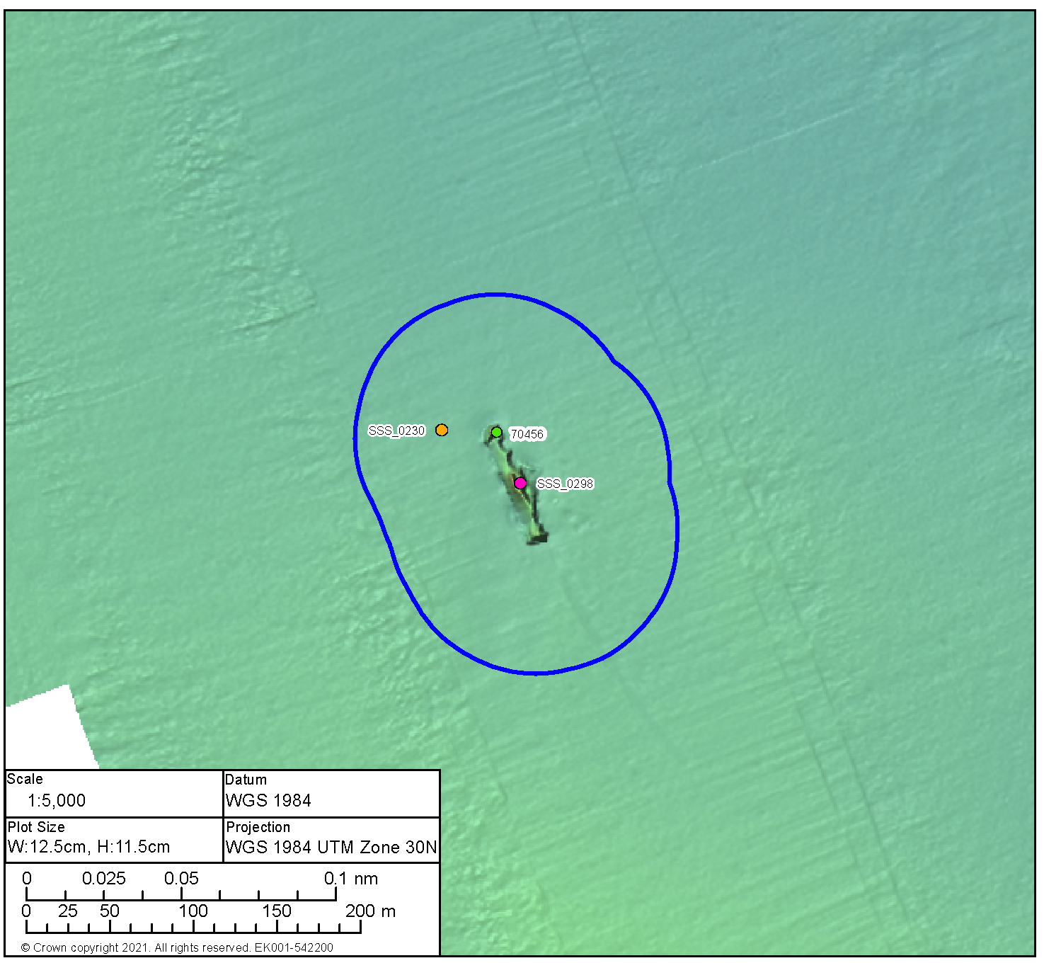
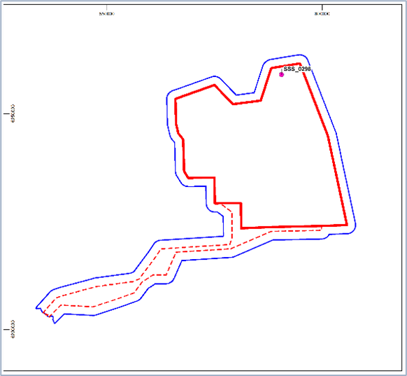
High Potential Contact BBMB_SSS_2020_0212 | ||||
|---|---|---|---|---|
Position coordinates
| 601282.4 E 6245056.7 N | Area | Proposed Development array area |
|
Archaeological potential | High | |||
Geophysical survey dimensions and notes | Dimensions: 91.6 m x 37.7 m x 6.1 m high Contact is associated with magnetic anomaly 1,056.7 and large debris adjacent 50 m to the west ( BBMB_SSS_2020_0254) and 60 m to the south (BBMB_SSS_2020_0255) | |||
AEZ dimensions | 100 m from extents Note: the location of BBMB_SSS_2020_0254 and BBMB_SSS_2020_0255 (both anomalies of medium potential probably representing debris from the wreck) is also shown and protected within this AEZ | |||
| ||||
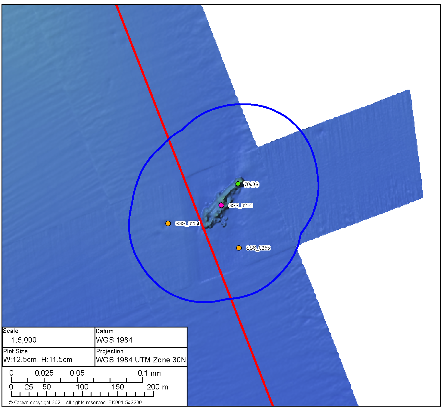
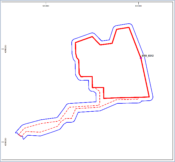
High Potential Contact BBMB_MBES_2020_0005 | ||||
|---|---|---|---|---|
Position coordinates
| 588871.4 E 6232899.6 N | Area | Proposed Development array area |
|
Archaeological potential | High | |||
Geophysical survey dimensions and notes | Dimensions: 41.5 m x 12.3 m x 0.8 m high Contact is not associated with any magnetic anomaly UKHO Ref 70460 | |||
AEZ Dimensions | 50 m from extents | |||
| ||||
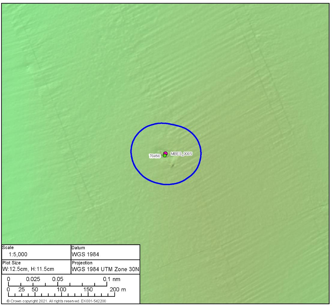
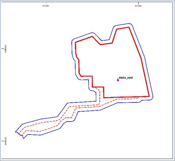
High Potential Contact BBMB_MBES_2020_0006 | ||||
|---|---|---|---|---|
Position coordinates
| 590388.3 E 6232872.8 N | Area | Proposed Development array area |
|
Archaeological potential | High | |||
Geophysical survey dimensions and notes | Dimensions: 28.5 m x 8.5 m x 3.0 m high Contact is not associated with any magnetic anomaly UKHO Ref 70457 | |||
AEZ dimensions | 50 m from extents | |||
| ||||
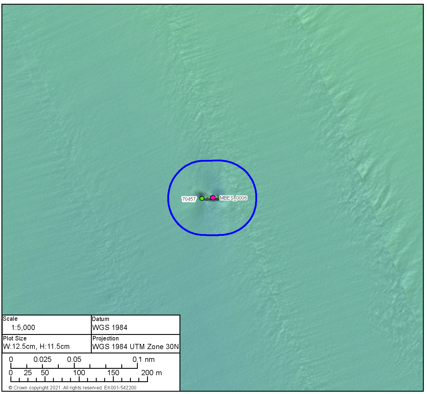
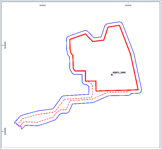
High Potential Contact BBMB_MBES_2020_0010 | ||||
|---|---|---|---|---|
Position coordinates
| 597610.4 E 6231315.9 N | Area | Proposed Development array area |
|
Archaeological potential | High | |||
Geophysical survey dimensions and notes | Dimensions: 34.0 m x 10.7 m x 2.7 m high Contact is not associated with any magnetic anomaly UKHO ref 70439 | |||
AEZ Dimensions | 50 m from extents | |||
| ||||
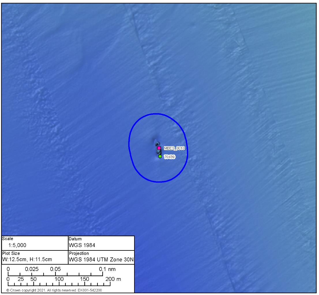
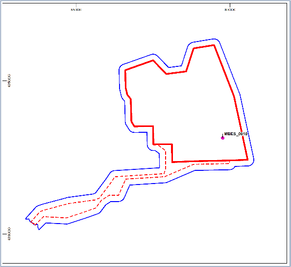
High Potential Contact BBMB_SSS_2020_0341 | ||||
|---|---|---|---|---|
Position coordinates
| 591366.5 E 6226686.0 N | Area | Proposed Development array area |
|
Archaeological potential | High | |||
Geophysical survey dimensions and notes | Dimensions: 33.5 m x 7.6 m x 3.3 m high Contact is not associated with a magnetic anomaly UKHO ref 3151 | |||
AEZ Dimensions | 50 m from extents | |||
| ||||
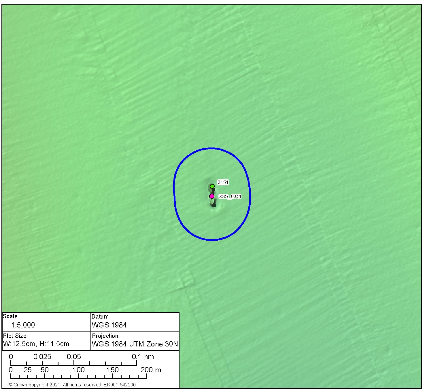
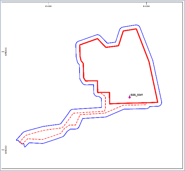
High Potential Contact BBMB_SSS_2020_0332 | ||||
|---|---|---|---|---|
Position coordinates
| 597770.1 E 6227609.8 N | Area | Proposed Development array area |
|
Archaeological potential | High | |||
Geophysical survey dimensions and notes | Dimensions: 35.6 m x 8.6 m x 2.3 m high Contact is not associated with a magnetic anomaly UKHO ref 71600 | |||
AEZ Dimensions | 50 m from extents | |||
| ||||
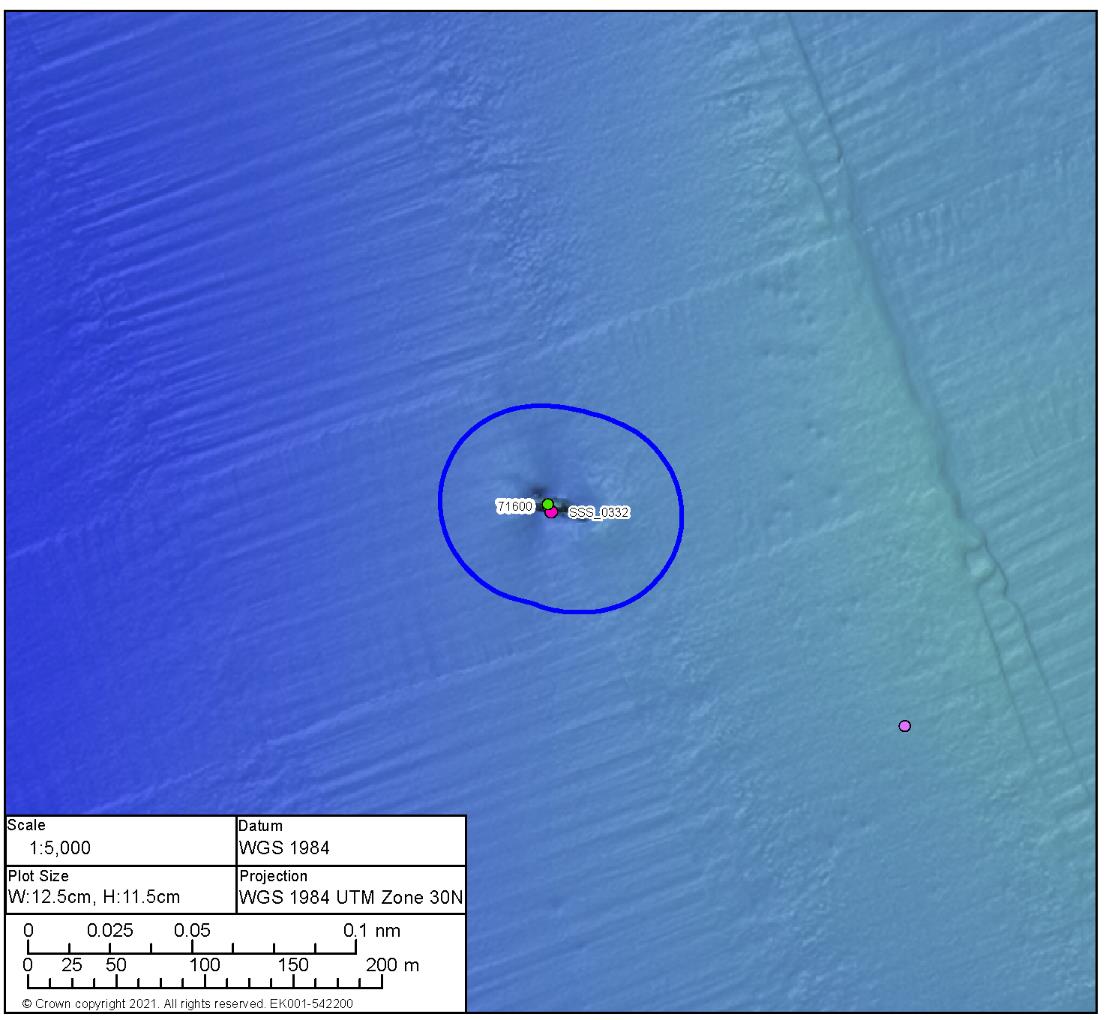
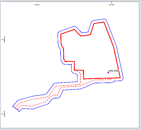
High Potential Contact BBMB_SSS_2020_0373 | ||||
|---|---|---|---|---|
Position coordinates
| 571145.9 E 6248792.9 N | Area | Proposed Development array area |
|
Archaeological potential | High | |||
Geophysical survey dimensions and notes | Dimensions: 33.1 m x 10.8 m x 8.7 m high Contact is not associated with a magnetic anomaly UKHO ref 70467 | |||
AEZ Dimensions | 50 m from extents | |||
| ||||
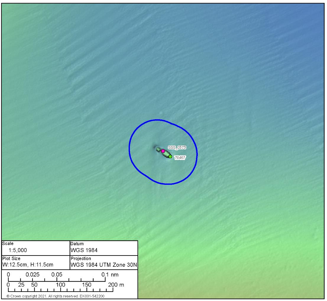
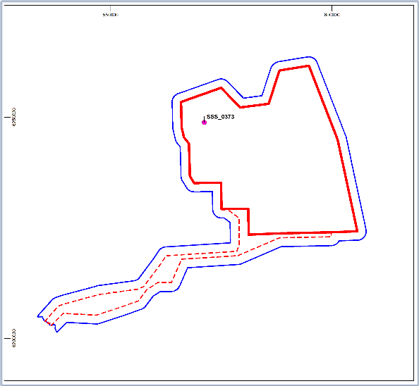
High Potential Contact BBMB_MBES_2020_0002 | ||||
|---|---|---|---|---|
Position coordinates
| 567551.6 E 6246444.9 N | Area | Proposed Development array area |
|
Archaeological potential | High | |||
Geophysical survey dimensions and notes | Dimensions: 60.5 m x 10.4 m x 3.4 m high Contact is not associated with a magnetic anomaly UKHO ref 70469 | |||
AEZ Dimensions | 75 m from extent | |||
| ||||
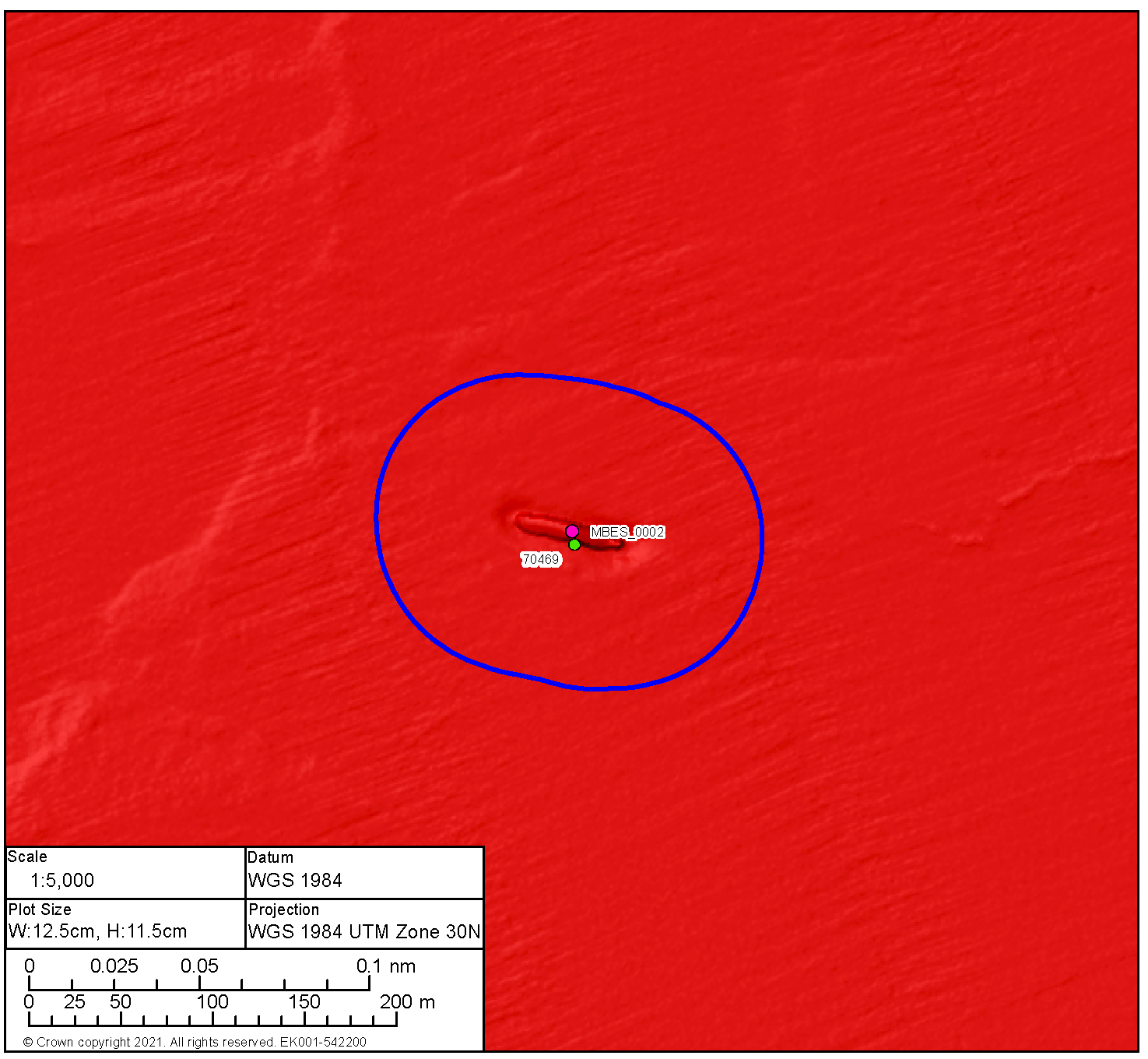
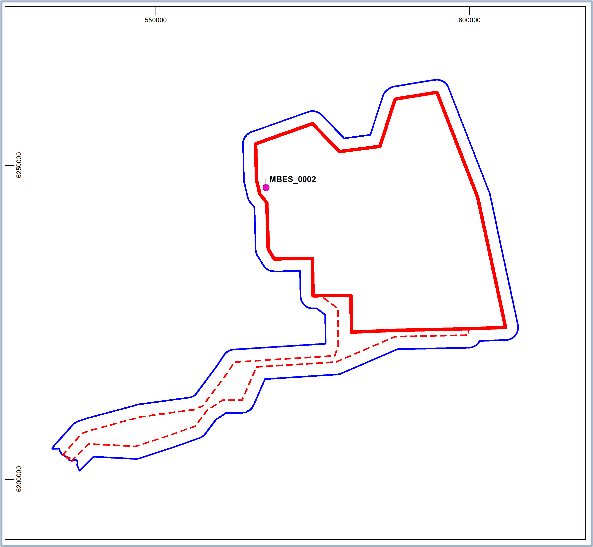
High Potential Contact BBMB_SSS_2020_0360 | ||||
|---|---|---|---|---|
Position coordinates
| 577863.1 E 6245712.0 N | Area | Proposed Development array area |
|
Archaeological potential | High | |||
Geophysical survey dimensions and notes | Dimensions: 48.1 m x 14.2 m x 2.3 m high Contact is associated with a significant magnetic anomaly of 13,071.7 nT UKHO ref 70464 | |||
AEZ Dimensions | 75 m from extent | |||
| ||||
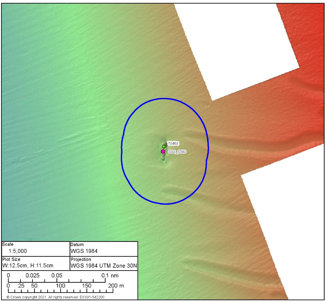
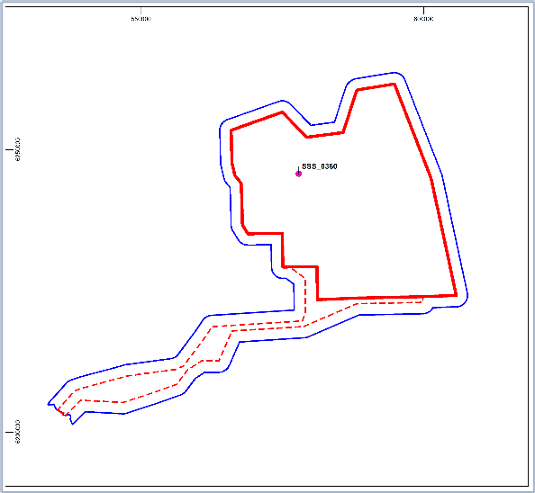
High Potential Contact BBMB_SSS_2020_0189 | ||||
|---|---|---|---|---|
Position coordinates
| 574835.5 E 6230067.7 N | Area | Proposed Development array area |
|
Archaeological potential | High | |||
Geophysical survey dimensions and notes | Dimensions: 36.2 m x 19.1 m x 1.0 m high Contact is not associated with a magnetic anomaly nor has it been recorded on the UKHO | |||
AEZ Dimensions | 50 m from extent | |||
| ||||
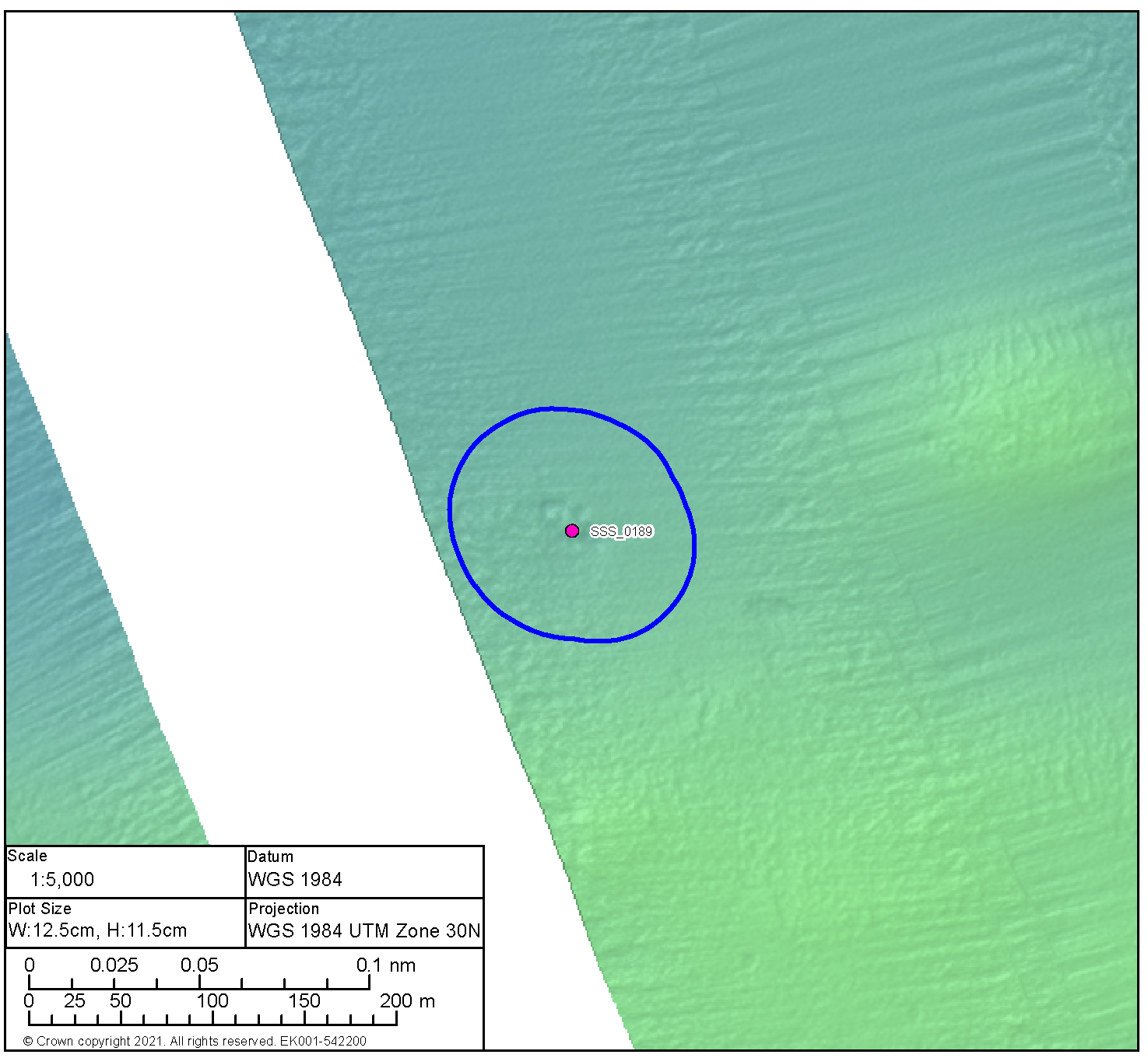
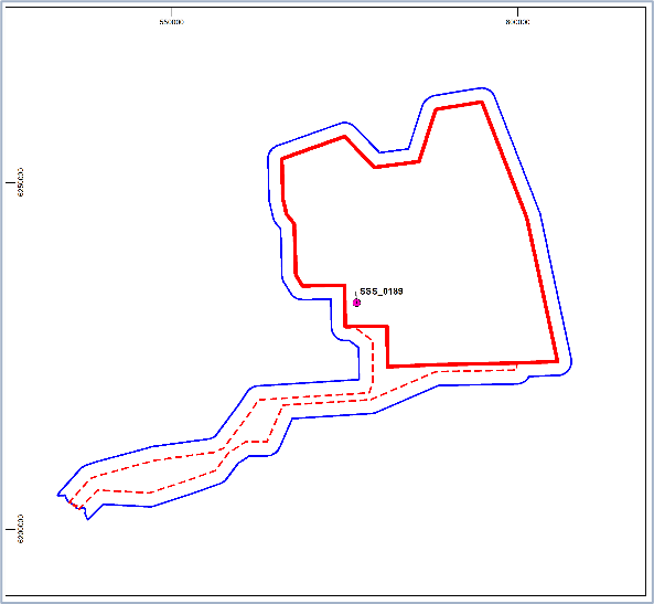
17.5. Appendix E: AEZ Sheets: Medium Potential Archaeological Anomalies
17.5. Appendix E: AEZ Sheets: Medium Potential Archaeological Anomalies
Medium Potential Contact BBMB_SSS_0258 | ||
|---|---|---|
Anomaly number | BBMB_SSS_0258 |
|
Location | Proposed Development array area | |
Position coordinates
| 595006.5 E 6260421.3 N | |
Archaeological potential | Medium | |
Geophysical Survey dimensions and notes | Measurements: 38.1 m x 2.7 m x 0.1 m high This contact is not associated with any Magnetic Anomaly Unidentified debris | |
AEZ Dimension | 15 m from extents | |
| ||
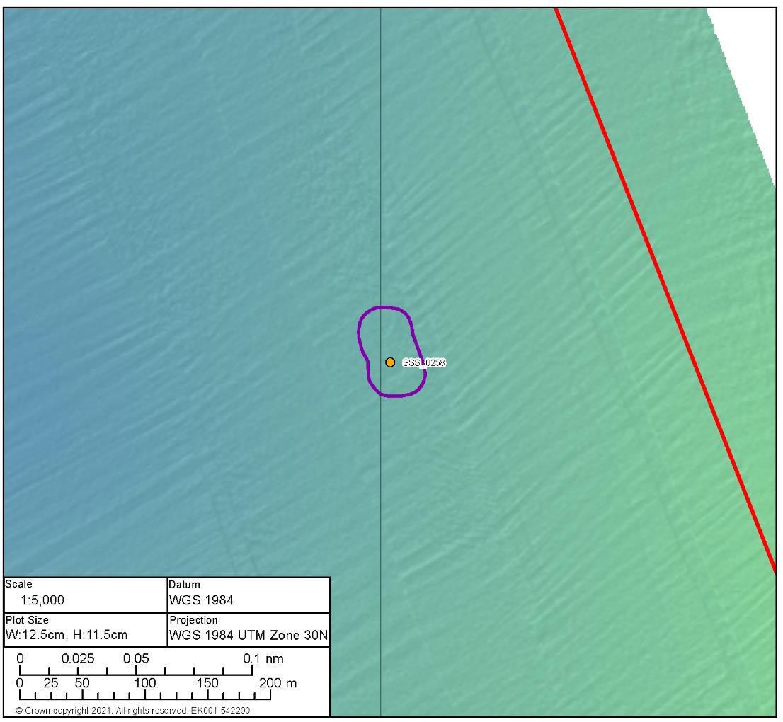
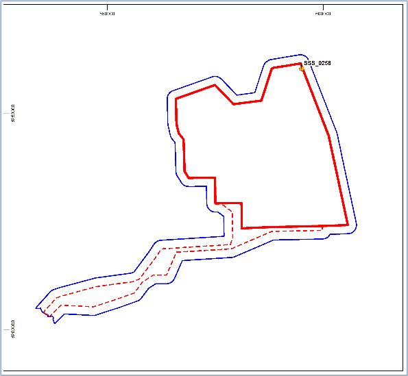
Medium Potential Contact BBMB_SSS_0294 | ||
|---|---|---|
Anomaly number | BBMB_SSS_0294 |
|
Location | Proposed Development array area | |
Position coordinates
| 592454.3 E 6255077.3 N | |
Archaeological potential | Medium | |
Geophysical Survey Dimensions and Notes | Measurements: 12.2 m x 8.0 m x 0.1 m high This contact is not associated with any Magnetic Anomaly Likely geological | |
AEZ Dimensions | 15 m radius | |
| ||
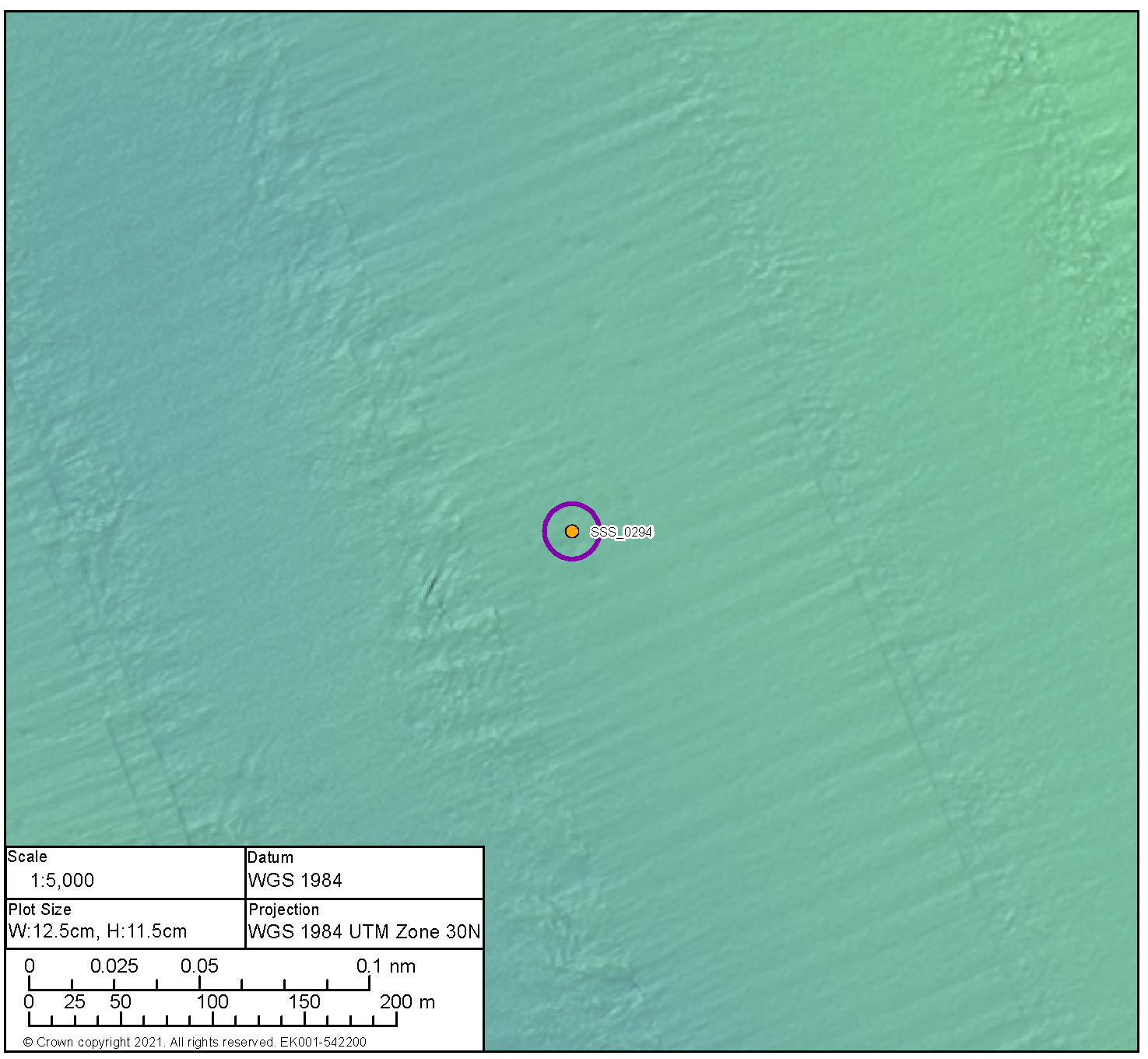

Medium Potential Contact BBMB_SSS_0311 | ||
|---|---|---|
Anomaly number | BBMB_SSS_0311 |
|
Location | Proposed Development array area | |
Position coordinates
| 595997.4 E 6242134.5 N | |
Archaeological potential | Medium | |
Geophysical Survey Dimensions and Notes | Measurements: 5.9 m x 3.2 m x 0.2 m high This contact is not associated with a Magnetic Anomaly Unidentified debris | |
AEZ dimensions | 15 m radius | |
| ||
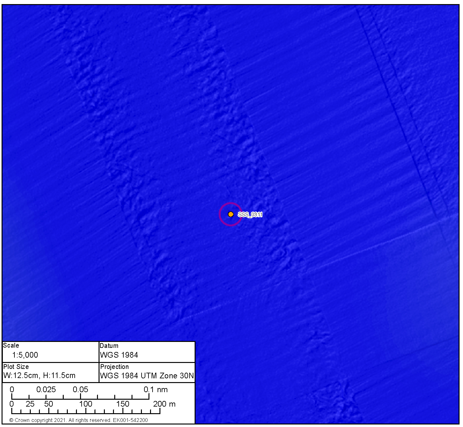

Medium Potential Contact BBMB_SSS_0209 | ||
|---|---|---|
Anomaly number | BBMB_SSS_0209 |
|
Location | Proposed Development array area | |
Position coordinates
| 596419.7 E 6237798.6 N | |
Archaeological potential | Medium | |
Geophysical survey dimensions and notes | Measurements: 7.8 m x 4.1 m x 0.6 m high This contact is not associated with a Magnetic Anomaly Likely geological | |
AEZ dimensions | 15 m radius | |
| ||
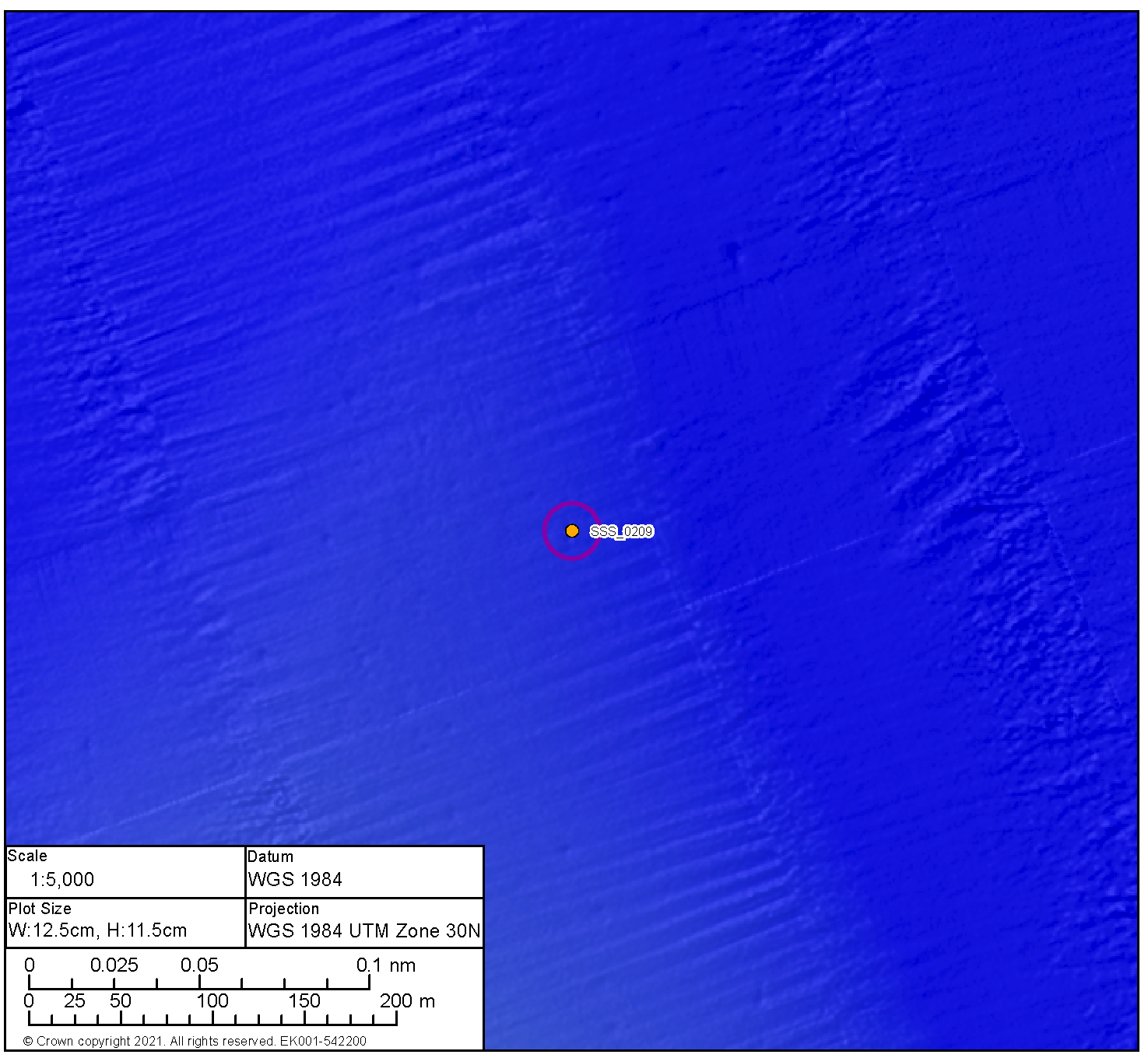
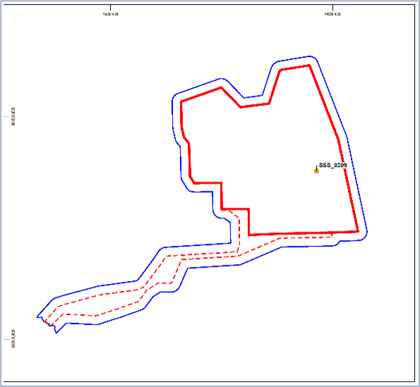
Medium Potential Contact BBMB_MBES_0007 | ||
|---|---|---|
Anomaly number | BBMB_MBES_0007 |
|
Location | Proposed Development array area | |
Position coordinates
| 591704.6 E 6233921.9 N | |
Archaeological potential | Medium | |
Geophysical survey dimensions and notes | Measurements: 32.6 m x 6.6 m x 1.1 m high This contact is not associated with a Magnetic Anomaly Unidentified debris | |
AEZ dimensions | 10 m from extents | |
| ||
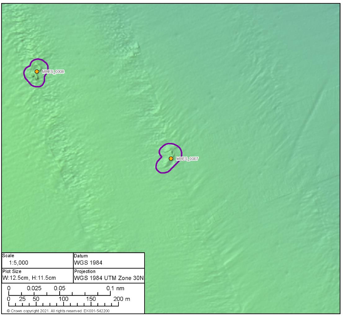
Medium Potential Contact BBMB_SSS_0317 | ||
|---|---|---|
Anomaly number | BBMB_SSS_0317 |
|
Location | Proposed Development array area | |
Position coordinates
| 597156.8 E 6233525.5 N | |
Archaeological potential | Medium | |
Geophysical Survey dimensions and notes | Measurements: 16.1 m x 8.2 m x 0.2 m high This contact is not associated with a Magnetic Anomaly Potential debris | |
AEZ dimensions | 20 m radius | |
| ||


Medium Potential Contact BBMB_SSS_0340 | ||
|---|---|---|
Anomaly number | BBMB_SSS_0340 |
|
Location | Proposed Development array area | |
Position coordinates
| 591642.8 E 6227315.5 N | |
Archaeological potential | Medium | |
Geophysical survey dimensions and notes | Measurements: 31.2 m x 13.2 m x 0.2 m high This contact is not associated with a Magnetic Anomaly Unidentified debris | |
AEZ dimensions | 15 m from extents | |
| ||
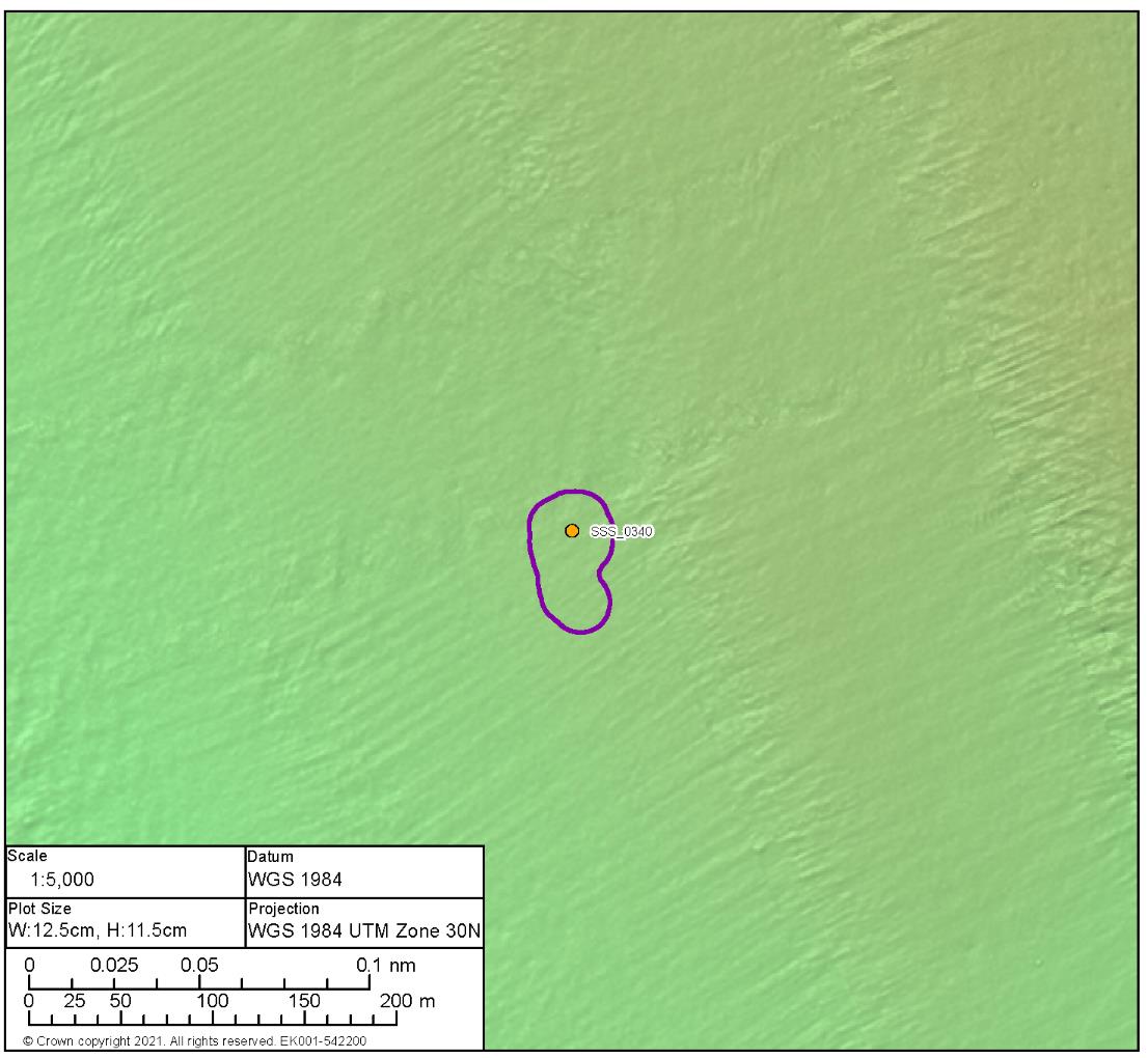
Medium Potential Contact BBMB_MBES_0015 | ||
|---|---|---|
Anomaly number | BBMB_MBES_0015 |
|
Location | Proposed Development array area | |
Position coordinates
| 599253.7 E 6225536.9 N | |
Archaeological potential | Medium | |
Geophysical survey dimensions and notes | Measurements: 20.9 m x 16.3 m x 1.2 m high This contact is not associated with a Magnetic Anomaly Mound | |
AEZ dimensions | 20 m radius | |
| ||
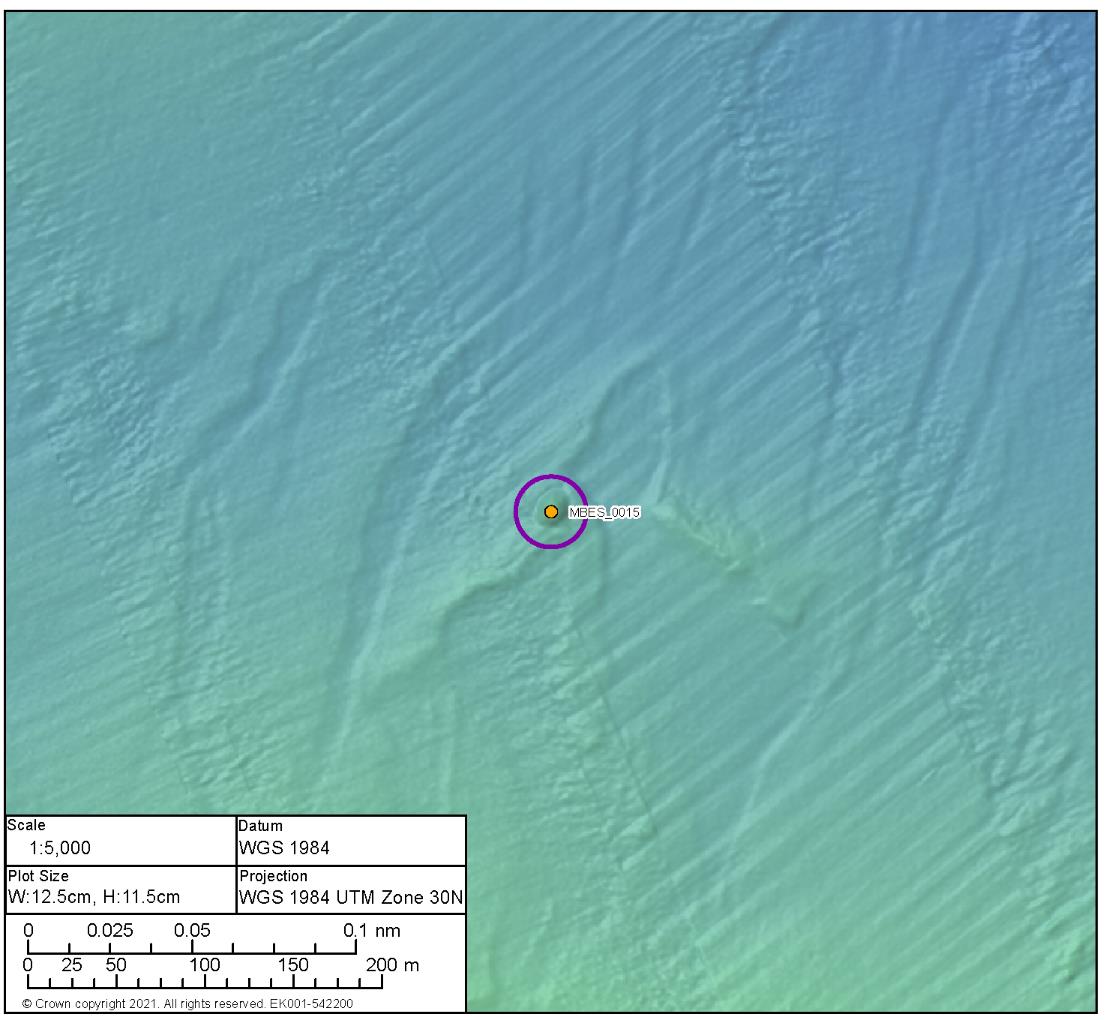
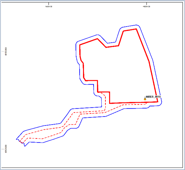
Medium Potential Contact BBMB_SSS_0329 | ||
|---|---|---|
Anomaly number | BBMB_SSS_0329 |
|
Location | Proposed Development array area | |
Position coordinates
| 589027.1 E 6237440.2 N | |
Archaeological potential | Medium | |
Geophysical survey dimensions and notes | Measurements: 14.7 m x 12.3 m x 0.2 m high This contact is not associated with a Magnetic Anomaly Unidentified debris | |
AEZ dimensions | 15 m radius | |
| ||
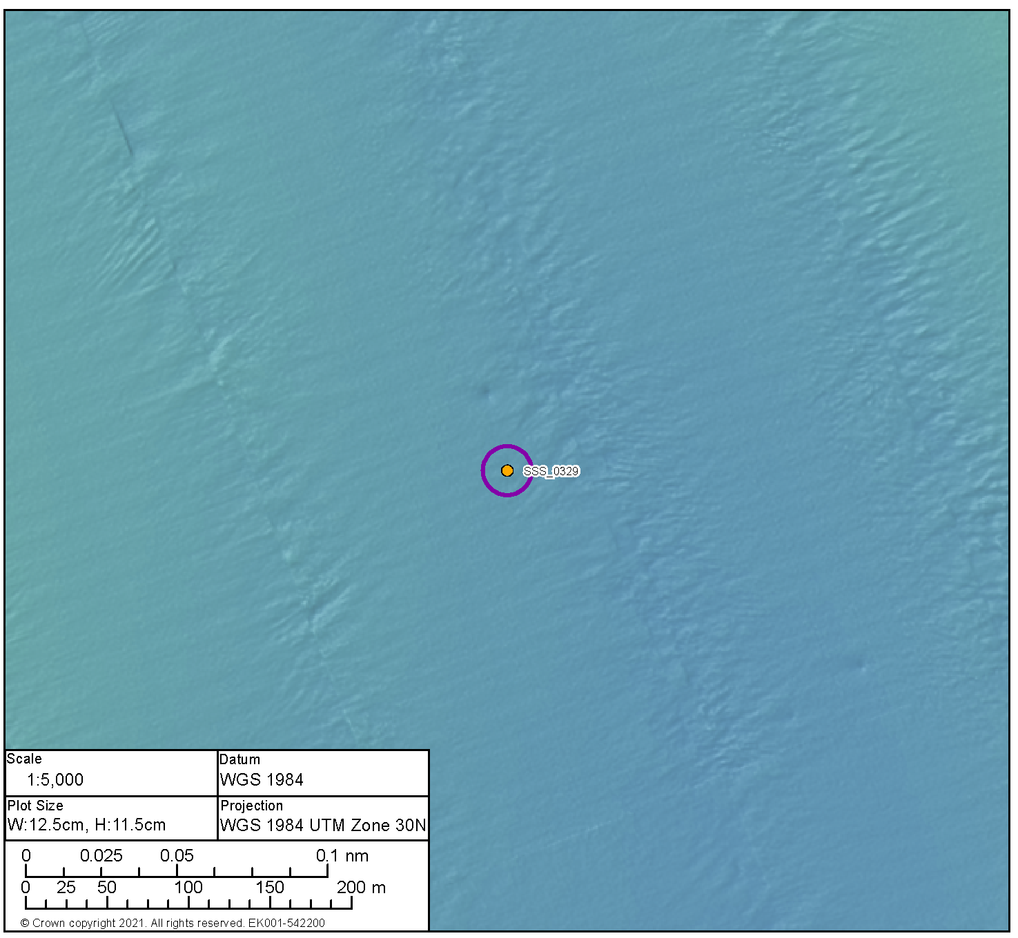
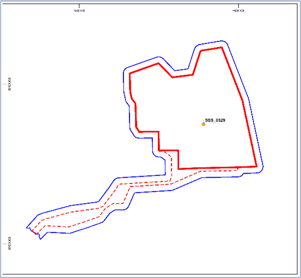
Medium Potential Contact BBMB_MBES_0009 | ||
|---|---|---|
Anomaly number | BBMB_MBES_0009 |
|
Location | Proposed Development array area | |
Position coordinates
| 591260.0 E 6234573.3 N | |
Archaeological potential | Medium | |
Geophysical survey dimensions and notes | Measurements: 25.3 m x 4.5 m x 0.9 m high This contact is not associated with a Magnetic Anomaly Unidentified debris | |
AEZ dimensions | 10 m from extents | |
| ||
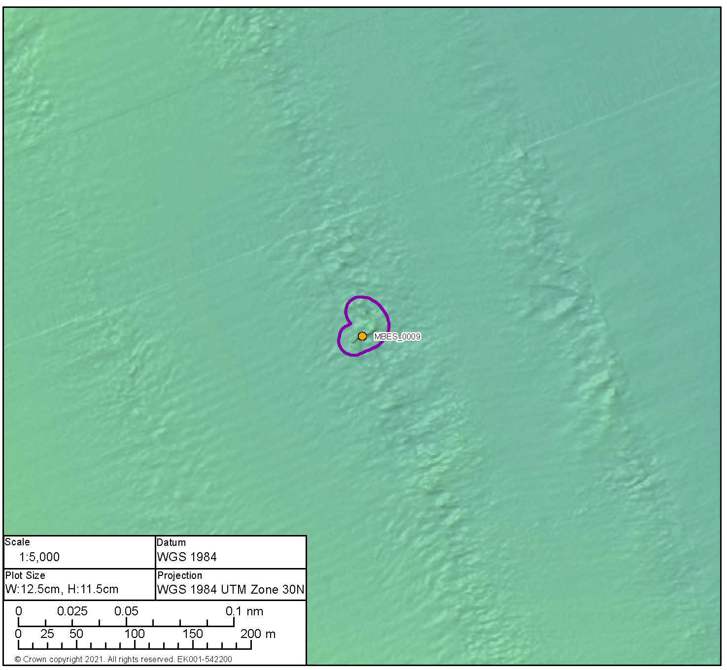
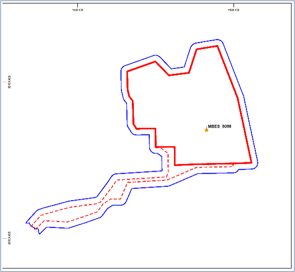
Medium Potential Contact BBMB_SSS_0380 | ||
|---|---|---|
Anomaly number | BBMB_SSS_0380 |
|
Location | Proposed Development array area | |
Position coordinates
| 586970.2 E 6232104.8 N | |
Archaeological potential | Medium | |
Geophysical survey dimensions and notes | Measurements: 7.5 m x 3.4 m x 0.3 m high This contact is not associated with a Magnetic Anomaly Seabed disturbance | |
AEZ dimensions | 15 m radius | |
| ||
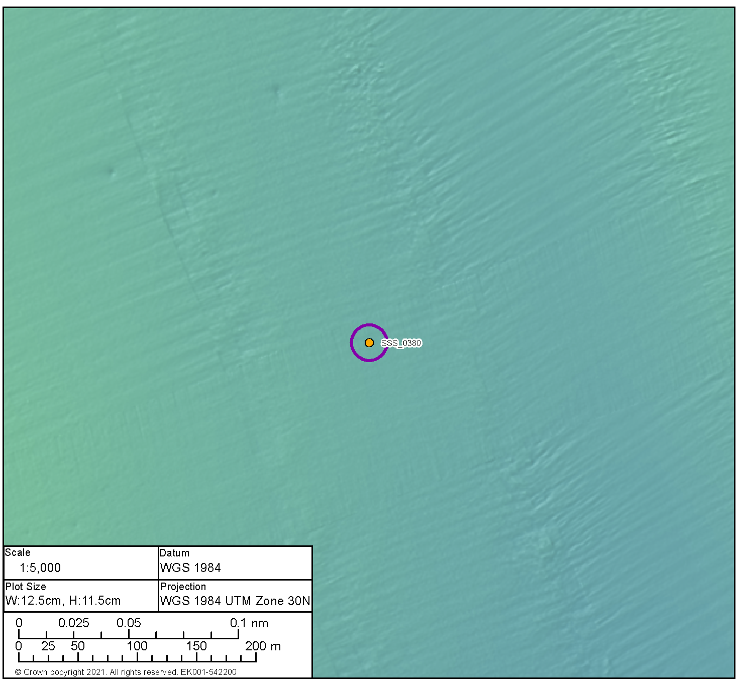

Medium Potential Contact BBMB_SSS_0368 | ||
|---|---|---|
Anomaly number | BBMB_SSS_0368 |
|
Location | Proposed Development array area | |
Position coordinates
| 570872.7 E 6255445.0 N | |
Archaeological potential | Medium | |
Geophysical Survey dimensions and notes | Measurements: 16.7 m x 8.1 m x 1.1 m high This contact is not associated with a Magnetic Anomaly Mound | |
AEZ dimensions | 20 m radius | |
| ||
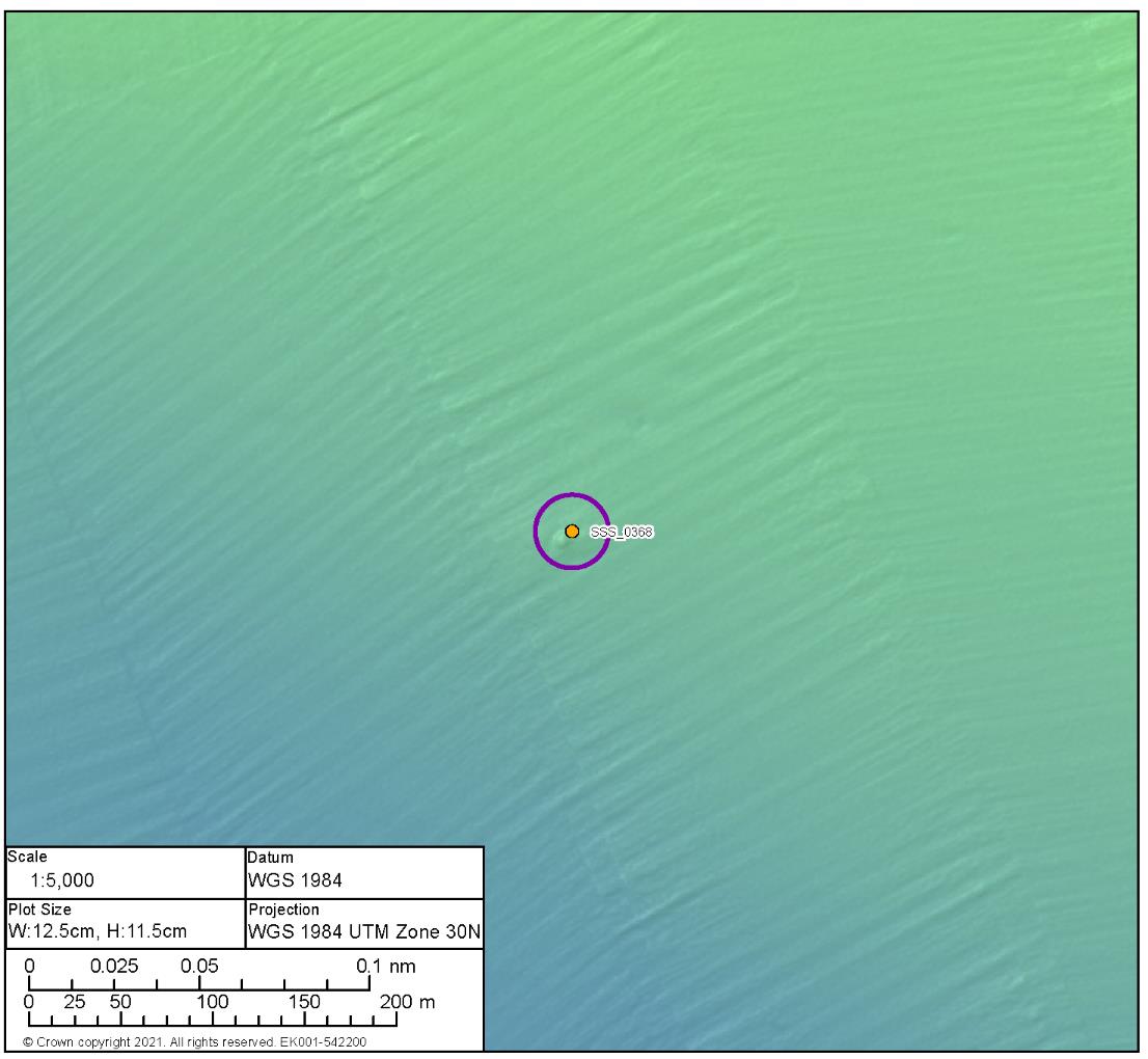
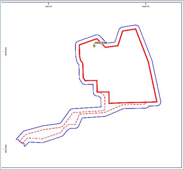
Medium Potential Contact BBMB_SSS_0136 | ||
|---|---|---|
Anomaly number | BBMB_SSS_0136 |
|
Location | Proposed Development array area | |
Position coordinates
| 573999.2 E 6250628.2 N | |
Archaeological potential | Medium | |
Geophysical survey dimensions and notes | Measurements: 13.4 m x 9.0 m x 0.3 m high This contact is not associated with a Magnetic Anomaly Unidentified debris | |
AEZ dimensions | 15 m radius | |
| ||
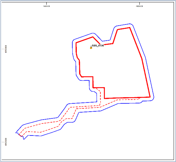
Medium Potential Contact BBMB_SSS_0364 | ||
|---|---|---|
Anomaly number | BBMB_SSS_0364 |
|
Location | Proposed Development array area | |
Position coordinates
| 577231.7 E 6239666.5 N | |
Archaeological potential | Medium | |
Geophysical Survey dimensions and notes | Measurements: 23. 8 m x 3.3 m x 0.4 m high This contact is not associated with a Magnetic Anomaly Unidentified debris | |
AEZ dimensions | 15 m from extents | |
| ||
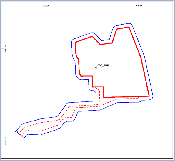
Medium Potential Contact BBMB_SSS_0178 | ||
|---|---|---|
Anomaly number | BBMB_SSS_0178 |
|
Location | Proposed Development array area | |
Position coordinates
| 567819.5 E 6237262.4 N | |
Archaeological potential | Medium | |
Geophysical survey dimensions and notes | Measurements: 34.5 m x 3.6 m x 0.2 m high This contact is associated with a Magnetic Anomaly up to 44.9nT Unidentified debris with magnetic anomaly | |
AEZ dimensions | 15 m from extents | |
| ||
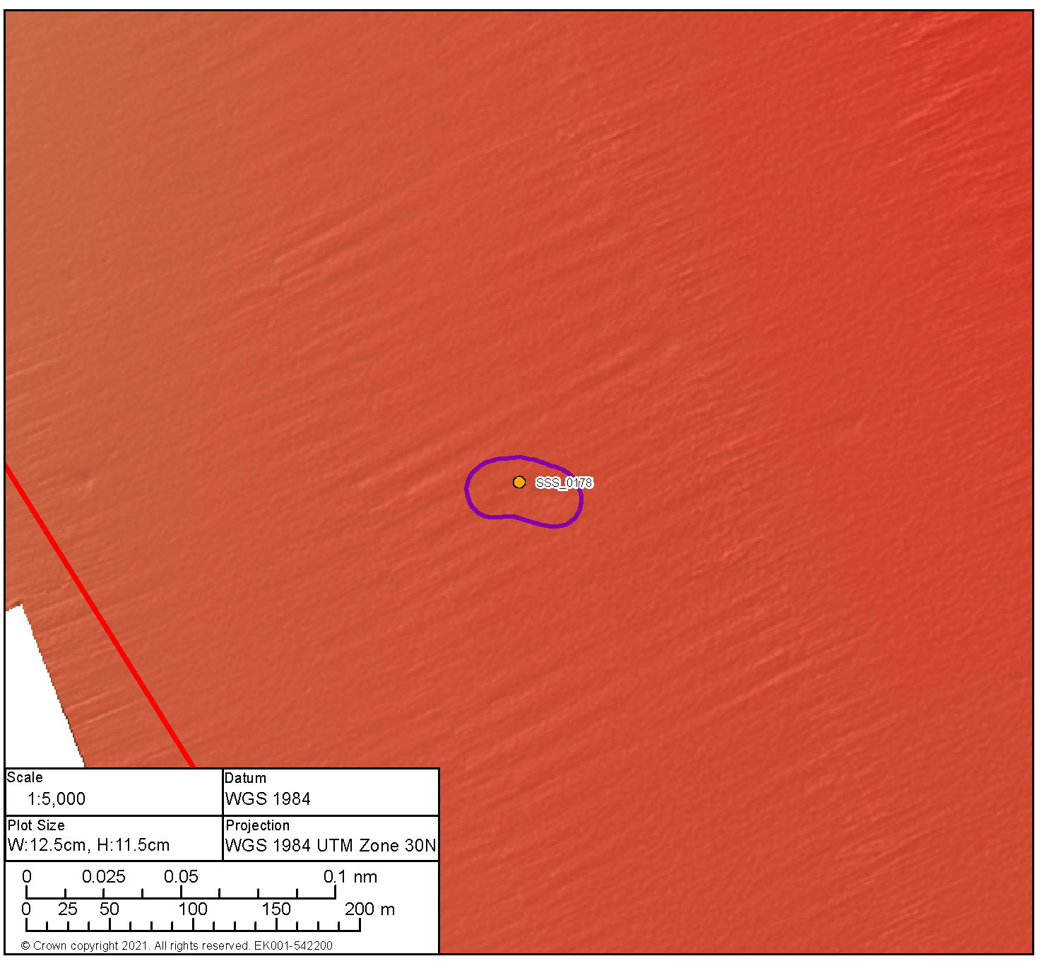
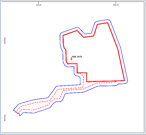
Medium Potential Contact BBMB_SSS_0374 | ||
|---|---|---|
Anomaly number | BBMB_SSS_0374 |
|
Location | Proposed Development export cable corridor | |
Position coordinates
| 579361.4 E 6225549.2 N | |
Archaeological potential | Medium | |
Geophysical dimensions and notes | Measurements: 140.8 m x 36.3 m x 0.8 m high This contact is associated with a Magnetic Anomaly up to 88.2nT Unidentified debris with magnetic anomaly | |
AEZ dimensions | 25 m extents | |
| ||
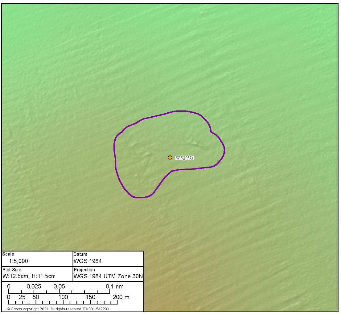

Anomaly number | BBMB_MBES_0008 |
|
Location | Proposed Development array area | |
Position coordinates
| 591460.0 E 6234080.5 N | |
Archaeological potential | Medium | |
Geophysical dimensions and notes | Measurements: 44.9 m x 223.3 m x 1.2 m high This contact is not associated with a Magnetic Anomaly Unidentified debris | |
AEZ dimensions | 10 m extents | |
| ||
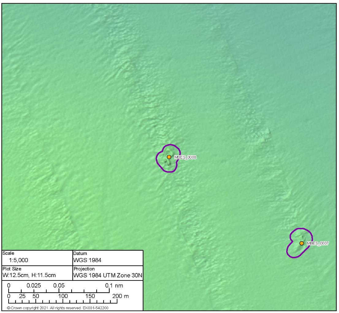
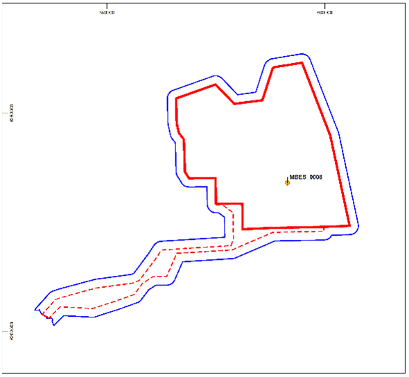
Medium Potential Contact BBMB_MBES_0016 | ||
|---|---|---|
Anomaly number | BBMB_MBES_0016 |
|
Location | Proposed Development array area | |
Position coordinates
| 591068.8 E 6258079.9 N | |
Archaeological potential | Medium | |
Geophysical dimensions and notes | Measurements: 103.2 m x 30.9 m x 1.1 m high This contact is not associated with a Magnetic Anomaly Likely geological | |
AEZ dimensions | 15 m extents | |
| ||
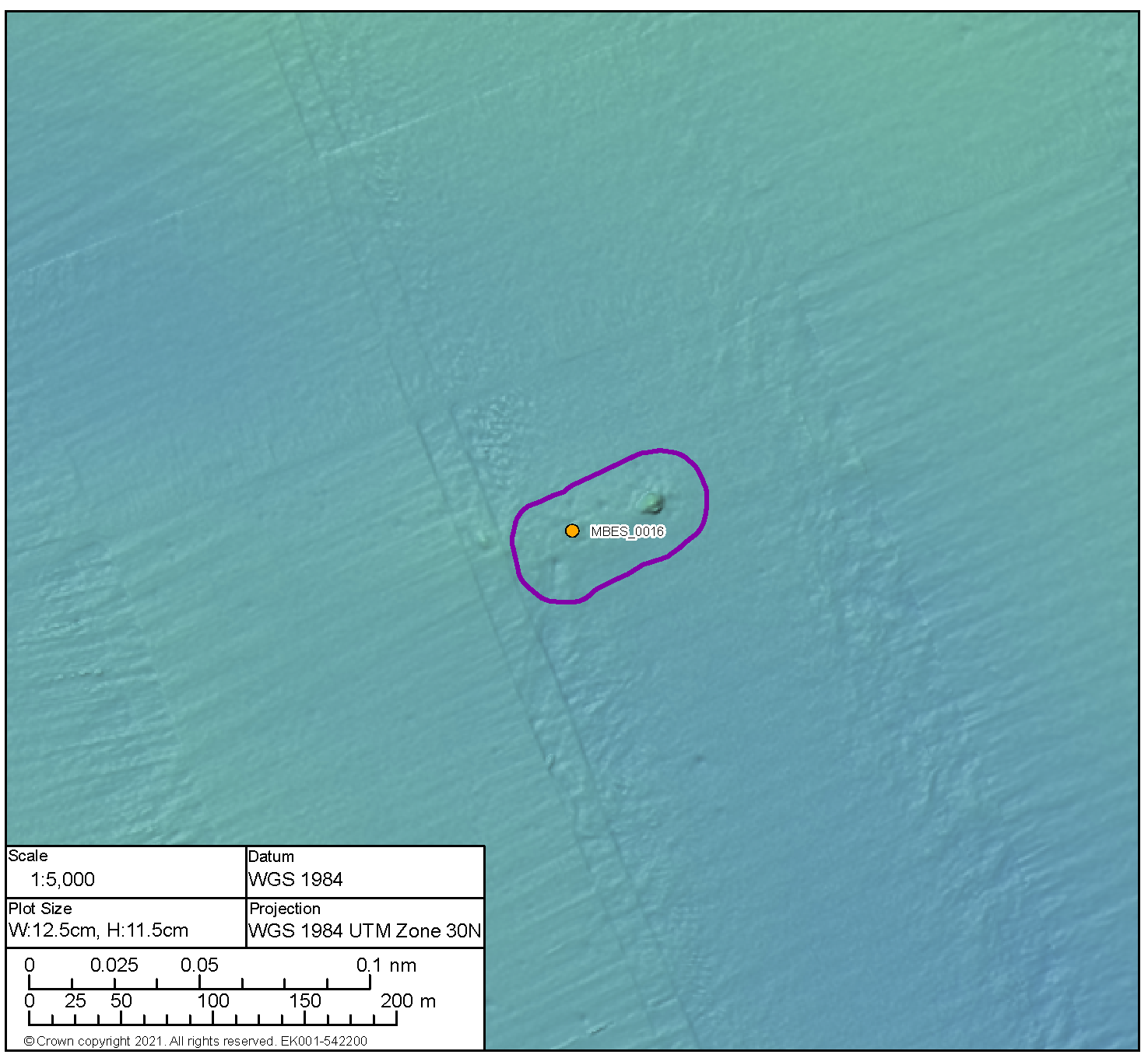
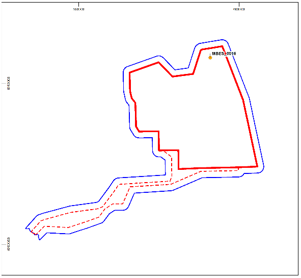
Medium Potential Contact BBMB_SSS_0089 | ||
|---|---|---|
Anomaly number | BBMB_SSS_0089 |
|
Location | Proposed Development export cable corridor | |
Position coordinates
| 593403.5 E 6223700.3 N | |
Archaeological potential | Medium | |
Geophysical survey dimensions and notes | Measurements: 6.1 m x 4.7 m x 0.3 m high This contact is not associated with a Magnetic Anomaly Seabed disturbance | |
AEZ dimensions | 15 m radius | |
| ||
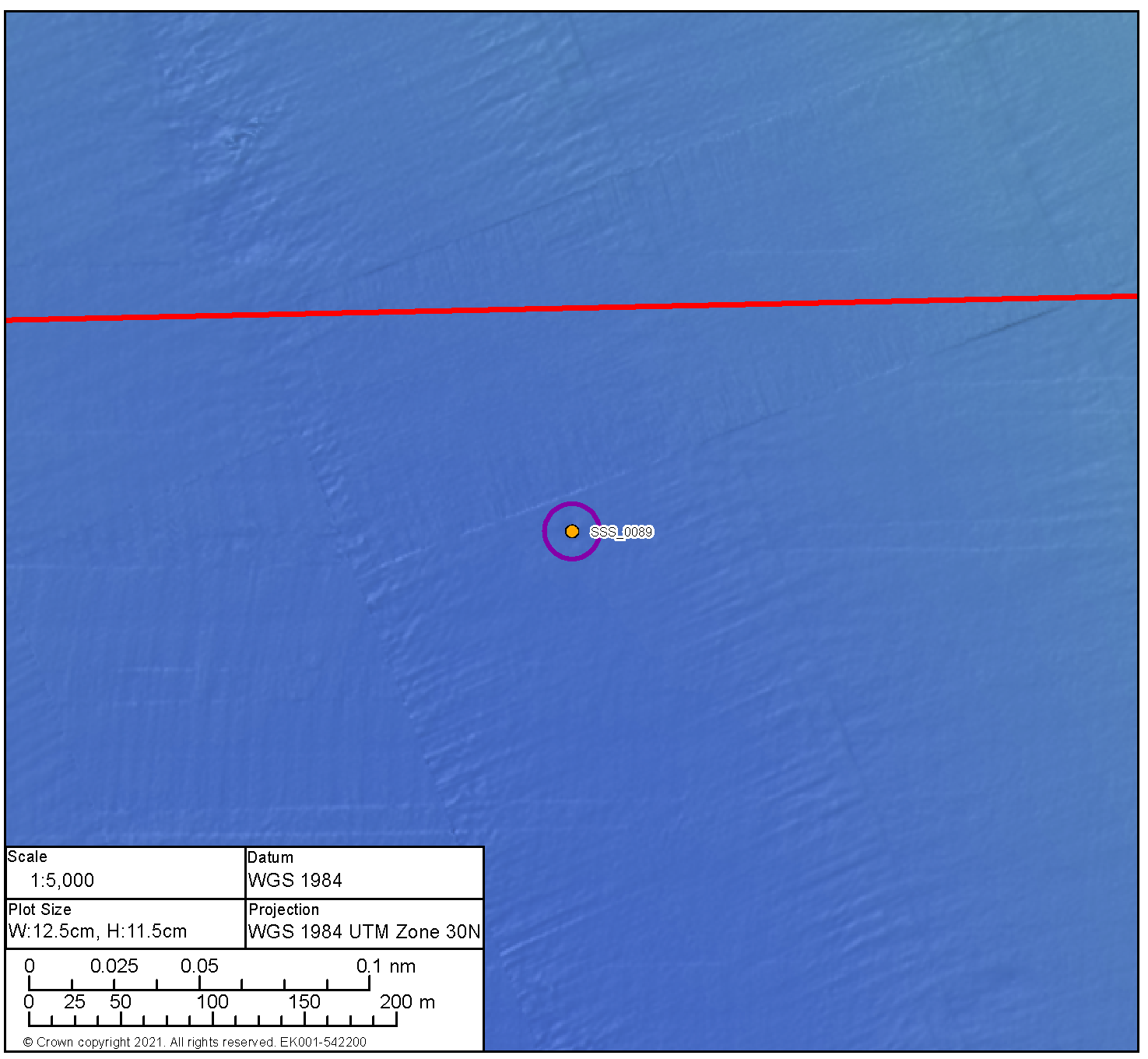
Medium Potential Contact BBMB_SSS_0092 | ||
|---|---|---|
Anomaly number | BBMB_SSS_0092 |
|
Location | Proposed Development export cable corridor | |
Position coordinates
| 567172.9 E 6218924.3 N | |
Archaeological potential | Medium | |
Geophysical Survey dimensions and notes | Measurements: 11.0 m x 3.3 m x 0.9 m high This contact is not associated with a Magnetic Anomaly Unidentified debris | |
AEZ dimensions | 15 m radius | |
| ||
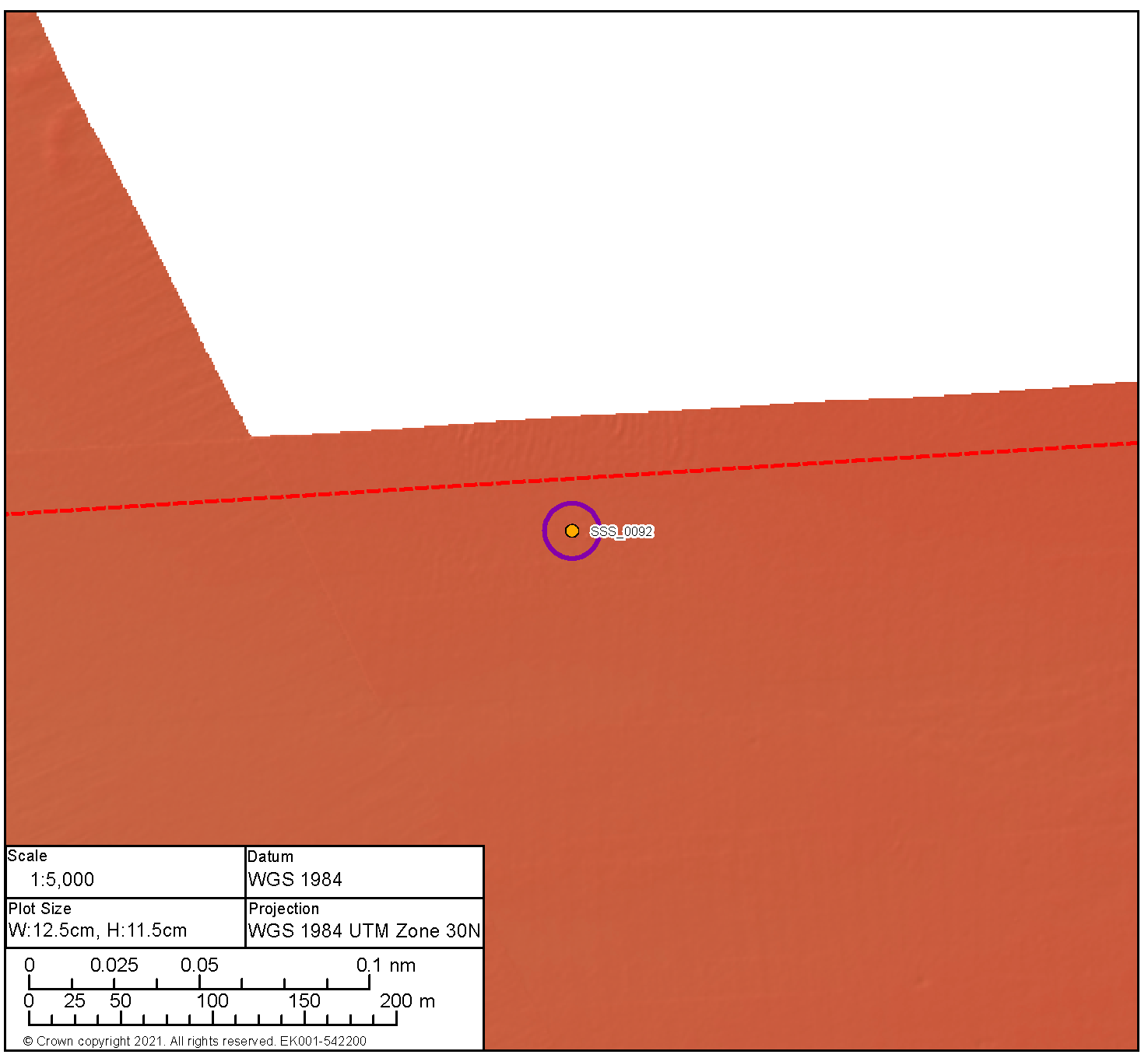

Medium Potential Contact BBMB_SSS_0028 | ||
|---|---|---|
Anomaly number | BBMB_SSS_0028 |
|
Location | Proposed Development export cable corridor | |
Position coordinates
| 562254.0 E 6217904.9 N | |
Archaeological potential | Medium | |
Geophysical Survey dimensions and notes | Measurements: 5.6 m x 1.6 m x 0.5 m high This contact is not associated with a Magnetic Anomaly Potential debris | |
AEZ dimensions | 15 m radius | |
| ||
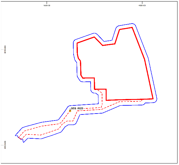
Medium Potential Contact BBMB_SBP_0001 | ||
|---|---|---|
Anomaly number | BBMB_SBP_0001 |
|
Location | Proposed Development export cable corridor | |
Position coordinates
| 549261.0 E 6206294.0 N | |
Archaeological potential | Medium | |
Geophysical survey dimensions and notes | Measurements: N/A This contact is not associated with a Magnetic Anomaly Unidentified anomaly | |
AEZ dimensions | 30 m radius | |
| ||

17.6. Appendix F: AEZ Sheets: Recorded Wrecks with No Corresponding Geophysical Anomaly
17.6. Appendix F: AEZ Sheets: Recorded Wrecks with No Corresponding Geophysical Anomaly
UKHO 2884 Unknown | ||
|---|---|---|
Location
| Proposed Development export cable corridor |
|
Position coordinates | 555261.1 6209598.8 | |
Archaeological Potential | Unknown | |
AEZ dimensions | None | |
| ||

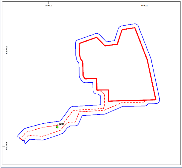
UKHO 2892 Unknown | ||
|---|---|---|
Location
| Proposed Development export cable corridor |
|
Position Coordinates | 549717.9 6209342.0 | |
Archaeological Potential | Unknown | |
AEZ dimensions | None | |
`
| ||

UKHO 63948 Unknown | ||
|---|---|---|
Location
| Proposed Development export cable corridor |
|
Position Coordinates | 547196.8 6208000.2 | |
Archaeological Potential | Unknown | |
AEZ Dimensions | None | |
| ||

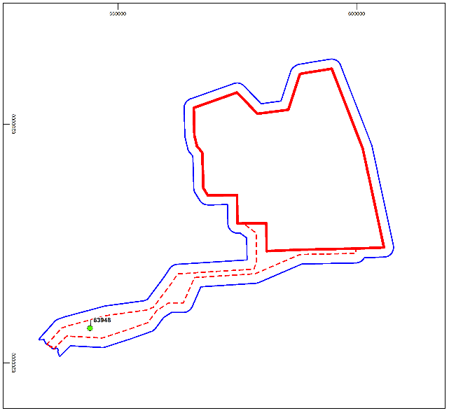
[1] Scottish Borders Council (SBC), Historic Environment Scotland (HES) and East Lothian Council Archaeology Service (ELC).
[2] the extent of the Geophysical Survey Area is presented in the Marine Archaeology Technical Report
[3] The UKHO records mark the wreck as 'dead' (the wreck has not been identified following repeated surveys suggesting it does not exist at that position)
[4] BBMB_SSS_2020_0230 lies within the recommended high potential exclusion zone for BBMB_SSS_2020_0298.
BBMB_SSS_2020_0255 lies within the recommended high potential exclusion zone for BBMB_SSS_2020_0212
[5] BBMB_SSS_2020_0254 lies within the recommended high potential exclusion zone for BBMB_SSS_2020_0212.