

1. Introduction
1.1 Overview
1.1 Overview
ITPEnergised was appointed by SSE Renewables, to undertake a Preliminary Ecological Appraisal informed by an ecological desk study and extended Phase 1 habitat survey for the onshore transmission works of the proposed Berwick Bank offshore wind farm development at Torness, southeast of Dunbar (hereafter referred to as the ‘Site’). The Site has central Ordnance Grid Reference: NT 74632 73282. The Study Area comprised the Site (landward of the Mean Low Water Spring (MLWS)) and up to a 500 m buffer dependent on the feature of interest (as shown on Figure 7.1.1).
The purpose of the extended Phase 1 habitat survey was to document the habitats present within the Site and immediately adjacent areas. The potential for protected or otherwise notable species to be present within the Site was also assessed to inform further survey requirements. The survey included a Preliminary Roost Assessment (PRA) of all buildings, structures and trees within the Site and a 50 m buffer. The results of the PRA including survey methods are reported upon within Volume 4, Appendix 7.3 (ITPEnergised, 2022a).
This report describes the methods used to gather and record information for the Site and summarises the findings of the study.
1.2 Site Description
1.2 Site Description
The Site is approximately 600 hectares (ha) in size and extends from north-west of Skateraw Harbour to Bilsdean in the south. The A1 trunk road and the East Coast Main Line (ECML) railway pass through the Site from the north-west to the south-east. The Site largely comprises agricultural land with a mixture of arable and grazed fields. Braidwood Burn and Ogle Burn run through the western reaches of the Site, Thornton Burn and Branxton Burn runs through the centre of the Site, Dry Burn runs through the north of the Site and Bilsdean Burn runs through the south of the Site. These watercourses are commonly associated with corridors of scrub and mixed woodland habitat. The Site also encompasses a number of small hamlets and farm steadings. Larger settlements include Crowhill, Branxton and Lawfield to the south of the A1 trunk road and Skateraw and Thorntonloch to the north. The Site includes areas of the coastline the landfall locations to the north of Torness Point.
2. Legislation, Policy and Guidelines
2. Legislation, Policy and Guidelines
An overview of relevant legislation, policy and guidance is provided below.
2.1 Legislation
2.1 Legislation
Full consideration has been given to the relevant nature conservation legislation when carrying out this assessment. This includes the following:
The Conservation of Natural Habitats and Wild Flora and Fauna (the ‘Habitats Directive’) 1992 (92/4/3EEC) (European Commission, 1992), transposed into Scots law by the Conservation (Natural Habitats, &c.) Regulations 1994 (as amended);
Directive (2009/147/EC) of the European Parliament and of the Council of 30 November 2009 on the conservation of wild birds (the ‘Birds Directive’) (European Commission, 2009), transposed into Scots law by the Conservation (Natural Habitats, &c.) Regulations 1994 (as later amended);
The Conservation (Natural Habitats, &c.) Regulations 1994 (as amended);
Wildlife and Countryside Act 1981 (as amended) (WCA);
Protection of Badgers Act 1992 (as amended);
The Wildlife and Natural Environment (Scotland) (WANE) Act 2011 (as amended); and
Legislation specific to otter, badger and great crested newts including details of all actions which would constitute an offence, is detailed fully within Annex A.
2.2 Policy Framework
2.2 Policy Framework
The policies set out in Annex B are those relevant to nature conservation and include those from National Planning Framework 4 (NPF4) (Scottish Government, 2023), Planning Advice Note 60: Planning for Natural Heritage (Scottish Government, 2000) and the East Lothian Council Local Development Plan (LDP) (East Lothian Council, 2018).
2.3 Good Practice Ecological Guidance
2.3 Good Practice Ecological Guidance
In preparing this work, cognisance has been taken of the Chartered Institute of Ecology and Environmental Management (CIEEM) good practice guidelines and survey methods (CIEEM, 2017 and 2018). The extended Phase 1 habitat survey is based on the Joint Nature Conservation Committee (JNCC) guidelines for Phase 1 habitat survey (JNCC, 2010). In addition, cognisance has been taken of the following best practice guidelines and survey method publications in relation to badgers (Meles meles), otter (Lutra lutra), water vole (Arvicola amphibius) and great crested newt (Triturus cristatus):
2.3.1 Otter
Competencies for Species Survey: Otter (CIEEM, 2013a); and
Monitoring the Otter Lutra lutra (Chanin, 2003).
2.3.2 Water vole
Competencies for Species Survey: Water Vole (CIEEM, 2013b); and
The Water Vole Mitigation Handbook (Dean et al., 2016).
2.3.3 Badger survey
Competencies for Species Survey: Badger (CIEEM, 2013c); and
Surveying for Badgers: Good Practice Guidelines (Scottish Badgers, 2018).
2.3.4 Great crested Newt
Competencies for Species Survey: Great Crested Newt (CIEEM, 2013d); and
Evaluating the suitability of habitat for the great crested newt (Triturus cristatus) (Oldham et al., 2000).
3. Biodiversity Priorities
3. Biodiversity Priorities
3.1 Scottish Biodiversity List
3.1 Scottish Biodiversity List
Scottish Ministers created the Scottish Biodiversity List (SBL) (Scottish Government, 2013) in 2005 to satisfy the requirements under Section 2(4) of the Nature Conservation (Scotland) Act 2004 and assist public bodies in carrying out conservation of biodiversity, as well as to provide the general public with information regarding conservation within Scotland. The SBL comprises species and habitats listed using both scientific and social criteria. Only scientific criteria are considered relevant to this report. They include the following:
All UK Priority Species present in Scotland;
Species which Scotland has an international obligation to safeguard;
All species defined as nationally rare at a UK level that are present in Scotland;
Species with populations present (resident, wintering or breeding) in 5 or fewer 10 km squares or sites in Scotland;
All species that are endemic to Scotland;
Any sub-species or race that is widely recognised and accepted by the scientific (or other relevant) community and that is endemic to Scotland, if it also meets one of the other criteria; and
Natural and semi-natural habitats that are known to be particularly important for supporting assemblages of plant or animal groups that are data deficient, such as fungi, bryophytes, lichens, algae and invertebrates.
3.2 Local Biodiversity Reporting
3.2 Local Biodiversity Reporting
The East Lothian Biodiversity Partnership published the first edition of the East Lothian Biodiversity Action Plan (LBAP) in 2008 (East Lothian Biodiversity Partnership, 2008). A more recent version is not publicly available but it is considered that the 2008 document remains relevant. The LBAP outlines priority habitats and species for East Lothian. Those Priority Habitats relevant to the Site include:
Woodland Habitats:
- Scrub; and
- Veteran trees.
Rivers and Wetlands:
- Burns and Rivers.
Farmland:
- Neutral grasslands;
- Hedgerows; and
- Cereal field margins.
Urban Habitats:
- Urban Woodland; and
- Greenspace Networks.
Coastal habitats:
- Sand dunes;
- Estuarine habitats, saltmarsh, mudflats; and
- Intertidal habitats.
Those Priority Species or Species Groups relative to the Site include:
Great crested newt;
Otter;
Badger;
Red squirrel (Sciurus vulgaris);
Water vole;
Bats (all species);
Farmland birds;
Migrants; and
Waders.
3.3 Birds of Conservation Concern 5 (BoCC)
3.3 Birds of Conservation Concern 5 (BoCC)
The leading government (JNCC) and non-government conservation organisations in the UK jointly reviewed the population status of the 246 bird species that are regularly found within the United Kingdom, using data from national monitoring schemes. This was most recently done in 2021 (Stanbury et al., 2021). On the basis of seven quantitative criteria, each species has been placed on one of three lists, these being:
Red – red-listed species are those that are globally threatened, have had an historical population decline in the UK from 1800 -1995, a rapid (> or = 50%) decline in UK breeding population over the past 25 years, or a rapid (> or = 50%) contraction of UK breeding range over the past 25 years;
Amber – amber-listed species have had a historical population decline from 1800-1995 but are recovering; population size has more than doubled over the past 25 years, a moderate (25-49%) decline in UK breeding population over the past 25 years, a moderate (25-49%) contraction of UK breeding range over the past 25 years, a moderate (25-49%) decline in UK non-breeding population over the past 25 years, or species with unfavourable conservation status in Europe also known as Species of European Conservation Concern (SPEC); and
Green – green-listed species have no identified threat to their population status.
4. Methods
4. Methods
4.1 Desk Study
4.1 Desk Study
The ecological desk study was carried out using a range of publicly available information sources to provide an understanding of the ecological context of the Study Area.
In terms of statutory nature conservation designations, the desk study identified any international and national designations, such as Special Protection Areas (SPAs), Special Areas of Conservation (SACs), Sites of Special Scientific Interest (SSSIs), National Nature Reserves (NNRs) or Local Nature Reserves (LNRs) within 5 km of the Site (extended to 20 km when considering SPAs designated for geese). Only ecological (biological) features were considered relevant to the present study. Any non-statutory designations, such as Environmentally Sensitive Areas (ESA), Local Biodiversity Sites (LBS), Sites of Interest for Nature Conservation (SINCs), RSPB Important Bird Areas, Scottish Wildlife Trust Reserves (SWTR) or woodland areas included on the Ancient Woodland Inventory (AWI), were identified within a 2 km distance of the Site boundary.
Existing records for protected or otherwise notable species (e.g. SBL/LBAP priority species) were identified with a 5 km distance of the centre point of the Site (NT 30770 71363). Only records from the last 10 years were considered relevant to the study.
The local biological records centre, The Wildlife Information Centre (TWIC), was approached for records. Additional data sources consulted included the following online databases:
NBN Atlas (NBN Atlas, 2020);
NatureScot SiteLink (NatureScot, 2020);
Scotland’s Environment Web (SEPA, 2015); and
Ancient Woodland Inventory (Scotland) (Scottish Natural Heritage, 2018).
4.2 Extended Phase 1 Habitat Survey
4.2 Extended Phase 1 Habitat Survey
An extended Phase 1 habitat survey was undertaken between the 21st and 27th July 2020, by Stuart Abernethy, Ecologist, following the standard JNCC survey methodology (JNCC, 2010) which is a technique for classifying and mapping habitats. Further, targeted updates were made on 15th October 2020 by Stuart Abernethy and Richard King, Principal Ecologist. An update walkover survey was completed by Stuart Abernethy in June and July 2021 to ground truth the results of the previous years’ surveys and note any changes to the baseline. During the surveys, habitats larger than 0.1 ha were mapped within the study area. Where applicable, dominant plant species were recorded and habitats were classified according to their vegetation types. A series of target notes (TNs) were also produced to describe representative habitats and features of interest. TNs were also recorded to describe habitats too small to be mapped. Plant nomenclature follows that of Stace (2010).
If present, invasive plant species such as Japanese knotweed (Fallopia japonica), giant hogweed (Heracleum mantegazzianum) and Himalayan balsam (Impatiens glandulifera) were identified and mapped as well as significant stands of other non-native plant species listed on Section 9 of the WCA (1981) as amended in Scotland through the WANE (Scotland) Act 2011.
The habitats within the survey area were assessed in terms of their suitability to support protected or otherwise notable species, such as amphibians, reptiles, breeding birds, bats, water vole (Arvicola amphibius), badger (Meles meles) and otter (Lutra lutra). Any incidental field sign indicating presence of these species was recorded.
Wetlands with potential groundwater dependence were subject to National Vegetation Classification using the methods in Rodwell (2006).
4.3 Great Crested Newt Habitat Suitability Index Assessment
4.3 Great Crested Newt Habitat Suitability Index Assessment
Waterbodies within the Site and within 500 m of the Site (where accessible) were assessed for their potential to support great crested newt (GCN) using a Habitat Suitability Index (HSI) (Oldham et al., 2000).
The HSI is a measure of habitat suitability for GCN. Ten key habitat criteria are assessed for the calculation: Geographic location (SI1), pond area (SI2), pond permanence (SI3), water quality (SI4), pond shading (SI5), number of waterfowl (SI6), occurrence of fish (SI7), pond density (SI8), terrestrial habitat quality (SI9) and macrophyte content (SI10). Each habitat criteria is assigned a value between 0 (highly unsuitable) and 1 (highly suitable). The geometric mean of these values provides an overall suitability score for the waterbody using the following equation: HSI = (SI1 x SI2 x SI3 x SI4 x SI5 x SI6 x SI7 x SI8 x SI9 x SI10) 1/10. This score is then used to categorise a waterbody’s suitability for use by GCN as shown below:
< 0.5 = Poor;
0.5–0.59 = Below Average;
0.6–0.69 = Average;
0.7–0.79 = Good; and
>0.8 = Excellent.
ARG UK (2010) states that HSI scoring can be useful in:
‘Evaluating the general suitability of a pond, or ponds, for great crested newts;
Comparing general suitability of ponds across different areas;
Evaluating the suitability of receptor ponds in a proposed mitigation scheme; and
Identifying habitat management priorities.’
4.4 Survey Limitations
4.4 Survey Limitations
4.4.1 Extended Phase 1 Habitat Survey
The extended Phase 1 habitat survey was undertaken within the optimal survey season from April to September, inclusive, and conditions were suitable for survey. Some targeted updates were made in mid-October but involved habitats that were readily classifiable, because species remained present and identifiable.
4.4.2 Great crested newt HSI survey
There was no access to ponds within the Viridor site, to the northwest of the Site.
5. Results
5. Results
5.1 Desk Study
5.1 Desk Study
5.1.1 Nature Conservation Designations
In terms of statutory designations, one designation of international importance and five designations of national importance lie within 5 km of the Site, including one SPA designated for geese. Additionally, one further SPA designated for geese was identified within 20 km and five non-statutory local designations are within 2 km. Statutory nature conservation designations are detailed in Table 1 below and shown on Figure 7.1.2. Non-statutory nature conservation designations are detailed in Table 1 below and shown on Figure 7.1.3
Table 1: Statutory and Non-Statutory Nature Conservation Designations
Name | Designation | Distance to Site | Designated Features |
|---|---|---|---|
Statutory Designations | |||
Firth of Forth | SPA (also Ramsar and SSSI) | 6.3 km NW | The Firth of Forth SPA qualifies under Article 4.1 by regularly supporting populations of European importance of the Annex 1 species (1993/94 to 1997/98 winter peak means):
The site qualifies under Article 4.1 by regularly supporting a population of European importance of the Annex 1 species Sandwich tern (Sterna sandvicensis) during the passage period (a winter peak mean during the five year period 1993/94 to 1997/98 of 1,617 individuals, 6% of the GB population). The site further qualifies under Article 4.2 by regularly supporting populations of European importance of the migratory species (1993/94 to 1997/98 winter peak means):
The site also qualifies under Article 4.2 by regularly supporting in excess of 20,000 individual waterfowl. In the five year period 1992/93 to 1996/97 a winter peak mean of 95,000 individual waterfowl was recorded, comprising 45,000 wildfowl and 50,000 waders including nationally important populations of the following species:
In the five-year winter period 1991/92 to 1995/96 the assemblage additionally included nationally important populations greater than 2,000 individuals of:
|
Outer Firth of Forth and St Andrew’s Bay Complex | SPA | SPA borders the northern boundary of the Site at the landfall location, northwest of Torness. | The Outer Firth of Forth and St Andrews Bay Complex SPA qualifies under Article 4.1 by regularly supporting a non-breeding population of European importance of the following Annex 1 species:
The site further qualifies under Article 4.2 by regularly supporting populations of European importance of the following migratory waterfowl species:
by regularly supporting in excess of 20,000 individual waterfowl including nationally important populations of the following species during the five year period 2001/02 to 2004/05:
during the period 2006/07-2010/11:
The site further qualifies under Article 4.2 by regularly supporting populations of European importance of the 2 following migratory species of seabird:
The site further qualifies under Article 4.2 by regularly supporting in excess of 20,000 individual seabirds during the breeding season including nationally important populations of the following species during the period 1980-2006:
The site further qualifies under Article 4.2 by regularly supporting in excess of 20,000 individual seabirds during the non-breeding season including nationally important populations of the following species during the period 2003/04-2005/06:
and, during the period 1980-2006:
|
Barns Ness Coast | SSSI | Part of the SSSI lies within the northern boundary of the Site at the landfall location north-west of Torness. | This SSSI is designated for the following coastland habitats:
The mineral enriched dune grassland, beach-head saltmarshes and shingle are of particular interest as examples of very uncommon habitats in the Lothian area. The grassland contains an exceptionally diverse range of wild flowers, with species such as purple milk-vetch (Astragalus danicus), restharrow (Ononis repens), red campion (Silene dioica) and white campion (S. latifolia). The site as a whole supports a number of locally rare plant species, including sea milkwort (Glaux maritima), saltmarsh rush (Juncus gerardii), crested hair-grass (Koeleria macrantha), yellow horned-poppy (Glaucium flavum), sea arrow-grass (Triglochin maritimum), sea meadow-grass (Puccinellia maritima) and various sedges such as sand sedge (Carex arenaria), distant sedge (Carex distans) and long-bracted sedge (Carex extensa). A good diversity of birds, butterflies, day flying moths and invertebrates also add to the interest of the site. |
Pease Bay Coast | SSSI | 1.15 km SE | This SSSI is designated for the following coastland habitat:
The range of para-maritime cliff-slope grassland communities at this site is also of national importance, as the most representative example of this grassland habitat for this rock type in the Scottish Borders. There are small areas of calcareous grassland on some of the smaller rocky outcrops, with neutral grassland along the top and upper slopes of the cliffs. |
Lammermuir Deans | SSSI | 3.3 km SW | This SSSI is designated for:
|
Woodhall Dean | SSSI | 3.8 km SW | This SSSI is designated for:
The woodland is dominated by relatively pure forms of sessile oak which show little hybridisation, a feature that is almost unique in south-east Scotland. This site supports a particularly large number of vascular plants, several of which are rare or uncommon in the area, as well as a large number of mosses and liverworts. |
Pease Bridge Glen | SSSI | 4.1 km SE | This SSSI is designated for the following habitats:
The site comprises steep valley woodland, ancient and well-documented throughout the last 500 years. The woodland has vascular plant communities typical of northern oakwoods which grade from acid, species-poor upland communities to more diverse oak/ash/elm communities.
Several regionally rare ferns occur in the humid woodland conditions, including soft shield fern (Polystichum setiferum) and intermediate polypody (Polypodium interjectum). A Continental lichen flora is present, yet the site has also Mediterranean-Atlantic bryophytes which are rare in Scotland and three of the hepatic liverwort species; Lophocolea fragrans, Cololejeunea rossettiana, Lejeunea lamacerina occur here at their only known eastern location in the United Kingdom. These species are dependent on the splash-zone rock faces along the stream.
The site also contains a number of locally rare woodland invertebrates, particularly beetles. |
Non-Statutory Designations | |||
Thornton Glen | SWT | Borders the central area of the Site. | This steep, narrow gorge is lined with a broadleaved woodland of ash, elm (Ulnus sp) and oak, and a ground flora of ramson and ferns. A path along the edge of the reserve leads to the ruins of Innerwick Castle. |
Dryburn Valley | LNCS | Borders the Site at the landfall location and along the north-west boundary of the Site. | Habitat feature: Woodland, grassland, AWI, NWSS and habitat connectivity. Notable species: Ancient woodland flora |
Thurston Burn Valley | LNCS | Runs through centre of the Site. | No description provided but overlaps with Thornton Glen (see above). |
Dunglass Burn | LNCS | Runs through centre of the Site and within 340 m SE of the Site. | Habitat feature: Woodland, grassland, AWI, NWSS and habitat connectivity. Notable species: Ancient woodland flora. |
Bilsdean Coast | LNCS | 135 m NE | Habitat features: Habitat connectivity, maritime cliff and foreshore. Notable species: lesser meadow-rue (Thalictrum minus), oysterplant (Mertensia sp.) and sea sandwort (Honckenya peploides). |
As shown on Figure 7.1.3 and detailed below in Table 2 below, 29 areas of ancient woodland were identified within 2 km of the Site.
Table 2: Ancient Woodland within 2 km of the Site
Name | Distance to Site | Size (ha) | Type |
|---|---|---|---|
Unnamed | Within the Site | 3.24 | Long-Established (of plantation origin) |
Unnamed | Partly within Site, southern reaches. | 8.22 | Long-Established (of plantation origin) |
Unnamed | Borders SE corner of the Site | 18.97 | Long-Established (of plantation origin) |
Unnamed | Borders central area of the Site, within Thornton Glen | 4.83 | Ancient (of semi-natural origin) |
Unnamed | Borders central area of the Site, within Thornton Glen | 2.93 | Ancient (of semi-natural origin) |
Unnamed | 81 m SW | 1.49 | Long-Established (of plantation origin) |
Unnamed | 87 m W | 42.34 | Long-Established (of plantation origin) |
Unnamed | 141 m SW | 8.26 | Long-Established (of plantation origin) |
Unnamed | 165 m S | 3.08 | Ancient (of semi-natural origin) |
Unnamed | 347 m W | 2.64 | Ancient (of semi-natural origin) |
Unnamed | 388m SE | 10.84 | Ancient (of semi-natural origin) |
Unnamed | 463 m SE | 1.6 | Long-Established (of plantation origin) |
Unnamed | 670 m SE | 8.08 | Long-Established (of plantation origin) |
Unnamed | 732 m SE | 1.99 | Long-Established (of plantation origin) |
Unnamed | 849 m SE | 4.12 | Ancient (of semi-natural origin) |
Belvidere Wood | 879 m SE | 6.5 | Long-Established (of plantation origin) |
Unnamed | 1.06 km SE | 12.2 | Ancient (of semi-natural origin) |
Unnamed | 1.07 km SE | 13.35 | Ancient (of semi-natural origin) |
Unnamed | 1.08 km SE | 1.03 | Ancient (of semi-natural origin) |
Unnamed | 1.1 km W | 2.47 | Long-Established (of plantation origin) |
Unnamed | 1.1 km SE | 5.28 | Long-Established (of plantation origin) |
Unnamed | 1.1 km W | 1.98 | Ancient (of semi-natural origin) |
Cockpit Hat Strip | 1.14 km S | 4.24 | Long-Established (of plantation origin) |
Unnamed | 1.2 km SE | 5.85 | Long-Established (of plantation origin) |
Unnamed | 1.27 km SE | 0.78 | Ancient (of semi-natural origin) |
Eildbalks Wood | 1.28 km SE | 4.12 | Long-Established (of plantation origin) |
Battens Cleugh | 1.46 km S | 1.87 | Ancient (of semi-natural origin) |
Battens Cleugh | 1.57 km S | 1.55 | Ancient (of semi-natural origin) |
Rowan Cleugh | 1.9 km S | 3.28 | Ancient (of semi-natural origin) |
5.1.2 Invasive Non-native Species
The records from TWIC included the following 10 species of non-native invasive species within 2 km of the Site boundary (TWIC, 2021):
Austrian pine (Pinus nigra);
Garden Lady's-mantle (Alchemilla mollis);
Few-flowered Garlic (Allium paradoxum);
Giant hogweed (Heracleum mantegazzianum);
Hybrid bluebell (Hyacinthoides non-scripta x hispanica = H. x massartiana);
Indian balsam (Impatiens glandulifera);
Monkeyflower (Mimulus guttatus);
Cherry laurel (Prunus laurocerasus);
Rhododendron (Rhododendron ponticum); and
Snowberry (Symphoricarpos albus).
5.1.3 Terrestrial Fauna
Data obtained from TWIC (TWIC, 2021) and NBN Atlas (NBN Atlas, 2020) included records of 22 protected or otherwise notable species within 5 km of the Site; see Table 3.
Table 3: Protected or Otherwise Notable Non-avian Species
Common Name | Scientific Name | Legal/Conservation Status | Description |
|---|---|---|---|
Land mammal | |||
Otter | Lutra lutra | Fully protected under the Conservation (Natural Habitats, &c.) Regulations 1994 (as amended) SBL Priority Species LBAP Priority Species | Nine records of otter were identified: the most recent dates from 2020 and two records are found within the Site |
Water vole | Arvicola amphibius | Partially protected under the Wildlife and Countryside Act (1981) as amended. This protection is restricted to the animal’s place of shelter not the animal itself SBL Priority Species LBAP Priority Species | One record of water vole was identified: dated from 2020 and located 2.3 km southeast of the Site |
Badger | Meles meles | Fully protected under the Protection of Badgers Act 1992 as amended by the Wildlife and Natural Environment (Scotland) Act 2011 LBAP Priority Species | Six records of badger were identified: the most recent dates from 2019 and located 0.7 km northwest of the Site |
European hedgehog | Erinaceus europaeus | Partially protected under the Wildlife and Countryside Act 1981 (as amended) SBL Priority Species
| 24 records of hedgehog were identified: the most recent dates from 2019 with two records found within the Site |
Brown hare | Lepus europaeus | Protected during the closed season under the Wildlife and Countryside Act 1981 (as amended) SBL Priority Species | 16 records of brown hare were identified: the most recent dates from 2019 and is located 1.1 km southwest of the Site |
Bats | |||
Myotis spp. | Myotis species | Fully protected under the Conservation (Natural Habitats, &c.) Regulations 1994 (as amended) SBL Priority Species LBAP Priority Species | Five records within the last 10 years with the most recent in 2016 and closest record lies 1.6 km southeast of Site |
Daubenton’s bat | Myotis daubentonii | Fully protected under the Conservation (Natural Habitats, &c.) Regulations 1994 (as amended) SBL Priority Species LBAP Priority Species | Two records within the last 10 years with the most recent in 2016 and closest record lies 2.5 km south of Site |
Whiskered/Brandt's bat | Myotis mystacinus / brandtii | Fully protected under the Conservation (Natural Habitats, &c.) Regulations 1994 (as amended) SBL Priority Species LBAP Priority Species | Four records within the last 10 years with the most recent in 2016 and closest record lies 2.5 km south of Site |
Natterer's bat | Myotis nattereri | Fully protected under the Conservation (Natural Habitats, &c.) Regulations 1994 (as amended) SBL Priority Species | Four records within the last 10 years with the most recent in 2016 and the closest record lies 1.3 km southeast of Site |
Noctule bat | Nyctalus noctula | Fully protected under the Conservation (Natural Habitats, &c.) Regulations 1994 (as amended) SBL Priority Species LBAP Priority Species | Four records within the last 10 years with the most recent in 2016 and the closest record lies 3.6 km south of Site |
Common pipistrelle | Pipistrellus pipistrellus | Fully protected under the Conservation (Natural Habitats, &c.) Regulations 1994 (as amended) SBL Priority Species LBAP Priority Species | Six records within the last 10 years with the most recent in 2016 and the closest record lies 1.2 km southeast of Site |
Soprano pipistrelle | Pipistrellus pygmaeus | Fully protected under the Conservation (Natural Habitats, &c.) Regulations 1994 (as amended) SBL Priority Species LBAP Priority Species | Six records within the last 10 years with the most recent in 2016 and the closest record lies 1.2 km southeast of Site |
Brown long-eared bat | Plecotus auritus | Fully protected under the Conservation (Natural Habitats, &c.) Regulations 1994 (as amended) SBL Priority Species LBAP Priority Species | One record within the last 10 years lies 1.3 km southeast of Site |
Marine mammal | |||
Grey seal | Halichoerus grypus | Fully protected under the Marine (Scotland) Act 2010 / The Conservation (Natural Habitats, &c.) Regulations 1994 / The Protection of Seals (Designation of Haul-out Sites) (Scotland) Order 2014 SBL Priority Species | Two records of grey seal were identified: the most recent dates from 2018 and is located 0.7 km north of the Site |
Harbour seal | Phoca vitulina | Fully protected under the Marine (Scotland) Act 2010 / The Conservation (Natural Habitats, &c.) Regulations 1994 / The Protection of Seals (Designation of Haul-out Sites) (Scotland) Order 2014 | One record of harbour seal was identified in 2011, 0.3 km northwest of the Site |
Bottle-nosed dolphin | Tursiops truncatus | Fully protected under the Offshore Marine Conservation (Natural Habitats, &C.) Regulations 2017 / The Conservation (Natural Habitats, &c.) Regulations 1994 SBL Priority Species | One record of bottle-nosed dolphin was identified in 2019 0.7 km northwest of the Site |
Common porpoise | Phocoena phocoena | Fully protected under the Offshore Marine Conservation (Natural Habitats, &C.) Regulations 2017 / The Conservation (Natural Habitats, &c.) Regulations 1994 SBL Priority Species | One record of porpoise was identified within 460 m north of the Site in 2019 |
Amphibians and Reptiles | |||
Great crested newt | Triturus cristatus | Fully protected under the Conservation (Natural Habitats, &c.) Regulations 1994 (as amended) SBL Priority Species LBAP Priority Species | One record within 3.8 km southwest of the Site, recorded in 2012 |
Common toad | Bufo bufo | Partially protected under the Wildlife and Countryside Act 1981 (as amended) SBL Priority Species | One record of common toad was identified: the record was from 2013 and was located 4.7 km west of the Site |
Common frog | Rana temporaria | Partially protected under the Wildlife and Countryside Act 1981 (as amended)
| One record of common toad was identified: the record was from 2014 and was located 4.7 km west of the Site |
Common lizard | Zootoca vivipara | Partially protected under the Wildlife and Countryside Act 1981 (as amended) SBL Priority Species | Two records were identified, the closest was recorded in 2015 within 1.65 km west of the Site |
Adder | Vipera berus | Partially protected under the Wildlife and Countryside Act 1981 (as amended) SBL Priority Species | Seven records were identified, within Woodhall Dean approximately 4 km southwest of the Site, the most recent record was 2013 |
A total of 128 bird species have been recorded within 5 km of the Site in the last ten years. Of these, 31 species are listed on Schedule 1 of the Wildlife and Countryside Act 1981 (as amended), 23 are listed within Annex 1 of the Birds Directive 2009, and 44 are listed on the SBL. Thirty are included on the BoCC Red List and a further 51 species are Amber-Listed; see Table 4, below. The full list of bird species recorded within 5 km of the Site is provided in Table C1, Annex C.
Table 4: Protected or otherwise Notable Bird Species
Vernacular Name | Scientific name | ||||
|---|---|---|---|---|---|
Lesser Redpoll | Acanthis cabaret |
|
| X | Red |
Common Redpoll | Acanthis flammea |
|
|
| Amber |
Goshawk | Accipiter gentilis |
| X |
| N/A |
Marsh Warbler | Acrocephalus palustris |
| X |
| Red |
Reed Warbler | Acrocephalus scirpaceus |
|
| X | N/A |
Common sandpiper | Actitis hypoleucos |
|
|
| Amber |
Skylark | Alauda arvensis |
|
| X | Red |
Razorbill | Alca torda |
|
|
| Amber |
Kingfisher | Alcedo atthis | X | X | X | Amber |
Pintail | Anas acuta |
|
|
| Amber |
Teal | Anas crecca |
|
|
| Amber |
Mallard | Anas platyrhynchos |
|
|
| Amber |
Greylag Goose | Anser anser |
|
|
| Amber |
Pink-footed Goose | Anser brachyrhynchus |
|
|
| Amber |
Bean Goose | Anser fabalis |
|
| X | Amber |
Meadow Pipit | Anthus pratensis |
|
|
| Amber |
Water Pipit | Anthus spinoletta |
|
|
| Amber |
Tree Pipit | Anthus trivialis |
|
| X | Red |
Swift | Apus apus |
|
| X | Amber |
Turnstone | Arenaria interpres |
|
|
| Amber |
Short-eared Owl | Asio flammeus | X |
| X | Amber |
Pochard | Aythya ferina |
|
| X | Red |
Scaup | Aythya marila |
| X | X | Red |
Brent Goose | Branta bernicla |
|
|
| Amber |
Barnacle Goose | Branta leucopsis | X |
| X | Amber |
Goldeneye | Bucephala clangula |
|
|
| Amber |
Lapland Bunting | Calcarius lapponicus |
| X |
| Amber |
Sanderling | Calidris alba |
|
|
| Amber |
Dunlin (schinzii race) | Calidris alpina schinzii | X |
|
| Amber |
Knot | Calidris canutus |
|
|
| Amber |
Curlew Sandpiper | Calidris ferruginea |
|
|
| Amber |
Purple Sandpiper | Calidris maritima |
| X | X | Amber |
Ruff | Calidris pugnax | X | X | X | Red |
Black Guillemot | Cepphus grylle |
|
|
| Amber |
Little Ringed Plover | Charadrius dubius |
| X |
| N/A |
Ringed Plover | Charadrius hiaticula |
|
|
| Red |
Black Tern | Chlidonias niger | X | X |
| Green |
Black-headed gull | Chroicocephalus ridibundus |
|
| X | Amber |
Dipper | Cinclus cinclus |
|
|
| Amber |
Hen Harrier | Circus cyaneus | X | X | X | Red |
Long-tailed Duck | Clangula hyemalis |
| X |
| Red |
Hawfinch | Coccothraustes coccothraustes |
|
| X | Red |
Stock Dove | Columba oenas |
|
|
| Amber |
Hooded Crow | Corvus cornix |
|
| X | N/A |
Quail | Coturnix coturnix |
| X |
| Amber |
Cuckoo | Cuculus canorus |
|
| X | Red |
Whooper swan | Cygnus cygnus | X | X | X | Amber |
Mute swan | Cygnus olor |
|
|
| Amber |
House Martin | Delichon urbicum |
|
|
| Amber |
Little Egret | Egretta garzetta | X |
|
| Green |
Reed Bunting | Emberiza schoeniclus |
|
| X | Amber |
Shore Lark | Eremophila alpestris |
| X |
| Amber |
Merlin | Falco columbarius | X | X | X | Red |
Peregrine | Falco peregrinus | X | X | X | N/A |
Kestrel | Falco tinnunculus |
|
| X | Amber |
Pied flycatcher | Ficedula hypoleuca |
|
|
| Red |
Red-breasted Flycatcher | Ficedula parva | X |
|
| N/A |
Puffin | Fratercula arctica |
|
|
| Red |
Brambling | Fringilla montifringilla |
| X | X | N/A |
Fulmar | Fulmarus glacialis |
|
|
| Amber |
Snipe | Gallinago gallinago |
|
|
| Amber |
Black-throated Diver | Gavia arctica | X | X | X | Amber |
Great Northern Diver | Gavia immer | X | X | X | Amber |
Red-throated Diver | Gavia stellata | X | X | X | Green |
Crane | Grus grus | X |
|
| Amber |
Oystercatcher | Haematopus ostralegus |
|
|
| Amber |
Storm Petrel | Hydrobates pelagicus | X |
| X | Amber |
Little Gull | Hydrocoloeus minutus |
| X |
| Green |
Red-backed Shrike | Lanius collurio | X | X | X | Red |
Herring Gull | Larus argentatus |
|
| X | Red |
Common Gull | Larus canus |
|
|
| Amber |
Lesser Black-backed Gull | Larus fuscus |
|
|
| Amber |
Iceland Gull | Larus glaucoides |
|
|
| Amber |
Glaucous Gull | Larus hyperboreus |
|
|
| Amber |
Great black-backed Gull | Larus marinus |
|
|
| Amber |
Bar-tailed Godwit | Limosa lapponica | X |
| X | Amber |
Linnet | Linaria cannabina |
|
| X | Red |
Twite | Linaria flavirostris |
|
| X | Red |
Grasshopper warbler | Locustella naevia |
|
| X | Red |
Crossbill | Loxia curvirostra |
| X |
| N/A |
Bluethroat | Luscinia svecica | X | X |
| N/A |
Velvet Scoter | Melanitta fusca |
| X |
| Red |
Common Scoter | Melanitta nigra |
| X | X | Red |
Smew | Mergellus albellus | X |
| X | Amber |
Bee-eater | Merops apiaster |
| X |
| N/A |
Red Kite | Milvus milvus | X | X | X | Green |
Gannet | Morus bassanus |
|
|
| Amber |
Grey Wagtail | Motacilla cinerea |
|
|
| Red |
Yellow Wagtail | Motacilla flava |
|
| X | Red |
Spotted Flycatcher | Muscicapa striata |
|
| X | Red |
Curlew | Numenius arquata |
|
| X | Red |
Whimbrel | Numenius phaeopus |
| X |
| Red |
Golden Oriole | Oriolus oriolus |
| X |
| Red |
Osprey | Pandion haliaetus | X | X | X | Amber |
House Sparrow | Passer domesticus |
|
| X | Red |
Tree sparrow | Passer montanus |
|
| X | Red |
Grey Partridge | Perdix perdix |
|
| X | Red |
5.2 Extended Phase 1 Habitat Survey
5.2 Extended Phase 1 Habitat Survey
5.2.1 Habitats
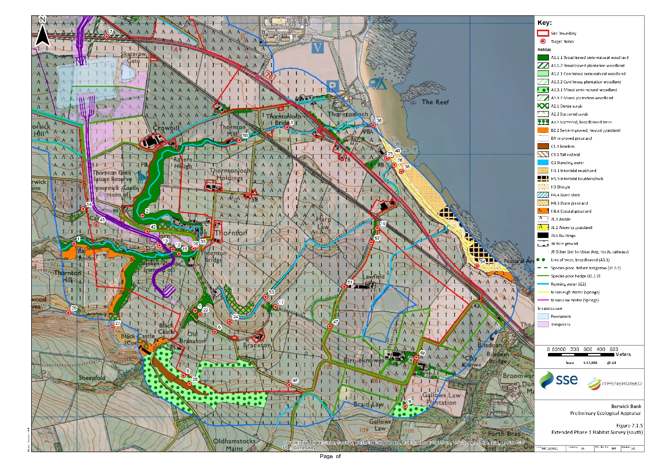
The Study Area for the Phase 1 habitat survey encompassed the Site and 250 m buffer, excluding the area seaward of the MHWS. The habitats recorded within the Study Area are detailed below and shown in Figure 7.1.4 and Figure 7.1.5 and Target Notes (TNs) are detailed in Annex D, Table D.1, and shown on Figure 7.1.4 and Figure 7.1.5 Scientific names of plant species are provided in Annex D. Twenty-nine habitats were recorded during the survey and are listed in Table 5 below.
Table 5: Habitats recorded within the Site and 250m buffer
Phase 1 Habitat | Phase 1 Code | Area within Study Area | Area within Site (ha) | % of Site |
|---|---|---|---|---|
Broadleaved, semi-natural woodland | A1.1.1 | 19.08 | 8.07 | 1.34 |
Broadleaved, plantation woodland | A1.1.2 | 1.84 | 1.60 | 0.09 |
Coniferous, semi-natural woodland | A1.2.1 | 0.24 | 0.11 | 0.04 |
Coniferous, plantation woodland | A1.2.2 | 2.67 | 2.67 | 0.42 |
Mixed, semi-natural woodland | A1.3.1 | 22.78 | 2.83 | 0.46 |
Mixed, plantation woodland | A1.3.2 | 0.71 | 0.70 | 0.08 |
Dense/Continuous Scrub | A2.1 | 14.63 | 10.96 | 0.94 |
Scattered scrub | A2.2 | 7.44 | 5.36 | 0.30 |
Broadleaved scattered trees | A3.1 | 0.18 | 0.08 | 0.01 |
Semi-improved neutral grassland | B2.2 | 53.98 | 38.58 | 3.07 |
Improved grassland | B4 | 562.39 | 208.62 | 58.54 |
Continuous Bracken | C1.1 | 2.03 | 0 | 0 |
Tall ruderal | C3.1 | 1.09 | 0.24 | 0.10 |
Bryophyte dominated spring | E2.3 | <0.01 | 0 | 0 |
Standing water | G1 | 0.09 | 0.09 | 0.01 |
Running water | G2.1 | 18.92 km | 10.64 km | - |
Intertidal mud/sand | H1.1 | 9.97 | 4.16 | 0.48 |
Intertidal boulders / rock | H1.3 | 40.09 | 21.06 | 4.54 |
Shingle above high tide mark | H3 | 4.46 | 0.23 | 0.02 |
Dune grassland | H6.5 | 4.32 | 0 | 0 |
Coastal grassland | H8.4 | 5.89 | 3.29 | 0.39 |
Arable | J1.1 | 238.20 | 126.23 | 22.27 |
Amenity grassland | J1.2 | 0.15 | 0 | 0 |
Intact species-poor hedgerow | J2.1.2 | 15.57 km | 15.57 km | - |
Defunct species-poor hedgerow | J2.2.2 | 0.81 km | 0.81 km | - |
Wall | J2.5 | 25.47 km | 15.62 km | - |
Buildings | J3.6 | 3.61 | 0.09 | 0.02 |
Bare ground | J4 | 4.38 | 0.95 | 0.16 |
Other (incl. roads/railway and grounds of properties) | J5 | 59.94 | 40.53 | 6.73 |
Total |
| 1060.21 | 602.33 | 100 |
5.2.1.1 Broadleaved, semi-natural woodland (A1.1.1)
Mature broadleaved, semi-natural woodland extends along the Braidwood Burn (TN1), Thornton Burn (TN2) and Thurston Burn (TN3) corridor through the centre of the Site. The canopy is dominated by ash, beech and sessile oak with occasional Scots pine. Gorse, hawthorn, elder and bramble were recorded in the understorey. Ground flora included great wood-rush, male-fern, butterbur and bracken. Part of this woodland forms Thornton Glen SWT which borders the Site. A small area of broadleaved, semi-natural woodland borders the Site to the east of Thorntonloch Holdings (TN4). This woodland is listed on the AWI as LEPO 2b.
5.2.1.2 Broadleaved, plantation woodland (A1.1.2)
An area of broadleaved plantation woodland surrounds Orchard House in Skateraw, outwith the Site (TN5).
5.2.1.3 Coniferous, semi-natural woodland (A1.2.1)
A strip of coniferous, semi-natural woodland lies along the road to the west of Branxton Cottage (TN6). This woodland is listed on the AWI as LEPO 2b.
5.2.1.4 Coniferous, plantation woodland (A1.2.2)
An area of coniferous plantation dominated by Scots pine borders the A1 trunk road to the south of Skateraw (TN 7). The woodland extends north and south along a drainage ditch.
5.2.1.5 Mixed, semi-natural woodland (A1.3.1)
Mixed, semi-natural woodland can be found at the south-east of the study area (TN8 and TN9) where it provides excellent badger habitat and along the Dry Burn at the north-west of the Phase 1 habitat Study Area and along Skateraw Dean (TN10)
5.2.1.6 Mixed, plantation woodland (A1.3.2)
Mixed, plantation woodland was recorded within the Site to the north of Skateraw, bordering arable fields (TN11) and within the Viridor site outwith the western Site boundary.
5.2.1.7 Dense/continuous scrub (A2.1)
Dense scrub is found within the Site running adjacent to the Thornton Burn (TN12) and Braidwood Burn (TN13), Dry Burn and bordering an arable field at the west side of the Site (TN14).
5.2.1.8 Scattered scrub (A2.2)
Scattered gorse scrub is found adjacent to Dry Burn (TN15) and bordering areas of dense scrub within the study area.
5.2.1.9 Broadleaved scattered trees (A3.1)
Scattered broadleaved tree lines were recorded along roadsides (TN16) and field margins (TN17). This habitat was also often recorded around properties.
5.2.1.10 Semi-improved neutral grassland (B2.2)
Semi-improved grassland recorded at the north-west of the Site lying between coastal grassland and arable land as it following the North Atlantic coastline from north to south before reaching Torness power station (TN18), along access track to the south of the Thornton Burn (TN19), along roadside edges (TN20) and bordering coastal grassland at the north-west of the Site (TN21).
5.2.1.11 Improved grassland (B4)
Improved grassland is the dominant habitat type found within the Site and wider Study Area often used for grazing sheep or horses. Typical examples of this habitat are provided in TN22-24.
5.2.1.12 Bracken (C1.1)
Area of continuous bracken found at the southern reaches of the study area (TN25).
5.2.1.13 Tall ruderal (C3.1)
Area of tall ruderal along the Branxton Burn where it ends at the North Atlantic (TN26).
5.2.1.14 Bryophyte dominated spring (E2.3)
Bryophyte-dominated spring vegetation occurs locally within a c 100 m length of coastal cliff in the southeast of the Study Area (TN54). It is dominated by the bryophyte Palustriella commutata and red fescue, with other species including colt’s-foot, sea plantain, marsh thistle, ragwort, marsh marigold and marsh horsetail. Water drips through the community and areas of bare mud are present, suggesting local slippage. The vegetation conforms with the M37 Palustriella commutata[1]-Festuca rubra spring community of the NVC.
5.2.1.15 Standing water (G1)
Six waterbodies were identified within the study area. One waterbody is fed by Kames Well (TN27), one is fed by Ogle Burn (TN28) and one lies within woodland at Skateraw (TN29). Three waterbodies lies within the Viridor site (TN30, TN31 and TN32), but there was no access to this area to fully survey.
5.2.1.16 Running water (G2)
Running water within the study area includes Braidwood Burn, Thornton Burn (TN33 and TN36), Skateraw Dean (TN34), the Dry Burn (TN35 and TN37), Thurston Mains, Ogle Burn and Branxton Burn. Weirs were present along Thornton Burn, Dry Burn and Bilsdean Burn that were impassable to fish.
5.2.1.17 Intertidal mud/sand (H1.1)
Found along the coastline at the east side of the study area (TN38) and at Skateraw harbour.
5.2.1.18 Intertidal Boulders/rocks (H1.3)
Boulders and rocks both intertidal and above the high tide mark are found to the west of Torness Point (TN39) and south-east of Thornton Loch Caravan park.
5.2.1.19 Shingle above high tide mark (H3)
Shingle above high tide lies between coastal grassland and intertidal mud/sand at south-eastern reaches of the study area (TN40) and to the west of Torness Point along Skateraw Harbour.
5.2.1.20 Dune grassland (H6.5)
A small area of dune grassland is found to the south-east of Thornton Loch Caravan Park within the eastern reaches of the Site, running adjacent to the coastline. This habitat is also associated with the Barns Ness Coast SSSI to the west of the Site.
5.2.1.21 Coastal grassland (H8.4)
Coastal grassland was recorded along the edge of the rocky intertidal habitat within Barns Ness SSSI (TN41).
5.2.1.22 Arable (J1.1)
Arable land comprises approximately 20% of the Site. Examples of this habitat type are given in TN42-46.
5.2.1.23 Intact, species-poor hedge (J2.1.2)
Species-poor, intact hedgerow border improved and arable fields throughout the study area (TN47).
5.2.1.24 Defunct, species-poor hedge (J2.2.2)
Species poor, defunct hedgerow dominated by hawthorn are also commonly found throughout the study area, bordering improved grassland and arable fields (TN48-49).
5.2.1.25 Wall (J2.5)
Stone walls are frequently found throughout the study area as field boundaries and around properties. The height of walls vary considerably from c.0.5 m to over 2 m. A typical boundary wall is shown in TN51.
5.2.1.26 Buildings (J3.6)
Multiple residential and farm buildings can be found throughout the Site and wider study area.
5.2.1.27 Bare ground (J4)
Bare ground is found associated with residential and farm buildings for the movement and storage of vehicles, plant or machinery. Often small areas of <0.1 ha.
5.2.1.28 Other (incl. roads/railway line) (J5)
The A1 trunk road runs through the east to the west of the Site with smaller roads criss-crossing the Site. The East Coast Main Line (ECML) railway also runs from the north-west of the Site to the south-west, passing under the A1 trunk road. Ground within the boundaries of residential properties and farms was also mapped under this code.
5.2.2 Invasive Non-Native Species
5.2.2.1 Japanese knotweed
One area of Japanese knotweed was found within the Site at the north side of Thornton Burn estimated to be c.50 m² in area (TN50).
5.2.2.2 Himalayan balsam
Two areas of Himalayan balsam were found within the Site during the PEA walkover surveys. One area extends for c.50 m along a roadside ditch next to a stone wall (TN51) and the other extends for c.100 m along a roadside ditch next to an unmanaged hedgerow (TN52). In addition to this, an area of Himalayan balsam was identified during preconstruction checks by the ECoW ahead of site investigation works (pers. comm. Mohr Environmental, 12.07.2022) in July 2022 (TN55).
5.2.3 Groundwater-dependent Terrestrial Ecosystmes (GWDTEs)
M37 bryophyte spring is likely to be highly groundwater dependent (SEPA, 2017). M37 occurs on ground kept permanently moist by irrigation with base-rich, calcareous and generally oligotrophic waters. The community is known to occur near coastal areas in East Lothian (Averis et al. 2014).
5.2.4 Protected or Otherwise Notable Species
5.2.4.1 Foraging and commuting bats
The Site and immediately surrounding areas present a variety of suitable foraging, commuting and potential roosting habitat for bat species, with a mix of woodland edge habitat, tree lines, hedgerows, field margins and open spaces. A number of watercourses traverse the Site and the associated riparian vegetation provides high quality foraging and commuting habitat for bats including water habitat specialists such as Daubenton’s bat. Linear features are also in abundance within the Site, including hedgerows, walls, strips of scrub and arable field boundaries which provide bats with connectivity to the wider area and a large potential resource of commuting and foraging habitat beyond the Site. No incidental evidence of bat use was recorded during the survey.
5.2.4.2 Otter
The desk study found records of otter within the Site. During the survey one otter spraint was found underneath a bridge within the Site next to the Thornton Burn beneath a railway underbridge. The watercourses within the Site and wider study area provide excellent foraging and commuting habitat for otter, connecting the coastline to inland habitats. The Thurston Mains Burn, Thornton Burn and Braidwood Burn in particular provide optimal otter habitat with bankside mature tree root systems and rock formations providing numerous opportunities for resting sites. Dense scrub habitat along Dry Burn and Ogle Burn also provide sheltered commuting routes for otter and potential resting site habitat.
5.2.4.3 Water vole
The desk study found one record of water vole within 2.3 km south-east of the Site. No incidental evidence of water vole was observed during the survey. The main watercourses within the Site including Dry Burn and Thornton Burn, and smaller watercourses such as the Branxton Burn, are considered to provide suitable habitat for water vole due to slow flowing water and suitable bankside vegetation cover.
5.2.4.4 Badger
The desk study found records of badger within 2 km of the Site, the closest record was within 0.7 km north of the Site. The habitats within the Site and adjacent areas including woodland, scrub, arable and grassland fields are considered highly suitable for badger providing numerous opportunities for sett building, quality foraging habitat and habitat corridors to facilitate badger dispersal and movement within the wider landscape.
No badger setts were identified within the Site, however four badger setts were identified within the wider Study Area. Full details of the setts are contained within Confidential Volume 5, Appendix 7.2 (ITPEnergised, 2022).
A number of established mammal paths were found throughout the areas of woodland that could be used by badger though roe deer (Capreolus capreolus) were also noted during the survey.
5.2.4.5 Reptiles
The desk study found records of common lizard (Zootoca vivipara) within 2 km of the Site and adder (Vipera berus) within 4 km of the Site. The habitats within the study area are considered less likely to support adder; however, areas of rough, tussocky grassland along field margins and burn corridors, overgrown rubble piles, stone walls and scrub habitat provide suitable terrestrial habitat for common lizard. The areas where these types of habitats are often encountered is at the centre of the Site close to the Thornton Burn, along the Dry Burn corridor and the south-west of the Site. Arable fields and improved grassland, which form the majority of the Site, are largely suboptimal for reptiles with suitable habitat confined to the field margins in these areas.
5.2.4.6 Great crested newt
The desk study found records of great crested newt within 3.8 km of the Site. There are six waterbodies within the study area that would be suitable for amphibians, including ponds formed from the Kames Well (TN27) which lies 300 m south-west of the Site boundary, the Ogle Burn (TN28) which lies 315 m south of the Site boundary, the Skateraw burn (TN29) which lies within the northern reaches of the Site and three ponds within the Viridor site (TN30-32), outwith the north-west Site boundary.
Kames Well is surrounded by a mix of scattered scrub with dense areas of gorse to the north side. The terrestrial habitat for great crested newt in this area of the Site is good and it allows covered commuting access to other waterbodies such as the drainage pond fed by the Ogle Burn to the east.
The drainage pond off of the Ogle Burn is surrounded by rough grassland, a stone wall to the west, woodland to the east and scrub habitat. These habitats provide suitable foraging, commuting and refugia habitat.
The small waterbody of the Skateraw burn lies within an area of woodland, is completely shaded and has no suitable aquatic vegetation.
Two waterbodies within the Viridor site, could be viewed from a distance and appear to be situated within rough grassland, surrounded by scattered gorse scrub. This is likely to provide good terrestrial habitat.
An HSI assessment of the accessible waterbodies was conducted, the results of which are detailed fully in Annex E. In summary, Kames Well scored 0.71 (Good) and the waterbody fed by the Ogle Burn scored 0.78 (Good). The waterbody fed by the Skateraw Burn scored 0.46 (Poor). The waterbodies within the Viridor site could not be accessed to complete the HSI assessment.
5.2.4.7 Other Amphibians
The desk study found records of common frog and common toad within 1.1 km of the Site. No incidental evidence of amphibian species were recorded during the survey. The waterbodies described above in 5.2.3.5 would also support other amphibian species. Rough grassland, woodland and scrub vegetation adjacent to watercourses within the Site were also considered to provide good refugia and foraging habitat for amphibians.
5.2.4.8 Breeding Birds
Habitats within the Site including woodland, tree lines, scrub, arable fields and grasslands provide high quality foraging and breeding habitat for a variety of farmland bird species. Sand martin (Riparia riparia) burrows were found along the sandy banks of Branxton burn (TN53).
Habitats within the Site such as the arable land to the north of the A1 trunk road were observed to be in use by pink-footed geese for feeding and loafing. This species is a qualifying interest of both the Outer Firth of Forth and St Andrews Bay Complex SPA and Firth of Forth SPA.
5.2.4.9 Fisheries
Due to the presence of substantial weirs on Thornton Burn, Dry Burn and Bilsdean Burn, migration of fish upstream is considered unlikely. Therefore fish are not considered further.
6. Discussion
6. Discussion
6.1 Nature Conservation Designations
6.1 Nature Conservation Designations
6.1.1 Assessment
6.1.1.1 Statutory nature conservation designations – SPAs
Given the potential for connectivity between the Proposed Development and the SPAs of which one is also a Ramsar site, there is a potential for activities associated with the Proposed Development’s construction and operation to result in adverse effects on the qualifying interests and conservation objectives of specific qualifying features. Consequently, a Habitat Regulations Appraisal (HRA) screening exercise was undertaken in September and October 2021 which, upon consultation with NatureScot and East Lothian Council, determined that an HRA was necessary to identify the nature, extent and significance of any adverse effects on a number of specific SPA qualifying and assemblage species and, if confirmed, whether these are likely to impact the integrity of the designation.
Following the HRA screening exercise a Report to Inform Appropriate Assessment (RIAA) was undertaken in relation to specific receptors due to the Site’s proximity to the following SPAs:
Firth of Forth SPA/Ramsar;
Outer Firth of Forth and St Andrews Bay Complex SPA;
St. Abb’s Head to Fast Castle SPA; and
Forth Islands SPA.
The RIAA (ITPEnergised, 2022b) included within Volume 1, Chapter 8 and standalone document, details the results of this assessment and must be read in conjunction with this document.
6.1.1.2 Statutory nature conservation designations – SSSIs
Barns Ness Coast SSSI overlaps with the Site at the landfall location. This SSSI is designated for its coastland habitats. Working methods will need to be adopted during the construction phase, in consultation with NatureScot, to avoid potential negative impacts.
The remaining SSSIs of Pease Bay Coast; Pease Bridge Glen; Woodhall Dean; and Lammermuir Deans lie between 1.15 km and 3.3 km from the Site boundary. Due to the separation distance and the nature of the proposed works these SSSIs are unlikely to be affected by the Proposed Development.
6.1.1.3 Non-statutory nature conservation designations
One SWT and four LNCS were identified during the desk study. Thurston Burn Valley LNCS and Dunglass Burn LNCS lie within the Site and Thornton Glen SWT and Dryburn Valley LNCS lie directly adjacent to the Site. The remaining site, Bilsdean Coast LNCS, lies 135 m east of the Site. The footprint of the Proposed Development will not directly impact these sites however working methods will need to be adopted during the construction phase to avoid potential indirect negative impacts.
Twenty-nine areas of ancient woodland were identified within 2 km of the Site. Of these, two lie within the Site and three directly adjacent to the Site. The footprint of the Proposed Development will not directly impact these areas of woodland however working methods will need to be adopted during the construction phase to avoid potential indirect negative impacts.
6.2 Habitats
6.2 Habitats
6.2.1 Assessment
A large majority of the Site (c. 70%) is improved grassland or arable fields. Other habitats recorded within the Site included semi-improved neutral grassland, mature coniferous and broadleaved woodland, standing and running water, dense and scattered scrub, species-poor hedgerows and coastal habitats. Plant species diversity within the areas of improved grassland and arable fields was low, with higher species diversity recorded in less managed areas of the Site including field margins, mature woodland, dense scrub, semi-improved neutral grassland and coastal habitats. The plant species recorded within the Site and 100 m buffer were considered to consist of common and widespread species commonly found within sites of this nature in this part of Scotland.
As described in Section 3.2, scrub, veteran trees, burns and rivers, neutral grasslands, hedgerows, cereal field margins, sand dunes and intertidal habitats are priority habitats within the LBAP. There is scope to increase biodiversity within the Site by incorporating the measures and recommendations outlined in the LBAP.
6.2.2 Protection of Existing Habitats
In order to reduce potential negative impacts, the following measures are recommended:
To protect scrub and woodland habitats within and adjacent to the Site working methods should proceed in line ‘BS 5837 (2012) – Trees in relation to Design, Demolition and Construction’.
There should be no storage of material within 10m of any watercourse in line with SEPA requirements to reduce risk of runoff (SEPA, 2009).
A biodiversity enhancement plan should be produced for the Site detailing measures to enhance habitats and increase biodiversity within the Site.
Avoid bryophyte springs and a minimum 250 m buffer.
6.3 Groundwater Dependent Terrestrial Ecosystems
6.3 Groundwater Dependent Terrestrial Ecosystems
The area of M37 bryophyte spring is likely to be groundwater dependent. If this habitat lies within 250 m of the Proposed Development, mitigation may be needed to reduce impacts.
6.4 Invasive Non-Native Species
6.4 Invasive Non-Native Species
Evidence of invasive non-native species was found during the survey, with an area of Japanese knotweed recorded next to the Thornton Burn and Himalayan balsam found in some of the roadside ditches within the Site.
While there is no legal obligation to remove or treat these non-native invasive species, the Wildlife and Natural Environment Act (2011) states that this species must not be planted or caused to grow in the wild. Responsibility for dealing with invasive weeds rests with individual landowners and there is a duty of care with regards to the disposal of any part of the plant that may facilitate establishment in the wild and cause environmental harm. Therefore, waste containing Japanese knotweed and Himalayan balsam is classified as ‘controlled waste,’ under the Environmental Protection Act (1990).
Works should be reviewed and if there is a risk that works are likely to be within 10 m of these stands an Invasive Non-Native Species (INNS) plan must be produced to prevent the spread of these species within and off the Site. The management plan should include suitable precautions to prevent spread of plant fragments/seeds including exclusion zones, biological control, on-site treatment or removal by an approved company that specialises in non-native species disposal.
6.5 Protected or Otherwise Notable Species
6.5 Protected or Otherwise Notable Species
5.1.2 Badger
It is considered highly likely that badgers will be present within the study area and may be directly and indirectly impacted by the works. Following the PEA a badger survey of the Site and a 100 m buffer began in October 2020 and the results of these surveys can be viewed in Volume 4, Appendix 7.2 (ITPEnergised, 2022b).
5.1.3 Otter
Otters are wide-ranging, primarily nocturnal and spend a lot of their time within aquatic environs. They can occupy large home ranges and utilise a wide range of habitats, including rivers, streams, ditches and wetlands.
Evidence of otter presence was found along the Thornton Burn confirming their presence within the Site. The watercourses that traverse the Site and the coastline, provide high quality foraging and commuting habitat as well as numerous habitat features within banks, rocky substrates and surrounding tree root systems that could be used by otter as resting sites (e.g. holts, couches). Following the PEA an otter survey of all watercourses within the Site and up to 250 m upstream and downstream of the Site boundary was completed to provide full information on otter presence within the Site and to determine potential impacts/licensing and mitigation requirements. The survey also encompassed the area of the coastline that falls within this buffer zone. Otter surveys began in October 2020 and results of these surveys can be viewed in Volume 4, Appendix 7.2 (ITPEnergised, 2022c).
5.1.4 Water Vole
No incidental evidence of water vole as found on the Site during the survey. However, suitable habitat was recorded within the study area including the Thornton Burn, Thurston Mains Burn Dry Burn and Bilsdean Burn.
Further survey for water vole was conducted alongside the otter survey and the results of these surveys can be viewed in Volume 4, Appendix 7.2 (ITPEnergised, 2022c).
5.1.5 Reptiles
In Scotland, reptiles are partly protected under the Wildlife and Countryside Act 1981 (as amended) making it an offence to kill or injure a reptile. Common lizard could potentially be present in parts of the Site, particularly on south-facing slopes of semi-improved grassland where it forms a mosaic with scrub, piles of overgrown rubble etc. This habitat lies along the Dry Burn corridor and as edge habitat adjacent to the Braidwood Burn corridor. However, areas of improved grassland and arable fields which form the majority of the Site are largely suboptimal, with presence of reptiles likely to be restricted to the field margins.
Where works require removal of suitable terrestrial habitat, such as rough grassland, tall ruderal and scrub, or removal of suitable refugia habitat, such as stone walls or piles of rubble, then pre-construction checks should be carried out by a Suitably Qualified Ecologist.
5.1.6 Great Crested Newt
Two waterbodies within 500 m of the Site were assessed as having potential suitability for use by great crested newt. Further surveys environmental DNA (eDNA) surveys were completed in May 2021 to inform licencing, mitigation and compensation requirements. The results are contained within Volume 4, Appendix 7.2 (ITPEnergised, 2022c).
5.1.7 Other Amphibians
There was no incidental evidence of common frog, common toad, palmate newt (Lissotriton helveticus) and smooth newt (Lissotriton vulgaris) found during the survey, but the habitats identified as suitable for great crested newt are likely to also support these species. These species are offered limited protection under the Wildlife and Countryside Act 1981 (as amended). Common frog, common toad and smooth newt are listed as SBL species, so are considered key species for biodiversity conservation in Scotland. If any amphibians are encountered during the works they should be collected by a member of the Site team or the ECoW and moved a safe distance from the works area within suitable habitat.
5.1.8 Breeding birds
Habitats within the Site and study area are suitable for a range of farmland and lowland bird species. In order to ensure compliance with the Wildlife and Countryside Act 1981 (as amended), which affords protection to all birds (whilst actively nesting), their nests and eggs, it is recommended that all construction works should be completed outside of the bird breeding season (March to August, inclusive).
Should this not be possible, a suitably qualified ecologist should search the Site of evidence of nesting birds immediately prior to any works commencing in areas that have been highlighted as having the potential to support bird species, with a re-check undertaken for any works delayed longer than 48 hours. Should a nest be recorded, a suitable working buffer would be put in place until the young have successfully fledged the nest.
5.1.9 Use of Appropriate Lighting
Artificial lighting can often impact the foraging and commuting behaviour of nocturnal mammals such as badger, otter and bats. As a consequence, it is advised that construction phase lighting be directed to where it is needed and light spillage (whether direct/or in-direct) should be avoided, particularly within the vicinity of edge habitat, riparian corridors and other linear features such as pathways, tree lines and hedgerows. The times during which the lighting is on should be limited to provide some dark periods. Roads, track ways and hedgerows in areas likely to contain foraging bats should contain stretches left unlit to avoid isolation of bat colonies. These unlit stretches should be ten metres in length either side of a commuting route (ILP, 2018).
6.6 Compliance with Legislation and Policy
6.6 Compliance with Legislation and Policy
The baseline survey data is considered to be valid for 18 months (e.g. up to the end January 2023). If construction works commence after this time, it is recommended that an updated survey, as per the methods section of this report, is undertaken to ensure there has been no significant change to the baseline outlined within this report.
Fulfilment of the recommendations outlined above will ensure compliance with the relevant nature conservation legislation and planning policy outlined in Section 2.1 (Legislation) and 2.2 (Policy Framework), respectively.
7. References
7. References
Averis AM, Averis B, Birks HJB, Horsfield D, Thompson DBA and Yeo MJM (2014). An illustrated guide to British upland vegetation, 2014 re-print. Joint Nature Conservation Committee.
British Standards Institute. (2012). BS5837: 2012 Trees in Relation to Design, Demolition and Construction: Recommendations.
Chanin P (2003). Monitoring the Otter Lutra lutra. Conserving Natura 2000 Rivers Monitoring Series No. 10. English Nature, Peterborough.
CIEEM (2017). Guidelines for Preliminary Ecological Appraisal. 2nd Edition. Chartered Institute of Ecology and Environmental Management. Available online at: https://cieem.net/resource/guidance-on-preliminary-ecological-appraisal-gpea/ (accessed April 2019).
CIEEM (2018). Guidelines for Ecological Impact Assessment in the UK and Ireland. Chartered Institute of Ecology and Environmental Management. Available online at: http://www.cieem.net/data/files/Publications/EcIA_Guidelines_Terrestrial_Freshwater_and_Coastal_Jan_2016.pdf (accessed May 2020).
CIEEM (2013a). Competencies for Species Survey: Eurasian Otter. Available online at: https://cieem.net/wp-content/uploads/2019/02/CSS-EURASIAN-OTTER-April-2013.pdf (accessed May 2020).
CIEEM (2013b). Competencies for Species Survey: Water Vole. Available online at: https://cieem.net/wp-content/uploads/2019/02/CSS-WATER-VOLE-April-2013.pdf (accessed May 2020).
CIEEM (2013c). Competencies for Species Survey: Badger. Available online at: https://cieem.net/wp-content/uploads/2019/02/CSS-BADGER-April-2013.pdf (accessed May 2020).
CIEEM (2013d). Competencies for Species Survey: Great Crested Newt. Available online at: https://cieem.net/wp-content/uploads/2019/02/CSS-GREAT-CRESTED-NEWT-April-2013.pdf (accessed May 2020).
Dean, M, Strachan, R, Gow, D and Andrews, R (2016). The Water Vole Mitigation Handbook (Mammal Society Mitigation Guidance Series). Matthews, F and Chanin, P Eds, Mammal Society, London.
East Lothian Council (2017). East Lothian Biodiversity Report. Available at: https://www.eastlothian.gov.uk/downloads/file/23321/biodiversity_report_2017
East Lothian Biodiversity Partnership (2008). East Lothian Biodiversity Action Plan 2008-13. August 2008.
ITPEnergised (2022a). Berwick Bank EIA, Ecology Chapter, Technical Appendix 7.3, Bat ITPEnergised (2022c). Berwick Bank EIA, Ecology Chapter, Technical Appendix 7.2, Protected Species Report.
ITPEnergised (2022b). Berwick Bank Onshore RIAA.
ITPEnergised (2022c). Berwick Bank EIA, Ecology Chapter, Technical Appendix 7.2, Protected Species Report.
ILP (2018). Guidance Note 08/18 Bats and artificial lighting in the UK Bats and the Built Environment series. Institution of Lighting Professionals. Document download available online at: https://www.theilp.org.uk/documents/guidance-note-8-bats-and-artificial-lighting/
JNCC (2010). Handbook for Phase 1 Habitat Survey – a technique for environmental audit, revised re-print. Joint Nature Conservation Committee, Peterborough, UK.
NatureScot (2022). Sitelink. Available online at: https://sitelink.nature.scot/home (accessed January 2021).
NBN Atlas (2022). Explore Your Area. Available online at: https://nbnatlas.org/ (accessed January 2021).
Rodwell JS (ed.) (1991). British Plant Communities, Volume 2: Mires and heaths. Cambridge University Press, Cambridge.
Rodwell JS (2006). National Vegetation Classification: Users’ Handbook. JNCC, Peterborough.
Scottish Badgers (2018). Surveying for Badgers Good Practice Guidelines Version 1: 2018. Available online at: https://www.scottishbadgers.org.uk/userfiles/file/planning_guidelines/Surveying-for-Badgers-Good-Practice-Guidelines_V1.pdf (accessed February 2022).
Scottish Government (2000). Planning for Natural Heritage: Planning Advice Note 60. Available online at: https://www2.gov.scot/Publications/2000/08/pan60-root/pan60 (accessed February 2022).
Scottish Government (2013). Scottish Biodiversity List. Available online at: https://www2.gov.scot/Topics/Environment/Wildlife-Habitats/16118/Biodiversitylist/SBL (accessed February 2022).
Scottish Government (2014a). National Planning Framework 3. Available online at: https://www.gov.scot/publications/national-planning-framework-3/ (accessed February 2023).
Scottish Government (2014b). Scottish Planning Policy. Available online at: https://www.gov.scot/publications/scottish-planning-policy/ (accessed February 2023).
Scottish Government (2023). National Planning Framework 4. Available online at: https://www.gov.scot/publications/national-planning-framework-4/ (accessed February 2023).
SEPA (2009) Temporary Construction Methods. Engineering in the Water Environment Good Practice Guide. https://www.sepa.org.uk/media/150997/wat_sg_29.pdf
SEPA (2015) Scotland’s Environment Web. Available at: https://www.environment.gov.scot/maps/scotlands-environment-map/ (accessed March 2022).
SEPA (2017). Guidance on Assessing the Impacts of Development Proposals on Groundwater Abstractions and Groundwater Dependent Terrestrial Ecosystems. Version 3. Land Use Planning System SEPA Guidance Note 31.
SNH (2018). A guide to understanding the Scottish Ancient Woodland Inventory (AWI). Scottish Natural Heritage, November 2018. Available online at: https://www.nature.scot/sites/default/files/2018-11/A%20guide%20to%20understanding%20the%20Scottish%20Ancient%20Woodland%20Inventory%20%28AWI%29.pdf (accessed March 2022).
Stace, C (2010). New Flora of the British Isles Third Edition. C&M Floristics
Stanbury A, Eaton M, Aebischer N, Balmer D, Brown A, Douse A, Lindley P, McCulloch N, Noble D, and Win I (2021). The status of our bird populations: the fifth Birds of Conservation Concern in the United Kingdom, Channel Islands and the Isle of Man and the second IUCN Red List assessment of extinction risk for Great Britain. British Birds 114, December 2021, 723-747. Available online at https://britishbirds. Co.uk/wp-content/uploads/2014/07/BoCC4.pdf (accessed March 2022).
TWIC (2021). Protected and Notable Species Records, Data Request January 2021.
Figures
Figure 7.1.1 Location Plan
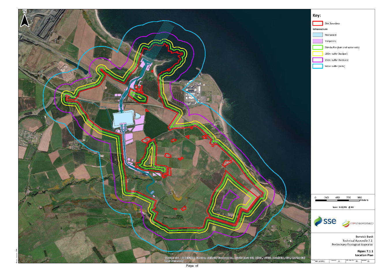
Figure 7.1.2 Statutory Nature Conservation Designations
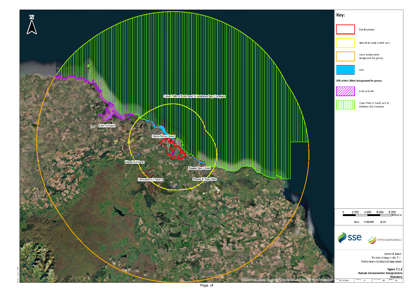
Figure 7.1.3 Non-Statutory Nature Conservation Designations
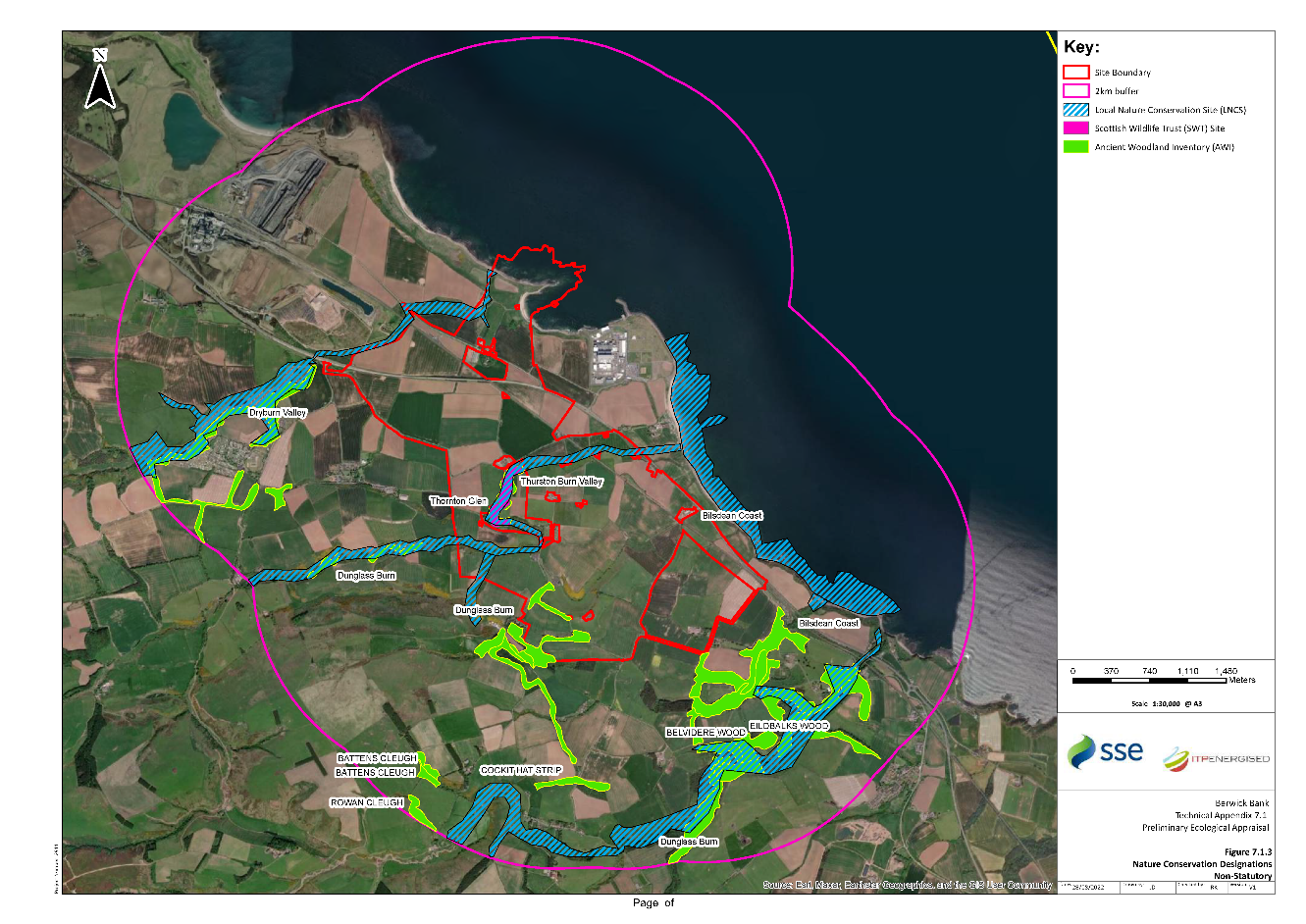
Figure 7.1.4 Extended Phase 1 Habitat Survey Results (north)
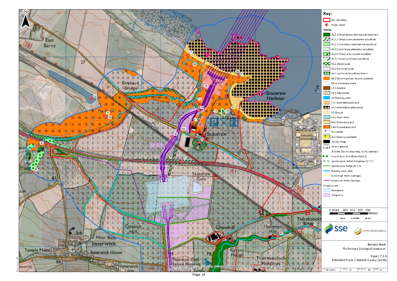
Figure 7.1.5 Extended Phase 1 Habitat Survey Results (south)
Annexes
Annex A: Species Specific Legislation
Badger
Badgers and their setts are protected under the Protection of Badgers Act 1992, as amended by the Wildlife and Natural Environment (Scotland) Act 2011. Under this legislation it is an offence to intentionally or recklessly:
Kill, injure, take, possess or cruelly ill-treat a badger or attempt to do so;
Interfere with a sett by damaging or destroying it;
Obstruct access to a badger sett;
Disturb a badger whilst it is occupying a sett;
Cause or allow a dog to enter a sett;
Sell a live badger, or offer one for sale, or possess a live badger; and
Be in the possession, or control of, a dead badger or anything derived from a dead badger.
Under the Protection of Badgers Act 1992, a badger sett is defined as ‘any structure or place which displays signs indicating current use by a badger’. Following NatureScot guidance, in the absence of any case law to define current use, the presence of field signs such as bedding, fresh spoil heaps, signs of recent digging, hair, latrines, or footprints in or around the potential sett or evidence of badgers entering or exiting the structure or place in question would indicate current use of the structure / place by a badger (SNH, 2018). Where a possible sett has no immediate evidence of current use, and is to be impacted by works, the structure should be actively monitored for a minimum of two weeks.
This legislation means that badgers are fully protected in Scotland, and that any planned activity, which may affect them, requires prior consultation with the appropriate statutory nature conservation organisation (i.e. NatureScot). Under Section 10 (1) of The Protection of Badgers Act 1992, licences may be granted by NatureScot for certain purposes that would otherwise be illegal.
Otter
Otters are a European Protected Species (EPS), protected under the Conservation (Natural Habitats, &c.) Regulations 1994. As such, in Scotland it is an offence to deliberately or recklessly:
Capture, injure or kill an otter;
Harass an otter or group of otters;
Disturb an otter in a den or any other structure or place it uses for shelter or protection;
Disturb an otter while it is rearing or otherwise caring for its young;
Obstruct access to a den or other structure or place otters use for shelter or protection, or otherwise deny the animal use of that place;
Disturb an otter in a manner or in circumstances likely to significantly affect the local distribution or abundance of the species; and
Disturb an otter in a manner or in circumstances likely to impair its ability to survive, breed or reproduce, or rear or otherwise care for its young.
It is also an offence to:
Damage or destroy a breeding site or resting place of such an animal (whether deliberately or recklessly); and
Keep, transport, sell or exchange, or offer for sale or exchange any wild otter (or any part or derivative of one) obtained after 10 June 1994.
It should be noted that otter shelters are always legally protected, whether an otter is present or not.
Otter is also included on the Scottish Biodiversity List (SBL), where it is listed for avoidance of negative impacts (The Scottish Government, 2013).
Water Vole
Water vole receives partial protection through its listing on Schedule 5 of The Wildlife and Countryside Act 1981 (as amended). In Scotland, this legal protection is currently restricted only to the water vole places of shelter or protection; it does not extend to the animal itself. It is an offence to intentionally or recklessly:
Damage, destroy or obstruct access to any structure or place that water voles use for shelter or protection; or
Disturb a water vole while it is using any such place of shelter or protection.
Water vole is a Priority Species on the Scottish Biodiversity List (SBL) (Scottish Government, 2013), where it is listed for both conservation action and for avoidance of negative impacts. This species has suffered significant declines in recent decades, mainly due to habitat loss and degradation, population fragmentation and predation by American mink (Mustela vison).
Great Crested Newt
Great crested newts are a European Protected Species (EPS), protected under the Conservation (Natural Habitats, &c.) Regulations 1994. As such, in Scotland it is an offence to deliberately or recklessly:
Capture, injure or kill a great crested newt;
Harass a great crested newt or group of great crested newts;
Disturb a great crested newt in a structure or place it uses for shelter or protection;
Disturb a great crested newt while it is rearing or otherwise caring for its young;
Obstruct access to a structure or place great crested newt use for shelter or protection, or otherwise deny the animal use of that place;
Disturb a great crested newt in a manner or in circumstances likely to significantly affect the local distribution or abundance of the species;
Disturb a great crested newt in a manner or in circumstances likely to impair its ability to survive, breed or reproduce, or rear or otherwise care for its young;
Disturb a great crested newt while it is migrating or hibernating; and
Take or destroy the eggs of a great crested newt.
It is also an offence of strict liability to:
Damage or destroy a breeding site or resting place of such an animal (whether deliberately or recklessly). These sites and places are protected even when the animal isn’t present. For example, great crested newt ponds are protected all of the time as long as it can be shown that the newts use the ponds some of the time; and
Keep, transport, sell or exchange, or offer for sale or exchange any wild great crested newt (or any part or derivative of one) obtained after 10 June 1994.
Great crested newt is also included on the Scottish Biodiversity List (SBL), where it is listed for avoidance of negative impacts (The Scottish Government, 2013).
Annex B: Policy Framework
National Planning Framework 4 (NPF4)
National Planning Framework 4 (NPF4) (Scottish Government, 2023) replaces National Planning Framework 3 (Scottish Government, 2014a) and Scottish Planning Policy (Scottish Government, 2014b). NPF4 outlines the duty of planning authorities to further the conservation of biodiversity as defined in the Nature Conservation (Scotland) Act 2004.
The planning system has an important role to play in improving the environment, for example by strengthening green and blue infrastructure, safeguarding, and enhancing urban and rural biodiversity, and contributing to the improvement of water, air and soil quality. Development plans should also seek to achieve a net enhancement of landscape quality and biodiversity. Policies relevant to nature conservation include:
Policy 1: Tackling the climate and nature crises;
Policy 3: Biodiversity;
Policy 4: Natural places;
Policy 5: Soils;
Policy 6: Forestry, woodland and trees;
Policy 8: Green belts;
Policy 11: Energy; and
Policy 20: Blue and green infrastructure.
Planning Advice Note (PAN) 60
National planning policy on landscape and natural heritage is supported by Planning Advice Note (PAN) 60 Planning for Natural Heritage, the key elements include:
Taking a broader approach to landscape and natural heritage than just conserving designated or protected sites and species, taking into account ecosystems and natural processes.
Facilitating positive landscape change whilst maintaining and enhancing distinctive character.
Seeking benefits for species and habitats from new development including the restoration of degraded habitats.
Siting and design of development should be informed by local landscape character.
Encouraging connectivity between habitats, through green networks.
Protecting internationally and nationally designated habitats and species.
Protecting and enhancing woodland and trees of high nature conservation value.
Local Development Plan
The East Lothian Council Local Development Plan’s (ELC, 2018) Sustainable Natural and Environment policies relevant to nature conservation are as follows:
Natural Heritage:
- Policy NH1: Internationally Designated Sites (RAMSAR);
- Policy NH2: Protection of Sites of Special Scientific Interest and Geological Conservation Review Sites;
- Policy NH3: Protection of Local Sites and Areas;
- Policy NH4: European Protected Species;
- Policy NH5: Biodiversity and Geodiversity Interests, including Nationally Protected Species;
- Policy NH7: Protecting Soils;
- Policy NH8: Trees and Development;
- Policy NH9: Water Environment;
- Policy NH10: Sustainable Urban Drainage Systems;
- Policy NH11: Flood Risk;
- Policy NH12: Air Quality; and
- Policy NH13: Noise.
Infrastructure and Resources:
- Policy T4: Active Travel Routes and Core Paths as part of the Green Network Strategy;
- PROP T5: Cycle Route Network; and
- PROP T20: Transport Related Air Quality Measures: Relocation of Bus Stops.
Energy Generation, Distribution and Transmission:
- Policy SEH1: Sustainable Energy and Heat; and
- Policy SEH2: Low and Zero Carbon Generating Technologies.
Countryside and Coastal Areas:
- Policy DC10: The Green Network.
Annex C: Full bird records
Annex C: Full bird records
Table C1: Bird species recorded within 5 km of the Site
Vernacular Name | Scientific name | ||||
|---|---|---|---|---|---|
Lesser Redpoll | Acanthis cabaret |
|
| X | Red |
Common Redpoll | Acanthis flammea |
|
|
| Amber |
Goshawk | Accipiter gentilis |
| X |
|
|
Sparrowhawk | Accipiter nisus |
|
|
|
|
Marsh Warbler | Acrocephalus palustris |
| X |
| Red |
Sedge Warbler | Acrocephalus schoenobaenus |
|
|
|
|
Reed Warbler | Acrocephalus scirpaceus |
|
| X |
|
Common sandpiper | Actitis hypoleucos |
|
|
| Amber |
Skylark | Alauda arvensis |
|
| X | Red |
Razorbill | Alca torda |
|
|
| Amber |
Kingfisher | Alcedo atthis | X | X | X | Amber |
Little Auk | Alle alle |
|
|
|
|
Pintail | Anas acuta |
|
|
| Amber |
Teal | Anas crecca |
|
|
| Amber |
Mallard | Anas platyrhynchos |
|
|
| Amber |
White-fronted Goose | Anser albifrons albifrons |
|
|
|
|
Greylag Goose | Anser anser |
|
|
| Amber |
Pink-footed Goose | Anser brachyrhynchus |
|
|
| Amber |
Snow Goose | Anser caerulescens |
|
|
|
|
Bean Goose | Anser fabalis |
|
| X | Amber |
Rock Pipit | Anthus petrosus |
|
|
|
|
Meadow Pipit | Anthus pratensis |
|
|
| Amber |
Water Pipit | Anthus spinoletta |
|
|
| Amber |
Tree Pipit | Anthus trivialis |
|
| X | Red |
Swift | Apus apus |
|
| X | Amber |
Grey Heron | Ardea cinerea |
|
|
|
|
Turnstone | Arenaria interpres |
|
|
| Amber |
Short-eared Owl | Asio flammeus | X |
| X | Amber |
Long-eared Owl | Asio otus |
|
|
|
|
Ring-necked Duck | Aythya collaris |
|
|
|
|
Pochard | Aythya ferina |
|
| X | Red |
Tufted Duck | Aythya fuligula |
|
|
| Green |
Scaup | Aythya marila |
| X | X | Red |
Waxwing | Bombycilla garrulus |
|
|
|
|
Brent Goose | Branta bernicla |
|
|
| Amber |
Greater Canada Goose | Branta canadensis |
|
|
|
|
Barnacle Goose | Branta leucopsis | X |
| X | Amber |
Goldeneye | Bucephala clangula |
|
|
| Amber |
Buzzard | Buteo buteo |
|
|
|
|
Rough-legged Buzzard | Buteo lagopus |
|
|
|
|
Lapland Bunting | Calcarius lapponicus |
| X |
| Amber |
Sanderling | Calidris alba |
|
|
| Amber |
Dunlin (schinzii race) | Calidris alpina schinzii | X |
|
| Amber |
Baird’s Sandpiper | Calidris bairdii |
|
|
|
|
Knot | Calidris canutus |
|
|
| Amber |
Curlew Sandpiper | Calidris ferruginea |
|
|
| Amber |
Purple Sandpiper | Calidris maritima |
| X | X | Amber |
Little Stint | Calidris minuta |
|
|
|
|
Ruff | Calidris pugnax | X | X | X | Red |
Goldfinch | Carduelis carduelis |
|
|
|
|
Black Guillemot | Cepphus grylle |
|
|
| Amber |
Treecreeper | Certhia familiaris |
|
|
|
|
Little Ringed Plover | Charadrius dubius |
| X |
|
|
Ringed Plover | Charadrius hiaticula |
|
|
| Red |
Black Tern | Chlidonias niger | X | X |
| Green |
Black-headed gull | Chroicocephalus ridibundus |
|
| X | Amber |
Dipper | Cinclus cinclus |
|
|
| Amber |
Hen Harrier | Circus cyaneus | X | X | X | Red |
Long-tailed Duck | Clangula hyemalis |
| X |
| Red |
Hawfinch | Coccothraustes coccothraustes |
|
| X | Red |
Stock Dove | Columba oenas |
|
|
| Amber |
Raven | Corvus corax |
|
|
|
|
Hooded Crow | Corvus cornix |
|
| X |
|
Quail | Coturnix coturnix |
| X |
| Amber |
Cuckoo | Cuculus canorus |
|
| X | Red |
Blue Tit | Cyanistes caeruleus |
|
|
|
|
Whooper swan | Cygnus cygnus | X | X | X | Amber |
Mute swan | Cygnus olor |
|
|
| Amber |
House Martin | Delichon urbicum |
|
|
| Amber |
Great Spotted Woodpecker | Dendrocopos major |
|
|
|
|
Little Egret | Egretta garzetta | X |
|
| Green |
Reed Bunting | Emberiza schoeniclus |
|
| X | Amber |
Shore Lark | Eremophila alpestris |
| X |
| Amber |
Robin | Erithacus rubecula |
|
|
|
|
Merlin | Falco columbarius | X | X | X | Red |
Peregrine | Falco peregrinus | X | X | X |
|
Kestrel | Falco tinnunculus |
|
| X | Amber |
Pied flycatcher | Ficedula hypoleuca |
|
|
| Red |
Red-breasted Flycatcher | Ficedula parva | X |
|
|
|
Puffin | Fratercula arctica |
|
|
| Red |
Brambling | Fringilla montifringilla |
| X | X |
|
Coot | Fulica atra |
|
|
|
|
Fulmar | Fulmarus glacialis |
|
|
| Amber |
Snipe | Gallinago gallinago |
|
|
| Amber |
Moorhen | Gallinula chloropus |
|
|
|
|
Black-throated Diver | Gavia arctica | X | X | X | Amber |
Great Northern Diver | Gavia immer | X | X | X | Amber |
Red-throated Diver | Gavia stellata | X | X | X | Green |
Crane | Grus grus | X |
|
| Amber |
Oystercatcher | Haematopus ostralegus |
|
|
| Amber |
Swallow | Hirundo rustica |
|
|
| Green |
Storm Petrel | Hydrobates pelagicus | X |
| X | Amber |
Little Gull | Hydrocoloeus minutus |
| X |
| Green |
Red Grouse | Lagopus lagopus |
|
|
|
|
Red-backed Shrike | Lanius collurio | X | X | X | Red |
Herring Gull | Larus argentatus |
|
| X | Red |
Common Gull | Larus canus |
|
|
| Amber |
Lesser Black-backed Gull | Larus fuscus |
|
|
| Amber |
Iceland Gull | Larus glaucoides |
|
|
| Amber |
Glaucous Gull | Larus hyperboreus |
|
|
| Amber |
Great black-backed Gull | Larus marinus |
|
|
| Amber |
Bar-tailed Godwit | Limosa lapponica | X |
| X | Amber |
Linnet | Linaria cannabina |
|
| X | Red |
Twite | Linaria flavirostris |
|
| X | Red |
Grasshopper warbler | Locustella naevia |
|
| X | Red |
Crossbill | Loxia curvirostra |
| X |
|
|
Bluethroat | Luscinia svecica | X | X |
|
|
Jack Snipe | Lymnocryptes minimus |
|
|
| Green |
Velvet Scoter | Melanitta fusca |
| X |
| Red |
Common Scoter | Melanitta nigra |
| X | X | Red |
Smew | Mergellus albellus | X |
| X | Amber |
Goosander | Mergus merganser |
|
|
|
|
Red-breasted Merganser | Mergus serrator |
|
|
|
|
Bee-eater | Merops apiaster |
| X |
|
|
Red Kite | Milvus milvus | X | X | X | Green |
Gannet | Morus bassanus |
|
|
| Amber |
Pied Wagtail | Motacilla alba |
|
|
|
|
Grey Wagtail | Motacilla cinerea |
|
|
| Red |
Yellow Wagtail | Motacilla flava |
|
| X | Red |
Spotted Flycatcher | Muscicapa striata |
|
| X | Red |
Curlew | Numenius arquata |
|
| X | Red |
Whimbrel | Numenius phaeopus |
| X |
| Red |
Wheatear | Oenanthe oenanthe |
|
|
| Green |
Golden Oriole | Oriolus oriolus |
| X |
| Red |
Osprey | Pandion haliaetus | X | X | X | Amber |
Great Tit | Parus major |
|
|
|
|
House Sparrow | Passer domesticus |
|
| X | Red |
Tree sparrow | Passer montanus |
|
| X | Red |
Grey Partridge | Perdix perdix |
|
| X | Red |
Annex D: Target Notes
Annex D: Target Notes
Table D1: Plants and habitats
Target Note | Grid Reference | Description |
|---|---|---|
1 | NT 72979 73322 |
Broadleaved, semi-natural woodland follows the course of the Braidwood Burn. Tree species recorded along the burn corridor included ash, sessile oak, beech, grey willow and alder with occasional Scots pine. Understorey vegetation included gorse, elder, hawthorn, bramble, butterbur, great wood-rush, male-fern and bracken. |
2 | NT 73502 73535 |
An area of dense broadleaved, semi-natural woodland follows the Thornton Burn northwards. Tree species recorded included ash and sycamore with a scrub understorey of hawthorn, dog-rose, honeysuckle and elder. Ground flora recorded included common hogweed, bramble, silverweed, red campion, lesser burdock, hedge woundwort, crossword, bush vetch, field forget-me-not, greater plantain, ribwort plantain, herb-robert, purple dead nettle, red clover, square-stalked St John’s-wort and ox-eye daisy. |
3 | NT 76035 72359 |
A strip of broadleaved, semi-natural woodland measuring follows the route of the Thurston Burn down to the sea within the central reaches of the Site. Dense vegetation provides limited access to the public but creates an ideal commuting and foraging corridor for a variety of species including bats, otter and badger. Common tree species found in this habitat include alder, ash, sycamore and pedunculate oak. Ground flora included common nettle, common valerian, creeping buttercup, lady’s bedstraw, rosebay willowherb, tormentil, ground elder, foxglove, maidenhair spleenwort, wood sedge, common hogweed. Buddleia was also recorded within the woodland. The surrounding habitat consists primarily of wheat crop being grown to the north of the woodland and grazing used by horses on the south of the woodland. |
4 | NT 73903 72809 | An area of broadleaved, semi-natural woodland borders the Site to the east of Thorntonloch Holdings. This is listed on the AWI as LEPO 2b. |
5 | NT 73411 75105 | An area of broadleaved, plantation woodland surrounds Orchard House near Skateraw, outwith the Site. |
6 | NT 74054 72649 | An area of coniferous, semi-natural woodland dominated by Scots pine lies to the west of Branxton Farm Cottage, outwith the Site. This is listed on the AWI as LEPO 2b. |
7 | NT 73227 74900 | An area of coniferous plantation dominated by Scots pine borders the A1 trunk road to the south of Skateraw and extends north and south along a drainage ditch. |
8 | NT 73813 72315 |
Large area of mixed semi-natural woodland located within the south-eastern reaches of the study area. Tree species recorded included beech, ash, sessile oak and sycamore with occasional sweet chestnut. The woodland stand directly to the south of the arable field was found to have high percentage of Scots pine and Sitka spruce in these areas the ground flora was more sparse. The understorey vegetation included wild garlic, great wood-rush, bluebell, common nettle, ground elder, bracken and creeping buttercup. Along the woodland margins species include meadow foxtail, soft brome, common bent, common yarrow, meadow crane’s bill, purple dead nettle, lesser spearwort and field scabious. The well-drained slopes within the woodland are considered to provide badgers with good sett building habitat. |
9 | NT 75506 72081 |
The edge of Gallow’s Law, a mixed, semi-natural woodland in the south-east corner of the study area, outwith the Site. The habitat is considered suitable for badger and bats due to the dense vegetation understorey and the variety of tree species that would provide good foraging potential. The common tree species in this habitat include Scots pine, sycamore, rowan and silver birch with an extensive understorey of rhododendron. Ground flora species recorded included lady-fern, male-fern, broad-leaved dock, ground elder, wild garlic, wood forget-me-not, germander speedwell, maidenhair spleenwort, foxglove, great wood-rush and common nettle. |
10 | NT 73729 75438 |
Small area of mixed, semi-natural woodland located to the north-east of Skateraw along the Skateraw Dean which connects to the Dry Burn to the west. Tree species recorded included sycamore, Scots pine, rowan and ash with an understorey of elder and hawthorn. The ground flora was dominated by bracken and common nettle. Bat boxes were sited on a mature sycamore within the stand. |
11 | NT 73331 75312 |
Shelterbelt of mixed, plantation woodland located within 100 m of a farm shed to the west of Skateraw. The treeline follows the field boundary in an L-shape, bordering fields used for sheep grazing and crops. Tree species recorded in this area include sycamore, Scots pine, silver birch, beech, elder and ash. This tree line is a potential commuting route for species such as bats and badger to the wider environment. |
12 | NT 73733 73277 |
Areas of dense/continuous scrub located at the edge of the roadside extending into an adjacent area of broadleaved, semi-natural woodland, becoming the understorey and in this case following the Thornton Burn. Dominant species found in these areas include gorse, bramble and elder with ground flora species of tall fescue, tufted hair-grass, false brome, common nettle, false nettle, cleavers, honeysuckle and thistle species. |
13 | NT 73631 73307 |
Large sections of dense gorse scrub found at the slope of Brunt Hill leading south towards Braidwood Burn. Other plant species recorded included common bent, perennial rye-grass, sweet vernal grass, ragwort, meadow-grasses and cock’s-foot. |
14 | NT 73049 73584 |
Dense scrub habitat along the slope of improved grassland bordering an arable field with scattered immature trees providing a commuting route for species including badgers and bats. Species recorded included hawthorn, gorse and regenerating sycamore encompassed by a stone wall field boundary. |
15 | NT 73377 75525 |
Scattered scrub running adjacent to Dry Burn. Species include bramble, immature willow, elder, gorse and hawthorn. Understorey species included greater burdock, common thistle, false oat-grass and meadow-grasses. |
16 | NT 75293 73439 |
Scattered ash within beech hedge with elder understorey located along the roadside and drainage ditch. Understorey vegetation included broad-leaved dock, lesser plantain, common nettle, common nipplewort, lesser spearwort, creeping thistle, cleavers, common yarrow, field forget-me-not, devil’s-bit scabious, Himalayan balsam and rosebay willowherb. This habitat feature provides a good commuting and foraging route for bats however no potential roost features suitable for bats were observed. |
17 | NT 74517 72839 |
Area of broadleaved scattered trees including ash, sycamore and beech. No features identified with bat roosting potential however these trees provide a potential foraging and commuting route to further areas of beech and hawthorn to the south. |
18 | NT 73321 75894 |
Semi-improved grassland found at the north-west of the Study Area, lying between coastal grassland and arable land as it follows the North Sea coastline west to east towards Torness power station. Species recorded included false oat-grass, cock’s-foot, wavy hair-grass and meadow fescue with occasional ragwort, sheep’s-bit, devil’s-bit scabious, common knapweed and tormentil. |
19 | NT 73780 73245 |
Small area of semi-improved grassland along access track close to Thornton Burn running south of the bridge crossing and the arable fields. Grass species including cock’s-foot, Yorkshire-fog and false oat-grass recorded. Other plant species recorded in this area included butterbur, broom, common figwort, common knapweed, common nipplewort and herb Robert. |
20 | NT 73890 73284 |
Vegetation typically found at the edge of the road in overgrown lay-bys and as margins between hedgerow and wooded areas as semi-improved grassland. Common grass species identified include cock’s-foot, false oat-grass and meadow fescue with other plants including dog-rose, ragwort, ribwort plantain, dock and bramble. |
21 | NT 73292 76025 |
Semi-improved grassland meadow to north-west of Skateraw harbour. Species recorded included crested dog’s-tail, timothy, creeping buttercup, perennial rye-grass, ragwort, yellow saxifrage, sea campion, gorse, broad-leaved dock, meadow crane’s-bill and cow parsley. |
22 | NT 73940 72782 |
Improved grassland currently used for grazing with species including perennial rye-grass, false oatgrass, cock’s-foot grass and meadow fescue and bordered by row of immature ash trees. |
23 | NT 75366 73970 |
Improved grassland field of perennial rye-grass, cock’s-foot and Yorkshire fog with a high percentage of white clover. |
24 | NT 74168 72728 |
Improved grassland fields of perennial rye-grass with white clover, Yorkshire fog and common meadow-grass also recorded. Used for grazing and bordering the Branxton Burn. |
25 | NT 73859 72252 |
Area of continuous bracken within woodland. Other species recorded in this area included bramble and common nettle. |
26 | NT 75423 73921 |
The end of the Branxton Burn watercourse at the eastern boundary of Site leading down to sea is heavily overgrown by tall ruderal species including rosebay willowherb. Other species recorded in this area included bramble, common comfrey and foxglove. Vegetation was dense and at least c.2 m deep either side of the burn in this area. |
27 | NT 73269 72680 |
Pond 1 – Waterbody fed by Ogle Burn found c.315 m south of the Site boundary, within the 500 m survey area. The pond is c.150 m² with a low level of macrophyte cover, good surrounding habitat and no water fowl or fish observed during the survey. The HSI score for great crested newt potential is 0.71 (Good) |
28 | NT 72935 72795 |
Pond 2 – Kames Well found c.300 m west of the Site boundary, within the 500 m survey area. The pond is c.200 m |
29 | NT 73671 75405 |
Small pond/pool fed by the Skateraw burn underneath the canopy of woodland and within the Site. The pond is c.50 m² with no macrophyte cover and grassy vegetative habitat immediately surrounding the pond. The HSI score for GCN potential is 0.46 (Poor). |
30 | NT 72428 75367 | Small waterbody within Viridor site, 177 m west of the Site – no access. Review of aerial photograph suggests this is likely a settlement pond, situated in rough grassland surrounded by scattered scrub. |
31 | NT 72408 75382 | Small waterbody within Viridor site, 235 m west of the Site – no access. Review of aerial photograph suggests this is likely a settlement pond, situated in rough grassland surrounded by scattered scrub. |
32 | NT 72272 75560 | Large water body within Viridor site, 370 m west of the Site – no access. Review of aerial photograph suggests this waterbody is over 3.7 hectares in area. Likely to be suboptimal due to presence of fish and or water fowl. |
33 | NT 73918 73302 |
Bridge crossing over valley overlooking Thornton Burn watercourse. Slope gradient alongside watercourse is c.40 degree. Tree species recorded along the riparian corridor included beech, alder, hazel, ash with an understorey of ivy, lady-fern, great wood-rush and hard fern. Depth of watercourse in this area was shallow c.10-30 cm but fast flowing. Channel width c.4 m and burn width c.1 m in this section. |
34 | NT 73403 75439 |
Skateraw watercourse covered by a dense tree canopy including Scots pine, Leyland cypress, sycamore and ash. The burn was estimated to be 10 cm deep and 3m across at time of survey with a stone base and bankside vegetation including holly, elder and bramble. Other plants identified include rhododendron, hawthorn and rosebay willowherb. |
35 | NT 73444 75670 |
Inlet of the watercourse where Dry Burn ends at sea. Stoney bank at edges of burn before banks are dominated by grass species and dense scrub. |
36 | NT 75263 74223 |
Mouth of Thornton Burn watercourse. Estimated as 4 m across, 40 cm deep and with a sand and rock base. Bordering vegetation includes grey willow, goat willow, common comfrey, oxeye daisy, marram grass, broad-leaved dock, Yorkshire-fog and thistle species. |
37 | NT 71708 75064 |
Dry Burn to the west of A1 trunk road at west side of study area passing under road culvert. The stone base was estimated as 3m wide with an average channel depth of 20 cm. |
38 | NT 75478 73871 |
Coastland intertidal beachhead of sand with no vegetation leading up to dune grassland. |
39 | NT 73837 75818 |
Boulders and rocks above and below the high tide mark can be found to the north of Torness Point. Size of rock along the beach measured c.10-20 cm in diameter. Species recorded included biting stonecrop, bladder wrack, spiral wrack, oarweed and sea lettuce. |
40 | NT 75403 73993 |
Shingle above high tide mark between coastal grassland and intertidal mud/sand. |
41 | NT 73822 75793 |
Coastal grassland recorded along the edge of the rocky intertidal habitat. Within the sparser areas of marram grass and sea bindweed other species such as bird’s-foot trefoil, lady’s bedstraw and wild thyme were recorded. |
42 | NT 73538 73415 |
Arable field of cereal with marginal vegetation including common burdock, crested dog’s-tail, timothy, common nettle, white clover, ox-eye daisy and field poppy. Mature hawthorn hedge border the field. |
43 | NT 73149 73468 |
Arable crop fields within western reaches of study area, outwith the Site. Barley was commonly grown in these areas and field boundaries were often defined by stone walls approximately 1.5 m high. |
44 | NT 73543 75402 |
Edge of arable crop field, observed to be growing brussel sprouts and surrounded by a stone wall boundary leading to houses. |
45 | NT 71646 74788 |
Edge of western survey area is predominantly arable wheat fields bordered by semi-mature broadleaved woodland and mature, defunct and intact, hawthorn hedgerows. |
46 | NT 73123 75160 |
Arable land used for growing Brussels sprouts at north of Site. |
47 | NT 74932 72690 |
Species-poor intact hedge dominated by hawthorn. Other species recorded in understorey included bindweed, bramble, bird’s-foot trefoil, dock, butterbur, thistle species and dandelion. |
48 | NT 74621 72244 |
Species-poor defunct hawthorn hedgerow with scattered trees including willow and ash. |
49 | NT 75592 72453 |
Stone wall c.1 m at side of road with species-poor hedge on east. Understory species include bramble and common grasses such as cock’s-foot and Yorkshire fog. On the west side of the road there is a high managed hedge of sycamore and hawthorn with an understorey of ivy, nettle and bramble. |
50 | NT 74241 74110 |
Invasive non-native species (INNS) Japanese knotweed extending for approximately 50 m² alongside Thornton Burn. |
51 | NT 75041 72992 |
Himalayan balsam extending c.50 m along roadside ditch next to stone wall. |
52 | NT 75248 73330 |
Himalayan balsam extending c.100 m along roadside ditch next to hedge and scrub. |
53 | NT 74441 72916 |
Sand Martin burrows along sandy bank of burn. |
54 | NT 76053 73150 |
Coastal cliff with Palustriella commutata-dominated spring vegetation. Smaller areas of similar bryophyte spring communities occur along the cliff c. 50 m north and south of this location. The vegetation conforms to National Vegetation Classification (NVC) (Rodwell, 1991) M37 Palustriella commutata-Festuca rubra spring. The bryophyte Palustriella commutata (formerly Cratoneuron commutatum) and red fescue are abundant, with other species including colt’s-foot, sea plantain, marsh thistle, ragwort, marsh marigold and marsh horsetail. Water drips through the community and areas of bare mud are present, suggesting local slippage. |
55 | NT 73210 75209 |
|
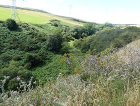
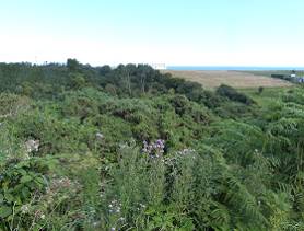
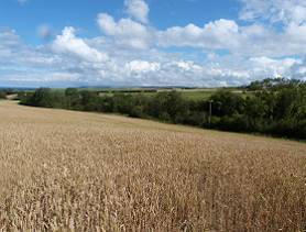
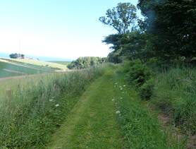
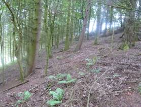
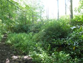
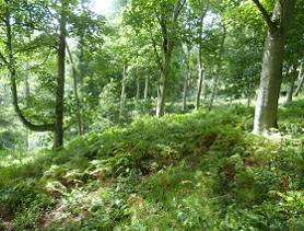
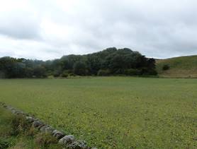
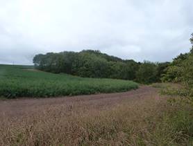
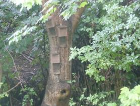
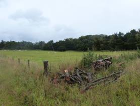
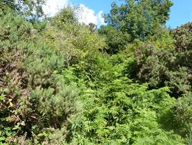
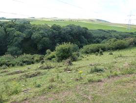
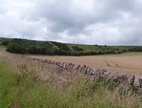
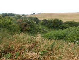
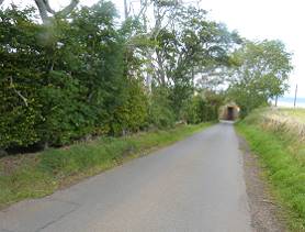
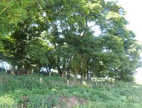
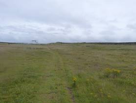
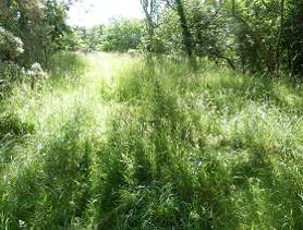
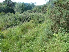
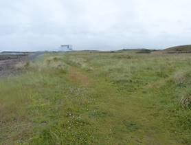
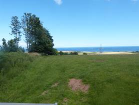
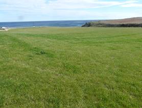
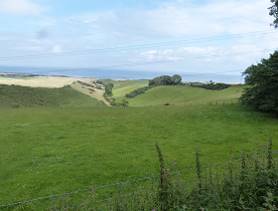
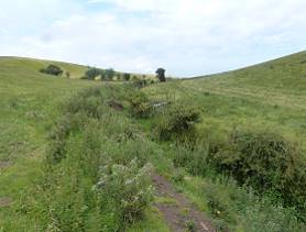
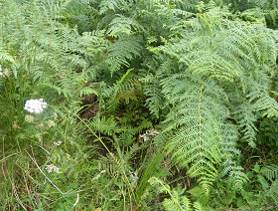
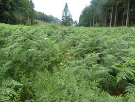
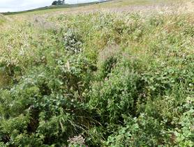
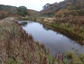
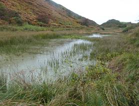
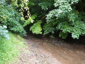
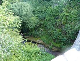
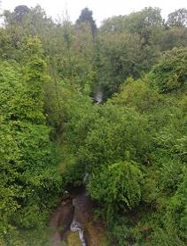
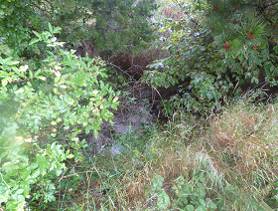
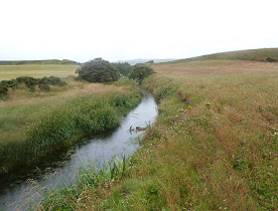
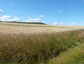
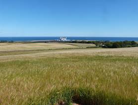
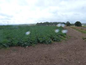
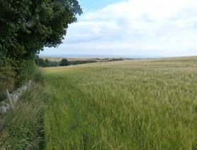
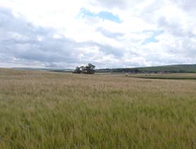
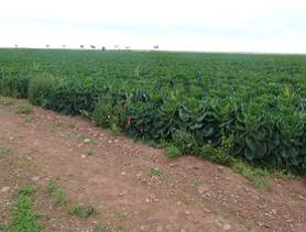
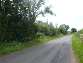
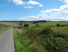
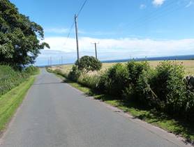
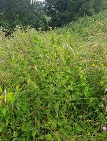
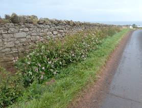
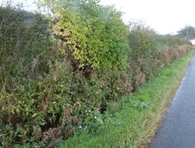
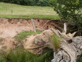
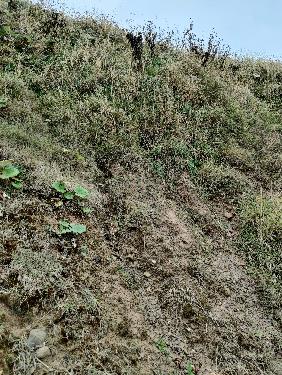
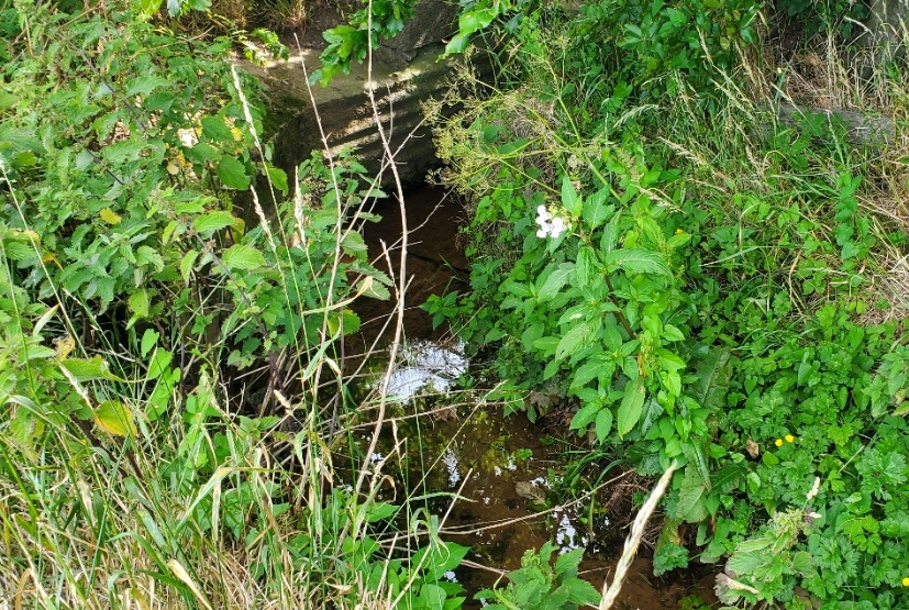
Annex E: Species List
Annex E: Species List
Table E1: Common and Scientific Names
Scientific Name | |
|---|---|
Forbs |
|
Bird’s-foot trefoil | Lotus corniculatus |
Biting stonecrop | Sedum acre |
Bladder campion | Silene vulgaris |
Bluebell | Hyacinthoides non-scripta |
Broad-leaved dock | Rumex obtuifolius |
Broom | Cytisus scoparius |
Bush vetch | Vicia sepium |
Butterbur | Petasites hybridus |
Cleavers | Galium aparine |
Colt’s-foot | Tussilago farfara |
Common burdock | Arctium minus |
Common comfrey | Symphytum officinale |
Common figwort | Scrophularia nodosa |
Common hogweed | Heracleum sphondylium |
Common knapweed | Centaurea nigra |
Common nettle | Urtica dioica |
Common nipplewort | Lapsana communis |
Common thistle | Cirsium vulgare |
Common valerian | Valeriana officialis |
Common yarrow | Achillea millefolium |
Cow parsley | Anthriscus sylvestris |
Creeping buttercup | Ranunculus repens |
Crosswort | Cruciata laevipes |
Devil’s-bit scabious | Succisa pratensis |
False nettle | Boehmeria cylindrical |
Field forget-me-not | Myosotis arvensis |
Field poppy | Papaver rhoeas |
Field scabious | Knautia arvensis |
Foxglove | Digitalis purpurea |
Germander speedwell | Veronica chamaedrys |
Globe thistle | Echinops bannaticus |
Gorse | Ulex europaeus |
Greater burdock | Articum lappa |
Greater burnet-saxifrage | Pimpinella major |
Greater plantain | Plantago major |
Ground elder | Aegopodium podagraria |
Hedge bindweed | Convolvulus arvensis |
Hedge mustard | Sisymbrium officinale |
Hedge woundwort | Stachys sylvatica |
Herb-robert | Geranium robertianum |
Lady’s bedstraw | Galium verum |
Large thyme | Thymus pulegioides |
Lesser burdock | Arctium minus |
Lesser spearwort | Ranunculus flammula |
Maidenhair spleenwort | Asplenium trichomanes |
Marsh marigold | Caltha palustris |
Marsh thistle | Cirsium palustre |
Meadow crane’s-bill | Geraium pratense |
Navelwort | Umbilicus rupestris |
Oxeye daisy | Leucanthemum vulgare |
Pineappleweed | Matricaria discoidea |
Purple deadnettle | Lamium purpureum |
Ragwort | Jacobaea vulgaris |
Red campion | Silene dioica |
Red clover | Trifolium pratensis |
Ribwort plantain | Plantago lanceolata |
Rosebay willowherb | Chamerion angustifolium |
Scentless mayweed | Tripleurospermum inodorum |
Sea bindweed | Calystegia soldanella |
Sea campion | Silene uniflora |
Sea plantain | Plantago maritima |
Sea sandwort | Honckenya peploides |
Sheep’s-bit | Jasione montana |
Silverweed | Argentina ansrina |
Smooth hawks-beard | Crepis capillaris |
Spearwort | Ranunculus flammula |
Spleenwort | Asplenium trichomanes |
Square-stalked St. John’s wort | Hypericum tetrapterum |
Sunspurge | Euphorbia helioscopia |
Teasel | Dipsacus fullonum |
Thrift | Armeria maritima |
Tormentil | Potentilla erecta |
Water mint | Mentha aquatica |
White clover | Trifolium repens |
White deadnettle | Lamium album |
Wild garlic | Allium ursinum |
Wild thyme | Thymus polytrichus |
Wood forget-me-not | Myosotis sylvatica |
Yellow saxifrage | Saxifraga aizoides |
Yellow toadflax | Linaria vulgaris |
Grasses |
|
Annual meadow grass | Poa annua |
Cock’s-foot | Dactylis glomerata |
Common bent | Agrostis capillaris |
Crested dog’s-tail | Cynosurus cristatus |
Crested-hair grass | Koeleria macrantha |
False oat-grass | Arrhenatherum elatius |
Hairy oat-grass | Arrhenatherum elatius |
Marram | Ammophila |
Meadow fescue | Festuca pratensis |
Meadow foxtail | Alopecurus pratensis |
Perennial rye-grass | Lolium perenne |
Red fescue | Festuca rubra |
Sheep’s fescue | Festuca ovina |
Smooth meadow-grass | Poa pratensis |
Soft brome | Bromus hordeaceus |
Sweet vernal-grass | Anthoxanthum odoratum |
Tall fescue | Festuca arundinacea |
Timothy | Phleum pratense |
Tufted hair-grass | Deschampia cespitosa |
Wall barley | Hordeum murinum |
Wavy hair-grass | Deschampsia flexuosa |
Yorkshire-fog | Holcus lanatus |
Sedges and rushes |
|
Field woodrush | Luzula campestris |
Greater woodrush | Luzula slyvatica |
Sand sedge | Carex arenaria |
Wood sedge | Carex sylvatica |
Seaweed | |
Sea lettuce | Ulva lactua |
Oarweed | Laminaria digitata |
Spiral wrack | Fucus spiralis |
Bladder wrack | Fucus vesiculosus |
Ferns and Horsetails | |
Bracken | Pteridun aquilinum |
Broad-buckler fern | Dryopteris dilatata |
Hard fern | Blechnum spicant |
Lady-fern | Athyrium filix-femina |
Male-fern | Dryopteris filix-mas |
Marsh horsetail | Equisetum palustre |
Bryophytes | |
A bryophyte | Palustriella commutata |
Trees, shrub and scrub: |
|
Ash | Fraxinus excelsior |
Bramble | Rubus fruticosus agg. |
Common ivy | Hedera helix |
Dog-rose | Rosa canina |
Elder | Sambucus nigra |
Field rose | Rosa arvensis |
Goat willow | Salix caprea |
Gooseberry | Ribes uva-crispa |
Grey willow | Salix cinerea |
Hawthorn | Crataegus monogyna |
Hazel | Corylus avellana |
Holly | Ilex aguilfolium |
Honeysuckle | Lonicera periclymenum |
Leyland cypress | Cupressus × leylandii |
Pedunculate oak | Quercus robur |
Privet | Ligustrum vulgare |
Raspberry | Rubus idaeus |
Rowan | Sorbus acuparia |
Scots pine | Pinus sylvatica |
Scotch laburnum | Laburnum alpinum |
Sessile oak | Quercus petrea |
Silver birch | Betula pendula |
Sitka Spruce | Picea sitchensis |
Sweet chestnut | Castanea sativa |
Sycamore | Acer pseudoplatanus |
Wild cherry | Prunus avium |
Introduced Shrub (Non-Native) |
|
Buddleja | Buddleja davidii |
Rhododendron | Rhododendron indicum |
Invasive Non Native Species |
|
Himalayan balsam | Impatiens glandulifera |
Japanese knotweed | Fallopia japonica |
Annex F: Habitat Suitability Index Scores
Annex F: Habitat Suitability Index Scores
Table F1. HSI Scores of waterbody suitability for GCN within the Site and 500 m Study Area
| Pond 1 (TN28) | Pond 2 (TN29) | Pond 3 (TN30) | |
|---|---|---|---|---|
SI No. | SI Description | SI Value | SI Value | SI Value |
1 | Geographic Location | 0.5 (marginal location) | 0.5 (marginal location) | 0.5 (marginal location) |
2 | Pond area | 0.3 | 0.4 | 0.10 |
3 | Pond permanence | 1.0 (rarely dries) | 1.0 (rarely dries) | 1.0 (rarely dries) |
4 | Water quality | 0.67 (Moderate) | 0.67 (Moderate) | 0.67 (Moderate) |
5 | Shade | 1 (20%) | 1 (30%) | 0.20 (100%) |
6 | Waterfowl effect | 1 (absent) | 1 (absent) | 1 (absent) |
7 | Fish presence | 0.67 (possible) | 0.67 (possible) | 1 (nil) |
8 | Pond density | 0.9 | 0.9 | 0.66 |
9 | Terrestrial habitat | 1 (Good) | 1 (Good) | 0.33 (poor) |
10 | Macrophyte cover | 0.51 (20%) | 1.0 (80%) | 0.31 (0%) |
| HSI Score | 0.71 | 0.78 | 0.46 |
Pond Suitability | Good | Good | Poor | |

ITPEnergised is a leading, international consultancy offering renewable energy, natural resources, environmental, engineering, technical advisory and asset management services for clients with onshore and offshore projects.
Visit the ITPEnergised group offices in:
Bristol, London, Edinburgh, Glasgow, Buenos Aries, Lisbon, Madrid, Delhi, Beijing, Canberra, Auckland
Sectors:
Onshore Renewables & Storage | Offshore Renewables | Oil & Gas
Property & Urban Regeneration | Infrastructure | Industrial Manufacturing

[1] Formerly Cratoneuron commutatum.