

6.4.2. Distribution of Fishing Activity
- An indication of the distribution of fishing activity by scallop dredgers in the commercial fisheries study area is provided in Figure 6.33 Open ▸ to Figure 6.40 Open ▸ . This includes analysis of surveillance sightings ( Figure 6.33 Open ▸ ), annual landings values ( Figure 6.34 Open ▸ ), data gathered as part of the Shelmerdine and Mouat (2021) study ( Figure 6.35 Open ▸ ) and VMS data for over 15 m scallop dredgers ( Figure 6.36 Open ▸ to Figure 6.39 Open ▸ ). In addition, information on the distribution of activity by smaller vessels (under 15 m) available from the ScotMap Project (Kafas et al., 2014) is presented in Figure 6.40 Open ▸ .
- Surveillance sightings and landings data show that the majority of activity by scallop dredgers within the commercial fisheries study area is undertaken in areas of relevance to the Proposed Development array area (ICES rectangle 41E8).
- As shown in Figure 6.36 Open ▸ , VMS data suggests that scallop dredging activity by larger vessels (over 15 m), takes place at moderate levels in the Proposed Development array area and for the most part is concentrated in its north-western section. The level of activity recorded within the Proposed Development is however relatively low compared to that recorded in other grounds around Scotland and the UK ( Figure 6.37 Open ▸ ).
- Analysis of VMS data by year for the period 2012 to 2019 is presented in Figure 6.38 Open ▸ and Figure 6.39 Open ▸ and illustrates the cyclical nature of the fishery. As shown, grounds in areas of relevance to the Proposed Development are targeted at varying degrees depending on the year under consideration.
- In the case of smaller under 15 m vessels, data collected as part of the ScotMap Project ( Figure 6.40 Open ▸ ) suggest that activity within the Proposed Development array area occurs at very low levels, with activity concentrating primarily inshore, within ICES rectangle 41E7. In line with this, information on inshore scallop fishing grounds gathered during consultation with fisheries stakeholders indicates the presence of inshore scallop grounds within the commercial fisheries study area. As shown in Figure 5.3 Open ▸ , these are found immediately to the east of the inshore section of the Proposed Development export cable corridor, with limited overlap with it.
Figure 6.33: Surveillance Sightings of Dredgers (2010 to 2020) (Source: MMO and Marine Scotland)
Figure 6.34: Annual Landings Value (£) Scallops (Average 2015 - 2019) (Source: MMO)
Figure 6.35: Combined Fishing Activity for Scallop Dredgers (Shelmerdine and Mouat, 2021)
Figure 6.36: VMS Value (£) Dredges (Average 2015 - 2019) (Source: MMO)
Figure 6.37: VMS Value (£) Dredges UK Wide (Annual Average 2015 -2019) (Source: MMO)
Figure 6.38: VMS Value (£) Dredges for Individual Years (2012 - 2015) (Source: MMO)
Figure 6.39: VMS Value (£) Dredges for Individual Years (2016 - 2019)
Figure 6.40: Inshore Fishing Scallop Towed Dredges Monetary Value (£) (Kafas et al., 2014)
7. Summary
- The commercial fisheries study area supports the following main commercial fishing activities:
- demersal otter trawling (predominantly for Nephrops and to a much lesser extent squid);
- creeling for lobster and crab; and
- scallop dredging.
- Demersal trawling for Nephrops concentrates on inshore areas of the commercial fisheries study area, predominantly within the 6 nm limit, including in areas that overlap with the Proposed Development export cable corridor. Within the Proposed Development array area, negligible levels of trawling for Nephrops are expected, due to the unsuitability of the predominant ground conditions.
- Demersal trawling for squid is often undertaken by Nephrops trawlers that change gear to target the squid fishery seasonally. Vessels targeting squid in the commercial fisheries study area are primarily active in inshore areas, including in sections of the Proposed Development export cable corridor. There is also potential, however, for some activity to take place within the Proposed Development array area. This is expected to be primarily undertaken by visiting squid vessels from other areas of the east coast of Scotland.
- Creeling, targeting lobster and crab, is undertaken at higher levels in inshore areas of the commercial fisheries study area. Although at relatively lower level, considerable activity by local creelers has also been reported from offshore areas, including the Proposed Development array area, particularly around its north-western section.
- Scallop dredging by vessels over 15 m in length (typically nomadic vessels) is undertaken at moderate levels in areas of relevance to the Proposed Development array area, being predominantly concentrated in its north-western section. The level of activity recorded within the Proposed Development is however relatively low compared to that recorded in other grounds around Scotland and the UK that are targeted by the nomadic scallop fleet. There is also some activity by smaller scallop dredgers (under 15 m local vessels) within the commercial fisheries study area. This is however limited to inshore areas and shows limited overlap with the Proposed Development export cable corridor.
8. References
Catherall, C.L. and Kaiser, M.J. (2014). Review of king scallop dredge designs and impacts, legislation and potential conflicts with offshore wind farms. Fisheries & Conservation Report No. 39.
Cappell, R., Robinson, M., Gascoigne, J. and Nimmo, F. (2013). A review of the Scottish Scallop Fishery. Poseidon report to Marine Scotland.
Cappell, R., Huntington, T., Nimmo, F., and MacNab, S. (2018). UK scallop fishery: current trends, future management options and recommendations. Report produced by Poseidon Aquatic Resource Management Ltd.
Hastie, L., Pierce, G., Pita, C., Viana, M., Smith, J. and Wangvoralak, S. (2009). Squid Fishing in UK Waters. Seafish. Available at: https://www.seafish.org/document/?id=72bdf841-6e5b-435f-9dee-b87ffd2c481b. Accessed on: 30 September 2021.
Hawkins, T., Christie, J. and Coull, K. (1998). The industrial fisheries for sandeels. Scottish Office, Agriculture, Environment and Fisheries Department, Marine Laboratory Aberdeen.
Kafas, A., McLay, A., Chimienti, M., Gubbins, M. (2014). ScotMap Inshore Fisheries Mapping in Scotland: Recording Fishermen’s use of the Sea. Scottish Marine and Freshwater Science Volume 5 Number 17. Edinburgh: Scottish Government, 32p.
Kafas, A., Jones, G., Watret, R., Davies, I. and Scott, B. (2013). 2009 -2013 amalgamated VMS intensity layers, GIS Data. Marine Scotland, Scottish Government. doi: 10.7489/1706.
Marine Scotland Science. (2017). Creel Fishing Effort Study. Marine Analytical Unit. Available at: https://www.gov.scot/publications/creel-fishing-effort-study/documents/. Accessed on: 30 September 2021.
Shelmerdine, R. L. and Mouat, B. (2021). Mapping fisheries and habitats in the North and East Coast RIFG area. S.l: NAFC Marine Centre.
SWFPA (2022). Gear locations. Available at: Gear Locations — The Scottish White Fish Producers Association Ltd (swfpa.com). Accessed on: 28 February 2022.
Annex A: Consultation Questionnaire
Skipper name |
| |
Vessel name |
| |
Reg. No |
| |
Home port |
| |
Fishing Association |
| |
|
|
|
VESSEL DETAILS |
|
|
Length |
| metres |
Beam |
| metres |
Draft |
| metres |
Vessel tonnage |
| tonnes |
Main engine HP |
| HP |
|
|
|
Average no. of days fishing per year |
| days |
Days at sea allocation this year |
| days |
|
|
|
Typical fishing trip duration |
| Hours/days |
Typical distance steamed per fishing trip |
| n.miles |
Average steaming speed |
| knots |
Principal fishing method(s) (potting, trawling etc.)
If main method is potting, what type of pots are used? No. fleets? No. of pots per fleet?
If scallops, how many dredges per side?
If demersal trawling, twin or single rig? |
|
Seasonality of fishing method(s) (if multiple methods, seasons for each) |
|
Main species targeted by method(s)
|
|
Main fishing areas by species, method & month (illustrate on chart provided or provide plotter shot) |
|
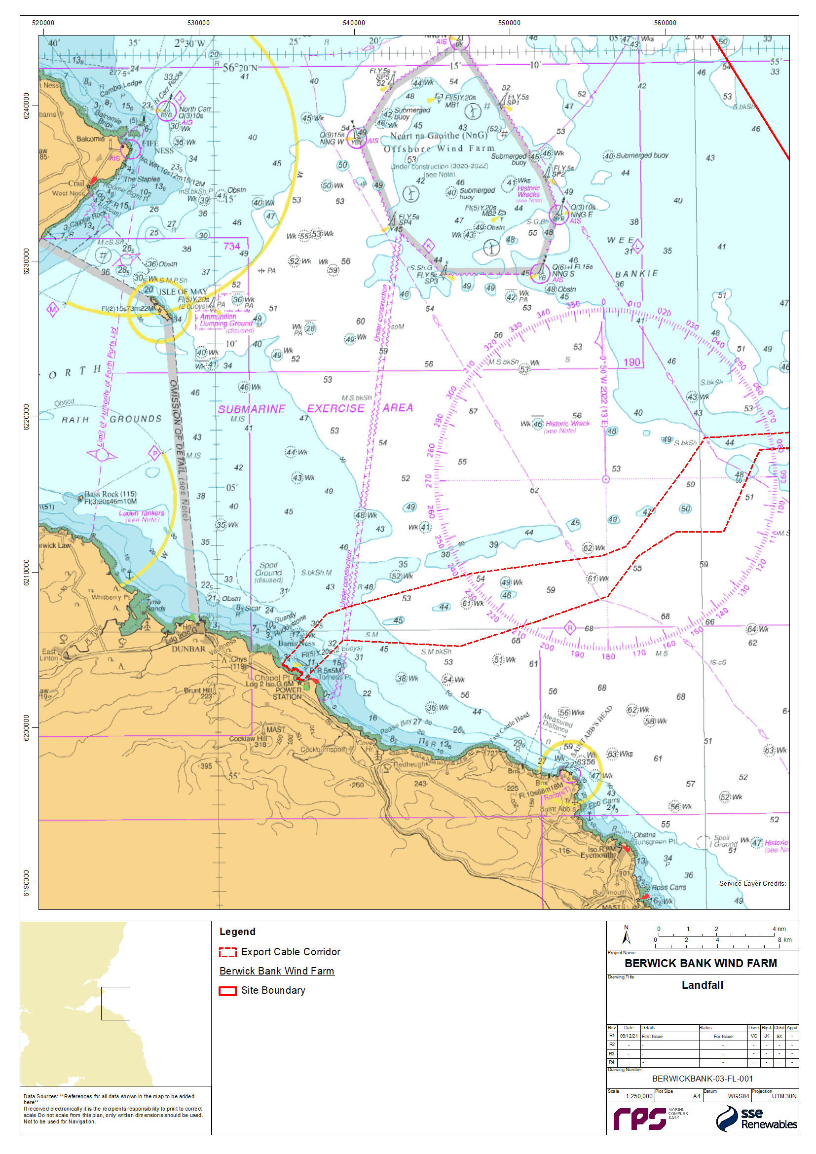
Figure 8.1: Map of Proposed Development (Overview)
[1] https://www.legislation.gov.uk/ssi/2006/487/article/2/made
[2] https://eur-lex.europa.eu/legal-content/EN/TXT/?qid=1565001726034&uri=CELEX:32019R1241
[3] https://eur-lex.europa.eu/legal-content/EN/TXT/?qid=1549971658776&uri=CELEX:32019R0124
[4] Creelers are referred to as “potters/whelkers" in the surveillance sightings dataset
[5] Creeling activity is included under the gear category “pots/traps” in the landings by ICES rectangle dataset