

1. Introduction
1.1 Overview
ITPEnergised was appointed by SSE Renewables to undertake protected species surveys for the onshore component of the proposed Berwick Bank offshore windfarm development at Torness, southeast of Dunbar, East Lothian (hereafter referred to as the ‘Site’). The site has central Ordnance Grid Reference: NT 74632 73282.
ITPEnergised undertook a Preliminary Ecological Appraisal of the Site in 2020 (ITPEnergised, 2022a) and habitats suitable to support bats, badger (Meles meles), otter (Lutra lutra), water vole (Arvicola amphibius) and great crested newt (Triturus cristatus) were identified within the Site.
Targeted surveys for these species/species group were therefore undertaken. The results of the badger, otter, water vole and great crested newt surveys are presented within this report, whereas the bat survey results are presented within Technical Appendix 7.3 (ITPEnergised, 2022b). The Study Area incorporated the application boundary and up to a 500m buffer (where accessible) dependent on the species of interest (as shown in Figure 7.2.1).
This report describes the methods used to gather and record information for the Site and summarises the findings of the study.
1.2 Site Description
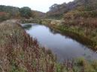
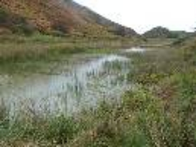
The Site is approximately 599.6 hectares (ha) in size and extends from north-west of Skateraw Harbour to Bilsdean in the south. The A1 trunk road and the East Coast Main Line (ECML) railway pass through the Site from the north-west to the south-east. The Site largely comprises agricultural land with a mixture of arable and grazed fields. Braidwood Burn and Ogle Burn run through the western reaches of the Site, Thornton Burn and Branxton Burn runs through the centre of the Site, Dry Burn runs through the north of the Site and Bilsdean Burn runs through the south of the Site. These watercourses are commonly associated with corridors of scrub and mixed woodland habitat. The Site also encompasses a number of small hamlets and farm steadings. Larger settlements include Crowhill, Branxton and Lawfield to the south of the A1 and Skateraw and Thorntonloch to the north. The Site includes areas of the coastline the landfall locations to the north of Torness Point.
2. Legislation
2.1 Legislation
Full consideration has been given to all relevant nature conservation legislation when carrying out this assessment. This includes the following:
The Conservation of Natural Habitats and Wild Flora and Fauna (the ‘Habitats Directive’) 1992 (92/43/3EEC), transposed into domestic law by the Conservation (Natural Habitats, &c.) Regulations 1994 (as amended);
Directive (2009/147/EC) of the European Parliament and of the Council on the conservation of wild birds (the ‘Birds Directive’), transposed into domestic law by the Conservation (Natural Habitats, &c.) Regulations 1994 (as amended);
The Conservation (Natural Habitats, &c.) Regulations 1994 (as amended);
Wildlife and Countryside Act 1981 (as amended) (WCA);
The Nature Conservation (Scotland) Act 2004 (as amended);
The Wildlife and Natural Environment (Scotland) (WANE) Act, 2011 (as amended); and
The Protection of Badgers Act 1992, as amended by the Wildlife and Natural Environment (Scotland) Act 2011.
Legislation specific to badger, otter, water vole and great crested newt including details of all actions which would constitute an offence, is detailed fully within Appendix A.
2.2 Good Practice Ecological Guidance
Cognisance has been taken of the following best practice guidelines and survey method publications in relation to otter, water vole, great crested newts and badgers:
2.2.1 Badger survey
Competencies for Species Survey: Badger (CIEEM, 2013a); and
Surveying for Badgers: Good Practice Guidelines (Scottish Badgers, 2018).
2.2.2 Otter
Competencies for Species Survey: Otter (CIEEM, 2013b); and
Monitoring the Otter Lutra lutra (Chanin, 2003).
2.2.3 Water vole
Competencies for Species Survey: Water Vole (CIEEM, 2013c); and
The Water Vole Mitigation Handbook (Dean et al., 2016).
2.2.4 Great crested Newt
Competencies for Species Survey: Great Crested Newt (CIEEM, 2013d);
Evaluating the suitability of habitat for the great crested newt (Triturus cristatus) (Oldham et al., 2000); and
Great Crested Newt Conservation Handbook, Froglife, Halesworth (Langton et al., 2001).
3. Methods
3.1 Desk Study
A review of desk study data was completed to gather baseline information on badger, otter, water vole and great crested newts. The following resource was consulted:
ITPEnergised (2022a). Berwick Bank EIA, Ecology Chapter, Technical Appendix 7.1, Preliminary Ecological Appraisal. ITPEnergised, Edinburgh.
3.2 Badger
3.2.1 Field survey
Field surveys were undertaken on 5th and 6th October 2020 by Stuart Abernethy, Ecologist, with update surveys completed on 13th and 17th September 2021. Following a revision to the application boundary, additional surveys of an area to the south-west of Skateraw were undertaken on 4th February 2022 by Jenny Diack, Senior Ecologist, and Helen Lamont, Ecologist.
As part of the survey, field signs including setts, day beds, latrines, evidence of foraging, badger paths, scratching posts, hair and footprints, were actively searched for within the Site and a 100 m buffer. The survey was based on the methods described by Scottish Badgers (2018). The survey included all hedgerows, field boundaries, watercourses, paths and other linear features within the Study Area.
On identification of a badger sett, the observer noted the number of entrances, in addition to a description of the activity level and status of the sett wherever possible. The status of a sett was evaluated and determined, wherever possible, based on descriptions presented in Scottish Badgers Good Practice Guidelines (2018), which assigns setts into one of four categories:
Main sett (used throughout the year and constitutes the main breeding sett);
Annexe sett (forms part of the main sett area, but is not directly linked by an underground passage to the main sett, either due to a barrier (e.g. separated by a watercourse or ditch) or by distance);
Subsidiary sett (offers an alternative large sett complex to the main sett but is usually although not always at least 50 m away and are not always obviously linked by a well-used path); and
Outlier sett (often comprising just one or two holes and is infrequently used by badgers).
Each sett entrance is classified according to its degree of usage:
Well-used: are clear of vegetation and debris, sides worn smooth but not necessarily excavated recently;
Partially used: not in regular use and have debris in the entrance; and
Disused: not in use for some time, are partially blocked and could not be used without considerable effort.
It should be noted that the status of a badger sett can change over a relatively short period of time. For example, some badger social groups will move the location of the main sett to other less used setts within their territory in response to external factors, such as disturbance.
3.2.2 Badger Camera Monitoring
Trail cameras were used between 8th and 13th October 2020 and between 13th and 17th September 2021 to provide supporting evidence of badger using the area and to assist with establishing sett status.
3.3 Otter
The field survey was undertaken on 15th, 16th, 21st, 22nd and 23rd October 2020 and 3rd and 4th June 2021 with the lead surveyor being Stuart Abernethy, Ecologist. Following a revision to the application boundary an additional survey of a section of the Dry Burn to the north of the A1 trunk road was completed on 4th February 2022 with the lead surveyor being Jenny Diack, Senior Ecologist.
Watercourses including Thornton Burn, Braidwood Burn, Ogle Burn, Branxton Burn, Bilsdean Burn and Dry Burn and any unmapped watercourses within the Site were surveyed. A search was undertaken of the riparian zone and up to 20 m away from the water’s edge (where suitable habitat was found to be present) within the Site and within 250 m upstream and downstream of the Site boundary. Throughout the survey, overhanging banks, cavities, bankside vegetation and riparian features, such as boulders and mud, were searched for the following signs of otter use:
Resting-up places – comprising couches (areas of flattened vegetation) or hovers (lay-up areas, including ledges under rocks or hollows under fallen trees or roots);
Potential holt sites – holes or dens;
Spraints –used for marking territories, and often located on prominent features within the channel or on the embankment (including weirs, bridges, rocks, tree roots, watercourse confluences, etc.);
Footprints – located in soft mud, silt or sand banks;
Runs and trails – pathways from the water into dense cover or around bankside trees;
Slides – down banks as an entry to waterbodies; and
Feeding remains – e.g. remains of fish and amphibians.
It should be noted that that features, such as resting-up places, holts, runs, trails or slides, require presence of either a spraint or footprint to confirm use by otter. These features cannot be used in isolation to definitively indicate otter presence.
3.3.1 Otter Camera Monitoring
Trail cameras were used between 18th March 2022 and 1st April 2022 to determine the status of potential holts along the Dry Burn that lay outwith 30m but within 200 m of the Proposed Development.
3.4 Water Vole
The field survey was undertaken in tandem with the otter survey on 15th, 16th, 21st, 22nd and 23rd October 2020 and 3rd and 4th June 2021, with the lead surveyor being Stuart Abernethy, Ecologist. Following a revision to the application boundary an additional survey of a section of the Dry Burn to the north of the A1 was completed on 4th February 2022 with the lead surveyor being Jenny Diack, Senior Ecologist.
Watercourses including Thornton Burn, Braidwood Burn, Ogle Burn, Branxton Burn, Bilsdean Burn and Dry Burn and any unmapped watercourses within the Site were surveyed. A search for evidence of water voles was undertaken in the riparian zone and up to 2 m away from the water’s edge, within the Site and within 50 m upstream and downstream of the Site boundary.
Potential evidence of water vole searched for included the following:
Latrines – water vole droppings are often concentrated in discreet latrine sites near the nest, at range boundaries and places where they regularly enter and exit the water;
Feeding stations and feeding remains – feeding remains in the form of neat piles of chewed lengths of vegetation are often found in runways and at haul-out platforms;
Tunnel/burrow entrances – these are typically found along the water’s edge on top of the bank up to 5 m from the water’s edge. Holes on top of the banks often have grazed ‘lawns’ around them;
Paths and runs at the water’s edge;
Footprints – these may be identified in soft mud or silt;
Sightings and/or sounds of water voles entering the water; and
Droppings – while most droppings will be deposited in latrines, some may also be found scattered along runways in vegetation.
Specifically for watercourses, the approximate depth and speed of water flow, the waterway width, bankside vegetation and surrounding land use, was also recorded, as these factors may determine the suitability of habitat for supporting water voles.
It should be noted that any single field sign recorded in isolation, especially when ambiguous (e.g. a burrow or footprints) would not be definitive in confirming presence.
3.5 Great Crested Newt
3.5.1 Environmental DNA (eDNA) survey
ITPEnergised undertook a Preliminary Ecological Appraisal (PEA) of the Site which included a Habitat Suitability Index (HSI) assessment (Oldham et al., 2000; ARG UK, 2010) of all water bodies within the Site and up to 500 m of the Site boundary, where accessible (ITPE, 2022). As a result, two off-Site waterbodies within 500 m of the Site boundary (referred to as Pond 1 and Pond 2 and shown on Figure 7.2.2) were assessed as suitable to support great crested newt and further eDNA surveys were recommended.
An eDNA survey was carried out on 10th May 2021 during the recommended survey window for eDNA surveys (mid-April to June). The water samples were collected by Stuart Abernethy, Ecologist and licenced great crested newt worker (NatureScot licence number 148785). Samples were taken following the instructions provided within the Surescreen Scientifics sample kits (a company specialising in environmental sampling analysis). From each waterbody, 20 water samples were taken at equidistant intervals around the circumference of the outer edge (where possible). The 20 samples were then mixed and six individual samples were taken and sent to SureScreen Scientifics laboratory for eDNA analysis.
3.6 Survey Limitations
3.6.1 Badger Survey
The optimal survey period for badgers is spring or autumn when badgers are most active and vegetation has died back allowing field sign to be more visible. The badger survey was carried out in autumn 2020 and 2021 and in spring 2022 when vegetation density was low and any field signs, if present, more easy to detect. However, during the 2020 and 2021 surveys, bracken (Pteridium aquilinum) was still high, and areas of dense gorse (Ulex europaeus) were also impassable in some areas of the Site, especially around the Thornton Burn and Braidwood Burn, and this may have obscured some badger field signs. The perimeter of any dense stands was therefore walked and mammal paths followed as far as possible to reduce this limitation. Areas apparently suitable for badger setts were noted to ensure that appropriate working methods can be adopted (e.g. supervised vegetation removal) during any site clearance works (see ‘dense scrub or steep slope’ in Figure 7.2.3, Confidential Technical Appendix 7.2a).
3.6.2 Otter and Water Vole
Heavy rainfall in October 2020 caused water levels within watercourses to rise and may have washed away otter and water vole evidence at lower levels such as prints and spraint. Water levels at the time of the survey were not considered to be a limitation and would not have obscured resting sites or burrows.
Areas of dense gorse scrub along some of the Thornton Burn and Dry Burn was often found to be impenetrable by surveyors when surveying 20 m from channel. In addition, steep, rocky banks through sections of the Thornton Burn and Braidwood Burn could not be safely accessed to survey. As a result, full assessment for resting sites could not be conducted in some areas of the bankside. These sections are highlighted in Figure 7.2.2
3.6.3 Great Crested Newt
There was no access to some areas of the Study Area as highlighted in Figure 7.2.2 Three waterbodies, Pond 3 (177 m north-west of the Site boundary), Pond 4 (235 m north-west of the Site boundary) and Pond 5 (370 m north-west of the Site boundary) could therefore not be assessed for suitability to support great crested newt. The ponds are separated from the Site by the Dry Burn which is likely to be a partial barrier to movement of great crested newt into the site and habitats under the footprint of works within 500 m of the ponds are arable and improved grassland which are suboptimal for this species. It is therefore considered unlikely that the works will impact great crested newts, if present within these ponds, and further survey and / or mitigation is not deemed necessary.
4. Results
The results of the otter, water vole, and great crested newt surveys are described below and shown on Figure 7.2.2 Target Notes (TNs) are detailed in Annex B. Badger survey results are summarised below and, due to the sensitive nature of these records, the full survey results are provided in Confidential Technical Appendix 7.2a.
4.1 Badger
The desk study found six records of badger within 5 km of the Site, with the closest record within 0.7 km north of the Site (TWIC, 2021). Evidence of badger activity recorded during the survey included four setts (one potential main, one likely annex and two likely outlier setts), latrines and pathways. All setts lie outwith 30 m of the proposed works. A large mammal hole was also identified by the site ECoW during GI works undertaken in July 2022. There was no evidence to suggest the mammal hole was in use by badger, but works were microsited to avoid a 30 m buffer of the hole as a precautionary measure. For the full badger survey results, including Figure 7.2.3 showing sett and large mammal hole locations, please refer to Confidential Technical Appendix 7.2a.
4.2 Otter
The desk study returned nine records of otter within 2km of the Site, with the most recent from 2020 and two of those records are found within the red line boundary of the Site (TWIC, 2021).
Evidence of otter was found within the Study Area along the Thornton Burn, Braidwood Burn, Ogle Burn and Dry Burn. No evidence was found along the remaining watercourses surveyed.
4.2.1 Thornton Burn
The Thornton Burn was surveyed on 15th October 2020 and 3rd June 2021. Evidence of otter presence was found throughout the section of watercourse surveyed between the coastline at the east and where it splits into Braidwood Burn and Ogle Burn at the west of the Site. Nine potential otter resting sites (hovers) with spraint nearby to support the assumption that they are being used or have previously been used by otter, were found during the survey (TN4, TN8, TN11-15 and TN22). One area that was found to have frequent otter activity included Thorntonloch Bridge beneath the A1. Fresh spraint, sign heaps and prints were found and trail cameras positioned at this location captured one individual using the area for digging and spraint marking on 16th and 20th October 2020 (TN7). Spraint was recorded throughout the watercourse (TN1-3, TN5-6 and TN9). No holts were found within the area of the watercourse surveyed. However, steep, rocky banks in some section could not be safely accessed and presence of resting sites cannot be ruled out in these areas.
Thornton Burn was noted to have good water quality and clarity, with depth of water visibility up to c.50 cm from the surface. Vegetation at the bankside was often a mixture of grassland, scrub and woodland and the burn is considered to provide suitable foraging and commuting habitat for otter, connecting to coastal habitat at the east. Fish were seen to be present within the Thornton Burn up to a weir at the centre of the Site (TN10). Anecdotal evidence from local residents indicate that fish occur above the weir even if none were seen during the survey past this point.
4.2.2 Braidwood Burn
The Braidwood Burn was surveyed on 22nd October 2020 (Stuart Abernethy, Ecologist and Jenny Diack, Senior Ecologist) and 4th June 2021 (Stuart Abernethy, Ecologist) and three potential resting sites (hovers) and associated spraint were found (TN17-19). The burn was considered to provide good foraging and commuting habitat for otter and connects to Thornton Burn to the east. No holts were found within the area surveyed however in some sections steep, rocky banks could not be safely accessed and presence of resting sites in these areas cannot be ruled out.
Braidwood Burn was noted to have good water quality and clarity, with depth of water visibility up to c.50 cm from the surface.
4.2.3 Ogle Burn
Evidence of otter was found during the survey of Ogle Burn on 22nd October 2020 (Stuart Abernethy, Ecologist and Jenny Diack, Senior Ecologist) and 4th June 2021 including three potential resting sites (hovers) (TN16, TN20-21). The hover located at TN16 had recent spraint indicating current use. The potential hovers at TN20-21 lay beneath the root systems of mature oak trees and smoothed earth within indicated mammal use. However, no recent field sign was found to confirm use by otter at the time of the survey. No holts were found within the area of watercourse surveyed.
One pond fed by the Ogle Burn, is located at the west side of the Study Area. The pond would provide excellent foraging habitat for otter due to the associated amphibian population.
Ogle Burn was noted to have good water quality and clarity, with depth of water visibility to full depth of burn c.30 cm. No fish were observed during the survey but otter could easily access areas that were confirmed as having fish presence using the Ogle Burn as a commuting route.
4.2.4 Branxton Burn
Branxton Burn was surveyed on 16th October 2020 (Stuart Abernethy, Ecologist and Richard King, Principal Ecologist) and 4th June 2021 (Stuart Abernethy, Ecologist). No evidence of otter was found during the survey. The burn is considered to provide limited potential for use as a foraging and commuting route and is culverted at the eastern end where it passes under the A1. At the time of the survey the watercourse was shallow and slow flowing (TN25-26); fish presence is considered unlikely though amphibians may be present.
4.2.5 Dry Burn
The Dry Burn was surveyed on 21st October 2020 and 3rd June 2021 (Stuart Abernethy, Ecologist) with evidence of otter found including one potential hover and slide (TN29) and four recordings of spraint (TN30-33). None of the spraint found were considered to be fresh, all older than 3 weeks due to them being dry and fragmented. Following a revision to the planning application boundary an additional section of the burn, to the north of the A1 trunk road was surveyed on 4th February 2022 (Jenny Diack, Senior Ecologist and Helen Lamont, Ecologist) and three potential holts (TN36, TN43 and TN45), one active hover (TN42) and numerous spraints (of various ages from fresh to old (TN34-35, TN37-41, TN44 and TN46-48) were found along the burn corridor. Camera monitoring of the three potential holts between 18th March and 1st April 2022 found no evidence of otter using these features as a resting site.
Dry Burn is considered to provide good otter habitat with clear water within the channel and grass and scrub habitat lining the watercourse providing good commuting cover for otter. The majority of the burn had a channel width of 2-3 metres and water depth of 5-20 cm with some deep sections of >50 cm.
4.3 Water Vole
The desk study found one record of water vole within 5 km of the Site. Dating from 2020 the record lies 2.3 km south-east of the Site (TWIC, 2021).
The surveys were carried out in tandem with the otter survey. No evidence of water vole (e.g. burrows, latrines, feeding stations or footprints) were identified during the survey. Sections of the Thornton Burn were considered suitable for water vole due to the bankside gradient and associated vegetation cover. The remaining watercourses surveyed were considered unsuitable.
4.4 Great Crested Newt
The desk study found one record of great crested newt c.4.6 km west of the Site dating from 2012 and two other historical records in total (TWIC, 2021).
The HSI survey data collected during the extended Phase 1 habitat survey is included in Annex C and the eDNA laboratory analysis results are presented in Annex D. Both results are summarised in Table 1, below. The locations of the water bodies are presented in Figure 7.2.2 The positive eDNA result for Pond 1 confirms presence of great crested newt within the waterbody. If the pond was to be directly impacted, further survey would be required to determine population size class and inform the development licence application and mitigation strategy.
Table 1. Summary of HSI and eDNA results
Pond Number | Grid Reference | Pond Shape | HSI Score | Suitability | Pond Area (m²) | Distance from Cable Route | eDNA Result |
|---|---|---|---|---|---|---|---|
1 | NT 73269 72680 |
Rectangular | 0.71 | Good | 150 | 315 m S | Positive |
2 | NT 72935 72795 |
Rectangular | 0.78 | Good | 200 | 300 m SW | Negative |
5. Discussion
5.1 Badger
The Site and surrounding area provide high quality badger foraging, commuting and setting habitat, and the results of the surveys indicate that badgers are active in the area with four setts found during the within the Study Area. All setts currently lie outwith 30 m of the proposed works and are unlikely to be impacted (either directly or indirectly).
The large mammal hole lies close to the landfall location, if works are required within 30 m of the hole it should be monitored prior to works to determine if it is in use by badger and inform mitigation and/or licensing requirements.
Some areas of dense scrub and steep banks could not be fully assessed for presence of setts as highlighted in Figure 7.2.3, Confidential Technical Appendix 7.2a. Where works are required in these areas, the vegetation should be cleared under the supervision of a Suitably Qualified Ecologist.
5.2 Otter
Evidence of otter presence including confirmed and potential resting sites (hovers) along Thornton Burn, Braidwood Burn, Ogle Burn and Dry Burn were found during the survey. Three potential holts were also identified along the Dry Burn, including one feature located within 30 m of the Site Boundary. Further monitoring using trail cameras has found no evidence that these features are currently in use by otter.
The proposed route crosses the Braidwood Burn where otter are confirmed to be active including three potential resting sites (hovers). No resting sites were identified within 30 m of the Proposed Development.
Otter resting sites are legally protected at all times from disturbance or destruction. If works are required within 30 m of a resting site an otter development licence from NatureScot will be required in addition to the SPP. A larger protection zone of up to 200 m applies to natal holts.
Sections of the Braidwood Burn and the Thornton Burn, steep, rocky banks and areas of dense scrub could not be fully assessed therefore presence of holts (and other resting sites) cannot be ruled out in these areas (as shown on Figure 7.2.2 ‘dense scrub habitat or steep slopes’). Areas of dense scrub along watercourses should be cleared under the supervision of a Suitably Qualified Ecologist.