Lower shore
- The biotope LR.MLR.BF.Fser (Fucus serratus on moderately exposed lower eulittoral rock) occurred commonly on the lower shore of the Skateraw landfall. The biotope contained a canopy of F. serratus predominantly on bedrock with frequent green seaweeds underneath such as C. rupestris. The invertebrates S. balanoides, P. vulgata and N. lapillus occurred occasionally, particularly in rock crevices. Two variants of this biotope (Fser.R and Fser.Bo) were fairly widespread on site and are described below.
- The biotope LR.MLR.BF.Fser.R (Fucus serratus and red seaweeds on moderately exposed lower eulittoral rock) was characterised by red seaweeds including M. stellatus, Osmundea pinnatifida C. officinalis and Ceramium sp. which occurred commonly along. Green seaweeds such as C. rupestris and E. intestinalis were also occasionally present. Invertebrates included frequent occurrences of P. vulgata and S. balanoides with occasional specimens of L. littorea, N. lapillus and C. maenas.
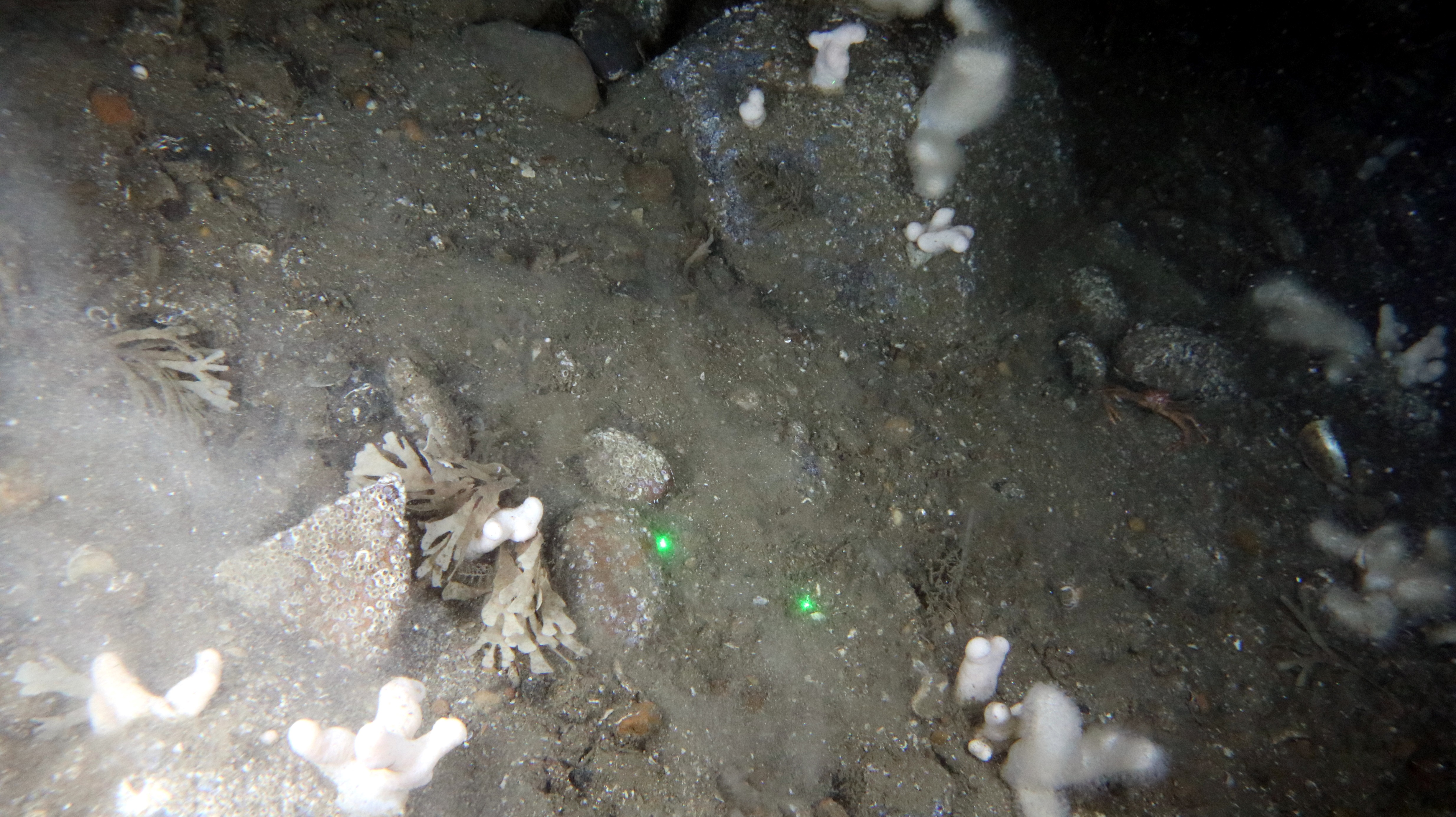
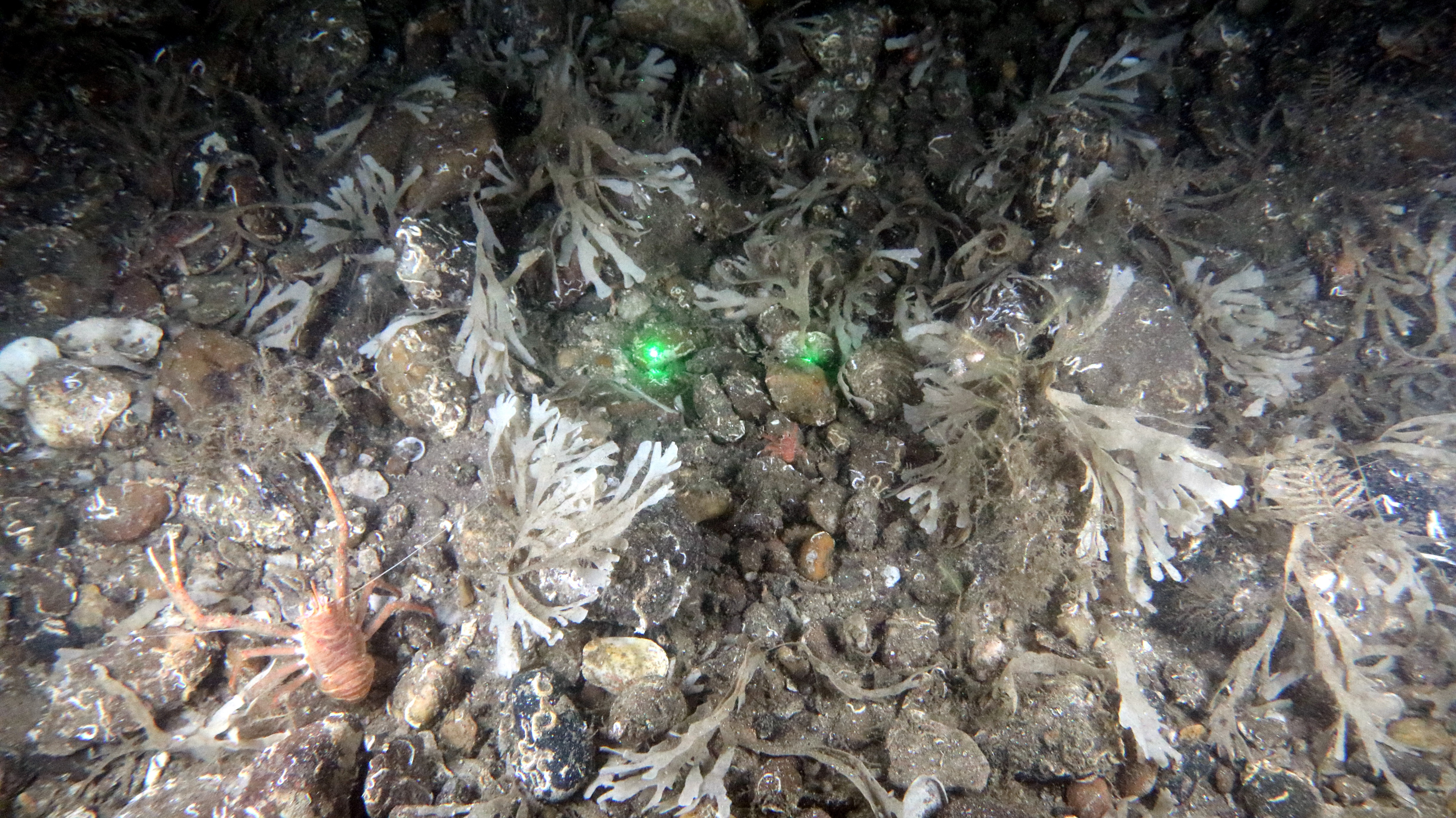
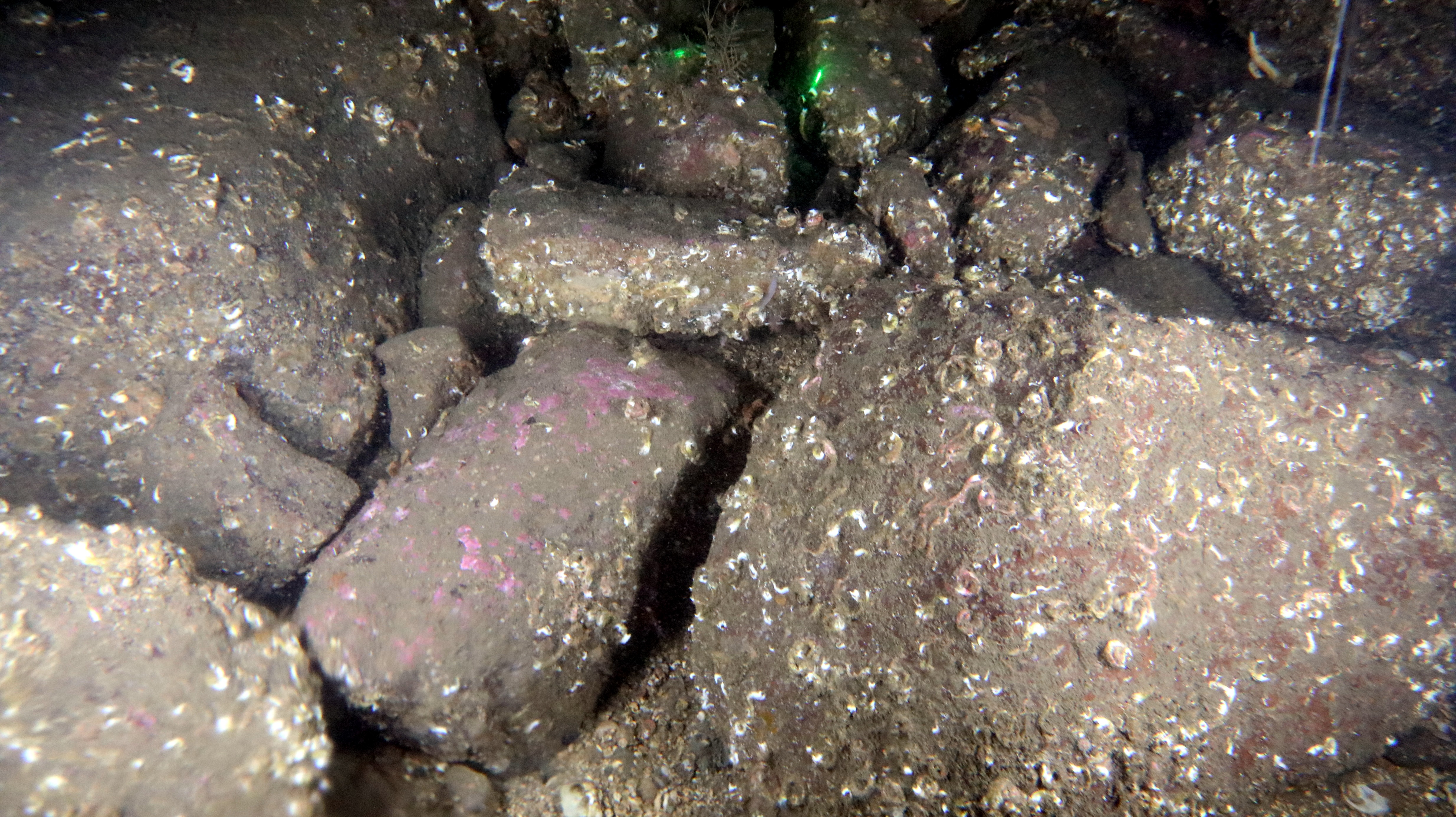
- Areas of the biotope LR.MLR.BF.Fser.Bo (Fucus serratus and under-boulder fauna on exposed to moderately exposed lower eulittoral boulders (
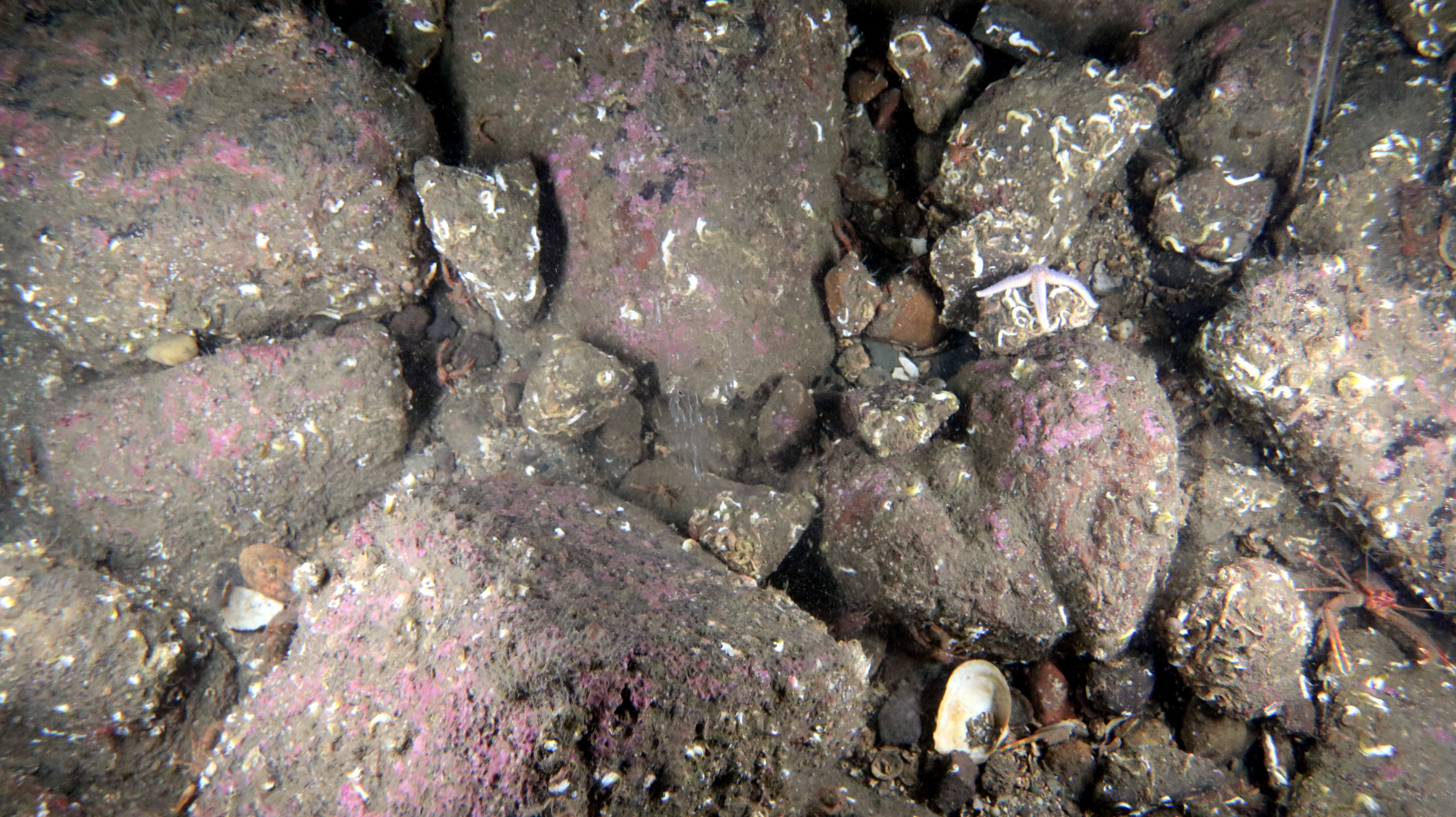
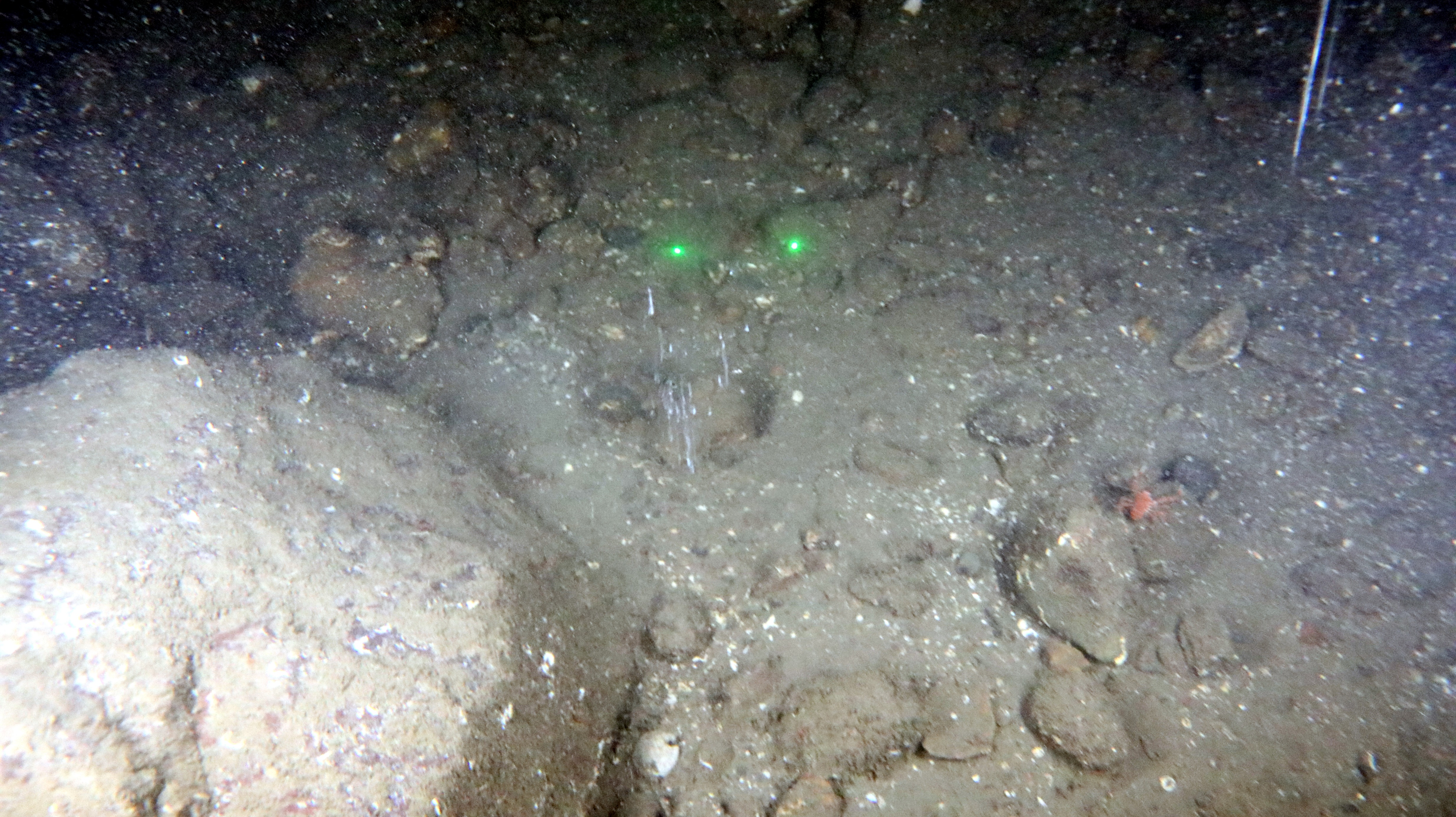
- Figure 3.40 Open ▸ )) were highly species rich with super abundant F. serratus and occasionally F. vesiculosus. Red seaweeds present included Palmaria palmata, M. stellatus, O. pinnatifida, Lomentaria articulata, Odonthalia dentata, C. officinalis and calcareous encrusters. A rich invertebrate fauna was present with the crustaceans Necora puber (
- Figure 3.40 Open ▸ ), Porcellana platycheles, C. maenas, C. pagurus and Galathea squamifera abundant under most rocks. The echinoderms Henricia sanguinolenta, Asterias rubens, Ophiothrix fragilis, Psammechinus miliaris and the anemone A. equina were occasionally recorded. Polychaetes occasionally observed included Eulalia viridis and Pomatoceros triqueter. The gastropod molluscs P. vulgata, N. lapillus, L. littoralis and G. cineraria were variously present above and under boulders and the sea slug D. pseudoargus occurred infrequently under stones. The sponge Halichondria panicea occurred abundantly while epiphytic colonies of the ascidian Botryllus schlosseri and the bryozoans Electra pilosa and Membranipora membranacea were present both on fronds of F. serratus and on rocks. Intertidal fishes present included rock gunnel Pholis gunnellus, five-bearded rockling Ciliata mustela and shanny Lipophrys pholis.
- The same assemblage of associated species and substrate composition occurred at the lowest part of the shore in the biotope LR.MIR.KR.Ldig.Bo (Laminaria digitata and under-boulder fauna on sublittoral fringe boulders). The kelp L. digitata became the dominant seaweed with F. serratus occasionally present. Additional species only recorded in this biotope included the seaweeds Saccharina latissima, L. hyperborea, Dilsea carnosa, the gastropod Trivia monacha and the intertidal long-spined sea scorpion Taurulus bubalis. This biotope was typically only accessible for a few metres width and occurred in places together with a narrow fringe of vertical LR.MIR.KR.Ldig (Laminaria digitata on moderately exposed sublittoral fringe rock biotope) where rock platforms dropped off either into lower shore intertidal L. digitata boulder fields or directly into the sea. These habitats are mapped as thin dashed lines on Figure 3.44 Open ▸ . The seaweed L. hyperborea appeared to become dominant in the nearshore subtidal area.
- Fucus serratus and the kelp L. digitata dominated the deeper waters of LR.FLR.Rkp.FK (Fucoids and kelp in deep eulittoral rockpools) while C. officinalis and coralline crusts dominated the shallow fringes. Halidrys siliquosa, M. stellatus, C. crispus, P. palmata, Ahnfeltia plicata and Ceramium sp. occurred frequently with scattered N. lapillus, P. vulgata and A. equina. Shrimps Palaemon sp. occurred occasionally. These pools were present throughout the lower and lower mid shore zones.
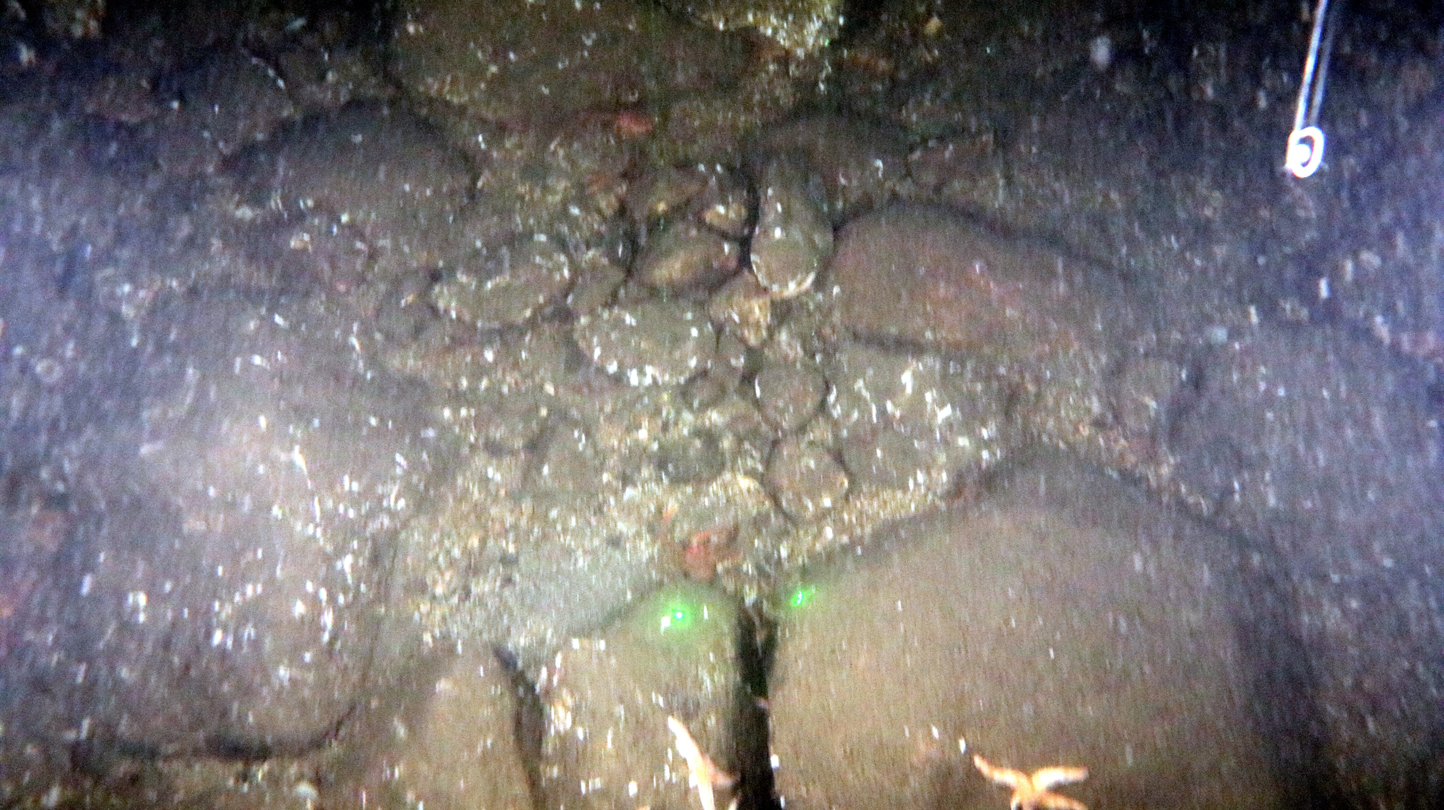
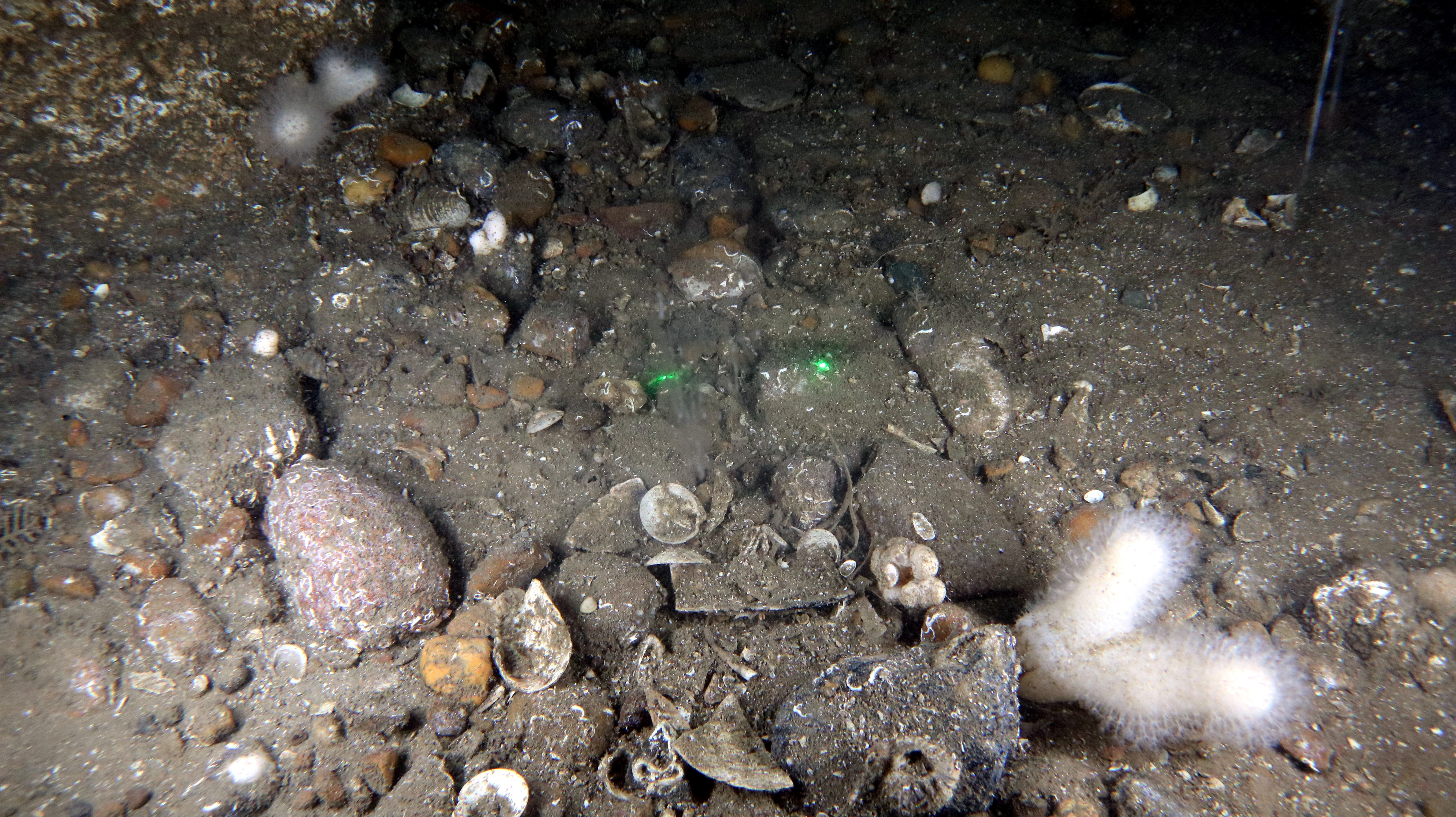
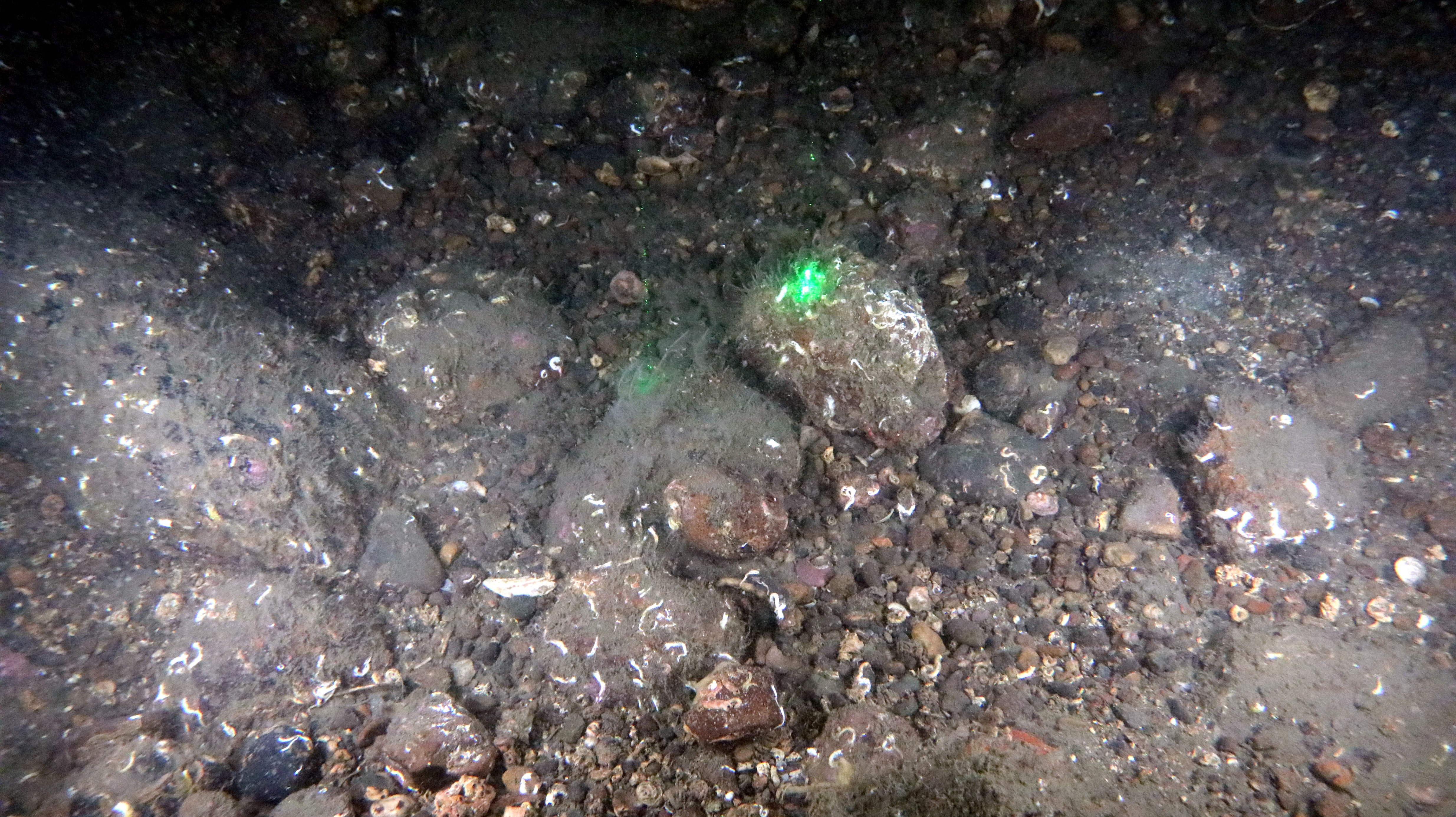
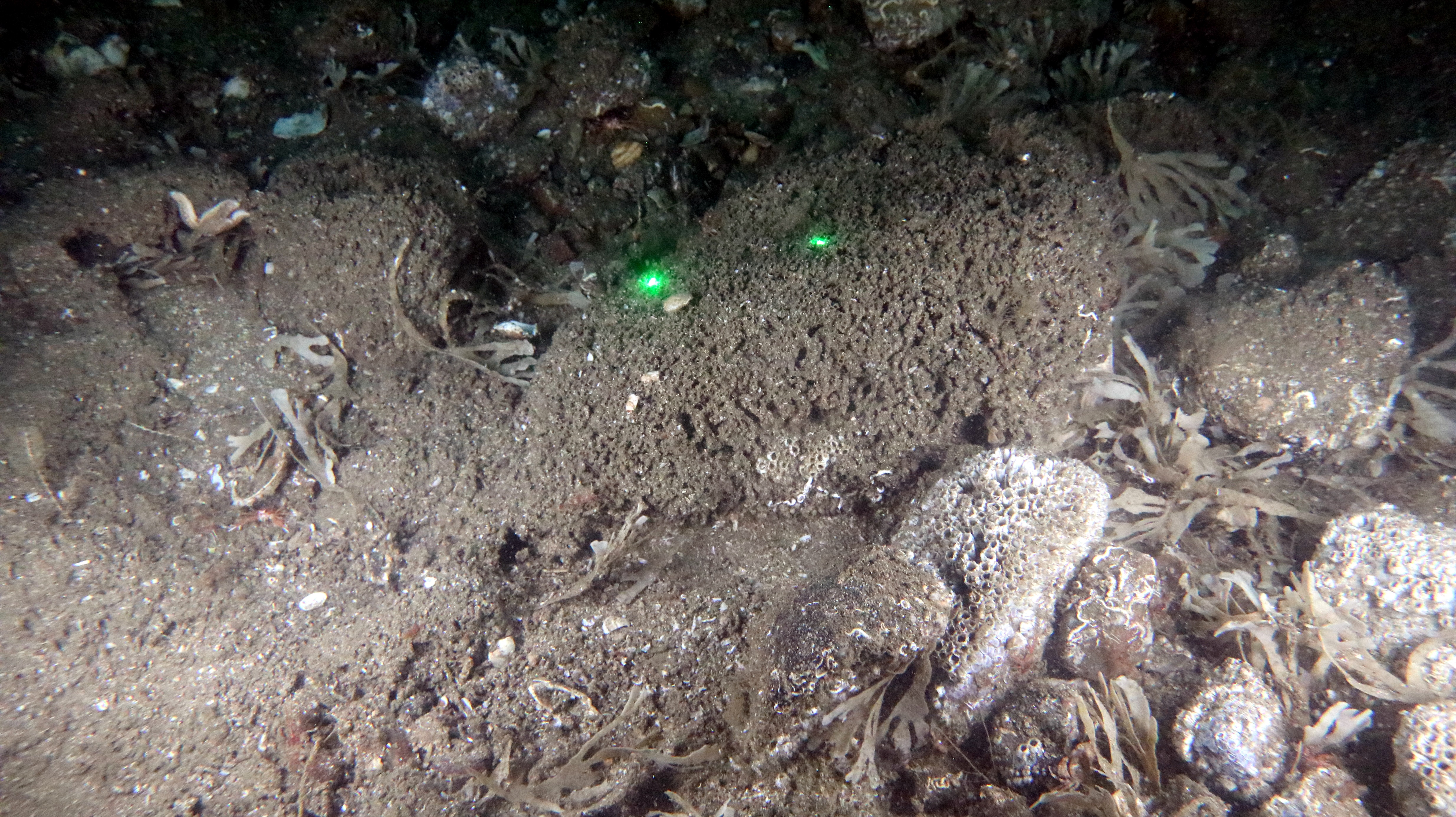
- Depth prevented access to the bottoms of many pools and hampered visibility. Visibility was particularly poor in a small number of large pools where significant amounts of suspended sediments were present in the water column ( Figure 3.41 Open ▸ ). These pools were predominantly characterised by the LR.FLR.Rkp.SwSed (Seaweeds in sediment-floored eulittoral rockpools) biotope and large pools even contained patches of LS.LSa.MuSa.MacAre (Macoma balthica and Arenicola marina in littoral muddy sand) biotope complete with an anoxic layer.
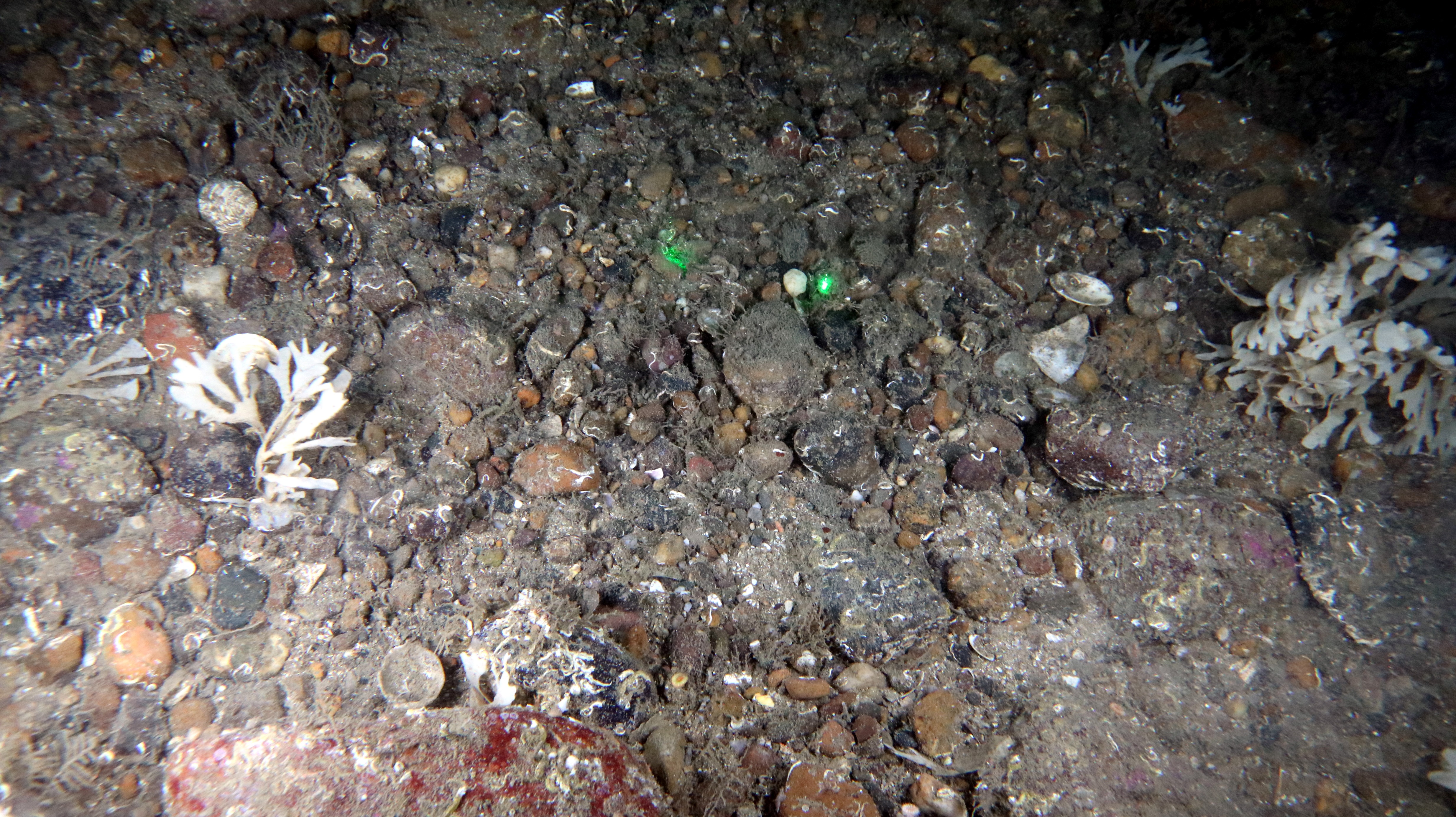
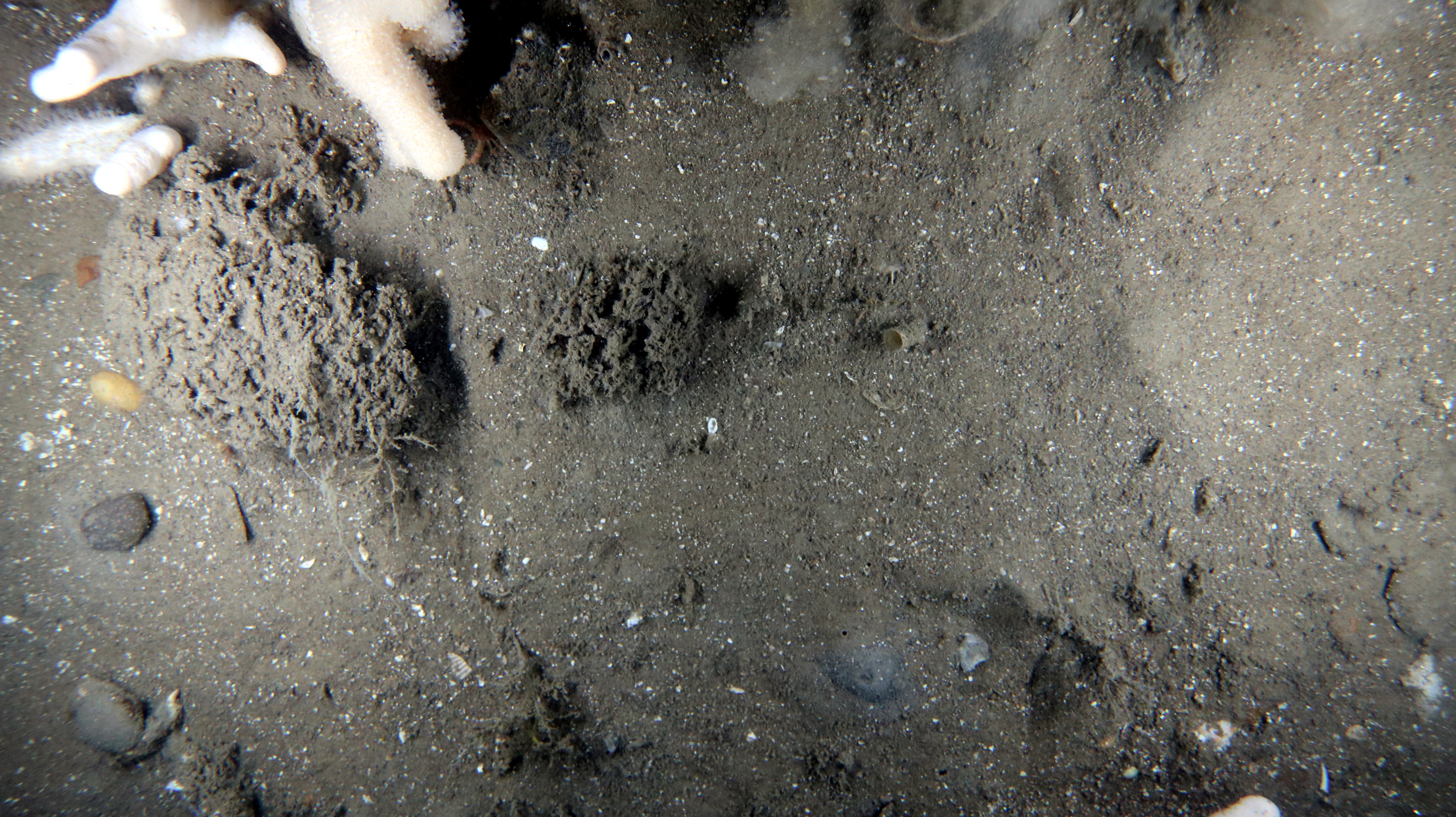
- The biotope LS.LSa.MuSa.MacAre occurred in upper shore and mid shore areas within the sandy bay at Skateraw beach (
- Figure 3.42 Open ▸ and Figure 3.43 Open ▸ ). Macoma balthica and the closely related thin tellin Macomangulus tenuis were rarely observed in dig over sampling. The fine muddy sand (Folk, 1966) in these areas contained an anoxic layer within centimetres of the surface and contained a small proportion of gravel.
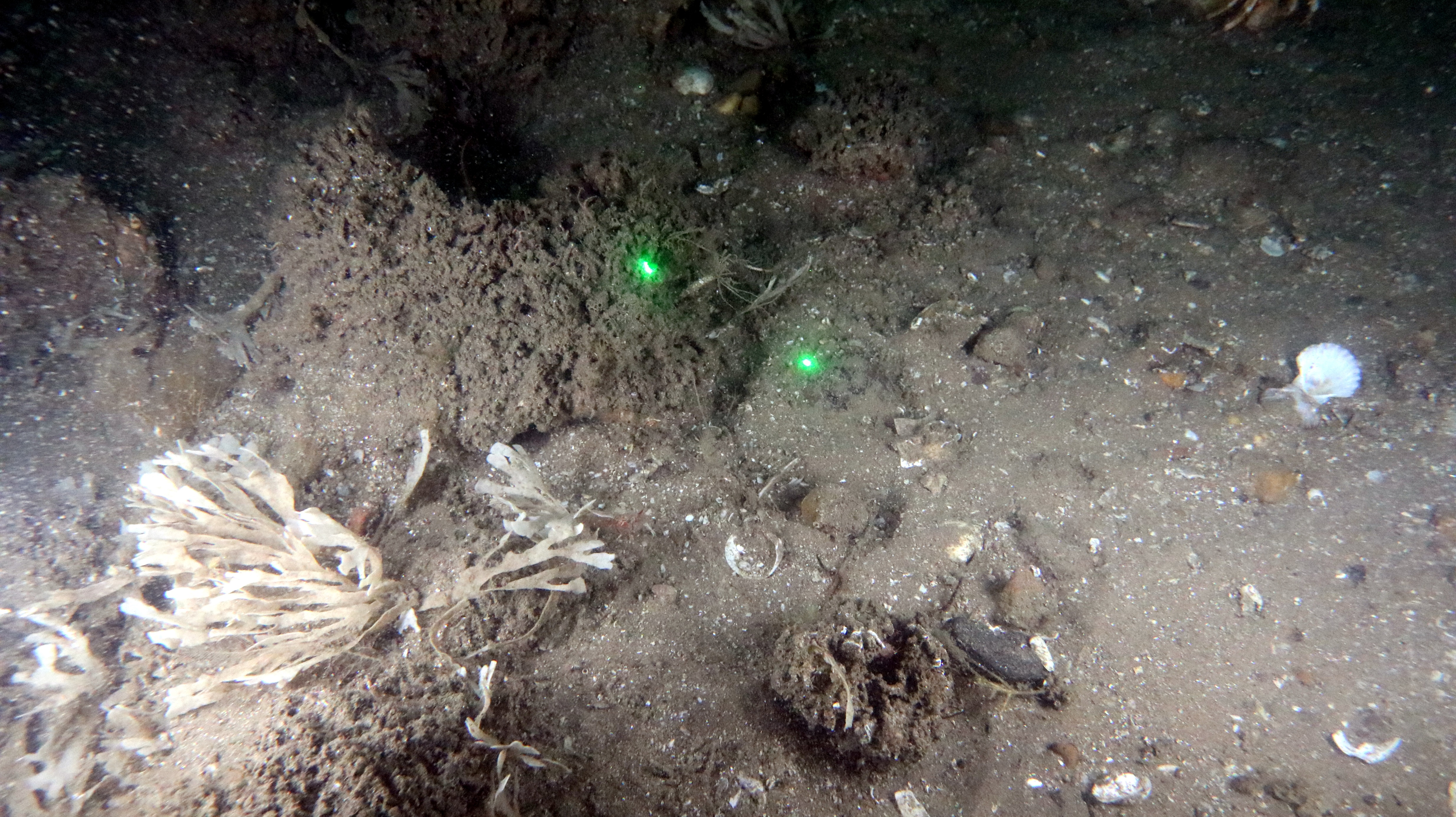
- Oligochaete worms and the polychaete worms Hediste diversicolor, Scoloplos armiger and Lanice conchilega were also recorded in low densities during dig over sampling. Arenicola marina was more abundant in this biotope than L. conchilega in areas where the latter was present. Both of these species could be readily surveyed without digging due to the distinctive casts of A. marina and the cases of L.conchilega which were easily visible above the surface of the sand.
- Where dense populations of L. conchilega occurred and A. marina was less abundant, if present, the biotope LS.LSa.MuSa.Lan (Lanice conchilega in littoral sand) was ascribed. This biotope occurred predominantly in clean sand, mainly along the mid and lower shores with polychaetes Euclymene lumbricoides, Nephtys hombergii, Scoloplos armiger and Arenicola marina often present. Transitional areas between this habitat and LS.LSa.MuSa.MacAre contained anoxic sand near the surface.
- A similar array of polychaetes occurred in the biotope LS.LSa.FiSa.Po (Polychaetes in littoral fine sand) with occasional occurrences of the polychaetes N. hombergii, Paraonis fulgens, H. diversicolor and S. armiger. A. marina was rarely present, and the sand lacked an anoxic layer.
Figure 3.39: Under Boulder Habitat of LR.MLR.BF.Fser.Bo
Figure 3.40: Necora puber from LR.MLR.BF.Fser.Bo at Skateraw Landfall
Figure 3.41: LR.FLR.Rkp.SwSed at Skateraw Landfall
Figure 3.43: Gravel Content From ~0.02 m2 of LS.LSa.MuSa.MacAre at the Skateraw Landfall
Figure 3.44: Phase 1 Intertidal Biotope Map of the Skateraw Landfall
3.5.3. Results - Habitats of Conservation Importance
Intertidal sand and mudflats
- The following biotopes, recorded at the Skateraw Landfall, are part of the Annex I Habitats Directive habitat – 1140 Mudflats and sandflats not covered by seawater at low tide:
- LS.Lsa.St.Tal: Talitrids on the upper shore and strand-line;
- LS.LSa.MuSa.Lan: Lanice conchilega in littoral sand and
- LS.LSa.MuSa.MacAre: Macoma balthica and Arenicola marina in littoral muddy sand. This biotope is also part of the Intertidal Mudflats habitat listed on the Scottish Biodiversity List and is a UK Priority Biodiversity Action Plan.
Intertidal boulder communities
- The following biotopes, recorded at the Skateraw Landfall, form part of the Intertidal Boulder Communities habitat listed on the Scottish Biodiversity List. This biotope is also UK Priority Biodiversity Action Plan habitats and is a representative of Habitats Directive Annex I reefs.
- LR.MLR.BF.Fser.Bo: Fucus serratus and under-boulder fauna on exposed to moderately exposed lower eulittoral boulders.
- These boulder fields are species rich examples of the biotope and contain abundant juveniles of the edible crab Cancer pagurus and adult velvet crab Necora puber which are commercial species.
- Other commercial species present were L. littorea (which occurs in very variable densities across the site though was locally super abundant under stones in the mid littoral zone) and M. edulis which was rarely recorded. Cerastoderma edule was not recorded during sampling of the sandflats though could occur within these habitats.
Other biotopes
- Other UK Broad Biodiversity Action Plan habitats are present. The most valuable among these are rockpools which significantly enhance diversity. Large deep rockpools in the mid and lower shore, particularly those with permanently submerged kelp, are essentially subtidal in nature and will extend the range of both subtidal and lower shore plants and animals well into the mid littoral zone.
4. Summary
- The subtidal site-specific survey consisted of infaunal grab samples, DDV survey and epibenthic trawls. Subtidal sediments recorded across the Proposed Development benthic subtidal and intertidal ecology study area ranged from sandy gravel to muddy sand with the most samples classified as slightly gravelly sand. The sediments within the eastern parts of the Proposed Development array area were dominated by slightly gravelly sands with areas of gravelly sand in the north and south. The sediments within the western parts of the Proposed Development array area were typically slightly coarser and characterised by sandy gravel sediments in addition to slightly gravelly sand and gravelly sand. The sediments within the offshore section of the Proposed Development export cable corridor were characterised by the same sediment types as the Proposed Development array area. This is aligned with the desktop data which indicated coarse sediments (gravelly sand) and sand across the proposed Development array area (Pearce et al., 2014; Axelsson et al., 2014; Southeran and Crawford-Avis, 2013). Sand sediments grade into muds, mixed sediments and rocky habitats with increasing proximity to the landfall.
- Nine sediments samples from across the Proposed Development benthic subtidal and intertidal ecology study area were analysed for sediment chemistry. No contaminants were found to exceed AL1/AL2 or the Canadian PEL. Only arsenic at five sample stations within the north-west of the Proposed Development array area exceeds the Canadian TEL.
- The site-specific survey data showed that the sediments within the eastern part of the Proposed Development array area were characterised by the SS.SSa.CFiSa.EpusBorApri and SS.SMu.AfilMysAnit biotope with smaller areas of SS.SMx.CMx.MysThyMx, SS.SSa.OSa and SS.SMx.OMx.PoVen. The sediment within the western parts of the Proposed Development array area were characterised by the SS.SMx.OMx.PoVen and SS.SMu.AfilMysAnit biotope with smaller areas of SS.SMx.OMx and SS.SSa.CFiSa.EpusOborApri. This is aligned with the desktop data which recorded SS.SSa.IFiSa.NcirBat, SS.SMx.CMx.MysThyMx and SS.SMu.CSaMu.AfilMysAnit in the nearshore environment (Brazier et al., 1998). The SS.SBR.PoR.SspiMx biotope was also recorded in the western part of the Proposed Development array area but it was not reef forming and did not correspond with any areas identified as potential Annex I S. spinulosa reef. The Annex I reef assessment identified ST20 as having low potential for S. spinulosa reef in the centre of the Proposed Development array area.
- The Seagreen (Alpha and Bravo) baseline characterisation surveys recorded SS.SMx.OMx.PoVen and the Seagreen Proposed Development export cable corridor validation survey recorded SS.SMu.CSaMu.AfilMysAnit and SS.SMx.OMx.PoVen in the adjacent areas of the Firth of Forth (Seagreen, 2012). SS.SMu.CFiMu.SpnMeg and SS.SBR.PoR.SspiMx were also previously recorded within the regional benthic subtidal and intertidal ecology study area (EMU, 2010; Southeran and Crawford-Avis, 2013).Surveys undertaken for the FFBC MPA also identified SS.SBR.PoR.SspiMx within the area overlapping with the western Proposed Development array area, although this was not concluded to be Annex I reef (Pearce et al., 2014).
- The habitats within the Proposed Development export cable corridor were characterised by the SS.SMu.CFiMu.SpnMeg, SS.SMu.CSaMu.AfilNten and SS.SMu.ThyNten biotopes. The seapens and burrowing megafauna assessment showed the areas identified as SS.SMu.CFiMu.SpnMeg within the Proposed Development export cable corridor classified as the OSPAR habitat.
- The inshore section of the Proposed Development export cable corridor was dominated by muddy sand, slightly gravelly muddy sand and sand sediments. The infaunal data recorded SS.SMu.ThyNten in the section of the Proposed Development export cable corridor by the Skateraw landfall. The epifaunal data recorded CR.MCR.EcCr in the section of the Proposed Development export cable corridor by the Skateraw landfall.
- The Annex I reef assessment identified two sample stations as medium and four sample stations as low potential Annex I cobble reef in the inshore section of the Proposed Development export cable corridor. One sample station in the nearshore area of the Proposed Development export cable corridor was classified as medium potential rocky reef. The desktop data reported discrete areas of rock distributed throughout the inshore regions of the Proposed Development export cable corridor (Inch Cape Offshore Limited, 2011; EMODnet, 2019).
- The site-specific survey recorded Ocean quahog A. islandica across the Proposed Development array area and Proposed Development export cable corridor, and M. modiolus was recorded across the Proposed Development array area. Axelsson et al. (2014) recorded M. modiolus to the west of the Proposed Development array area.
- A site-specific Phase 1 intertidal survey was undertaken at the selected landfall location. The intertidal survey comprised both a general walkover, noting changes in ecological and physical characteristics, and on-site dig over macrofauna sampling and analysis in soft sediments, to help characterise the habitats. A sandy bay was present at the Skateraw landfall which was mainly composed of fine and medium grained sand which became muddier at the lower shore. A small proportion of gravel was also present within the lower shore sands. The Skateraw landfall also had large areas of the bedrock exposed and contained a mosaic of deep pools cut into the sedentary platform by wave action. Rockpools also occurred frequently in other rocky areas between and under seaweeds and stones. Cobbles and boulders dominated the mid shore with fucoid seaweeds. Kelp beds were present in the lower shore, either attached to boulders or direct to bedrock. This is aligned with the habitats recorded at the survey undertaken for the same proposed landfall for the Neart na Gaoithe offshore wind farm which identified a soft sediment beach with the upper shore at Skateraw characterised by barren sand. Torness Nuclear Power Station also surveyed this site and recorded very similar habitats (ABPmer, 2019).
4.1. Important Ecological Features
- In accordance with the best practice guidelines (CIEEM, 2019), for the purposes of the benthic subtidal and intertidal ecology EIA, IEFs have been identified and all potential impacts of the Proposed Development will be assessed against the IEFs to determine whether or not they are significant. The IEFs of an area are those that are considered to be important and potentially affected by the Proposed Development. Importance may be assigned due to quality or extent of habitats, habitat or species rarity or the extent to which they are threatened (CIEEM, 2019). Species and habitats are considered IEFs if they have a specific biodiversity importance recognised through international or national legislation or through local, regional or national conservation plans (e.g. Annex I habitats under the Habitats Directive, OSPAR, National Biodiversity Plan or the Marine Strategy Framework Directive, Scottish PMFs and the Scottish Biodiversity list). The criteria used to inform the valuation of IEFs is presented in Table 4.1 Open ▸ and the IEFs, their conservation status and valuation is presented in Table 4.2 Open ▸ . The biotopes present across the Proposed Development benthic subtidal and intertidal ecology study area have been grouped into broad habitat/community types. The identified IEFs will be taken forward for assessment within the benthic subtidal and intertidal ecology EIA Report (volume 2, Chapter 8) and used to assess impacts associated with the construction, operation and decommissioning of the Proposed Development on benthic subtidal and intertidal ecology.
Table 4.1: Criteria Used to Inform the Valuation of IEFs in the Proposed Development Benthic Subtidal and Intertidal Ecology Study Area
Table 4.2: IEFs within the Project Development Benthic Subtidal and Intertidal Ecology Study Area
5. References
Abele, D., Strahl, J., Brey, T., Philipp, E., (2008). Imperceptible senescence: ageing in the ocean quahog Arctica islandica, Free Radical Research, 42(5):474-80
ABPmer (2019). Torness Seaweed Removal, Environmental Appraisal. ABPmer Report No. R.3103. A report produced by ABPmer for EDF Energy, September 2019.
AMEC (2015). Torness Cooling Water Protection Works, Intertidal Survey Report. Report by Amec Foster Wheeler for EDF Energy Nuclear Generation Ltd.
APEM (2020). Seagreen DDV Benthic Monitoring and Annex I Reef Survey Report. APEM Scientific Report P00004287. Seagreen Wind Energy Limited, 26/02/2021, v2.0 Final, 46pp + Appendices.
Axelsson, M., Dewey, S. and Allen, C. (2014). Analysis of seabed imagery from the 2011 survey of the Firth of Forth Banks Complex, the 2011 IBTS Q4 survey and additional deep-water sites from Marine Scotland Science surveys (2012). JNCC Report No. 471.
Brazier, D.P., Davies, J., Holt, R.H.F., and Murray, E. (1998). Marine Nature Conservation Review Sector 5. South-east Scotland and north-east England: area summaries. Peterborough, Joint Nature Conservation Committee. (Coasts and seas of the United Kingdom. MNCR series).
Brooks, A.J., Kenyon, N.H., Leslie, A., Long., D. and Gordon, J.E. (2013). Characterising Scotland’s marine environment to define search locations for new Marine Protected Areas. Part 2: The identification of Key Geodiversity Areas in Scottish waters. Scottish Natural Heritage Commissioned Report No. 432.
Canadian Council of Ministers of the Environment (CCME) (2001). Canadian sediment quality guidelines for the protection of aquatic life: Introduction. Updated. In: Canadian environment quality guidelines, 1999, Canadian Council of Ministers of the Environment.
CIEEM (2019) Guidelines for Ecological Impact Assessment in the UK and Ireland. Terrestrial, Freshwater, Coastal and Marine, Version 1.1 – Updated September 2019.
Clarke R. and Gorley R.N. (2006). PRIMER version 6: user manual/tutorial. PRIMER-E, Plymouth, UK, p192.
Clarke, K.R. and Warwick, R.M. (2001). Change in Marine Communities: An Approach to Statistical Analysis and Interpretation. Second Edition, PRIMER-E, Plymouth.
Connor, D.W., Allen, J.H., Golding, N., Howell, K.L., Lieberknecht, L.M., Northen, K.O. and Reker, J.B. (2004). The Marine Habitat Classification for Britain and Ireland. Version 04.05, JNCC, Peterborough.
Cooper, K. and Mason, C. (2019). Regional Seabed Monitoring Programme (RSMP) Protocol for Sample Collection and Processing. Version 7.0.
Cooper, K.M. and Barry, J. (2017). A big data approach to macrofaunal baseline assessment, monitoring and sustainable exploitation of the seabed. Sci Rep 7, 12431.
EMU (2010). Naert Na Gaoithe proposed offshore wind farm, benthic ecology characterisation survey, final report, a report for Neart na Gaoithe Offshore Wind Ltd. Report no. 09/J/1/03/1483/0943.
European Commission (2013). Interpretation manual of European Union habitats. EUR 28. http://ec.europa.eu/environment/nature/legislation/habitatsdirective/docs/Int_Manual_EU28. pdf. Accessed on: 1 August 2021.
European Marine Observation Data Network (EMODnet) (2019). Seabed Habitats Initiative. Financed by the European Union under Regulation (EU) No 508/2014 of the European Parliament and of the Council of 15 May 2014 on the European Maritime and Fisheries Fund. Available at: www.emodnetseabedhabitats.eu. Accessed on: 31 March 2021.
Folk, R.L. (1954). The distinction between grain size and mineral composition in sedimentary rock nomenclature. Journal of Geology 62 (4), 344-359.
Fugro (2020a). Seagreen 2 and 3 Windfarm Zones Geophysical Survey – Final Survey Results Report – Export Cable Route. Unpublished report for SSE Seagreen Wind Energy Limited, Fugro Document No: P906089-RESULTS-008 (01).
Fugro (2020b). Seagreen 2 and 3 and ECR Windfarm Zone Geophysical Survey – Final Survey Results Report – Seagreen 2 and Seagreen 3. Unpublished report for SSE Seagreen Wind Energy Limited, Fugro Document No: P906089-RESULTS-012 (01).
Golding, N., Albrecht, J., and McBreen, F. (2020). Refining the criteria for defining areas with a ‘low resemblance’ to Annex I stony reef, JNCC Report No. 656, September 2020.
Goudge, H. and Morris, L. (2014). Seabed imagery analysis from three Scottish offshore towed video surveys: 2011 MSS IBTSQ3 survey, 2011 1111s FRV Scotia Rona-Windsock survey and 2011 MSS Rockall survey. JNCC Report 470.
Gubbay, S. (2007). Defining and managing Sabellaria spinulosa reefs: Report of an inter-agency 1-2 May, 2007. In JNCC Report No.405. Available online at: https://doi.org/10.1038/onc.2012.495.
Hiscock (1996). Marine Nature Conservation Review: Rationale and methods. Coasts and seas of the United Kingdom. MNCR series. Joint Nature Conservation Committee, Peterborough.
Hitchin, R., Turner, J.A. and Verling, E. (2015). Epibiota Remote Monitoring from Digital Imagery: Operational Guidelines. 24.
Inch Cape Offshore Limited (2011). Offshore Environmental Statement, Volume 1B: Biological Environment, Chapter 12 Benthic Ecology.
Irving, R. (2009). Identification of the Main Characteristics of Stony Reef Habitats under the Habitats Directive. Summary of an Inter-Agency Workshop 26-27 March 2008. Joint Nature Conservation Committee, JNCC Report No. 432, 28pp.
Jenkins, C., Eggleton, J. Albrecht, J., Barry, J., Duncan, G., Golding, N. and O’Connor, J. (2015). North Norfolk Sandbanks and Saturn Reef cSAC/SCI management investigation report. JNCC/Cefas Partnership Report, No. 7.
JNCC (2014a). Firth of Forth Banks Complex MPA – Relevant Documentation – Site Summary Document. Available at: http://data.jncc.gov.uk/data/4d478592-6a82-4a75-97ad-de7057da9e8a/FFBC-1-SiteSummaryDocument-July14.pdf. Accessed on: 31 March 2021.
JNCC (2014b). JNCC clarifications on the habitat definitions of two habitat Features of Conservation Importance (FOCI). Peterborough, UK.
JNCC (2021a). Site Summary: Firth of Forth Banks Complex MPA. Available at: https://jncc.gov.uk/ourwork/firth-of-forth-banks-complex-mpa/. Accessed on: 31 March 2021.
JNCC (2021b). Site Summary: Berwickshire and North Northumberland Coast Designated Special Area of Conservation (SAC). Available at: https://sac.jncc.gov.uk/site/UK0017072. Accessed on 31 March 2021.
JNCC (2021c). Berwickshire and North Northumberland Coast, Designated Special Area of Conservation. Available at: https://sac.jncc.gov.uk/site/UK0017072 Accessed on: 5 July 2021.
JNCC (2021d). Isle of May Designated Special Area of Conservation. Available at: https://sac.jncc.gov.uk/site/UK0030172. Accessed on: 5 July 2021.
JNCC (2021e). Firth of Tay and Eden Estuary Designated Special Area of Conservation. Available at: https://sac.jncc.gov.uk/site/UK0030311. Accessed on 5 July 2021.Langenkämper D., Zuroweitz M., Schoening T. and Nattkemper T. (2017). BIIGLE 2.0- Browsing and Annotating Large Marine Image Collections. Frontiers in Marine Science, 28 March 2017.
Limpenny, D.S., Foster-Smith, R.L., Edwards, T.M., Hendrick, V.J., Diesing, M., Eggleton, J.D., Meadows, W.J., Crutchfield, Z., Pfeifer, S. and Reach, I.S. (2010). Best Methods for Identifying and Evaluating Sabellaria spinulosa and Cobble Reef. Natural England Supported Through Defra's Aggregates Levy Sustainability Fund, ALSF Ref No. MAL0008, 149pp.
Long (2006). BGS detailed explanation of seabed sediment modified Folk classification. Available from: https://webarchive.nationalarchives.gov.uk/20101014090013/http://www.searchmesh.net/PDF/GMHM3_Detailed_explanation_of_seabed_sediment_classification.pdf.
Marine Scotland (2017). Pre-disposal Sampling Guidance. Version 2. January 2017.
Mason, C. (2016). NMBAQC's Best Practice Guidance. Particle Size Analysis (PSA) for Supporting Biological Analysis. National Marine Biological AQC Coordinating Committee, 77pp, First published 2011, updated January 2016.
Natural England (2021). Natural England and NatureScot Conservation Advice for Marine Protected Areas Berwickshire and North Northumberland Coast SAC. Available at: https://designatedsites.naturalengland.org.uk/Marine/MarineSiteDetail.aspx?SiteCode=UK0017072&SiteName=berwi&SiteNameDisplay=Berwickshire%20and%20North%20Northumberland%20Coast%20SAC&countyCode=&responsiblePerson=&SeaArea=&IFCAArea=&NumMarineSeasonality=1&HasCA=1#SiteInfo. Accessed on: 31 March 2021.
NatureScot (2021). Montrose Basin RAMSAR site. Site code 8446. Available at: https://sitelink.nature.scot/site/8446 Accessed on: 5 July 2021.
OSPAR (2010). Background Document for Seapen and Burrowing megafauna communities. Biodiversity Series.
OSPAR (2009). Background Document for Modiolus beds. Available at: https://www.ospar.org/documents?v=7193. Accessed on: 31 March 2021.
Pearce, B., Grubb, L., Earnshaw, S., Pitts, J., and Goodchild, R. (2014). Biotope Assignment of Grab Samples from Four Surveys Undertaken in 2011 Across Scotland’s Seas (2012). JNCC Report No 509.
Pearce, B. and Kimber, J., (2020). The Status of Sabellaria spinulosa Reef off the Moray Firth and Aberdeenshire Coasts and Guidance for Conservation of the Species off the Scottish East Coast CR/2018/38, Scottish Marine and Freshwater Science Vol 11 No 17.
Seagreen (2012). Environmental Impact Statement. Volume 1, Chapter 11 Benthic Ecology and Intertidal Ecology. September 2012.
SNH (2011a). Barns Ness Coast Site of Specific Interest. Citation. Site code 153.
SNH (2011b). Barns Ness Coast Site of Specific Interest. Site management statement. Site code 153.
SNH (2011c). Firth of Forth Site of Special Scientific Interest. Site Management Statement. Site code 8163.
SNH (2010a). Montrose Basin Site of Special Scientific Interest. Site Management Statement. Site code 1184.
SNH (2010b). Tayport-Tentsmuir Coast SSSI Site of Special Scientific Interest. Site Management Statement. Site code 1523.
SNH (2010c). Berwickshire Coast (intertidal) Site of Special Scientific Interest. Site Management Statement. Site code 1695.
Sotheran, I. and Crawford-Avis, O. (2014). Mapping habitats and biotopes to strengthen the information base of Marine Protected Areas in Scottish waters, Phase 2 (Eastern Approaches to the Firth of Forth). JNCC Report No. 526.
Sotheran, I. and Crawford-Avis, O. (2013). Mapping habitats and biotopes to strengthen the information base of Marine Protected Areas in Scottish waters. JNCC Report, No. 503.
The National Biodiversity Network Gateway (NBN) (2021). Available at: https://nbnatlas.org/. Accessed on. 9 April 2021.
The Scottish Government (2017). Dynamic Coast: Scotlands NCCA. Available at: https://snh.maps.arcgis.com/apps/webappviewer/index.html?id=3b70a725513446749e62612e3dd4b463. Accessed on: 9 April 2021.
Turner, J.A., Hitchin, R., Verling, E., van Rein, H. (2016). Epibiota remote monitoring from digital imagery: Interpretation guidelines. Affiliated with JNCC and NMBAQC.
Tyler-Walters, H., James, B., Carruthers, M. (eds.), Wilding, C., Durkin, O., Lacey, C., Philpott, E., Adams, L., Chaniotis, P.D., Wilkes, P.T.V., Seeley, R., Neilly, M., Dargie, J. and Crawford-Avis, O.T. (2016). Descriptions of Scottish Priority Marine Features (PMFs). Scottish Natural Heritage Commissioned Report No. 406.
XOCEAN Ltd (2021) 00338 SSE Berwick Bank Lot 1 and 2 Operations and Results Report. Unpublished report for SSER.
6. Annex
6.1. Annex A: Seabed Sediments
Table 6.1: Results of the Particle Size Analysis
*Indicates sample station locations within the FFBC MPA.
6.2. Annex B: Annex I Reef Assessments
6.2.1. Annex 1 Sabellaria spinulosa Reef Assessment
Site | Sediment Description | Sabellaria Characteristics | Reef Definition | Reefiness | Sample Station Reefiness Assessment | Representative Image | ||||
|---|---|---|---|---|---|---|---|---|---|---|
Elevation (cm) | Extent (m2) | Patchiness (% cover) | Elevation | Extent | Patchiness | |||||
ST20 | Moderate Energy Circalittoral Rock | > 10 | 25-10000 | 21.17 | High | Low | Medium | Medium | Low |
|
ST20 | Moderate Energy Circalittoral Rock | 5 - 10 | 25-10000 | 23.81 | Medium | Low | Medium | Low | ||
ST20 | Moderate Energy Circalittoral Rock | > 10 | 25-10000 | 30.00 | High | Low | Medium | Medium | ||
ST20 | Moderate Energy Circalittoral Rock | 2 - 5 | 0 | 7.07 | Low | Not a Reef | Not a Reef | Not a Reef | ||
ST20 | Moderate Energy Circalittoral Rock | 5 - 10 | 25-10000 | 16.89 | Medium | Low | Low | Low | ||
ST20 | Moderate Energy Circalittoral Rock | 5 - 10 | 25-10000 | 10.13 | Medium | Low | Low | Low | ||
ST04 | Subtidal Mixed Sediment | 5 - 10 | 0 | 8.57 | Medium | Not a Reef | Not a Reef | Not a Reef | Not a Reef |
|
ST56 | Subtidal Biogenic Reef | 5 - 10 | <25 | 14.74 | Medium | Not a Reef | Low | Not a Reef | Not a Reef |
|
6.2.2. Annex 1 Stony Reef Assessment
Site | Sediment Description | Elevation (m) | Composition (% Cover) | Extent (m2) | Reef Definition | Reefiness | Sample Station Reefiness Assessment | Representative Image | ||
|---|---|---|---|---|---|---|---|---|---|---|
|
| Elevation | Composition | Extent | ||||||
ST101 | Moderate Energy Circalittoral Rock | 0.064-5 | 14.58 | <25 | Medium | Low | Not a Reef | Not a Reef | Not a Reef |
|
ST101 | Moderate Energy Circalittoral Rock | 0.064-5 | 40.57 | <25 | Medium | Medium | Not a Reef | Not a Reef | ||
ST107 | Moderate Energy Circalittoral Rock | 0.064-5 | 54.48 | >25 | Medium | Medium | Medium | Medium | Low |
|
ST107 | Moderate Energy Circalittoral Rock | 0.064-5 | 51.85 | >25 | Medium | Medium | Medium | Medium | ||
ST107 | Moderate Energy Circalittoral Rock | 0.064-5 | 24.46 | >25 | Medium | Low | Medium | Low | ||
ST107 | Moderate Energy Circalittoral Rock | 0.064-5 | 44.79 | >25 | Medium | Medium | Medium | Medium | ||
ST107 | Moderate Energy Circalittoral Rock | 0.064-5 | 30.86 | >25 | Medium | Low | Medium | Low | ||
ST107 | Moderate Energy Circalittoral Rock | 0.064-5 | 34.16 | >25 | Medium | Low | Medium | Low | ||
ST107 | Moderate Energy Circalittoral Rock | 0.064-5 | 9.56 | >25 | Medium | Not a Reef | Medium | Not a Reef | ||
ST107 | Moderate Energy Circalittoral Rock | 0.064-5 | 40.92 | >25 | Medium | Medium | Medium | Medium | ||
ST107 | Moderate Energy Circalittoral Rock | 0.064-5 | 36.18 | >25 | Medium | Low | Medium | Low | ||
ST107 | Moderate Energy Circalittoral Rock | 0.064-5 | 0.00 | >25 | Medium | Not a Reef | Medium | Not a Reef | ||
ST107 | Moderate Energy Circalittoral Rock | 0.064-5 | 45.70 | >25 | Medium | Medium | Medium | Medium | ||
ST107 | Moderate Energy Circalittoral Rock | 0.064-5 | 0.00 | >25 | Medium | Not a Reef | Medium | Not a Reef | ||
ST107 | Moderate Energy Circalittoral Rock | 0.064-5 | 31.05 | >25 | Medium | Low | Medium | Low | ||
ST107 | Moderate Energy Circalittoral Rock | 0.064-5 | 19.97 | >25 | Medium | Low | Medium | Low | ||
ST107 | Moderate Energy Circalittoral Rock | 0.064-5 | 38.32 | >25 | Medium | Low | Medium | Low | ||
ST107 | Moderate Energy Circalittoral Rock | 0.064-5 | 66.09 | >25 | Medium | Medium | Medium | Medium | ||
ST107 | Moderate Energy Circalittoral Rock | 0.064-5 | 25.63 | >25 | Medium | Low | Medium | Low | ||
ST107 | Moderate Energy Circalittoral Rock | 0.064-5 | 32.59 | >25 | Medium | Low | Medium | Low | ||
ST107 | Moderate Energy Circalittoral Rock | 0.064-5 | 30.47 | >25 | Medium | Low | Medium | Low | ||
ST107 | Moderate Energy Circalittoral Rock | 0.064-5 | 36.83 | >25 | Medium | Low | Medium | Low | ||
ST107 | Moderate Energy Circalittoral Rock | 0.064-5 | 27.40 | >25 | Medium | Low | Medium | Low | ||
ST107 | Moderate Energy Circalittoral Rock | 0.064-5 | 34.56 | >25 | Medium | Low | Medium | Low | ||
ST107 | Moderate Energy Circalittoral Rock | 0.064-5 | 31.60 | >25 | Medium | Low | Medium | Low | ||
ST107 | Moderate Energy Circalittoral Rock | 0.064-5 | 57.90 | >25 | Medium | Medium | Medium | Medium | ||
ST107 | Moderate Energy Circalittoral Rock | 0.064-5 | 50.56 | >25 | Medium | Medium | Medium | Medium | ||
ST107 | Moderate Energy Circalittoral Rock | 0.064-5 | 52.08 | >25 | Medium | Medium | Medium | Medium | ||
ST107 | Moderate Energy Circalittoral Rock | 0.064-5 | 30.88 | >25 | Medium | Low | Medium | Low | ||
ST107 | Moderate Energy Circalittoral Rock | 0.064-5 | 53.51 | >25 | Medium | Medium | Medium | Medium | ||
ST107 | Moderate Energy Circalittoral Rock | 0.064-5 | 66.54 | >25 | Medium | Medium | Medium | Medium | ||
ST107 | Moderate Energy Circalittoral Rock | 0.064-5 | 37.10 | >25 | Medium | Low | Medium | Low | ||
ST107 | Moderate Energy Circalittoral Rock | 0.064-5 | 45.88 | >25 | Medium | Medium | Medium | Medium | ||
ST110 | Moderate Energy Circalittoral Rock | 0.064-5 | 12.30 | >25 | Medium | Low | Medium | Low | Low |
|
ST110 | Moderate Energy Circalittoral Rock | 0.064-5 | 20.83 | >25 | Medium | Low | Medium | Low | ||
ST110 | Moderate Energy Circalittoral Rock | 0.064-5 | 36.96 | >25 | Medium | Low | Medium | Low | ||
ST110 | Moderate Energy Circalittoral Rock | 0.064-5 | 34.20 | >25 | Medium | Low | Medium | Low | ||
ST110 | Moderate Energy Circalittoral Rock | 0.064-5 | 10.79 | >25 | Medium | Low | Medium | Low | ||
ST110 | Moderate Energy Circalittoral Rock | 0.064-5 | 38.38 | >25 | Medium | Low | Medium | Low | ||
ST110 | Moderate Energy Circalittoral Rock | 0.064-5 | 62.21 | >25 | Medium | Medium | Medium | Medium | ||
ST110 | Moderate Energy Circalittoral Rock | 0.064-5 | 31.63 | >25 | Medium | Low | Medium | Low | ||
ST110 | Moderate Energy Circalittoral Rock | 0.064-5 | 44.95 | >25 | Medium | Low | Medium | Medium | ||
ST110 | Moderate Energy Circalittoral Rock | 0.064-5 | 52.75 | >25 | Medium | Medium | Medium | Medium | ||
ST110 | Moderate Energy Circalittoral Rock | < 0.064 | 10.86 | >25 | Low | Low | Medium | Low | ||
ST02 | Moderate Energy Circalittoral Rock | < 0.064 | 12.66 | <25 | Low | Low | Not a Reef | Not a Reef | Not a Reef |
|
ST02 | Moderate Energy Circalittoral Rock | < 0.064 | 17.57 | <25 | Low | Low | Not a Reef | Not a Reef | ||
ST20 | High Energy Circalittoral Rock | 0.064-5 | 22.31 | >25 | Medium | Low | Medium | Low | Low |
|
ST38 | Moderate Energy Circalittoral Rock | 0.064-5 | 10.18 | > 25 | Medium | Low | Medium | Low | Low |
|
ST38 | Moderate Energy Circalittoral Rock | 0.064-5 | 12.44 | > 25 | Medium | Low | Medium | Low | ||
ST38 | Moderate Energy Circalittoral Rock | 0.064-5 | 15.81 | > 25 | Medium | Low | Medium | Low | ||
ST38 | Moderate Energy Circalittoral Rock | 0.064-5 | 11.60 | > 25 | Medium | Low | Medium | Low | ||
ST38 | Moderate Energy Circalittoral Rock | < 0.064 | 6.35 | > 25 | Low | Not a Reef | Medium | Not a Reef | ||
ST04 | Moderate Energy Circalittoral Rock | 0.064-5 | 14.66 | < 25 | Medium | Low | Not a Reef | Not a Reef | Not a Reef |
|
ST04 | Moderate Energy Circalittoral Rock | 0.064-5 | 15.52 | < 25 | Medium | Low | Not a Reef | Not a Reef | ||
ST61 | Moderate Energy Circalittoral Rock | 0.064-5 | 46.91 | < 25 | Medium | Medium | Not a Reef | Not a Reef | Not a Reef |
|
ST69 | High Energy Circalittoral Rock | < 0.064 | 10.86 | < 25 | Low | Low | Not a Reef | Not a Reef | Not a Reef |
|
ST69 | High Energy Circalittoral Rock | < 0.064 | 11.92 | < 25 | Low | Low | Not a Reef | Not a Reef | ||
ST69 | High Energy Circalittoral Rock | < 0.064 | 11.99 | < 25 | Low | Low | Not a Reef | Not a Reef | ||
ST69 | High Energy Circalittoral Rock | < 0.064 | 18.24 | < 25 | Low | Low | Not a Reef | Not a Reef | ||
ST69 | High Energy Circalittoral Rock | < 0.064 | 11.17 | < 25 | Low | Low | Not a Reef | Not a Reef | ||
ST69 | High Energy Circalittoral Rock | < 0.064 | 13.56 | < 25 | Low | Low | Not a Reef | Not a Reef | ||
ST83 | Moderate Energy Circalittoral Rock | 0.064-5 | 26.02 | < 25 | Medium | Low | Not a Reef | Not a Reef | Not a Reef |
|
ST84 | Moderate Energy Circalittoral Rock | 0.064-5 | 22.63 | < 25 | Medium | Low | Not a Reef | Not a Reef | Not a Reef |
|
ST84 | Moderate Energy Circalittoral Rock | < 0.064 | 9.31 | < 25 | Low | Not a Reef | Not a Reef | Not a Reef | ||
ST84 | Moderate Energy Circalittoral Rock | 0.064-5 | 25.13 | < 25 | Medium | Low | Not a Reef | Not a Reef | ||
ST89 | Moderate Energy Circalittoral Rock | 0.064-5 | 76.33 | >25 | Medium | Medium | Medium | Medium | Medium |
|
ST89 | Moderate Energy Circalittoral Rock | 0.064-5 | 49.53 | >25 | Medium | Medium | Medium | Medium | ||
ST89 | Moderate Energy Circalittoral Rock | 0.064-5 | 82.78 | >25 | Medium | Medium | Medium | Medium | ||
ST89 | Moderate Energy Circalittoral Rock | 0.064-5 | 62.29 | >25 | Medium | Medium | Medium | Medium | ||
ST89 | Moderate Energy Circalittoral Rock | 0.064-5 | 40.52 | >25 | Medium | Medium | Medium | Medium | ||
ST89 | Moderate Energy Circalittoral Rock | 0.064-5 | 54.55 | >25 | Medium | Medium | Medium | Medium | ||
ST89 | Moderate Energy Circalittoral Rock | 0.064-5 | 73.25 | >25 | Medium | Medium | Medium | Medium | ||
ST89 | Moderate Energy Circalittoral Rock | 0.064-5 | 74.03 | >25 | Medium | Medium | Medium | Medium | ||
ST89 | Moderate Energy Circalittoral Rock | 0.064-5 | 33.98 | >25 | Medium | Low | Medium | Low | ||
ST89 | Moderate Energy Circalittoral Rock | 0.064-5 | 41.45 | >25 | Medium | Medium | Medium | Medium | ||
ST89 | Moderate Energy Circalittoral Rock | 0.064-5 | 51.84 | >25 | Medium | Medium | Medium | Medium | ||
ST89 | Moderate Energy Circalittoral Rock | 0.064-5 | 85.23 | >25 | Medium | Medium | Medium | Medium | ||
ST89 | Moderate Energy Circalittoral Rock | 0.064-5 | 54.81 | >25 | Medium | Medium | Medium | Medium | ||
ST89 | Moderate Energy Circalittoral Rock | 0.064-5 | 58.93 | >25 | Medium | Medium | Medium | Medium | ||
ST89 | Moderate Energy Circalittoral Rock | 0.064-5 | 65.79 | >25 | Medium | Medium | Medium | Medium | ||
ST89 | Moderate Energy Circalittoral Rock | 0.064-5 | 38.39 | >25 | Medium | Medium | Medium | Low | ||
ST89 | Moderate Energy Circalittoral Rock | 0.064-5 | 68.00 | >25 | Medium | Medium | Medium | Medium | ||
ST89 | Moderate Energy Circalittoral Rock | 0.064-5 | 67.62 | >25 | Medium | Medium | Medium | Medium | ||
ST89 | Moderate Energy Circalittoral Rock | 0.064-5 | 36.92 | >25 | Medium | Low | Medium | Low | ||
ST89 | Moderate Energy Circalittoral Rock | 0.064-5 | 39.00 | >25 | Medium | Low | Medium | Low | ||
ST89 | Moderate Energy Circalittoral Rock | 0.064-5 | 41.97 | >25 | Medium | Medium | Medium | Medium | ||
ST89 | Moderate Energy Circalittoral Rock | 0.064-5 | 72.92 | >25 | Medium | Medium | Medium | Medium | ||
ST89 | Moderate Energy Circalittoral Rock | 0.064-5 | 52.35 | >25 | Medium | Medium | Medium | Medium | ||
ST89 | Moderate Energy Circalittoral Rock | 0.064-5 | 95.25 | >25 | Medium | High | Medium | Medium | ||
ST89 | Moderate Energy Circalittoral Rock | 0.064-5 | 30.15 | >25 | Medium | Low | Medium | Low | ||
ST89 | Moderate Energy Circalittoral Rock | < 0.064 | 15.79 | >25 | Low | Low | Medium | Low | ||
ST89 | Moderate Energy Circalittoral Rock | < 0.064 | 30.07 | >25 | Low | Low | Medium | Low | ||
ST89 | Moderate Energy Circalittoral Rock | < 0.064 | 2.45 | >25 | Low | Not a Reef | Medium | Not a Reef | ||
ST89 | Moderate Energy Circalittoral Rock | < 0.064 | 16.06 | >25 | Low | Low | Medium | Low | ||
ST89 | Moderate Energy Circalittoral Rock | < 0.064 | 17.21 | >25 | Low | Low | Medium | Low | ||
ST89 | Moderate Energy Circalittoral Rock | < 0.064 | 20.23 | >25 | Low | Low | Medium | Low | ||
ST89 | Moderate Energy Circalittoral Rock | < 0.064 | 14.72 | >25 | Low | Low | Medium | Low | ||
ST89 | Moderate Energy Circalittoral Rock | < 0.064 | 20.61 | >25 | Low | Low | Medium | Low | ||
ST89 | Moderate Energy Circalittoral Rock | < 0.064 | 0.00 | >25 | Low | Not a Reef | Medium | Not a Reef | ||
ST89 | Subtidal Coarse Sediment | < 0.064 | 5.78 | >25 | Low | Not a Reef | Medium | Not a Reef | ||
ST89 | Moderate Energy Circalittoral Rock | < 0.064 | 5.78 | >25 | Low | Not a Reef | Medium | Not a Reef | ||
ST89 | Moderate Energy Circalittoral Rock | < 0.064 | 5.78 | >25 | Low | Not a Reef | Medium | Not a Reef | ||
ST89 | Subtidal Coarse Sediment | < 0.064 | 5.78 | >25 | Low | Not a Reef | Medium | Not a Reef | ||
ST89 | Moderate Energy Circalittoral Rock | < 0.064 | 11.24 | >25 | Low | Low | Medium | Low | ||
ST111 | High Energy Infralittoral Rock |
| 35.82 | >25 |
| Low | Medium | Low | Medium |
|
ST111 | High Energy Infralittoral Rock |
| 99.31 | >25 |
| High | Medium | Medium | ||
ST111 | Moderate Energy Circalittoral Rock |
| 98.21 | >25 |
| High | Medium | Medium | ||
ST111 | Moderate Energy Circalittoral Rock |
| 99.24 | >25 |
| High | Medium | Medium | ||
ST111 | Moderate Energy Circalittoral Rock |
| 99.54 | >25 |
| High | Medium | Medium | ||
ST111 | Moderate Energy Circalittoral Rock |
| 98.80 | >25 |
| High | Medium | Medium | ||
ST111 | Moderate Energy Circalittoral Rock |
| 37.19 | >25 |
| Low | Medium | Low | ||
ST111 | Moderate Energy Circalittoral Rock |
| 55.74 | >25 |
| Medium | Medium | Medium | ||
ST111 | Moderate Energy Circalittoral Rock |
| 99.92 | >25 |
| High | Medium | Medium | ||
ST111 | Moderate Energy Circalittoral Rock |
| 99.97 | >25 |
| High | Medium | Medium | ||
ST111 | Moderate Energy Circalittoral Rock |
| 42.67 | >25 |
| Medium | Medium | Medium | ||
ST111 | Moderate Energy Circalittoral Rock |
| 91.30 | >25 |
| Medium | Medium | Medium | ||
ST111 | Moderate Energy Circalittoral Rock |
| 98.92 | >25 |
| High | Medium | Medium | ||
ST111 | Moderate Energy Circalittoral Rock |
| 97.44 | >25 |
| High | Medium | Medium | ||
ST111 | Moderate Energy Circalittoral Rock |
| 98.72 | >25 |
| High | Medium | Medium | ||
ST111 | High Energy Infralittoral Rock |
| 99.98 | >25 |
| High | Medium | Medium | ||
ST111 | High Energy Infralittoral Rock |
| 99.97 | >25 |
| High | Medium | Medium | ||
ST111 | High Energy Infralittoral Rock |
| 88.43 | >25 |
| Medium | Medium | Medium | ||
ST111 | Moderate Energy Circalittoral Rock |
| 99.97 | >25 |
| High | Medium | Medium | ||